Geography of Ontario

Last updated

Geography of Ontario
Map ont.jpg
Continent North America
Region Eastern Canada
Central Canada
Coordinates 49°15′0″N84°29′59″W / 49.25000°N 84.49972°W / 49.25000; -84.49972
Area
  Total917,741 km2 (354,342 sq mi)
  Land85.3%
  Water14.7%
Coastline3,840 km (2,390 mi)
Borders Total land borders: U.S. states Michigan, New York, Minnesota; Canadian provinces Manitoba, Nunavut, and Quebec
Highest point Ishpatina Ridge
693 m (2,274 ft)
Lowest point Hudson Bay
sea level
Longest river Albany River
980 km (610 mi)
Largest lake Lake Superior
28,700 km2 (11,100 sq mi)
(Canadian portion only)

Ontario is located in East/Central Canada. It is Canada's second largest province by land area. Its physical features vary greatly from the Mixedwood Plains in the southeast to the boreal forests and tundra in the north. Ontario borders Manitoba to the west, Hudson Bay and James Bay to the north, Quebec to the east, and the Great Lakes and the United States to the south. The province is named for Great Lake Ontario, an adaptation of the Iroquois word Onitariio, meaning "beautiful lake", or Kanadario, variously translated as "beautiful water". There are approximately 250,000 lakes and over 100,000 kilometres (62,000 mi) of rivers in the province.

Contents

Almost 94% of the population is concentrated within Southern Ontario, where the population was over 12,850,000 in the 2011 census. The Golden Horseshoe is the most populous part of Southern Ontario, with a population of 9,765,188 in the 2021 census. [1]

Population

The Toronto skyline seen from Toronto Harbour Cntower2.jpg
The Toronto skyline seen from Toronto Harbour

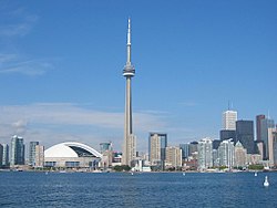
Ontario is the most populous province in Canada. Southern Ontario is one of the densest regions in the country. The north is vast and sparse compared to the south. The national capital Ottawa is located in Ontario bordering Quebec. Located within the Golden Horseshoe, Toronto is the capital of Ontario, the financial centre of Canada, and the country's most populous city.

Ontario is the second-most urbanized province after British Columbia, with 85.9% of the population living in urban areas. [2]

Population by Statistical Area Classification [3]
Statistical Area Classification2011 Census2006 CensusChange
Population % of totalPopulation % of total
Within CMAs10,270,00679.9%9,591,52978.9%Increase2.svg7.1%
Within CAs1,133,1278.8%1,128,6149.3%Increase2.svg0.4%
Total CMA/CA11,403,13388.7%10,720,14388.2%Increase2.svg6.4%
Strongly influenced644,2995.0%631,4105.2%Increase2.svg2.0%
Moderately influenced555,9314.3%554,0624.5%Increase2.svg0.3%
Weakly influenced225,1971.8%232,1071.9%Decrease2.svg3.0%
Not influenced23,2610.2%22,5600.2%Increase2.svg3.1%
Outside CMA/CA1,448,68811.3%1,440,13911.8%Increase2.svg0.6%
Total12,851,821100.0%12,160,282100.0%Increase2.svg5.7%
Census Metropolitan Areas (CMAs) by population
City2016 [4] 2011 [5] 2006 [6] 2001 [7] 1996 [8] 1991 [8]
Toronto 5,928,0405,583,0645,113,1494,682,8974,263,7573,898,933
Ottawa-Gatineau 1,323,7831,236,3241,130,7611,063,6641,010,498941,814
Hamilton 747,545721,053692,911662,401624,360599,760
Kitchener-Cambridge-Waterloo 523,894477,160451,235414,284382,940356,421
London 494,069474,786457,720432,451398,616381,522
St. Catharines-Niagara 406,074392,184390,317377,009372,406364,552
Oshawa 379,848356,177330,594296,298268,773240,104
Windsor 329,144319,246323,342307,877278,685262,075
Barrie 197,059187,013177,061148,480118,69597,150
Greater Sudbury 164,689160,770158,258155,601160,488157,613
Kingston 161,175159,561152,358146,838143,416136,401
Guelph 151,984141,097127,009117,344105,42097,667
Brantford 134,203135,501124,60786,417100,23897,106
Peterborough 121,721118,975|102,423100,19398,060-
Thunder Bay 121,621121,596122,907121,986125,562124,925
Belleville 103,472101,66891,51887,39587,871-
10 largest municipalities by population
City2011 [9] 20062001
Toronto (provincial capital)2,615,0602,503,2812,481,494
Ottawa (national capital)883,391812,129808,391
Mississauga 713,443668,549612,925
Brampton 523,911433,806325,428
Hamilton 519,949504,559499,268
London 366,151352,395336,539
Markham 301,709261,573208,615
Vaughan 288,301238,866182,022
Kitchener 219,153204,668190,399
Windsor 210,891216,473208,402

Physical geography

Relief of Ontario Ontario Relief.png
Relief of Ontario

Southwestern Ontario and a narrow strip along the coast of the Saint Lawrence River are in the Mixedwood Plains, a fertile and productive ecozone that is typically flat with rolling hills, and was once covered by forest before its use for agriculture, and later urbanization, resulted in deforestation of vast swaths of the area. To its north is the Boreal Shield, the largest provincial ecozone, extending from south-central Ontario to cover most of northern Ontario, where it abuts the Hudson Plains. The Northwestern Ontario portion of this area is part of the Midwestern Canadian Shield forests ecoregion of boreal forest that spreads west through Manitoba and Saskatchewan. The plains that cover the heartland of Ontario are a transitional ecozone characterized by boreal features in the south and tundra landscapes in the north. This extends the entire range of the northern coast of Ontario with Hudson Bay and James Bay, at which numerous wetlands act as staging and nesting grounds for migratory birds. The waters of the two bays are in the Arctic Archipelago Marine ecozone, forming its southern, subarctic extent.

Geology

Ontario, owing to its size, has diverse geology that varies in structure, age, and lithology. About 61% of the province is covered by the Canadian Shield, mostly with Precambrian rock. [10] These rocks contain large mineral deposits that are vital to the economy of northern Ontario. The shield can further be divided into three sections. The northwestern parts of the Shield, located roughly north and west of Sudbury, are known as the Superior Province; [10] this is the largest of the three sections, covering about 70% of the Shield portion in Ontario. [11] This region is more than 2.5 billion years old and is composed of felsic intrusive rocks. [10] In the northernmost parts of the Superior Province, the geology of the region is dominated by granite and gneiss rocks. [11] The central region of the Shield, known as the Grenville Province and located south of Sudbury, is 1.0 to 1.6 billion years old and is dominated by sedimentary rocks showing evidence of being subjected to metamorphism. [10] It makes up about 20% of the Canadian Shield in Ontario. These rocks were metamorphosed between 990 million years ago and 1.08 billion years ago. The third region, known as the Southern province which is a narrow region from Sault Ste. Marie to Kirkland Lake, is made of rocks dating 1.8 to 2.4 billion years ago. [10] The Hudson Bay lowlands, located north of the Canadian Shield, are mainly made of sedimentary rocks from the Silurian Period, although some parts date from the Ordovician and Devonian periods. [10] This area covers 25% of the province. Most of the bedrock in the Hudson Bay lowlands is composed of limestone and carbonate-dominated sedimentary rock. [12]

Boundaries

The longest border is with the Canadian province of Manitoba to the west for approximately 1,025 km (637 mi) along a line defined as the Northwesternmost point of the Lake of the Woods to latitude 52°50' N then a diagonal line to the point where the shore of Hudson Bay meets the 89th meridian west of Greenwich. [13] [14] The boundary of Ontario on Hudson and James Bay does not extend beyond the shoreline, as all islands within the bays belong to Nunavut. The border with Quebec is defined by a line due north of the head of Lake Timiskaming to James Bay, [15] and southeast from there, the Ottawa River for about 620 km (390 mi). The boundary follows a small portion of land south of the Ottawa River until it meets the Saint Lawrence River near Cornwall.

Ontario also shares borders with several U.S. states. From west to east, the Minnesota border consists of the Lake of the Woods, Rainy River, Rainy Lake and its tributaries. The border then includes the only 1 km of land of its entire 2,700 km U.S. border, the Height of Land Portage, which divides the Arctic Ocean and Nelson River watershed from that of the St Lawrence River and the Atlantic Ocean. The U.S./Minnesota border then follows tributaries of the Pigeon River to its mouth at Lake Superior. Ontario borders Michigan across Lake Superior, the Saint Mary's River, Lake Huron, the St. Clair River, Lake St. Clair, the Detroit River, and Lake Erie. The province also borders Ohio and Pennsylvania across Lake Erie. The 309 km boundary with New York includes Lake Ontario, the St. Lawrence and Niagara rivers.

Elevation

An extensive amount of land along the south and west shores of James Bay and Hudson Bay is low and covered with wetlands. The land in the North-east and North-west, generally north of Lake Superior, is the Canadian Shield where most of Ontario's highest points are found.

Further south, many hilltops of the Algonquin, Haliburton and Madawaska Highlands, which are also part of the shield that covers much of the north, surpass altitudes of 500 m (1640').

The Municipality of Temagami is located on the northeast arm of Lake Temagami, 100 km north of North Bay. Ontario's highest point, Ishpatina Ridge (693 metres), is within the municipality's boundaries. The next highest points are in Dufferin, Grey and the western side of Simcoe counties, where the elevation ranges from 430 m (1,400') to 540 m (1,750'). Much of the higher land sits atop the Niagara Escarpment in a generally flat area known as the Dundalk Highlands. Just to the south, in Wellington County and Waterloo Region, general elevations are from 300 m (1,000') to 400 m (1,300'). A striking topographical feature of the Niagara Escarpment is its limestone cliff face, in general between 80 m (250') and 100 m (330') above the surrounding land, extending from the Niagara peninsula northwest to the Bruce Peninsula. [16]

The flattest areas of the province can be found in the lowlands of the far north, and in southwestern and eastern Ontario.

Water

Niagara Falls, one of Ontario's most noted tourist destination and a source for hydroelectricity Niagara Falls and Maid of the Mist 2005.JPG
Niagara Falls, one of Ontario's most noted tourist destination and a source for hydroelectricity

Ontario is known for the large number of lakes and rivers it contains. About one-fifth of the world's fresh water can be found in Ontario. [17] Ontario is also known for being the only province in Canada that touches the Great Lakes. Ontario touches four of the Great Lakes: Huron, Lake Ontario (the province is named after the lake), Erie and Superior.

Ontario's vast rivers and lakes originally opened the province for exploration and have made possible hydroelectric power, mills and various forms of industrialization. Most of Ontario is fed by rainfall, and in most parts snow is relied on. Precipitation is most common in the southern and central parts of Ontario where variations among the seasons are not especially great; but winter and spring are less aqueous than in northern and northwestern Ontario. [18]

Climate

Koppen climate types of Ontario Ontario Koppen.svg
Köppen climate types of Ontario

The climate of Ontario varies by season and location. [19] It is affected by three air sources: cold, dry, arctic air from the north (dominant factor during the winter months, and for a longer part of the year in far northern Ontario); Pacific polar air crossing in from the western Canadian Prairies/US Northern Plains; and warm, moist air from the Gulf of Mexico and the Atlantic Ocean. [20] The effects of these major air masses on temperature and precipitation depend mainly on latitude, proximity to major bodies of water and to a small extent, terrain relief. [20] The surrounding Great Lakes greatly influence the climatic region of southern Ontario. [19] During the fall and winter months, heat stored from the lakes is released, moderating the climate near the shores of the lakes. [21] This gives some parts of southern Ontario milder winters than mid-continental areas at lower latitudes. [21] In general, most of Ontario's climate is classified as humid continental. [20]

Ontario has three main climatic regions:

Southern Ontario

Almost all of southern Ontario is Köppen climate classification Dfb, including the cities of Toronto, Ottawa, London, Kitchener and Kingston. The region has warm, humid summers and cold, usually moist winters. Extreme heat and cold usually occur for short periods. It is considered a temperate climate when compared with the remainder of continental Canada. In the fall and winter, temperatures are moderated by the delayed cooling of the Great Lakes; this effect is reversed in spring and summer when afternoon warming is tempered. The lakes' moderating effects allow for a longer growing season than areas at similar latitudes in the continent's interior; some areas exceed 200 frost-free days and have an annual mean temperature of 10 °C (50 °F). Both spring and fall generally consist of mild days and cool nights but are prone to drastic temperature changes over a short timespan. Annual precipitation ranges from 75 to 110 cm (30–43 in) and is well distributed throughout the year with a usual summer peak. Upland areas in this region have cooler conditions, generally more precipitation (especially snowfall), putting them into the Dfb climate scheme. Most of this region lies in the lee of the Great Lakes, making for abundant snow in some areas (London, Goderich for example) receive an average of over 2 m (80"), while some other areas are not in the direct snowbelt and receive closer to an average of 1 m (40") of snow per year. Also included in the Dfb climate are the southern reaches of Northern Ontario, including the cities of Sudbury and North Bay, which have a more severe humid continental climate. This region has warm and sometimes hot summers with cold, longer winters with roughly equal annual precipitation to the south. Along the eastern shores of Lake Superior and Lake Huron (including Georgian Bay), frequent heavy lake-effect snow squalls increase seasonal snowfall totals upwards of 3 m (120 in). Such conditions and the absence of long stretches of brutal cold make for excellent winter recreation. Köppen climate Dfa is represented in the southwestern tip of Ontario including the city of Windsor and areas of the Golden Horseshoe region. This regions climate has similarities to that of the lower Great Lakes portion of the Midwestern United States.

Köppen climate classification Dfc: The northernmost parts of Ontario — primarily north of 50°N and with no major cities in the area — have a subarctic climate with long, severely cold winters and short summers, with dramatic temperature changes possible in all seasons. In summer, hot weather occasionally reaches even the northernmost parts of Ontario for brief periods, although humidity is generally lower than in the south. With no major mountain ranges blocking sinking Arctic air masses, temperatures of −40 °C (−40 °F) are not uncommon. The snow stays on the ground much longer here than in other regions of Ontario; snow cover is usually present to some extent between October and May. Surprisingly warm temperatures sometimes occur in Northern Ontario communities when there is a long flow of wind from the south, as happened on 10 May 2022 when Moosonee recorded Canada's first 30 °C or 86 °F reading of the year. [22]

Severe weather

Severe and non-severe thunderstorms peak in frequency from June through August but can occur at any time. Thunderstorms form from daytime convective heating and frontal activity; in the south, lake breeze convergences also intensify storms. Another severe type of thunderstorm is known as a Mesocyclonic Convective Complex or Derecho, which is a larger cluster-type thunderstorm mass with a more or less circular shape, often with a pronounced bow shape at its front or leading edge. During periods of hot weather in summer, they often develop in the afternoon west of the Great Lakes then strike Southern and Central Ontario at night with great forward motion, bringing severe straight-line winds over wide areas resulting in damage to forests, power interruption and infrastructure damage. The areas with the highest severe weather frequency in the province are Southwestern (Windsor, Chatham, Stratford corridor) and Central Ontario (Simcoe County including the city of Barrie, Lake Simcoe and the Kawartha Lakes region), both areas often getting amplified storms resulting from the Lake Breeze Front convergence. London has the most lightning strikes per year in Canada, averaging 34 days of thunderstorm activity per year. In a typical year, Ontario averages 15 confirmed tornado touchdowns, but this number has recently been increasing. These tornadoes, however, are rarely destructive (the vast majority are classified as EF0 or EF1 on the Enhanced Fujita scale). In Northern Ontario, some tornadoes go undetected by ground spotters because of the sparse population and remote landscape; they are often discovered after the fact by aircraft pilots, where aerial observations of damaged forest confirm occurrences. All of Northern Ontario north of a line from Lake Nipigon to Timmins has no weather radar coverage by Environment Canada making it difficult to detect tornadoes in far northern Ontario when they occur. Tropical depression remnants can cause copious rains and winds in the south, but are rarely deadly. A notable exception was Hurricane Hazel in October 1954.

Climate charts

Windsor
Climate chart (explanation)
J
F
M
A
M
J
J
A
S
O
N
D
 
 
62
 
 
0
−7
 
 
62
 
 
1
−6
 
 
70
 
 
7
−2
 
 
83
 
 
14
4
 
 
89
 
 
20
10
 
 
86
 
 
26
15
 
 
89
 
 
28
18
 
 
73
 
 
27
17
 
 
94
 
 
23
13
 
 
73
 
 
16
7
 
 
80
 
 
9
1
 
 
74
 
 
2
−4
Average max. and min. temperatures in °C
Precipitation totals in mm
Source: [23]
Imperial conversion
JFMAMJJASOND
 
 
2.4
 
 
31
19
 
 
2.4
 
 
34
21
 
 
2.8
 
 
44
28
 
 
3.3
 
 
57
39
 
 
3.5
 
 
69
49
 
 
3.4
 
 
78
60
 
 
3.5
 
 
83
64
 
 
2.9
 
 
80
63
 
 
3.7
 
 
73
55
 
 
2.9
 
 
60
44
 
 
3.1
 
 
48
35
 
 
2.9
 
 
36
24
Average max. and min. temperatures in °F
Precipitation totals in inches
Toronto
Climate chart (explanation)
J
F
M
A
M
J
J
A
S
O
N
D
 
 
62
 
 
−1
−7
 
 
55
 
 
0
−6
 
 
54
 
 
5
−2
 
 
68
 
 
12
4
 
 
82
 
 
18
10
 
 
71
 
 
24
15
 
 
64
 
 
27
18
 
 
81
 
 
26
17
 
 
85
 
 
21
13
 
 
64
 
 
14
7
 
 
84
 
 
8
2
 
 
62
 
 
2
−3
Average max. and min. temperatures in °C
Precipitation totals in mm
Source: [24]
Imperial conversion
JFMAMJJASOND
 
 
2.4
 
 
31
20
 
 
2.2
 
 
33
22
 
 
2.1
 
 
40
29
 
 
2.7
 
 
53
39
 
 
3.2
 
 
65
50
 
 
2.8
 
 
75
59
 
 
2.5
 
 
80
64
 
 
3.2
 
 
78
63
 
 
3.3
 
 
70
56
 
 
2.5
 
 
57
45
 
 
3.3
 
 
46
36
 
 
2.4
 
 
36
26
Average max. and min. temperatures in °F
Precipitation totals in inches
Ottawa
Climate chart (explanation)
J
F
M
A
M
J
J
A
S
O
N
D
 
 
63
 
 
−6
−14
 
 
50
 
 
−3
−13
 
 
58
 
 
2
−7
 
 
71
 
 
11
2
 
 
87
 
 
19
8
 
 
93
 
 
24
13
 
 
84
 
 
27
16
 
 
84
 
 
25
15
 
 
93
 
 
21
10
 
 
86
 
 
13
4
 
 
83
 
 
6
−2
 
 
70
 
 
−2
−9
Average max. and min. temperatures in °C
Precipitation totals in mm
Source: [25]
Imperial conversion
JFMAMJJASOND
 
 
2.5
 
 
22
6
 
 
2
 
 
26
10
 
 
2.3
 
 
36
20
 
 
2.8
 
 
53
35
 
 
3.4
 
 
66
46
 
 
3.6
 
 
75
56
 
 
3.3
 
 
80
60
 
 
3.3
 
 
78
58
 
 
3.6
 
 
69
50
 
 
3.4
 
 
55
39
 
 
3.3
 
 
42
29
 
 
2.7
 
 
28
15
Average max. and min. temperatures in °F
Precipitation totals in inches
Sudbury
Climate chart (explanation)
J
F
M
A
M
J
J
A
S
O
N
D
 
 
62
 
 
−8
−18
 
 
51
 
 
−6
−16
 
 
66
 
 
0
−10
 
 
66
 
 
9
−2
 
 
83
 
 
17
5
 
 
80
 
 
22
11
 
 
77
 
 
25
13
 
 
85
 
 
23
12
 
 
101
 
 
18
8
 
 
91
 
 
10
2
 
 
79
 
 
3
−5
 
 
68
 
 
−4
−13
Average max. and min. temperatures in °C
Precipitation totals in mm
Source: [26]
Imperial conversion
JFMAMJJASOND
 
 
2.4
 
 
18
0
 
 
2
 
 
22
3
 
 
2.6
 
 
33
14
 
 
2.6
 
 
49
29
 
 
3.3
 
 
63
41
 
 
3.2
 
 
72
51
 
 
3
 
 
77
56
 
 
3.4
 
 
74
54
 
 
4
 
 
65
46
 
 
3.6
 
 
51
35
 
 
3.1
 
 
37
24
 
 
2.7
 
 
24
9
Average max. and min. temperatures in °F
Precipitation totals in inches
Thunder Bay
Climate chart (explanation)
J
F
M
A
M
J
J
A
S
O
N
D
 
 
31
 
 
−9
−21
 
 
25
 
 
−6
−18
 
 
42
 
 
0
−11
 
 
42
 
 
9
−3
 
 
67
 
 
16
3
 
 
86
 
 
21
7
 
 
89
 
 
24
11
 
 
88
 
 
23
10
 
 
88
 
 
17
5
 
 
63
 
 
10
−1
 
 
56
 
 
2
−8
 
 
38
 
 
−6
−17
Average max. and min. temperatures in °C
Precipitation totals in mm
Source: [27]
Imperial conversion
JFMAMJJASOND
 
 
1.2
 
 
16
−6
 
 
1
 
 
21
0
 
 
1.6
 
 
32
12
 
 
1.6
 
 
48
27
 
 
2.6
 
 
61
37
 
 
3.4
 
 
70
45
 
 
3.5
 
 
75
52
 
 
3.4
 
 
73
50
 
 
3.5
 
 
63
41
 
 
2.5
 
 
50
30
 
 
2.2
 
 
36
18
 
 
1.5
 
 
21
1
Average max. and min. temperatures in °F
Precipitation totals in inches
Moosonee
Climate chart (explanation)
J
F
M
A
M
J
J
A
S
O
N
D
 
 
34
 
 
−14
−27
 
 
23
 
 
−11
−26
 
 
32
 
 
−4
−19
 
 
39
 
 
4
−9
 
 
54
 
 
13
0
 
 
71
 
 
19
5
 
 
101
 
 
22
9
 
 
76
 
 
21
8
 
 
90
 
 
15
4
 
 
73
 
 
8
−1
 
 
54
 
 
−1
−9
 
 
35
 
 
−11
−22
Average max. and min. temperatures in °C
Precipitation totals in mm
Source: [28]
Imperial conversion
JFMAMJJASOND
 
 
1.3
 
 
6
−17
 
 
0.9
 
 
12
−14
 
 
1.2
 
 
24
−2
 
 
1.5
 
 
39
17
 
 
2.1
 
 
55
31
 
 
2.8
 
 
66
41
 
 
4
 
 
72
47
 
 
3
 
 
69
46
 
 
3.5
 
 
58
39
 
 
2.9
 
 
46
31
 
 
2.1
 
 
31
17
 
 
1.4
 
 
13
−7
Average max. and min. temperatures in °F
Precipitation totals in inches
Big Trout Lake
Climate chart (explanation)
J
F
M
A
M
J
J
A
S
O
N
D
 
 
23
 
 
−19
−29
 
 
21
 
 
−14
−27
 
 
28
 
 
−6
−21
 
 
32
 
 
3
−9
 
 
38
 
 
12
0
 
 
74
 
 
17
7
 
 
91
 
 
21
11
 
 
88
 
 
20
10
 
 
83
 
 
12
4
 
 
53
 
 
4
−2
 
 
50
 
 
−6
−13
 
 
29
 
 
−16
−25
Average max. and min. temperatures in °C
Precipitation totals in mm
Source: [29]
Imperial conversion
JFMAMJJASOND
 
 
0.9
 
 
−1
−20
 
 
0.8
 
 
6
−16
 
 
1.1
 
 
21
−5
 
 
1.3
 
 
38
15
 
 
1.5
 
 
54
31
 
 
2.9
 
 
63
44
 
 
3.6
 
 
70
52
 
 
3.5
 
 
67
50
 
 
3.3
 
 
53
39
 
 
2.1
 
 
40
29
 
 
2
 
 
22
10
 
 
1.1
 
 
4
−13
Average max. and min. temperatures in °F
Precipitation totals in inches

See also

Related Research Articles

<span class="mw-page-title-main">Geography of Canada</span>

Canada has a vast geography that occupies much of the continent of North America, sharing a land border with the contiguous United States to the south and the U.S. state of Alaska to the northwest. Canada stretches from the Atlantic Ocean in the east to the Pacific Ocean in the west; to the north lies the Arctic Ocean. Greenland is to the northeast with a shared border on Hans Island. To the southeast Canada shares a maritime boundary with France's overseas collectivity of Saint Pierre and Miquelon, the last vestige of New France. By total area, Canada is the second-largest country in the world, after Russia. By land area alone, however, Canada ranks fourth, the difference being due to it having the world's largest proportion of fresh water lakes. Of Canada's thirteen provinces and territories, only two are landlocked while the other eleven all directly border one of three oceans.

<span class="mw-page-title-main">Northwest Territories</span> Territory of Canada

The Northwest Territories is a federal territory of Canada. At a land area of approximately 1,144,000 km2 (442,000 sq mi) and a 2016 census population of 41,790, it is the second-largest and the most populous of the three territories in Northern Canada. Its estimated population as of 2023 is 45,668. Yellowknife is the capital, most populous community, and only city in the territory; its population was 19,569 as of the 2016 census. It became the territorial capital in 1967, following recommendations by the Carrothers Commission.

<span class="mw-page-title-main">James Bay</span> Bay on the southern end of the Hudson Bay, Canada

James Bay is a large body of water located on the southern end of Hudson Bay in Canada. It borders the provinces of Quebec and Ontario, and is politically part of Nunavut. Its largest island is Akimiski Island.

<span class="mw-page-title-main">Northern Canada</span> Region of Canada

Northern Canada, colloquially the North or the Territories, is the vast northernmost region of Canada, variously defined by geography and politics. Politically, the term refers to the three territories of Canada: Yukon, Northwest Territories and Nunavut. This area covers about 48 per cent of Canada's total land area, but has less than 0.5 per cent of Canada's population.

<span class="mw-page-title-main">Geography of Alberta</span>

Alberta is one of the thirteen provinces and territories of Canada. Located in Western Canada, the province has an area of 661,190 km2 (255,290 sq mi) and is bounded to the south by the United States state of Montana along 49° north for 298 km (185 mi); to the east at 110° west by the province of Saskatchewan for 1,223 km (760 mi); and at 60° north the Northwest Territories for 644 km (400 mi). The southern half of the province borders British Columbia along the Continental Divide of the Americas on the peaks of the Rocky Mountains, while the northern half borders British Columbia along the 120th meridian west. Along with Saskatchewan it is one of only two landlocked provinces or territories.

<span class="mw-page-title-main">Central Canada</span> Region of Eastern Canada

Central Canada is a Canadian region consisting of Ontario and Quebec, the largest and most populous provinces of the country. Geographically, they are not at the centre of Canada but instead overlap with Eastern Canada toward the east. Because of their large populations, Ontario and Quebec have traditionally held a significant amount of political power in Canada, leading to some amount of resentment from other regions of the country. Before Confederation, the term "Canada" specifically referred to Central Canada. Today, the term "Central Canada" is less often used than the names of the individual provinces.

<span class="mw-page-title-main">Southern Ontario</span> Primary region in Ontario, Canada

Southern Ontario is a primary region of the Canadian province of Ontario. It is the most densely populated and southernmost region in Canada, with approximately 13.5 million people, approximately 36% of Canada's population of 37 million. The region lies south of the province's other primary region, Northern Ontario, although the exact northern boundary of Southern Ontario is disputed. However, its core region is situated south of Algonquin Park, the latter being in an area of transition between coniferous forest north of the French and Mattawa Rivers and southern deciduous forest. It covers between 14 and 15% of the province, depending on the inclusion of the Parry Sound and Muskoka districts which also lie in the transitional area between northern and southern forest regions. Southern Ontario differs greatly from Northern Ontario, having a much higher population density, a different climate, and a different culture than its northern counterpart. It is broken into smaller subregions, including Central Ontario, Eastern Ontario, the Golden Horseshoe, and Southwestern Ontario.

<span class="mw-page-title-main">Kenora District</span> District in Ontario, Canada

Kenora District is a district and census division in Northwestern Ontario, Canada. The district seat is the City of Kenora.

<span class="mw-page-title-main">Central Ontario</span> Secondary region in Ontario, Canada

Central Ontario is a secondary region of Southern Ontario in the Canadian province of Ontario that lies between Georgian Bay and the eastern end of Lake Ontario.

<span class="mw-page-title-main">Southwestern Ontario</span> Secondary region in Ontario, Canada

Southwestern Ontario is a secondary region of Southern Ontario in the Canadian province of Ontario. It occupies most of the Ontario Peninsula bounded by Lake Huron, including Georgian Bay, to the north and northwest; the St. Clair River, Lake St. Clair, and Detroit River, to the west; and Lake Erie to the south. To the east, on land, Southwestern Ontario is bounded by Central Ontario and the Golden Horseshoe. The region had a population of 2,796,367 in 2021. It is sometimes further divided into "Midwestern Ontario" covering the eastern half of the area and the heart of Southwestern Ontario encompassing the western half of the region.

<span class="mw-page-title-main">Cross Lake, Manitoba</span> Place in Manitoba, Canada

Cross Lake is a community in the Northern Region of the Canadian province of Manitoba, situated on the shores of the Nelson River where the river enters the namesake Cross Lake. An all-weather road, PR 374, connects the communities to PR 373 via the Kichi Sipi Bridge.

<span class="mw-page-title-main">Geography of Manitoba</span>

The geography of Manitoba addresses the easternmost of the three prairie Canadian provinces, located in the longitudinal centre of Canada. Manitoba borders on Saskatchewan to the west, Ontario to the east, Nunavut to the north, and the American states of North Dakota and Minnesota to the south. Although the border with Saskatchewan appears straight on large-scale maps, it actually has many right-angle corners that give the appearance of a slanted line. In elevation, Manitoba ranges from sea level on Hudson Bay to 2727 ft (831 m) on top of Baldy Mountain. The northern sixty percent of the province is on the Canadian Shield. The northernmost regions of Manitoba lie permafrost, and a section of tundra bordering Hudson Bay.

<span class="mw-page-title-main">Hudson Bay Lowlands</span> Wetland located between the Canadian Shield and Hudson Bay

The Hudson Bay Lowlands is a vast wetland located between the Canadian Shield and southern shores of Hudson Bay and James Bay. Most of the area lies within the province of Ontario, with smaller portions reaching into Manitoba and Quebec. Many wide and slow-moving rivers flow through this area toward the saltwater of Hudson Bay: these include the Churchill, Nelson and Hayes in Manitoba, Severn, Fawn, Winisk, Asheweig, Ekwan, Attawapiskat, and Albany in Ontario, and the Harricana, Rupert and Eastmain in Quebec. This is the largest wetland in Canada, and one of the largest in the world. The region can be subdivided into three bands running roughly northwest to southeast: the Coastal Hudson Bay Lowland, Hudson Bay Lowland, and James Bay Lowland.

The Great Lakes-St. Lawrence Lowlands, or simply St. Lawrence Lowlands, is a physiographic region of Eastern Canada that comprises a section of southern Ontario bounded on the north by the Canadian Shield and by three of the Great Lakes — Lake Huron, Lake Erie and Lake Ontario — and extends along the St. Lawrence River to the Strait of Belle Isle and the Atlantic Ocean. The lowlands comprise three sub-regions that were created by intrusions from adjacent physiographic regions — the West Lowland, Central Lowland and East Lowland. The West Lowland includes the Niagara Escarpment, extending from the Niagara River to the Bruce Peninsula and Manitoulin Island. The Central Lowland stretches between the Ottawa River and the St. Lawrence River. The East Lowland includes Anticosti Island, Îles de Mingan, and extends to the Strait of Belle Isle.

<span class="mw-page-title-main">Taiga Shield Ecozone (CEC)</span>

The Taiga Shield Ecozone, as defined by the Commission for Environmental Cooperation (CEC), is an ecozone which stretches across Canada's subarctic region. Some regions exhibit exposed Precambrian bedrock of the Canadian Shield, the oldest of the world's geological formations. The world's oldest rocks, dating to four billion years, are found in the Canadian Shield north of Great Slave Lake.

<span class="mw-page-title-main">Eastern Great Lakes and Hudson Lowlands (ecoregion)</span>

The Eastern Great Lakes and Hudson Lowlands region extends along the south shores of Lake Erie and Lake Ontario and the St. Lawrence River to Lake Champlain, and south down the Hudson River. It is primarily within the state of New York, with smaller portions in Vermont, Pennsylvania, and Ohio. In the north it meets the Mixedwood Plains Ecozone of Canada in eastern Ontario and southern Quebec. It is mostly temperate deciduous forest and agricultural land.

<span class="mw-page-title-main">Mixedwood Plains Ecozone (Canada)</span>

The Mixedwood Plains Ecozone is the Canadian ecozone with the most southern extent, covering all of southwestern Ontario, and parts of central and northeastern Ontario and southern Quebec along the Saint Lawrence River. It was originally dominated by temperate deciduous forest growing mostly on limestone covered by glacial till. It is the smallest ecozone in Canada, but it includes the country's most productive industrial and commercial region, and is home to nearly half of Canada's population, including its two largest cities, Toronto, Ontario and Montreal, Quebec. Hence, little of the original forest cover remains, making protection of the remaining forests a high conservation priority. This ecozone includes two regions described by J.S. Rowe in his classic Forest Regions of Canada: the entire Deciduous Forest Region, and the southern portions of the Great Lakes-St. Lawrence Forest Region. In the province of Ontario, the Ontario Ministry of Natural Resources maps this area as Site Regions 6E and 7E.

<span class="mw-page-title-main">Southern Hudson Bay taiga</span> Taiga ecoregion of Canada

The Southern Hudson Bay taiga is a terrestrial ecoregion, as classified by the World Wildlife Fund, which extends along the southern coast of Hudson Bay and resides within the larger taiga biome. The region is nearly coterminous with the Hudson Plain, a Level I ecoregion of North America as designated by the Commission for Environmental Cooperation (CEC) in its North American Environmental Atlas.

References

  1. The population of communities in the Golden Horseshoe. Archived 2006-12-08 at the Wayback Machine
  2. Canada's rural population since 1851
  3. Population and dwelling counts, for Canada, provinces and territories by the Statistical Area Classification, 2011 and 2006 censuses
  4. "Population and Dwelling Count Highlight Tables, 2016 Census". 12.statcan.gc.ca. 8 February 2017. Retrieved 27 May 2018.
  5. "Population and dwelling counts, for Canada, provinces and territories, census metropolitan areas and census agglomerations, 2011 and 2006 censuses". 12.statcan.gc.ca. Retrieved 27 May 2018.
  6. "Population and dwelling counts, for Canada, provinces and territories, census metropolitan areas and census agglomerations, 2006 and 2001 censuses - 100% data". 12.statcan.gc.ca. Retrieved 27 May 2018.
  7. "Population and Dwelling Counts, for Canada, Provinces and Territories, Census Metropolitan Areas and Census Agglomerations, 2001 and 1996 Censuses - 100% Data". 12.statcan.gc.ca. Retrieved 27 May 2018.
  8. 1 2 "Population and Dwelling Counts, for Census Metropolitan : Areas in Decreasing Order of 1996 Population, 1991 and 1996 Censuses - 100% Data". Statcan.gc.ca. Retrieved 27 May 2018.
  9. Population and dwelling counts, for Canada, provinces and territories, and census subdivisions (municipalities), 2011 and 2006 censuses - Ontario
  10. 1 2 3 4 5 6 Baldwin, David; Desloges, Joseph; Band, Lawrence. "Physical Geography of Ontario" (PDF). Archived from the original (PDF) on 17 December 2007. Retrieved 9 February 2013.
  11. 1 2 Percival, J.; Easton, R. "Geology of the Canadian Shield in Ontario: An Update" (PDF). Ontario Geological Survey. Geological Survey of Canada. Retrieved 9 February 2013.
  12. "Hudson Bay Lowlands". Ontario Ministry of Natural Resources. Retrieved 9 February 2013.
  13. "Ontario Boundary Extension Act".
  14. "MANITOBA". 22 July 2007. Archived from the original on 22 July 2007. Retrieved 9 April 2018.
  15. Quebec Boundary Extension Act.
  16. Book: A conspectus of the Province of Ontario
  17. Water Geography information.
  18. [ dead link ] The Canadian Encyclopedia, Geography information of Ontario.
  19. 1 2 "The Canada Country Study: Climate Impacts and Adaptation: Ontario Region Executive Summary". Environment Canada. Archived from the original on 23 March 2013. Retrieved 29 January 2013.
  20. 1 2 3 Baldwin, David; Desloges, Joseph; Band, Lawrence. "Physical Geography of Ontario" (PDF). UBC Press. Archived from the original (PDF) on December 17, 2007. Retrieved March 25, 2013.
  21. 1 2 "Natural Processes in the Great Lakes". US Environmental Protection Agency. Archived from the original on February 2, 2013. Retrieved March 25, 2013.
  22. "You may never guess which Canadian city hit 30 °C first this year". 11 May 2022.
  23. Canadian Climate Normals 1981-2010 Windsor Airport
  24. Canadian Climate Normals 1981-2010 (Toronto City)
  25. Canadian Climate Normals 1981-2010 (Ottawa City)
  26. Canadian Climate Normals 1981-2010 (Sudbury)
  27. Canadian Climate Normals 1971-2000 (Thunder Bay)
  28. Canadian Climate Normals 1971-2000 (Moosonee)
  29. Canadian Climate Normals 1971-2000 (Big Trout Lake)