Westminster is an area of Central London, part of the wider City of Westminster.

Middlesex is a historic county in southeast England. Its area is almost entirely within the wider urbanised area of London and mostly within the ceremonial county of Greater London, with small sections in neighbouring ceremonial counties. Three rivers provide most of the county's boundaries; the Thames in the south, the Lea to the east and the Colne to the west. A line of hills forms the northern boundary with Hertfordshire.

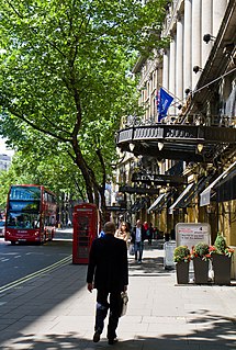
Strand is a major thoroughfare in the City of Westminster, Central London. It runs just over 3⁄4 mile (1,200 m) from Trafalgar Square eastwards to Temple Bar, where the road becomes Fleet Street inside the City of London, and is part of the A4, a main road running west from inner London.

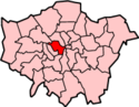
The Metropolitan Borough of Westminster was a metropolitan borough in the County of London, England, from 1900 to 1965.
Aldwych is a street and the name of the area immediately surrounding it in central London, England, within the City of Westminster. The 450 metres (1,480 ft) street starts 600 metres (2,000 ft) east-northeast of Charing Cross, the conventional map centre-point of the city.

St Clement Danes is an Anglican church in the City of Westminster, London. It is situated outside the Royal Courts of Justice on the Strand. Although the first church on the site was reputedly founded in the 9th century by the Danes, the current building was completed in 1682 by Sir Christopher Wren. Wren's building was gutted during the Blitz and not restored until 1958, when it was adapted to its current function as the central church of the Royal Air Force.

Ossulstone is an obsolete subdivision (hundred) covering 26.4% of – and the most metropolitan part – of the historic county of Middlesex, England. It surrounded but did not include the City of London and the area has been entirely absorbed by the growth of London. It now corresponds to the seven London Boroughs of Inner London north of the Thames and, from Outer London, in decreasing order, certain historic parishes of the London boroughs of Ealing, Brent, Barnet, Hounslow and Haringey.
The Holborn Division was one of four divisions of the Hundred of Ossulstone, in the county of Middlesex, England. The other divisions were named Finsbury, Kensington and Tower.

The City and Liberty of Westminster was a unit of local government in the county of Middlesex, England. It was located immediately to the west of the City of London. Originally under the control of Westminster Abbey, the local authority for the area was the Westminster Court of Burgesses from 1585 to 1900. The area now forms the southern part of the City of Westminster in Greater London.
The Precinct of the Savoy, also known as Savoy St John the Baptist, was a component of the Liberty of the Savoy in the metropolitan area of London, England. It was located between the Strand and the River Thames. Formerly extra-parochial, it was a civil parish between 1866 and 1922. It now forms part of the City of Westminster in Greater London.
The Savoy was a manor and liberty sandwiched between the Liberty of Westminster, on two sides, the Inner and Middle Temple corner of City of London and a steep bank of the Tideway. It was in the county of Middlesex. It was all held by the Duchy of Lancaster, and was also known as the Liberty of the Duchy of Lancaster. The duchy (monarch) has kept some reversionary interests and the Savoy Chapel outright. The manor, enjoying the status of a liberty, comprised the precinct of the Savoy, the southern half and detached south-west of the parish of St Clement Danes and about three quarters of St Mary le Strand as it only, in a tiny part, extended north of the Strand whereas those parishes straddled this ancient road.
The Liberty of the Rolls was a liberty, and civil parish, in the metropolitan area of London, England.
Strand was a local government district within the metropolitan area of London, England, from 1855 to 1900.

St George Hanover Square was a civil parish in the metropolitan area of London, England. The creation of the parish accompanied the building of the St George's Hanover Square Church, constructed by the Commission for Building Fifty New Churches to meet the demands of the growing population. The parish was formed in 1724 from part of the quite early medieval parish of Saint Martin in the Fields in the consequent Liberty of Westminster, hundred of Ossulstone and county of Middlesex. It included some of the most fashionable areas of the West End of London, including Belgravia and Mayfair. Civil parish administration, known as a select vestry, was dominated by members of the British nobility until the parish adopted the Vestries Act 1831. The vestry was reformed again in 1855 by the Metropolis Management Act. In 1889 the parish became part of the County of London and the vestry was abolished in 1900, replaced by Westminster City Council. The parish continued to have nominal existence until 1922. As created, it was a parish for both church and civil purposes, but the boundaries of the ecclesiastical parish were adjusted in 1830, 1835 and 1865.
St Mary le Strand was an ancient parish in the metropolitan area of London, England. It was partly within the Liberty of the Savoy and partly within the Liberty of Westminster. It took its name from the church of St Mary and the Innocents. The church was demolished in 1548 during the construction of Somerset House and not rebuilt until 1723. The parish was de facto merged with the Precinct of the Savoy as "St Mary Savoy", but an attempt to merge the parishes de jure in the early 18th century failed. It was restored as a separate parish following the construction of the New Church in the Strand in 1723. The parish was grouped into the Strand Poor Law Union in 1836 and the Strand District in 1855. In 1889 it became part of the County of London and the Metropolitan Borough of Westminster from 1900. It was abolished as a civil parish in 1922.
St Martin-in-the-Fields was a civil parish in the metropolitan area of London, England. It took its name from the church of St Martin-in-the-Fields and was within the Liberty of Westminster. It included within its boundaries the former extra-parochial areas of Buckingham Palace and St James's Palace.
St Anne Within the Liberty of Westminster, also known as St Anne Soho, was a civil parish in the metropolitan area of London, England. The creation of the parish accompanied the building of St Anne's Church, Soho to meet the demands of the growing population. The parish was formed in 1687 from part of the ancient parish of St Martin in the Fields in the Liberty of Westminster and county of Middlesex. It included the eastern section of the contemporary districts of Soho to the north of Shaftesbury Avenue and Chinatown to the south of it. Initially controlled by a select vestry, the parish was governed by an open vestry of all inhabitants until 1855, when the vestry was superseded for most purposes by the Strand District Board of Works. In 1889 the parish became part of the County of London and in 1900 the local authority became Westminster City Council. The parish continued to have nominal existence until 1922.
St Margaret was an ancient parish in the City and Liberty of Westminster and the county of Middlesex. It included the core of modern Westminster, including the Palace of Westminster and the area around, but not including Westminster Abbey. It was divided into St Margaret's and St John's in 1727, to coincide with the building of the Church of St John the Evangelist, constructed by the Commission for Building Fifty New Churches in Smith Square to meet the demands of the growing population, but there continued to be a single vestry for the parishes of St Margaret and St John. This was reformed in 1855 by the Metropolis Management Act, and the two parishes formed the Westminster District until 1887. St Margaret and St John became part of the County of London in 1889. The vestry was abolished in 1900, to be replaced by Westminster City Council, but St Margaret and St John continued to have a nominal existence until 1922.

The Cleveland Street Workhouse is a Georgian property in Cleveland Street, Marylebone, built between 1775 and 1778 for the care of the sick and poor of the parish of St Paul Covent Garden under the Old Poor Law. From 1836, it became the workhouse of the Strand Union of parishes. The building remained in operation until 2005 after witnessing the complex evolution of the healthcare system in England. After functioning as a workhouse, the building became a workhouse infirmary before being acquired by the Middlesex Hospital and finally falling under the NHS. In the last century it was known as the Middlesex Hospital Annexe and the Outpatient Department. It closed to the public in 2005 and it has since been vacated. On 14 March 2011 the entire building became Grade II Listed. Development of the site began in 2019 by current owner University College London Hospitals (UCLH) Charity as a mixed-use development including residential, commercial and open space, but construction has been held up by the necessity to remove human remains stemming from the use of the area around the workhouse as a parish burial ground between 1780 and 1853. There has also been controversy about the amount of social housing to be included in the development.

The Liberty of Glasshouse Yard was an extra-parochial liberty adjacent to the City of London. The liberty took its name from a glass manufacturing works established there. The area now forms part of the London Borough of Islington.