Related Research Articles

Sevier County is a county located in the U.S. state of Arkansas. As of the 2010 census, the population was 17,058. The county seat is De Queen. Sevier County is Arkansas's 16th county, formed on October 17, 1828, and named for Ambrose Sevier, U.S. Senator from Arkansas. On November 3, 2020 voters in Sevier County, AR approved alcohol sales by a vote of 3,499 to 1,699.

Saline County is located in the U.S. state of Arkansas. As of the 2010 census, the population was 107,118. at the 2010 census. Its county seat and largest city is Benton. Saline County was formed on November 2, 1835, and named for the salt water (brine) springs in the area, despite a differing pronunciation from saline. Until November 2014, it was an alcohol prohibition or dry county.

Pulaski County is located in the U.S. state of Arkansas with a population of 391,911, making it the most populous county in Arkansas. Its county seat is Little Rock, which is also Arkansas's capital and largest city. Pulaski County is Arkansas's fifth county, formed on December 15, 1818, alongside Clark and Hempstead Counties. The county is named for Casimir Pulaski, a Polish volunteer who saved George Washington's life during the American Revolutionary War.
Pope County is a county in the U.S. state of Arkansas. As of the 2010 census, the population was 61,754. The county seat is Russellville. The county was formed on November 2, 1829, from a portion of Crawford County and named for John Pope, the third governor of the Arkansas Territory. It is an alcohol prohibition or dry county.
Independence County is a county located in the U.S. state of Arkansas. As of the 2010 census, the population was 36,647. The county seat is Batesville. Independence County is Arkansas's ninth county, formed on October 20, 1820, from a portion of Lawrence County and named in commemoration of the Declaration of Independence. It is an alcohol prohibition or dry county.

Crawford County is a county located in the Ozarks region of the U.S. state of Arkansas. As of the 2010 census, the population was 61,948, making it the 12th-most populous of Arkansas's 75 counties. The county seat and largest city is Van Buren. Crawford County was formed on October 18, 1820 from the former Lovely County and Indian Territory, and was named for William H. Crawford, the United States Secretary of War in 1815.

Benton County is a county located in the northwestern corner of the U.S. state of Arkansas. As of the 2010 census, the population was 221,339, making it the second-most populous county in Arkansas. The county seat is Bentonville. The county was formed on September 30, 1836 and was named after Thomas Hart Benton, a U.S. Senator from Missouri. In 2012, Benton County voters elected to make the county wet, or a non-alcohol prohibition location. Benton County is part of the Northwest Arkansas region.

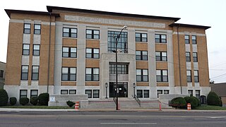
Lincoln is a city in Washington County, Arkansas, United States. The population was 2,249 at the 2010 census. It is part of the Northwest Arkansas metro area.

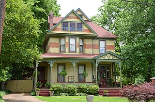
Canehill is an unincorporated community in Washington County, Arkansas, United States. The community is located in the Ozark Mountains on the outskirts of the Northwest Arkansas metropolitan area. One of the most historic communities in the state, Canehill contains seventeen listings on the National Register of Historic Places (NRHP). The Cane Hill College began operations in 1834, which led to the rapid growth and development of the community as a center of higher education. The college and community suffered during the Civil War, and was bypassed by the railroad, which chose a route through Lincoln. Recently, restoration and preservation of many historic buildings has been undertaken by a nonprofit organization, Historic Cane Hill Inc.
Lincoln Township is one of thirty-seven townships in Washington County, Arkansas, USA. As of the 2000 census, its total population was 1,752.

Suttle is an unincorporated community in Starr Hill Township, in western Washington County, Arkansas, United States. It is located on Washington County Road 33 and on the east bank of Moores Creek. Lincoln lies about two miles to the southwest.
Starr Hill may refer to:
West Fork Township is an inactive township in Washington County, Arkansas, United States.
Winslow Township is an inactive township in Washington County, Arkansas, United States.
Wedington Township is an inactive township in Washington County, Arkansas, United States.
Bowen Township is one of 21 inactive townships in Madison County, Arkansas, USA. As of the 2010 census, its population was 486.
Hilburn Township is one of 21 inactive townships in Madison County, Arkansas, USA. As of the 2010 census, its population was 310.
Boston Township is one of 21 inactive townships in Madison County, Arkansas, USA. As of the 2010 census, its population was 168.
Kentucky Township is one of 21 inactive townships in Madison County, Arkansas, USA. As of the 2010 census, its population was 265.
Valley Township is one of 21 inactive townships in Madison County, Arkansas, USA. As of the 2010 census, its population was 517.
References

Coordinates: 35°57′47″N94°27′58″W / 35.963°N 94.466°W
| This article about a location in Washington County, Arkansas is a stub. You can help Wikipedia by expanding it. |