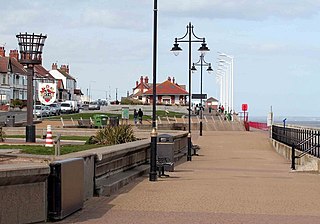
Hornsea is a seaside town and civil parish in the East Riding of Yorkshire, England. The settlement dates to at least the early medieval period. The town was expanded in the Victorian era with the coming of the Hull and Hornsea Railway in 1864. In the First World War the Mere was briefly the site of RNAS Hornsea Mere, a seaplane base. During the Second World War the town and beach was heavily fortified against invasion.

Cottingham is a large village and civil parish in the East Riding of Yorkshire, England. It lies 4 miles (6.4 km) north-west of the centre of Kingston upon Hull, and 6 miles (9.7 km) south-east of Beverley on the eastern edge of the Yorkshire Wolds. It forms part of Hull's Urban Area. It has two main shopping streets, Hallgate and King Street, which cross each other near the Church of Saint Mary the Virgin, and a market square called Market Green. Cottingham had a population of 17,164 residents in 2011, making it larger by area and population than many towns. As a result, it is one of the villages claiming to be the largest village in England.
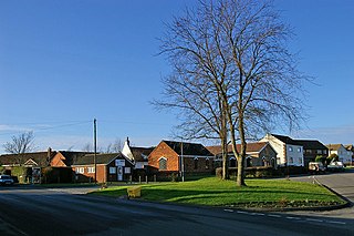
South Killingholme is a village and civil parish in North Lincolnshire, England. The population of the civil parish at the 2011 census was 1,108.
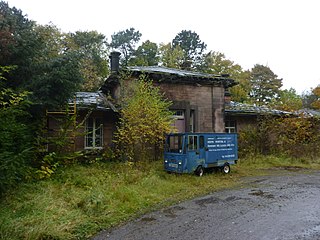
Wingfield railway station served a rural area of Derbyshire, England between 1840 and 1967.

Dogdyke railway station was a station on the former Great Northern Railway between Boston and Lincoln.
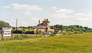
Tattershall railway station was a station in Tattershall, Lincolnshire. It was closed in 1963. It is now an art gallery.

Howsham railway station was a station in Howsham, Lincolnshire on the line between Grimsby and Lincoln, England. The station opened in 1848 closed on 1 November 1965 as were many neighbouring stations, however the line it stood on remains open.

North Kelsey railway station was a railway station serving both the village of North Kelsey and town of Caistor in Lincolnshire, England, it was opened in 1848 and closed in 1965.

Moortown railway station was a railway station serving both the village of Moortown and town of Caistor in Lincolnshire, England on the line between Grimsby and Lincoln opened in 1848 and closed in 1965.

Holton Le Moor railway station was a station in Holton le Moor, Lincolnshire, England. It was opened in 1848 and closed in 1965.
Wickenby railway station was a station in Wickenby, Lincolnshire on the line between Lincoln and Grimsby, opened in 1848 and closed in 1965.
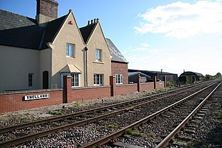
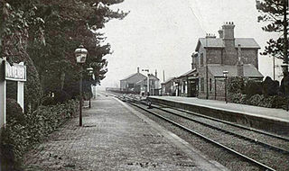
Snelland railway station was a station in Snelland, Lincolnshire, opened in 1848 as part of the Sheffield and Lincolnshire Extension Railway. and closed in 1965.

Northorpe railway station was a railway station in Northorpe, Lincolnshire, England. It opened on 2 April 1849 and closed for passengers on 4 July 1955 and freight on 2 March 1964. Originally named Northorpe, it became Northorpe (Lincs) at some point after January 1948. Although the station is now closed, the signal box here remains in use to supervise a level crossing and passing loop on the single track section of the route between Gainsborough Central and Kirton Lindsey.
Navenby railway station was a railway station in Navenby, Lincolnshire on the Grantham and Lincoln railway line. The station closed for passengers in 1962 and freight in 1964 but the line remained open until it was closed in 1965 as part of the Beeching Axe.

Branston and Heighington railway station was a station in the village of Heighington, Lincolnshire, on the line between Lincoln and Sleaford.

Torksey railway station was a station in Torksey, Lincolnshire on the line between Lincoln and Retford. It closed to passengers in 1959, but part of the line remained in use for freight traffic until the early 1980s. Torksey Viaduct remains as a Grade II Listed Structure.

Lea railway station was a station in Lea, Lincolnshire, England, south of Gainsborough. It was opened in 1849 by the Great Northern Railway, but was closed to passengers in 1957 and closed entirely in 1963.

Haxey and Epworth railway station served the towns of Haxey and Epworth on the Isle of Axholme, Lincolnshire, England. It closed to passengers in 1959 and completely in 1964.

Epworth railway station was a station that served the town of Epworth, on the Isle of Axholme in Lincolnshire, England.

Newland is a suburb of Kingston upon Hull, East Riding of Yorkshire, England, in the north-west of the city, a former village on the Hull to Beverley turnpike.
