Related Research Articles

Scunthorpe is an industrial town in the unitary authority of North Lincolnshire in Lincolnshire, England of which it is the main administrative centre. Scunthorpe had an estimated total population of 82,334 in 2016. A predominantly industrial town, the town is the United Kingdom's largest steel processing centre and is also known as the "Industrial Garden Town". It is the third largest settlement in Lincolnshire, after Lincoln and Grimsby. The Member of Parliament for Scunthorpe is Conservative politician Holly Mumby-Croft.

Scunthorpe railway station serves the town of Scunthorpe in North Lincolnshire, England. The station is located a short walk from the town centre, on Station Road.

The A18 is a road in England that links Doncaster in South Yorkshire with Ludborough in Lincolnshire, via Scunthorpe and Grimsby. Much of its route has been superseded by the M180 motorway.
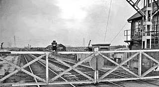
Beighton railway station is a former railway station near the village of Beighton on the border between Derbyshire and South Yorkshire, England.
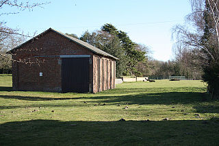
Aby for Claythorpe was a railway station on the East Lincolnshire Railway which served the hamlets of Aby and Claythorpe in Lincolnshire between 1848 and 1961. It originally opened as Claythorpe, but was renamed in 1885. Withdrawal of goods facilities took place in 1961, on the same day that the station was closed to passengers. The line through the station is closed.

Alford Town was a railway station on the East Lincolnshire Railway which served the town of Alford in Lincolnshire between 1848 and 1970. It originally opened as Alford, but was renamed in 1923. When passenger services were withdrawn in 1970 the line through the station was closed.

Authorpe was a railway station on the East Lincolnshire Railway, which served the village of Authorpe in Lincolnshire between 1848 and 1964. The station was closed to passengers in 1961, and withdrawal of goods facilities took place in 1964. The line through the station is closed.
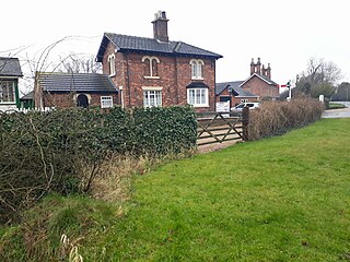
Legbourne Road was a railway station on the East Lincolnshire Railway which served the village of Legbourne in Lincolnshire between 1848 and 1964. The station was closed to passengers in 1953, and withdrawal of goods facilities took place in 1964. The line through the station closed in 1970. The station once housed a museum containing railway memorabilia; this closed in 1998 and the building is once again a private residence.
Waltham was a railway station on the East Lincolnshire Railway which served the villages of New Waltham and Humberston in Lincolnshire between 1848 and 1964. It was originally named Waltham and Humberstone, but Humberstone was dropped soon after opening. The line through Waltham remained open for freight until December 1980.

Holton Village Halt was a railway halt on the East Lincolnshire Railway which served the village of Holton-le-Clay in Lincolnshire between 1905 and 1961. The station, which opened as part of a new motor train service between Grimsby and Louth, was the second station to serve the village after Holton-le-Clay and Tetney situated further to the south. The line through Holton-le-Clay remained open for freight until December 1980.
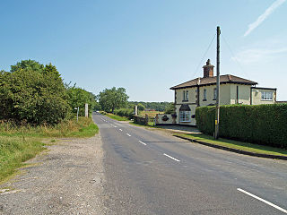
Holton-le-Clay was a railway station on the East Lincolnshire Railway which served the English villages of Holton-le-Clay and Tetney in Lincolnshire between 1848 and 1964. It was originally named Holton-le-Clay and Tetney, but Tetney was dropped soon after opening, even though the station was more conveniently sited for that village. The line through Holton-le-Clay remained open for freight until December 1980, but could be reopened by the Lincolnshire Wolds Railway as its northern terminus.

Utterby Halt was a railway halt on the East Lincolnshire Railway which served the village of Utterby in Lincolnshire between 1905 and 1961. The station, which opened as part of a new motor train service between Grimsby Town and Louth, is reputed to be haunted by the ghost of a ganger killed on the level crossing in 1953. The line through Utterby remained open for freight until December 1980.

Fotherby Halt was a railway halt on the East Lincolnshire Railway which served the village of Fotherby in Lincolnshire between 1905 and 1961. The station was opened on the site of a previous station named Fotherby Gate House which had closed in 1872. The second station closed in 1961, but the line through it remained open for freight until December 1980. The line through the station could be reopened by the Lincolnshire Wolds Railway as part of its extension south from Ludborough to Louth.

Appleby railway station is a former railway station in Appleby, Lincolnshire, England.
Scunthorpe railway station was a small railway station, the original southern terminus of the North Lindsey Light Railway situated adjacent to the level crossing on Dawes Lane and about 1⁄2 mile east of the present mainline station, opened in 1926, and about 1⁄8 mile east of Frodingham railway station, Scunthorpe's first station.

Grainsby Halt was a railway halt on the East Lincolnshire Railway which served the hamlet of Grainsby in Lincolnshire between 1905 and 1952. The station, which opened as part of a new motor train service between Grimsby and Louth, was opened to serve a Victorian hall situated 2 miles (3.2 km) to the west. The station, one of the smallest to be taken over by British Railways on nationalisation in 1947, never really justified its existence and closed in 1952 following a period of temporary closure during the Second World War. The line through Grainsby remained open for freight until December 1980.
Weelsby Road Halt was a railway halt on the East Lincolnshire Railway which served the Weelsby Road area of eastern Grimsby in Lincolnshire between 1905 and 1940. The station was opened as part of a new motor train service between Grimsby and Louth. It was the site of major works in 1933 when a plate girder bridge was constructed to replace a level crossing, enabling road traffic to pass underneath through a subway. The station closed in 1952 following a period of temporary closure during the Second World War. The line through Weelsby remained open for freight until December 1980. The trackbed was later reused by Humberside County Council to construct the A16 Peaks Parkway which now runs through the site. Building of the road put an end to the aspirations of the Great Northern and East Lincolnshire Railway plc to reopen the line as a heritage railway.
Hainton Street Halt was a railway halt on the East Lincolnshire Railway which served the Welholme Road area of Grimsby in Lincolnshire between 1905 and 1961. The station was opened as part of a new motor train service between Grimsby and Louth. The station briefly closed in 1939 as a Second World War economy measure, but reopened in 1940. The line through Hainton Street remained open for freight until December 1980. The trackbed was later reused by Humberside County Council to construct the A16 Peaks Parkway which now runs through the site. Building of the road put an end to the aspirations of the Great Northern and East Lincolnshire Railway plc to reopen the line as a heritage railway.
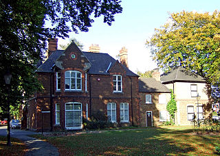
North Lincolnshire Museum is a local museum in the town of Scunthorpe, north Lincolnshire, England.

Frodingham was a hamlet in Lincolnshire which has grown into a suburb of Scunthorpe, North Lincolnshire. Although the village lay directly to the south of what is now Scunthorpe town centre, the name Frodingham is now often used to refer to the area directly to the north of the town centre.
References
- 1 2 3 Butt, R. V. J. (October 1995). The Directory of Railway Stations: details every public and private passenger station, halt, platform and stopping place, past and present (1st ed.). Sparkford: Patrick Stephens Ltd. ISBN 978-1-85260-508-7. OCLC 60251199. OL 11956311M.
- ↑ Quick, M E (2002). Railway passenger stations in England, Scotland and Wales – a chronology. Richmond: Railway and Canal Historical Society. p. 189. OCLC 931112387.
Coordinates: 53°35′17″N0°38′15″W / 53.5881°N 0.6376°W