The Kings River, is a 132.9-mile (213.9 km) river draining the Sierra Nevada mountain range in central California in the United States. Its headwaters originate along the Sierra Crest in and around Kings Canyon National Park and form the eponymous Kings Canyon, one of the deepest river gorges in North America. The river is impounded in Pine Flat Lake before flowing into the San Joaquin Valley southeast of Fresno. With its upper and middle course in Fresno County, the Kings River diverges into multiple branches in Kings County, with some water flowing south to the old Tulare Lake bed and the rest flowing north to the San Joaquin River. However, most of the water is consumed for irrigation well upstream of either point.

The Jordan River is a 51.4-mile-long (82.7 km) river in the U.S. state of Utah. Regulated by pumps at its headwaters at Utah Lake, it flows northward through the Salt Lake Valley and empties into the Great Salt Lake. Four of Utah's six largest cities border the river: Salt Lake City, West Valley City, West Jordan, and Sandy. More than a million people live in the Jordan Subbasin, part of the Jordan River watershed that lies within Salt Lake and Utah counties. During the Pleistocene, the area was part of Lake Bonneville.

Lake Isabella also called Isabella Lake, is a reservoir in Kern County, California, United States created by the earthen Isabella Dam. At 11,000 acres (4,500 ha), it is one of the larger reservoirs in California. Lake Isabella is located about 40 miles (64 km) northeast of Bakersfield, and is the main water supply for that city. It was formed in 1953 when the U.S. Army Corps of Engineers dammed the Kern River at the junction of its two forks. The area is in the southern end of the Sierra Nevada range and the lake itself is located in low mountains at an elevation of approximately 2,500 ft (760 m) where summer temperatures reach over 100 °F (38 °C) but low enough to avoid winter snows on the surrounding ridges. The former towns of Isabella and Kernville were flooded when the reservoir was created.

Indian Lake, also known as North Pond, is a lake located in northern Worcester, Massachusetts. The most recent water quality report from 2023 indicated that "Water Clarity at Indian Lake. Between 6Jun and 5-Jul, Secchi depth readings were high compared to past results at Indian Lake ranging between 6.75 ft and 10.75 ft, indicating clearer water. From mid-July through September, readings ranged between 4.5 ft and 5.25 ft, closer to past observations for summertime in Indian Lake. Secchi depth was in the range considered “Poor” on two occasions late in the season 19-Sep, and 17-Oct. This late season drop in clarity is expected based on past program monitoring results. Figure 4 - Secchi depth was considered "fair" for most of the season with some values in the "good" and "fair" categories. Depths ranged from 2.75-10.75 feet. At both in-lake sites, surface TSS results ranged between 1.5 mg/L and 8.9 mg/L, remaining in the range considered “Excellent” during all sampling events. These results were comparable to those in years past. All but one bottom TSS result from the Northern Site fell below 10 mg/L. As expected, TSS increased as Secchi depth decreased at Indian Lake. L&P rates water clarity at Indian Lake as “Fair” in 2023." The mean and maximum depths are 8 and 15 feet respectively. The bottom is sand and rock. The shoreline is heavily developed with residential dwellings and commercial buildings.

The Kaweah River is a river draining the southern Sierra Nevada in Tulare County, California in the United States. Fed primarily by high elevation snowmelt along the Great Western Divide, the Kaweah begins as four forks in Sequoia National Park, where the watershed is noted for its alpine scenery and its dense concentrations of giant sequoias, the largest trees on Earth. It then flows in a southwest direction to Lake Kaweah – the only major reservoir on the river – and into the San Joaquin Valley, where it diverges into multiple channels across an alluvial plain around Visalia. With its Middle Fork headwaters starting at almost 13,000 feet (4,000 m) above sea level, the river has a vertical drop of nearly two and a half miles (4.0 km) on its short run to the San Joaquin Valley, making it one of the steepest river drainages in the United States. Although the main stem of the Kaweah is only 33.6 miles (54.1 km) long, its total length including headwaters and lower branches is nearly 100 miles (160 km).

Wilson Lake is a reservoir in the U.S. state of Kansas, on the border of Russell County and Lincoln County. Built and managed by the U.S. Army Corps of Engineers for flood control, it is also used for wildlife management and recreation. Several parks are located along its shoreline, including Wilson State Park.

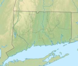
Mansfield Hollow Lake is a reservoir resting on the border of Windham County and Tolland County, Connecticut. The reservoir provides drinking water for Willimantic and helps control flooding in the 159-square-mile Thames River watershed. It was created by the Mansfield Hollow Dam and is entirely contained within Mansfield Hollow State Park and the Mansfield Hollow Wildlife Area. Designed and constructed by the United States Army Corps of Engineers, the dam substantially reduces flooding along the Quinebaug, Shetucket, and Thames rivers. Construction of the project began in 1949 with completion in 1952 at a cost of US$6.5 million. The Mansfield Hollow reservoir is located within the Shetucket River Watershed and is part of the Thames River Basin. Access to the site is available from US Route 6 and State Route 195. The damsite, covering an area of 25 acres (10 ha), was listed on the National Register of Historic Places in 2003.

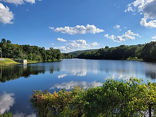
John Redmond Reservoir is a reservoir on the Neosho River in eastern Kansas. Built and managed by the U.S. Army Corps of Engineers, it is used for flood control, recreation, water supply, and wildlife management. It borders the Flint Hills National Wildlife Refuge to the northwest.
Bridgeport is the most populous city in the U.S. state of Connecticut and the fifth-most populous city in New England, with a population of 148,654 in 2020. Located in eastern Fairfield County at the mouth of the Pequonnock River on Long Island Sound, it is a port city 60 miles (97 km) from Manhattan and 40 miles (64 km) from The Bronx. It borders the towns of Trumbull to the north, Fairfield to the west, and Stratford to the east. Bridgeport and other towns in Fairfield County make up the Greater Bridgeport Planning Region, as well as the Bridgeport–Stamford–Norwalk–Danbury metropolitan statistical area, the second largest metropolitan area in Connecticut. The Bridgeport–Stamford–Norwalk–Danbury metropolis forms part of the New York metropolitan area.
Bridgeport State Park is a public recreation area located two miles east of Bridgeport, Washington, on the north shore of Rufus Woods Lake, the Columbia River reservoir created by the Chief Joseph Dam. The state park was built through a partnership between Washington State Parks and the Army Corps of Engineers after completion of the dam in 1955. The park's 25-year lease was renewed in 1990 and again in 2015. The 622-acre (252 ha) park includes 7,500 feet (2,300 m) of shoreline, camping areas, four miles (6.4 km) of hiking trails, and facilities for boating, fishing, swimming, and golf.

The Pequonnock River is a 16.7-mile-long (26.9 km) waterway in eastern Fairfield County, Connecticut. Its watershed is located in five communities, with the majority of it located within Monroe, Trumbull, and Bridgeport. The river has a penchant for flooding, particularly in spring since the removal of a retention dam in Trumbull in the 1950s. There seems to be a sharp difference of opinion among historians as to just what the Indian word Pequonnock signifies. Some insist it meant cleared field or open ground; others are sure it meant broken ground; while a third group is certain it meant place of slaughter or place of destruction.
Bridgeport Harbor is an inlet on the north side of Long Island Sound in Bridgeport, Connecticut. It was carved by the retreat of the glaciers during the last ice age approximately 13,000 years ago.

Lake Ahquabi State Park is a state park in Warren County, Iowa, United States, featuring a 115-acre (47 ha) reservoir. Ahquabi means "resting place" in the Fox language. The park is six miles (10 km) south of Indianola and 22 miles (35 km) south of Des Moines. Three sections of the park were listed on the National Register of Historic Places in 1991.

Melvern Dam is a dam in Osage County, Kansas.
Quinebaug Lake State Park is a public recreation area covering 181 acres (73 ha) in the town of Killingly, Connecticut. The state park offers opportunities for fishing and non-motorized boating on Wauregan Reservoir. The park is managed by the Connecticut Department of Energy and Environmental Protection.

Hopeville Pond State Park is a public recreation area located on Hopeville Pond, an impoundment of the Pachaug River, in the town of Griswold, Connecticut. A portion of the 554-acre (224 ha) state park occupies the site of the lost village of Hopeville. The park manager's house occupies Avery House, which is listed on the National Register of Historic Places. The park offers fishing, swimming, camping, and trails for hiking and biking. It is managed by the Connecticut Department of Energy and Environmental Protection.

Bridgeport, Connecticut is a major city of Connecticut located on Long Island Sound at the mouth of the Pequonnock River.
Beeds Lake State Park is located northwest of Hampton, Iowa, United States. It was listed has a historic district on the National Register of Historic Places as Beeds Lake State Park, Civilian Conservation Corps Area in 1990. At the time of its nomination it contained 21 resources, which included one contributing building, 15 contributing structures, and five non-contributing structures. The 319-acre (129 ha) park surrounds a 99-acre (40 ha) reservoir. It features hiking trails, boating, fishing, swimming, camping, picnic areas and shelters, lodges and concessions.

Moore Dam is a major hydroelectric dam on the Upper Connecticut River between Grafton County, New Hampshire and Caledonia County, Vermont in the northeastern United States. The dam is located near Littleton, New Hampshire, and forms the 3,490-acre (1,410 ha) Moore Reservoir. The Moore Station is the largest conventional hydroelectric plant in New England, in terms of installed capacity and average power generation. The dam and reservoir also provide flood control, recreational boating and fishing.
Higganum Reservoir is a 31-acre (13 ha) human-made body of water impounding Ponset Brook in the town of Haddam, Connecticut, United States. It is the primary feature of Higganum Reservoir State Park. Formed by construction of an earth dam in 1868, the reservoir was built to provide water power for the Higganum Manufacturing Company, a maker of plows and other farm equipment. Later known as Clark Cutaway Harrow, the company produced a line that included 400 types of plows, disk harrows, cider presses, hay spreaders, and carriage jacks. The reservoir's original dam had a maximum height of 48 feet and a total length of embankment of approximately 875 feet. It was reconstructed by the state in 2003. The dam is located at the reservoir's north end; a boat launch maintained by the state is found at its south end.