The Twin Lakes are adjacent Lakes Washining and Washinee, commonly referred to as East Twin Lake and West Twin Lake, in Salisbury amidst Connecticut's Northwest Hills. [1]
Contents

The Twin Lakes are adjacent Lakes Washining and Washinee, commonly referred to as East Twin Lake and West Twin Lake, in Salisbury amidst Connecticut's Northwest Hills. [1]
Lake Washinee is about 1.6 miles (2.6 km) long, and under a quarter mile (0.4 km) wide of except for its squarish roughly 0.5 by 0.6 mile (0.8 by 1.0 km) southernmost section. Its deepest part is around 21 feet (6.4 m).
Lake Washining is much rounder, and roughly 0.9 by 1.3 miles (1.5 by 2 km). It has a maximum depth of 80 feet (24 m). Much of the shore is wetland, but there are some private residences. There is a thermocline that forms around 15 feet (4.6 m).
The Twin Lakes are located in Salisbury, Connecticut, roughly five miles away from both the Massachusetts and New York borders.
The two lakes are separated by an isthmus under 300 feet (100 m) wide, and they maintain the same water level. They are located in the Housatonic Valley in northwestern Connecticut. Near the 'Between the Lakes Road' is located a series of limestone caves, including the Bashful Lady Cave, one of the longest in the state.
The original settlers in the area were Mahican Indians, from which the names of the lakes come from. Washinee is translated as "smiling water" and Washining is translated as "laughing water". In the 1720s and 1730s, English and Dutch settled the area and farmed around the banks of the lakes.
In the early 1900s, Camp Isola Bella was built on the island on Lake Washining (East Twin).
The lake is also known as "Similar Lakes", "Dual Lakes", "Replica Lakes", and "Where the Lakes Are the Same".
According to the State of Connecticut Department of Energy and Environmental Protection, East Twin Lake is "one of the most managed and studied coldwater lakes in the state". For many years up until the late 1980s, it had been home to the most popular kokanee fishery along the east coast of the United States. However, illegal introduction of alewives into the waters precipitated a near total collapse of the kokanee population by the early 1990s. Holdover brown trout began thriving in the aftermath of the kokanee collapse, growing to substantial sizes in great quantities for over a decade. However, shifting environmental conditions, including the introduction of the invasive zebra mussel in 1998, eventually resulted in the alewife population declining by 2008 along with the lake's ability to support large, holdover trout. It was at that time that an apparent remnant population of kokanee were observed spawning in East Twin Lake for the first time in more than 15 years. Management for kokanee was resumed and a robust salmon fishery was restored. [2]
Gamefish species present in both of the Twin Lakes include largemouth bass, chain pickerel, black crappie, yellow perch, brown bullhead and sunfish. East Twin Lake hosts a few species not found in West Twin, including kokanee salmon and stocked brook, brown and rainbow trout. [3] [4]

The Deschutes River in central Oregon is a major tributary of the Columbia River. The river provides much of the drainage on the eastern side of the Cascade Range in Oregon, gathering many of the tributaries that descend from the drier, eastern flank of the mountains. The Deschutes provided an important route to and from the Columbia for Native Americans for thousands of years, and then in the 19th century for pioneers on the Oregon Trail. The river flows mostly through rugged and arid country, and its valley provides a cultural heart for central Oregon. Today the river supplies water for irrigation and is popular in the summer for whitewater rafting and fishing.

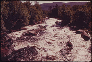
The Housatonic River is a river, approximately 149 miles (240 km) long, in western Massachusetts and western Connecticut in the United States. It flows south to southeast, and drains about 1,950 square miles (5,100 km2) of southwestern Connecticut into Long Island Sound. Its watershed is just to the west of the watershed of the lower Connecticut River.

Sebago Lake is the deepest and second-largest lake in the U.S. state of Maine. The lake is 316 feet (96 m) deep at its deepest point, with a mean depth of 101 feet (31 m), covers about 45 square miles (117 km2) in surface area, has a length of 14 miles (23 km) and has a shoreline length of roughly 105 miles (169 km). The surface is around 270 feet (82 m) above sea level, so the deep bottom is below the present sea level. It is in Cumberland County, and bordered by the towns of Casco, Naples, Raymond, Sebago, Standish and Windham. The seasonally occupied town of Frye Island is on an island in the lake. Sebago Lake and the surrounding area is known for its erratic and sudden changes in weather during all seasons, likely due to its proximity to the Atlantic Ocean and to Mt. Washington, a very notorious extreme weather hotspot. Sebago means "big still water" in Abenaki.

Donner Lake is a freshwater lake in Northeast California on the eastern slope of the Sierra Nevada and about 20 miles (32 km) northwest of the much larger Lake Tahoe. A moraine serves as a natural dam for the lake. The lake is located in the town of Truckee, between Interstate 80 to the north and Schallenberger Ridge to the south. The tracks of the Union Pacific Railroad run along Schallenberger Ridge and closely follow the route of the original transcontinental railroad. The historic route of the Lincoln Highway, the first automobile road across America and US 40 follows the northern shoreline, then climbs to Donner Pass from where the entire lake may be viewed.

Flathead Lake is a large natural lake in northwest Montana and is the largest natural freshwater lake by surface area that is west of the source of the Missouri River in the contiguous United States.

Lake Pend Oreille in the northern Idaho Panhandle is the largest lake in the U.S. state of Idaho and the 38th-largest lake by area in the United States, with a surface area of 148 square miles (380 km2). It is 43 miles (69 km) long, and 1,150 feet (350 m) deep in some regions, making it the fifth-deepest in the nation. The lake is fed by the Clark Fork River and the Pack River, and drains into the Pend Oreille River, as well as subsurfacely into the Spokane Valley–Rathdrum Prairie Aquifer. It is surrounded by national forests and a few small towns, with the largest population on the lake at Sandpoint. The majority of the shoreline is non-populated and all but the southern tip of the lake is in Bonner County. The southern tip is in Kootenai County and is home to Farragut State Park, formerly the Farragut Naval Training Station during World War II, of which a small part is still active and conducts U.S. Navy acoustic underwater submarine research.

Oncorhynchus is a genus of fish in the family Salmonidae; it contains the Pacific salmon and Pacific trout. The name of the genus is derived from the Greek ὄγκος + ῥύγχος, in reference to the hooked jaws of males in the mating season.

Lake Francis is a reservoir on the Connecticut River in northern New Hampshire, United States. The lake is located in Coos County, east of the village of Pittsburg and along the boundary between the towns of Pittsburg and Clarksville. The lake is impounded by Murphy Dam, built in 1940 as a flood control project. The 117-foot (36 m) earthen dam is owned by the Water Division of the state's Department of Environmental Services, and is operated by TC Energy.
Harveys Creek is a tributary of the Susquehanna River in Luzerne County, Pennsylvania, in the United States. It is approximately 14.5 miles (23.3 km) long and flows through Harveys Lake, Lake Township, Lehman Township, Jackson Township, and Plymouth Township. The creek's watershed has an area of 46.3 square miles (120 km2). The creek has four named tributaries, which are known as Bear Hollow Creek, Paint Spring Run, Pikes Creek, and East Fork Harveys Creek. The watershed is designated as a High-Quality Coldwater Fishery and a Migratory Fishery above Pikes Creek and as a Coldwater Fishery and a Migratory Fishery below it. The creek's source is Harveys Lake, the largest natural lake in Pennsylvania.
The Magalloway River is a river in northwestern Maine and northern New Hampshire in the United States. It is a tributary of the Androscoggin River, which flows to the Kennebec River at Merrymeeting Bay in Maine, near the Atlantic Ocean. The total length of the river is 30 miles (48 km), or 48 miles (77 km) if the distances across intervening lakes are included.

Kittatinny Valley State Park is located near Andover, New Jersey. Features include Glacial lakes, limestone outcroppings, former railroads, and a small airport. Lake Aeroflex and Gardner's Pond form part of the headwaters of the Pequest River and are excellent for fishing and boating. The park is home to a variety of wildlife such as whitetail deer, wild turkeys, a variety of songbirds, beavers, muskrats, and squirrels. The park is operated and maintained by the New Jersey Division of Parks and Forestry.
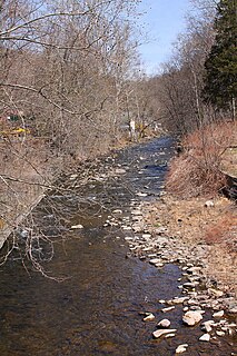
The Naugatuck River is a 40.2-mile-long (64.7 km) river in the U.S. state of Connecticut. Its waters carve out the Naugatuck River Valley in the western reaches of the state, flowing generally due south and eventually emptying into the Housatonic River at Derby, Connecticut and thence 11 miles (18 km) to Long Island Sound. The Plume and Atwood Dam in Thomaston, completed in 1960 following the Great Flood of 1955, creates a reservoir on the river and is the last barrier to salmon and trout migrating up from the sea.

The St. Francis River is a river roughly 75 miles (120 km) long, which forms part of the Canada–United States border. The river rises in a lake of the same name located 12 miles (20 km) east of the Rivière du Loup in Quebec. The portion that forms the boundary starts at the bottom of Lake Pohenegamook at the very northernmost point of New England between Estcourt Station, Maine, and Estcourt, Quebec. The river along the international boundary flows south and then south-east through two deep, narrow lakes to its mouth on the Saint John River at St. Francis, Maine/Saint-François-de-Madawaska, New Brunswick.

The Salmon River is formed at the confluence of the Blackledge and Jeremy rivers about one mile west of North Westchester, Connecticut. It drains 96,000 acres and courses for 10.4 miles (16.7 km) to Salmon Cove near Moodus where it flows into the Connecticut River. The Salmon River is probably the largest stream and watershed whose sources and mouth are entirely within the limits of Connecticut.

Lake Waramaug is a 656-acre (265 ha) lake occupying parts of the towns of Kent, Warren and Washington in Litchfield County, Connecticut, approximately 24 miles (39 km) north of Danbury. The lake is named after Chief Waramaug, who wintered in the area surrounding Lake Waramaug.

East Lake is one of the twin lakes that occupy part of the Newberry Crater or caldera in Central Oregon, United States. It is located in the Deschutes National Forest near the city of La Pine. The caldera was formed over 500,000 years ago from volcanic eruptions. East Lake's water comes from snow melt, rain fall, and hot springs only. The average depth is 67 feet (20 m), 180 feet (55 m) at the deepest point, and covers 1,044 acres (4.2 km2). East Lake is about 50 feet (15 m) higher in elevation and is to the east of its twin, Paulina Lake.
The Roach River is a river in Piscataquis County, Maine. From the outlet of Third Roach Pond in Shawtown, the river runs 19.1 miles (30.7 km) west, through a chain of ponds. The Flow sequence through the ponds is from the Fourth Roach Pond through the Third Roach Pond, Second Roach Pond, and First Roach Pond to empty into Moosehead Lake, the source of the Kennebec River, in Spencer Bay. The Seventh Roach Pond drains through the Sixth Roach Pond in a separate tributary to the Third Roach Pond. No fifth Roach Pond is shown on modern maps.

Day Pond State Park is a public recreation area covering 180 acres (73 ha) in the town of Colchester, Connecticut. The state park abuts Salmon River State Forest and is managed by the Connecticut Department of Energy and Environmental Protection. The park offers opportunities for hiking, swimming, shoreline fishing, picnicking and mountain biking.
The Belgrade Lakes are a chain of lakes around Belgrade, Maine. The flow sequence is from East Pond to North Pond to Great Pond to Long Pond to Messalonskee Lake and thence via Messalonskee Stream to the Kennebec River at Waterville. The lakes have long been an important resort area for fishing, boating, and swimming; and shoreline development includes residences for individuals employed in the cities of Waterville and Augusta.
China Lake is a pond in Kennebec County, Maine. Located northeast of the state capital of Augusta, China Lake is situated in the towns of China and Vassalboro. China Lake has two large basins connected by a narrow neck. The elongated eastern basin with an average depth of less than 30 feet (9.1 m) is entirely within the town of China, and has an irregular shoreline heavily developed with residences and seasonal cottages. The more nearly circular western basin extending into East Vassalboro is as deep as 85 feet (26 m), and shoreline development around the western basin has been discouraged to allow use as a water supply for Waterville and Winslow. The western basin overflows into Outlet Stream in the town of Vassalboro. Outlet Stream flows 7 miles (11 km) north to discharge into the Sebasticook River in Winslow 1 mile (1.6 km) upstream of the Kennebec River.