Suwanee is a city in the northern section of Gwinnett County in the U.S. state of Georgia. As of the 2010 census, the population was 15,355;[4] this had grown to an estimated 20,907 as of 2019.[5] In 2020, its population was 20,786.
Suwanee, like many towns in Georgia, has its roots based in the name of Native American with this name being from the Shawnee and a former Shawnee area. Settlment always thrived along the Chattahoochee River, where various societies flourished.[7] The city was officially recognized by the U.S. government in 1837, following the establishment of a post office. With the construction of the Georgia Air Line Railroad in 1871, and the Rhodes House hotel in 1880 to accommodate railroad passengers, Suwanee saw in influx of people and a boost in trade and economic activity.[7] Although a devastating fire in 1881 spared only one building on Main Street, the town continued to persevere. From 1880 to 1920, the population remained relatively static, growing from 216 people to 241 over 40 years.[7]As of 2015[update], Suwanee's population had surged to over 18,000, reflecting its growth and development.[8]
Recent history
From 1933 to 1936, the now heavily traveled Buford Highway was constructed through Suwanee.[7] In 1960, Interstate 85 was extended just south of Suwanee, where it ended at the time. Over the past century, several primary education schools have opened in Suwanee, including North Gwinnett High School and Suwanee Elementary School. Suwanee High School dates back to 1880, when it was a one-room schoolhouse.[7] The first city hall was built in the early 1960s, with a second city hall constructed in 1997. In 2005, Town Center was built in 2005 and completed in 2009, at which time the city hall moved to its current location in Town Center.[7] In 2003, Suwanee was named a City of Excellence by the Georgia Municipal Association and Trend Magazine.[7] In 2017, Suwanee was recognized as a Green Community by the Atlanta Regional Commission, earning bronze-level certification for its commitment to environmental stewardship and leadership in sustainability practices.
Geography
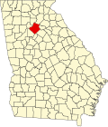
Suwanee is situated in northern Gwinnett County and southeastern Forsyth County. It is bordered to the northeast by the city of Sugar Hill, to the southwest by the city of Duluth, and on the west by the Chattahoochee River, which marks the Fulton County border. Across the river lies the city of Johns Creek.
According to the United States Census Bureau, Suwanee has a total area of 11.0 square miles (28.4km2), of which 10.9 square miles (28.2km2) is land and 0.1 square miles (0.2km2), or 0.70%, is water.[4]
There are several areas with Suwanee postal addresses that lie in unincorporated Gwinnett County and unincorporated Forsyth County. Those areas are not within the Suwanee corporate limits.[9]
Town Center Park is a 10-acre (4.0ha) park located at Buford Highway and Lawrenceville-Suwanee Road. It serves as the community's primary venue for special events and features an amphitheater that can accommodate up to 1,000 audience members for concerts and various performances. The park is also home to Gwinnett County's largest interactive fountain, known as the "Big Splash". The fountain boasts 43 jets and recycles 1,400 US gallons (5,300L; 1,200impgal) of water per minute. Additionally, Town Center Park is situated next to the Suwanee Public Library.[14]
George Pierce Park is a 304-acre (123ha) park, making it the largest in Suwanee. Amenities includes fields for football, baseball, soccer, and softball fields, a fishing pond, hard- and soft-surfaced trails, picnic areas, public restrooms, a playground, outdoor basketball courts, and a senior center.[14]
Suwanee Creek Greenway is a hard-surfaced multipurpose 4-mile (6.4km) trail with wooded areas and wildlife habitat. It is favored by walkers, joggers, and bikers.[14] A spur trail is being added to connect to the Western Gwinnett Bikeway.
Suwanee Creek Park is an 85-acre (34ha) park commonly used for family picnics and other reunions. It is connected to the Suwanee Creek Greenway.[14]
Playtown Suwanee is a super playground built by 1,200 volunteers in 2004. It is known as "the playground my mommy and daddy built."[14]
Sims Lake Park was opened in 2008. It consists of a 7-acre (2.8ha) lake with a looping trail surrounding it.[14]
In 2016, Suwanee unveiled the first Bike Share program in Gwinnett County.[16][17][18]
The city of Suwanee has released a master plan of existing and proposed trails and sidewalks to connect the community neighborhoods, schools and businesses.[19] Major trails include:
This page is based on this Wikipedia article Text is available under the CC BY-SA 4.0 license; additional terms may apply. Images, videos and audio are available under their respective licenses.