
Apra Harbor, also called Port Apra, is a deep-water port on the western side of the United States territory of Guam. It is considered one of the best natural ports in the Pacific Ocean. The harbor is bounded by Cabras Island and the Glass Breakwater to the north and the Orote Peninsula in the south. Naval Base Guam and the Port of Guam are the two major users of the harbor. It is also a popular recreation area for boaters, surfers, scuba divers, and other recreationalists.

Saco Bay is a small curved embayment of the Gulf of Maine on the Atlantic coast of Maine in the United States. The name derives "from a map of the coastline made in 1525 by the Spanish explorer Esteban Gómez. He named the bay Bahio de Saco ."

The sand tiger shark, grey nurse shark, spotted ragged-tooth shark or blue-nurse sand tiger, is a species of shark that inhabits subtropical and temperate waters worldwide. It inhabits the continental shelf, from sandy shorelines and submerged reefs to a depth of around 191 m (627 ft). They dwell in the waters of Japan, Australia, South Africa, and the east coasts of North and South America. The sand tiger shark also inhabited the Mediterranean, however it was last seen there in 2003 and is presumed extinct in the region. Despite its common names, it is not closely related to either the tiger shark or the nurse shark.

Umkomaas, a small coastal town on the subtropical south coast of KwaZulu-Natal, South Africa was formed when a harbour was built in 1861 to export sugar. The town rests beside the mouth of the navigable uMkhomazi River, also known as the Mkhomazi or Umkomaas. With the successful dredging of Durban harbour's sandbar and arrival of the railway, like Port Shepstone, the harbour fell into disuse, but the town came to life.

Papakōlea Beach is a green sand beach located near South Point, in the Kaʻū district of the island of Hawaiʻi. It is one of only four green sand beaches in the world, the others being Talofofo Beach, Guam; Punta Cormorant on Floreana Island in the Galapagos Islands; and Hornindalsvatnet, Norway. It gets its distinctive coloring from olivine sand eroded out of the enclosing volcanic cone.

The smalltooth sand tiger or bumpytail ragged-tooth is a species of mackerel shark in the family Odontaspididae, with a patchy but worldwide distribution in tropical and warm temperate waters. They usually inhabit deepwater rocky habitats, though they are occasionally encountered in shallow water, and have been known to return to the same location year after year. This rare species is often mistaken for the much more common grey nurse shark, from which it can be distinguished by its first dorsal fin, which is larger than the second and placed further forward. It grows to at least 4.1 m (13.5 ft) in length.

Lady Robinsons Beach is the stretch of beach between the mouth of the Cooks River and the mouth of Georges River on the western shore of Botany Bay in Sydney, New South Wales, Australia. Originally known as Seven Mile Beach, it was renamed after the wife of the then Governor, Sir Hercules Robinson. Isolated settlements separated from the beach by sand dunes were also given the name of Lady Robinson's Beach as their postal address.
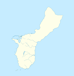
The Talofofo Falls are a scenic series of cascades on the Ugum River on the island of Guam. They are located in the southeast of the island, inland from Talofofo Bay.

Fena Lake (Reservoir) is the largest lake in the United States territory of Guam and it is a man made reservoir. It is located in the south of the island on the Ordnance Annex military installation, and is overlooked by the nearby peaks of Mounts Lamlam, Alifan and Jumullong Manglo. The lake's outflow is to the north-west, its waters eventually reaching the Pacific Ocean at Talofofo Bay.
Guam Highway 4 (GH-4) is one of the primary automobile highways in the United States territory of Guam.
The Talofofo River is one of the longest rivers on the Pacific Ocean island of Guam. Rising on the eastern slopes of Mount Lamlam in the island's south-west, it traverses the island in a north-eastward direction, flowing into the sea at Talofofo Bay.

Talo'fo'fo, formerly Talofofo, is a village located in the southern part of the United States territory of Guam, on the east coast. The village center is located in the hills above the coast, while the smaller coastal community below the cliff is known as Ipan.
10th Independent Mixed Regiment was a regiment of the Imperial Japanese Army that has association with a number of U.S. National Register of Historic Places-listed places in Guam.
The Pago Bay Japanese pillboxes are a pair of World War II-era coastal defense pillboxes located on the shore of Pago Bay, located on the central east coast of Guam. Built out of steel-reinforced concrete mixed with coral stone, these two structures were built by Japanese defenders during their occupation of the island between 1941 and 1944. They were listed on the National Register of Historic Places in 1991 as Pagu' Pillbox I and Pagu' Pillbox II. Neither of these would have seen substantial action during the 1944 liberation of Guam, whose military activities were focused on the western, central, and northern parts of the island.
The Talofofo Pillbox is a historic World War II-era defensive fortification in Talofofo, Guam. It is located near the coast, about 127 metres (417 ft) south of the mouth of the Togcha River and 27 metres (89 ft) inland from the high-tide line. It is roughly 2.75 by 3.0 metres, built out of concrete and coral limestone. Its walls are about 0.5 metres (1.6 ft) thick, with an embrasure providing a view of the Togcha River, and a window looking over the coast to the east. Its entrance is on the landward (south) side. This structure was built under the direction of the Imperial Japanese Army during its occupation of Guam in 1941–44.

The Helderberg Marine Protected Area is a small marine conservation area on the north-eastern side of False Bay in the Western Cape province of South Africa, It lies between the mouths of the Lourens River in the Strand, and the Eerste River in Macassar.

Kizugawa Maru, or Kitsugawa Maru, is a World War II-era Japanese water tanker sunk in Apra Harbor, Guam. Damaged by a submarine torpedo attack off Guam on April 8, 1944, she was towed into port for repairs. In port, she was further damaged in three separate U.S. air attacks during the Mariana and Palau Islands campaign. Deemed irreparable, Kizugawa Maru was scuttled by shore guns on June 27, 1944. The shipwreck is now a deep recreational diving site.
Pago Bay is the largest bay on the U.S. territory of Guam, located at the mouth of Pago River on the island's eastern coast. There is extensive evidence of CHamoru settlement before Spanish colonization during the late seventeenth century. During the Spanish-Chamorro Wars, the Spanish transferred the populations of Tinian and Aguigan to the village of Pago. However, a smallpox epidemic in 1856 killed much of the village's population and the Spanish moved survivors to other villages, leaving the bay shoreline largely uninhabited. The bay is popular with fishermen and recreationalists, and was the site of new housing development in the 2000s.

