This article relies largely or entirely on a single source .(March 2021) |


This is a list of census-designated places in Guam . Population data is from the 2010 Census. [1]
This article relies largely or entirely on a single source .(March 2021) |
This is a list of census-designated places in Guam . Population data is from the 2010 Census. [1]

Hagåtña is the capital village of the United States territory of Guam. From the 18th through mid-20th century, it was Guam's population center, but today it is the second smallest of the island's 19 villages in both area and population. However, it remains one of the island's major commercial districts in addition to being the seat of government.

Territories of the United States are sub-national administrative divisions overseen by the U.S. federal government. The various U.S. territories differ from the U.S. states and Native American tribes in that they are not sovereign entities. In contrast, each state has a sovereignty separate from that of the federal government and each federally recognized Native American tribe possesses limited tribal sovereignty as a "dependent sovereign nation". Territories are classified by incorporation and whether they have an "organized" government through an organic act passed by the Congress. U.S. territories are under U.S. sovereignty and, consequently, may be treated as part of the United States proper in some ways and not others. Unincorporated territories in particular are not considered to be integral parts of the United States, and the Constitution of the United States applies only partially in those territories.

University of Guam (U.O.G.) is a public land-grant university in Mangilao, Guam. It is accredited by the Western Association of Schools and Colleges and offers thirty-four degree programs at the undergraduate level and eleven at the master's level. Of the university's 3,387 students, 94% are of Asian-Pacific Islander ethnicity and nearly 72% are full-time. A full-time faculty of about 180 supports the university's mission of "Ina, Diskubre, Setbe"— which translates to "To Enlighten, to Discover, to Serve."

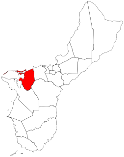
Tamuning, also known as Tamuning-Tumon-Harmon is a village located on the western shore of the United States territory of Guam. The village of Tamuning is the economic center of Guam, containing tourist center Tumon, Harmon Industrial Park, and other commercial districts. Its central location along Marine Corps Drive, the island's main thoroughfare, has aided in its development.

The Chamorro people are the indigenous people of the Mariana Islands, politically divided between the United States territories of Guam and the Commonwealth of the Northern Mariana Islands in Micronesia. Today, significant Chamorro populations also exist in several U.S. states including Hawaii, California, Washington, Texas, Tennessee, Oregon, and Nevada, all of which together are designated as Pacific Islander Americans according to the U.S. Census. According to the 2000 Census, approximately 64,590 people of Chamorro ancestry live in Guam and another 19,000 live in the Northern Marianas. Another 93,000 live outside the Marianas in Hawaii and the West Coast of the United States. The Chamorros are primarily Austronesian, but many also have Spanish, Mexican or Filipino ancestry.
These are lists of school districts in the United States

Hågat is a village in the United States territory of Guam. It is located south of Apra Harbor on the island's western shore. The village's population has decreased since the island's 2000 census.

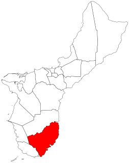
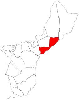
The United States territory of Guam is divided into nineteen municipalities, called villages. Each village is governed by an elected mayor. Village populations range in size from under 1,000 to over 40,000. In the 2020 census, the total population of Guam was 153,836. Each village is counted as a county equivalent by the United States Census Bureau for statistical purposes.
Piti is a village located on the central west coast of the United States territory of Guam. It contains northern and eastern coastlines of Apra Harbor, including Cabras Island, which has the commercial Port of Guam and the island's largest power plants. Piti was a pre-Spanish CHamoru village and, after Spanish colonization, became the primary port town on Guam. The town was largely destroyed during the 1944 liberation of Guam and the population relocated during the wartime construction of Apra Harbor.
The area code 671 is the local telephone area code of the United States territory of Guam. It was created with the beginning of permissive dialing on July 1, 1997, replacing Guam's previous International Telecommunication Union country code 671 at the end of permissive dialing on July 1, 1998.
Inalåhan is a village located on the southeastern coast of the United States territory of Guam. The village's original Chamoru name, Inalåhan, was altered when transliterated during Spanish control of the island.

Dededo is the most populated village in the United States territory of Guam. According to the U.S. Census Bureau, Dededo's population was just under 45,000 in 2010. The village is located on the coral plateau of Northern Guam. The greater Dededo-Machanao-Apotgan Urban Cluster had a population of 139,825 as of the 2010 census, making up 87.7% of Guam's population and 29.8% of its area.

Chalan Pago-Ordot is a village in the United States territory of Guam, containing the communities of Chalan Pago and Ordot. It is located in the eastern-central part of the island and is part of the Kattan (Eastern) District. The village's population has increased slightly following the island's 2000 census.

Barrigada is a village in the United States territory of Guam. A largely residential municipality, its main village is located south of the Antonio B. Won Pat International Airport near the intersections of Routes 8, 10, and 16. The community east of the airport known as Barrigada Heights is considered an affluent neighborhood on the island, where homes have excellent views overlooking much of Guam including the island's airport and hotels along Tumon Bay. Another significant location is Mount Barrigada, nearly 200 meters above sea level. Its location in the center of the island means it houses most of the island's radio masts and towers; the position and height make it easier for radio signals to reach the entire island.
Mangilao is a village on the eastern shore of the United States territory of Guam. The village's population has increased slightly following the island's 2000 census.