Piti Bomb Holes Marine Preserve

Last updated
Piti Bomb Holes Marine Preserve
Fish at Piti Bomb Holes Marine Preserve, Guam in 2012.jpg
Fish at Piti Bomb Holes Marine Preserve, 2012
USA Guam location map.svg
Red pog.svg
Pacific Ocean laea location map.svg
Red pog.svg
World location map (equirectangular 180).svg
Red pog.svg
LocationPiti Bay
Nearest city Piti, Guam
Coordinates 13°28′13″N144°42′04″E / 13.4702°N 144.7012°E / 13.4702; 144.7012 Coordinates: 13°28′13″N144°42′04″E / 13.4702°N 144.7012°E / 13.4702; 144.7012
Area3.64 km2 (900 acres)
Established1999
Governing body Guam Department of Agriculture

Piti Bomb Holes Marine Preserve is a marine protected area comprising all of Piti Bay on the western coast of Guam, located off of the village of Piti in the Philippine Sea. The defining "bomb hole" features, named because they look like bomb craters in the reef flat, are actually natural percolation pits where fresh water filters into the shallow lagoon at a depth of 25 to 30 feet (7.6 to 9.1 m). The largest pit houses the commercial Fish Eye Marine Park tourist attraction, which includes a wooden pier to a underwater observatory and a Seawalker tour of the lagoon bottom. It is visited by more than 200,000 people annually. The Piti preserve is the most ecologically diverse of Guam's five marine preserves. The pit around Fish Eye is a popular snorkeling and recreational diving site.

Contents

Geography

Benthic cover map of the preserve in 2009 Piti Bomb Holes Marine Preserve.jpg
Benthic cover map of the preserve in 2009

The preserve is 3.64 square kilometres (900 acres), 1.4 square kilometres (350 acres) of which is a broad reef flat. [1] It shares a fringing reef line with the regularly fished Asan Bay reef line. The eastern boundary of the preserve is off the tip of Asan Point in the village of Asan-Maina. Asan Point is the western boundary of Asan Invasion Beach, the northern invasion beach used by American forces in the 1944 retaking of the island. Therefore, portions of Piti Bomb Holes Marine Preserve around Asan Point also fall under the submarine portions of War in the Pacific National Historical Park's Asan Beach unit. The southern shoreline with Piti includes two beach parks: Tepungan Beach, at the entrance to the Fish Eye Marine Park pier, and Pedro Santos Memorial Park, farther west. Three rivers drain into the preserve: [2] from east to west, these are the Matgue River, the Taguag River, and the Masso River.

The western boundary of the preserve includes portions of Cabras Island to Piti Canal, a man-made cut, and includes the Tepungan Channel. Piti Canal and Tepungan Channel are used to intake cooling water intake to the Guam Power Authority plant at Cabras; discharge is into the Piti Channel that empties into Apra Harbor. [3] Tepungan Channel and other parts of the western preserve include a cable trench for submarine communications cables landing at Piti. [4]

Ecology

Much of the shoreline is fringed by seagrasses, which provide refuge for juvenile fish, while the three small river mouths provide estuarine nursery habitat for many species. [2] The "bomb holes", actually freshwater percolation pits, are the deepest features of the preserve, ranging down to 25 to 30 feet (7.6 to 9.1 m). Two identified species of mollusk and one species of sea urchin are endemic to Piti Bomb Holes Preserve, being found nowhere else in the world. [5] The sinkholes have dense populations of hard and soft coral, supporting fish and invertebrate populations not found elsewhere in the preserve. [1] The Piti preserve is the most ecologically diverse of Guam's five marine protected areas (MPAs), which was the driving factor why it was selected as an MPA site in 1999. [5] Establishment of the preserve resulted in a greater than 100% increase in the number of fish. [6]

The Fish Eye Marine Park boardwalk to the underwater observatory in the largest "bomb hole" Tourist pier and tower on Guam (line379380818).jpg
The Fish Eye Marine Park boardwalk to the underwater observatory in the largest "bomb hole"

Unlike Guam's other marine preserves, no fishing of any kind is permitted by default between the Piti shore and outer reef margin. Trolling outward of the reef line is allowed. A 2007 researcher observed many fishermen "fishing the line" in the hopes of catching larger fish coming out of the MPA. [1] The Guam Department of Agriculture periodically declares fishing within the preserve for specified species by specified methods. [7] The 2007 study found that the Piti preserve, compared to the Tumon Bay and Achang Reef Flat Marine Preserves, was the only to create spillover for adjacent fishing areas in all of its studied species, perhaps because it was the only studied area with a continuous reef line. The study found that the Piti Bomb Holes Marine Preserve spillover into the unrestricted fishing area of neighboring Asan Bay for convict surgeonfish, honeycomb grouper, yellowstripe goatfish, orangespine unicornfish, and little spinefoot was +14.1%, +7.5%, +30.8%, +25.4%, and +23.7%, respectively. [1]

Guam's first coral nursery was established at the Piti preserve in 2013 as a joint project of the University of Guam Marine Lab, UnderWater World Guam, and SECORE International. The Piti nursery includes three types of restoration structures: coral tables, A-frames, and coral trees. These structures allow marine biologists to place sexually mature corals next to each other, increases the change of fertilization and new coral growth. [8] A 2019 study noted that there had been significant coral bleaching at Piti Bomb Holes in four of the last five years. The study noted that Sinularia maxima and the hybrid S. maxima x polydactyla were more susceptible to bleaching than Sinularia polydactyla , and it appeared after early events that S. polyactyla would take over the soft coral niches occupied by S. maxima and S. maxima x polydactyla on Guam's back reefs. However, the successive events eventually overcame S. polyactyla's resistance, with the most likely outcome being continued loss of coral structure as a whole. [9] Before 2013, there were no records of Guam reefs bleaching for at least two decades, as Guam seas had experienced normal temperature ranges during the globally devastating 1997–98 El Niño event. [10]

Arrests of fishermen within the Piti Bomb Holes Marine Preserve continue to be made. [11] [12] After a 2020 arrest, Agriculture Director Chelsa Muna-Brecht stated, "The preserves exist to help our reef fish stock replenish, to help our corals recover and thrive, and to ensure our waters are a healthy habitat for our marine life. Each time poachers kill fish and marine life in our (marine preserves), they steal from our community and they risk the health and restoration of our critical ocean habitats." [13]

Fish Eye Marine Park

Fish Eye
Diver feeding fish (88705511).jpg
A Fish Eye employee feeding fish to attract them for visitors inside the observatory, 2006
Location Guam, USA
WaterbodyPiti Bay
Nearest land Piti
Coordinates 13°28′20″N144°42′13″E / 13.4722°N 144.7035°E / 13.4722; 144.7035
Dive type Open-water
Depth range15 to 35 ft (4.6 to 10.7 m)
Average visibility20 to 30 ft (6.1 to 9.1 m)
Entry typeShore
Bottom compositionRock, coral, sand
WaterSalt

The underwater observatory at Fish Eye Marine Park was constructed in 1996 in the eastern section of Piti Bay. It is located within the largest "bomb hole" and is the only underwater observatory in Micronesia. It is visited by over 200,000 people annually. [14] The deepest observation window is at about 30 feet (9.1 m) underwater. [15] The observatory is reached by a 1,000 feet (300 m)-long wooden boardwalk. [16] The pier also provides access to the Guam Seawalker business, in which customers put on surface-supplied helmets to look at sea life underwater. [17]

Child watching fish inside the underwater observatory Guam (5100241767).jpg
Child watching fish inside the underwater observatory

The area around the underwater observatory is a snorkeling and recreational diving site, referred to as Fish Eye, Fisheye, or Piti Bomb Holes. [18] [19] [20] The easy access, protective fringe reef, and shallow sandy bottom of the pit attract many dive classes. Due to both the many inexperienced diver groups and the feeding conducted at both the observatory and Seawalker locations, local fish are not as skittish as usual. The site is thus well suited to underwater photography.[ citation needed ] Entry is typically done from Tepungan Park, walking or snorkeling out along the right of the pier for 75 yards (69 m), depending on tides. [20] The left of the pier has many seagrasses that are habitat for juvenile fish that may be damaged by walkers. Piti Bomb Holes is a favored spot for introductory night dives; [21] while pier lights are turned off early in the evening, street lighting from Marine Corps Drive along the shore provide some ambient light and easy orientation.

The number of divers at Piti Bomb Holes increased dramatically after access to a third location particularly suitable for dive classes, Outhouse Beach on Apra Harbor, was restricted in 2001. [22] In the aftermath of the September 11, 2001 attacks, Outhouse Beach was deemed too close to critical infrastructure around the Port of Guam.[ citation needed ] An estimated 50 to 200 dives occurred daily within a 0.25 hectares (0.62 acres) section of Piti Bomb Holes Marine Preserve, putting the number of annual dives at over 18,000. The threshold at which coral damage can rapidly accumulate is 4,000 to 6,000 dives, putting the area hosting the vast majority of divers at severe risk. [23]

See also

Related Research Articles

<span class="mw-page-title-main">Klein Bonaire</span>

Klein Bonaire is a small uninhabited islet off the west coast of the Caribbean island of Bonaire, and is part of the Dutch special municipality of Bonaire.

<span class="mw-page-title-main">Apra Harbor</span> Seaport in Guam

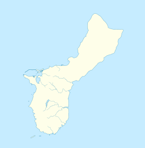
Apra Harbor, also called Port Apra, is a deep-water port on the western side of the United States territory of Guam. It is considered one of the best natural ports in the Pacific Ocean. The harbor is bounded by Cabras Island and the Glass Breakwater to the north and the Orote Peninsula in the south. Naval Base Guam and the Port of Guam are the two major users of the harbor. It is also a popular recreation area for boaters, surfers, scuba divers, and other recreationalists.

<span class="mw-page-title-main">Artificial reef</span> Human-made underwater structure that functions as a reef

An artificial reef is a human-created underwater structure, typically built to promote marine life in areas with a generally featureless bottom, to control erosion, block ship passage, block the use of trawling nets, or improve surfing.

<span class="mw-page-title-main">Mombasa Marine National Park and Reserve</span> Kenyan game park

Mombasa Marine National Park and Reserve is a marine park and national reserve in Mombasa, Kenya. The park is 10 km2 while the reserve is 200 km2.

<span class="mw-page-title-main">Blast fishing</span> Using bombs underwater to kill fish

Blast fishing, fish bombing, dynamite fishing or grenade fishing is a destructive fishing practice using explosives to stun or kill schools of fish for easy collection. This often illegal practice is extremely destructive to the surrounding ecosystem, as the explosion often destroys the underlying habitat that supports the fish. The frequently improvised nature of the explosives used, and undetonated charges, means danger for fishermen and divers as well, with accidents and injuries.

<span class="mw-page-title-main">Piti, Guam</span> Village in Guam, United States

Piti is a village located on the central west coast of the United States territory of Guam. It contains northern and eastern coastlines of Apra Harbor, including Cabras Island, which has the commercial Port of Guam and the island's largest power plants. Piti was a pre-Spanish CHamoru village and, after Spanish colonization, became the primary port town on Guam. The town was largely destroyed during the 1944 liberation of Guam and the population relocated during the wartime construction of Apra Harbor.

<span class="mw-page-title-main">John Pennekamp Coral Reef State Park</span> State park at Key Largo, Florida, USA

John Pennekamp Coral Reef State Park is a Florida State Park located on Key Largo in Florida. It includes approximately 70 nautical square miles (240 km²) of adjacent Atlantic Ocean waters. The park is approximately 25 miles in length and extends 3 miles into the Atlantic Ocean. It was the first underwater park in the United States. The park was added to the National Register of Historic Places on April 14, 1972. The primary attractions of the park are the coral reefs and their associated marine life.

<span class="mw-page-title-main">Apo Island</span> Volcanic island in Visayas, Philippines

Apo Island is a volcanic island covering 74 hectares in land area, 7 kilometers off the southeastern tip of Negros Island and 30 kilometers south of the Negros Oriental capital of Dumaguete in the Philippines. The name "Apo" means "elder" or "respected ancestor" in the Visayan languages.

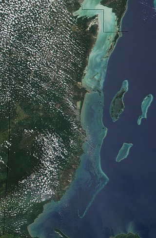
Tumon Bay is a bay in the United States territory of Guam, opening to the Philippine Sea. It is bounded to the north by Two Lovers Point and to the south by Ypao Point. The entirety of the bay falls within the Tumon Bay Marine Preserve, also known as the Tumon Bay Marine Preserve Area (MPA) and Tumon Preserve, one of five marine preserves on Guam. The Preserve measures 4.54 square kilometers and is roughly two miles long. The platform of the fringing reef that separates the open ocean from the lagoon is up to 1,450 feet (440 m) wide. and up to one mile from the shore. The bay is located off of the Tumon area, the tourist center of the island, in the village of Tamuning. The bay is extensively utilized for recreation and fishing.

<span class="mw-page-title-main">Belize Barrier Reef</span> Series of coral reefs straddling the coast of Belize

The Belize Barrier Reef is a series of coral reefs straddling the coast of Belize, roughly 300 metres (980 ft) offshore in the north and 40 kilometres (25 mi) in the south within the country limits. The Belize Barrier Reef is a 300-kilometre (190 mi) long section of the 900-kilometre (560 mi) Mesoamerican Barrier Reef System, which is continuous from Cancún on the north-eastern tip of the Yucatán Peninsula through the Riviera Maya and down to Honduras, making it the second largest coral reef system in the world after the Great Barrier Reef in Australia. It is Belize's top tourist destination, popular for scuba diving and snorkeling and attracting almost half of its 260,000 visitors. It is also vital to the country's fishing industry.

<span class="mw-page-title-main">Hol Chan Marine Reserve</span> Marine reserve off the coast of Belize

Hol Chan Marine Reserve is a marine reserve close to Ambergris Caye and Caye Caulker, off the coast of Belize. It covers approximately 18 km² (4,448 acres) of coral reefs, seagrass beds, and mangrove forest. Hol Chan is Mayan for "little channel".

<span class="mw-page-title-main">Coral reef protection</span> Modifying human activities to reduce impact on coral reefs.

Coral reef protection is the process of modifying human activities to avoid damage to healthy coral reefs and to help damaged reefs recover. The key strategies used in reef protection include defining measurable goals and introducing active management and community involvement to reduce stressors that damage reef health. One management technique is to create Marine Protected Areas (MPAs) that directly limit human activities such as fishing.

<span class="mw-page-title-main">Diving in the Maldives</span> Recreational diving region description

The Maldives, officially the Republic of Maldives, is a small archipelagic state in South Asia. It lies in the Indian Ocean southwest of Sri Lanka and India, about 700 kilometres (430 mi) from the Asian continent's mainland. The chain of 26 atolls stretches across the Equator from Ihavandhippolhu Atoll in the north to Addu Atoll in the south. The land area is roughly 298 square kilometres. Malé is the capital.

<span class="mw-page-title-main">Cancún Underwater Museum</span> Underwater display of sculpture in Cancún, Mexico

The Cancún Underwater Museum is a non-profit organization based in Cancún, Mexico devoted to the art of conservation. The museum has a total of 500 sculptures, by a series of international and local sculptors, with three different galleries submerged between three and six meters deep in the ocean at the Cancún National Marine Park. The museum was thought up by Marine Park Director Jaime González Cano, with the objective of saving the nearby coral reefs by providing an alternative destination for divers. It was started in 2009 and officially opened in November 2010.

<span class="mw-page-title-main">Molokini</span> Islet in Maui County, Hawaii

Molokini is a crescent-shaped, partially submerged volcanic crater which forms a small, uninhabited islet located in ʻAlalākeiki Channel between the islands of Maui and Kahoʻolawe, within Maui County in Hawaiʻi. It is the remains of one of the seven Pleistocene epoch volcanoes that formed the prehistoric Maui Nui island, during the Quaternary Period of the Cenozoic Era.

The following index is provided as an overview of and topical guide to Wikipedia's articles on recreational dive sites. The level of coverage may vary:

<span class="mw-page-title-main">Outline of recreational dive sites</span> Hierarchical outline list of articles about rereational dive sites

Recreational dive sites are specific places that recreational scuba divers go to enjoy the underwater environment or for training purposes. They include technical diving sites beyond the range generally accepted for recreational diving. In this context all diving done for recreational purposes is included. Professional diving tends to be done where the job is, and with the exception of diver training and leading groups of recreational divers, does not generally occur at specific sites chosen for their easy access, pleasant conditions or interesting features.

<span class="mw-page-title-main">Blue Hole (Guam)</span> Submarine sinkhole off the west coast of Guam

Blue Hole is a blue hole dive site off the western coast of Guam. It is variously described as "Guam’s signature natural feature dive," "the most requested dive site on Guam," and "one of Guam’s most popular divesites". It is located in northern Agat Bay, just south of the entrance to Apra Harbor. Despite being very close to the southern coast of the Orote Peninsula, sheer cliffs mean that it is done exclusively as a boat dive, typically out of Cabras Marina in Apra Harbor, located 20 minutes away. The top of the underwater sinkhole begins at about 60 ft (18 m) and drops to more than 300 ft (91 m). However, the sinkhole is located next to a wall and there is an opening that allows exit at about 130 ft (40 m), putting it just within the limits of an advanced recreational dive, depending on certifying agency. The opening of the sinkhole appears to be a heart shape to divers within it. While entry to the site is done while the dive boat is hooked into a mooring buoy, exit typically requires deploying a surface marker buoy in east-to-west current and pickup in the open ocean.

<span class="mw-page-title-main">Underwater diving on Guam</span> Recreational diving tourism destination

Underwater diving encompasses a variety of economically and culturally significant forms of diving on the U.S. island territory of Guam. Scuba diving tourism is a significant component of the island's tourist activity, in particular for visitors from Japan and South Korea. Recreational diving by Guam residents has a lesser but still substantial economic impact. Marine biologists have raised concerns about the effect of diving upon the health of some of Guam's reefs. Recreational dive sites on Guam include submerged shipwrecks, such as the double wrecks of SMS Cormoran and Tokai Maru, and natural features, such as Blue Hole.

References

  1. 1 2 3 4 Tupper, Mark H. (2007). "Spillover of commercially valuable reef fishes from marine protected areas in Guam, Micronesia" (PDF). Fish Bulletin. 105 (4): 527–537. Retrieved 8 April 2021.
  2. 1 2 "Draft Conservation Action Plan for Piti Bomb Holes Marine Preserve and Adjacent Watershed" (PDF). NOAA. August 6–7, 2009. Retrieved 8 April 2021.
  3. "National Pollutant Discharge Elimination System Fact Sheet, Final Permit: Guam Power Authority" (PDF). Environmental Protection Agency. December 19, 2012. Retrieved 8 April 2021.
  4. "Public Notice, Permit File Number: POH-2015-00172" (PDF). US Army Corps of Engineers, Honolulu District. November 21, 2016. Retrieved 8 April 2021.
  5. 1 2 Coral Reef Habitat Assessment for U.S. Marine Protected Areas: U.S. Territory of Guam (PDF). National Oceanic and Atmospheric Administration. February 2009. p. 10. Retrieved April 8, 2021.
  6. Brown, Valerie (2006). "Fish for the Future". Pacific Daily News. Man, Land & Sea - Volume I, Issue I. Retrieved 8 April 2021.
  7. "Special permits for fishing in Åchang Bay Preserve and Piti Bomb Holes". Pacific Daily News. April 1, 2021. Retrieved 8 April 2021.
  8. Berg, Justin; Lock, Colin (March 13, 2021). "Restoring Guam's Coral Reefs". Guampedia. Retrieved 8 April 2021.
  9. Slattery, Marc; Pankey, M. Sabrina; Lesser, Michael P. (May 30, 2019). "Annual Thermal Stress Increases a Soft Coral's Susceptibility to Bleaching". Scientific Reports. 9 (1): 8064. doi: 10.1038/s41598-019-44566-9 . PMC   6542812 . PMID   31147567.
  10. Reynolds, T.; Burdick, D.; Houk, P.; Raymundo, L.; Johnson, S. (March 26, 2014). "Unprecedented coral bleaching across the Marianas Archipelago". Coral Reefs. 33 (2): 499. doi: 10.1007/s00338-014-1139-0 .
  11. Weiss, Jasmine Stole (April 19, 2020). "Agriculture officers arrest 8 accused of illegal fishing, 4 accused of poaching". Pacific Daily News. Retrieved 8 April 2021.
  12. "Conservation officers make arrest, confiscate reef fish and gear". Pacific Daily News. September 8, 2020. Retrieved 8 April 2021.
  13. "Men accused of fishing in Piti marine preserve". The Guam Daily Post. September 3, 2020. Retrieved 8 April 2021.
  14. Babauta, Leo (January 10, 2021). "Piti". Guampedia. Retrieved 8 April 2021.
  15. "Fisheye Marine Park". Guam-Beaches.com. Retrieved 8 April 2021.
  16. "Fish Eye Marine Park". Guam Visitors Bureau. Retrieved 8 April 2021.
  17. "Guam Seawalker Tours". Guam Visitors Bureau. Retrieved 8 April 2021.
  18. Roberts, Peyton (31 March 2021). "Guam's Top 10 snorkeling spots". Stripes Guam. Retrieved 8 April 2021.
  19. "Piti Bomb Holes". MDA Guam. Retrieved 8 April 2021.
  20. 1 2 "Fish Eye". Guam Dive Guide. 23 May 2018. Retrieved 8 April 2021.
  21. Pampuro, Amanda (July 12, 2020). "Exposing Guam's Nocturnal Creatures – The Guam Guide". Guam Guide. Retrieved 8 April 2021.
  22. van Beukering, Pieter; Haider, Wolfgang; Longland, Margo; Cesar, Herman; Sablan, Joel; Shjegstad, Sonia; Beardmore, Ben; Liu, Yi; Garces, Grace Omega (March 2007), van Beukering, Pieter (ed.), The economic value of Guam's coral reefs (PDF), Technical Report, vol. 116, University of Guam Marine Laboratory, pp. 42–47
  23. Burdick, David; Brown, Valerie; Asher, Jacob; Gawel, Mike; Goldman, Lee; Hall, Amy; Kenyon, Jean; Leberer, Trina; Lundblad, Emily; McIlwain, Jenny; Miller, Joyce; Minton, Dwayne; Nadon, Marc; Pioppi, Nick; Raymundo, Laurie; Richards, Benjamin; Schroeder, Robert; Schupp, Peter; Smith, Ellen; Zglicynski, Brian (January 2005). "The State of Coral Reef Ecosystems of Guam". www.researchgate.net. Retrieved 29 March 2021.