Anguilla is a British Overseas Territory in the Caribbean. It is one of the most northerly of the Leeward Islands in the Lesser Antilles, lying east of Puerto Rico and the Virgin Islands and directly north of Saint Martin. The territory consists of the main island of Anguilla, approximately 16 miles long by 3 miles (5 km) wide at its widest point, together with a number of much smaller islands and cays with no permanent population. The territory's capital is The Valley. The total land area of the territory is 35 square miles (91 km2), with a population of approximately 15,753 (2021).

Basseterre is the capital and largest city of Saint Kitts and Nevis with an estimated population of 14,000 in 2018. Geographically, the Basseterre port is located at 17°18′N62°44′W, on the south western coast of Saint Kitts Island, and it is one of the chief commercial depots of the Leeward Islands. The city lies within Saint George Basseterre Parish.

Anguilla is an island in the Leeward Islands. It has numerous bays, including Barnes, Little, Rendezvous, Shoal, and Road Bays.

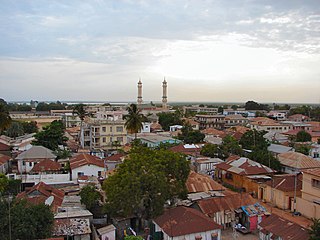
Banjul, officially the City of Banjul, is the capital and fourth largest city of The Gambia. It is the centre of the eponymous administrative division which is home to an estimated 400,000 residents, making it The Gambia's largest and most densely populated metropolitan area. Banjul is on St Mary's Island, where the Gambia River enters the Atlantic Ocean.

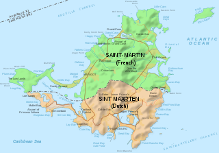
Saint Martin is an island in the northeast Caribbean, approximately 300 km (190 mi) east of Puerto Rico. The 87-square-kilometre (34 sq mi) island is divided roughly 60:40 between the French Republic and the Kingdom of the Netherlands, but the Dutch part is more populated than the French part. The division dates to 1648. The northern French part comprises the Collectivity of Saint Martin and is an overseas collectivity of the French Republic. The southern Dutch part comprises Sint Maarten and is one of four constituent countries that form the Kingdom of the Netherlands. Even though the island is an overseas possession of two European Union member states, only the French part of the island is part of the EU.

Cairns is a city in Queensland, Australia, on the tropical north east coast of Far North Queensland. In the 2021 census, Cairns had a population of 153,181 people.
Moka is a village in Mauritius located mainly in the Moka District. The western part of the village lies in the Plaines Wilhems District. Since 1967 it forms part of Constituency No. 8 Quartier Militaire and Moka. The village is administered by the Moka Village Council under the aegis of the Moka District Council. According to the census made by Statistics Mauritius in 2011, the population was at 8,846. The elevation is 203 meters and can be up to 425 meters in some places. Moka is directly on the other side of the Moka Range from Port Louis. The village is close to the mountain Le Pouce and the town Beau-Bassin Rose-Hill. Réduit is a suburb of the village where the State House and University of Mauritius is situated. The village is also home to the Mauritius Broadcasting Corporation and the Mahatma Gandhi Institute.

George Town is the capital and largest city in the Cayman Islands, located on Grand Cayman. As of 2022, the city had a population of 40,957, making it the largest city of all the British Overseas Territories.

Jamestown is the capital city of the British Overseas Territory of Saint Helena, Ascension and Tristan da Cunha, located on the island of Saint Helena in the South Atlantic Ocean. It is also the historic main settlement of the island and is on its north-western coast. Before the development of the port at Rupert's Bay, it was the island's only port and the centre of the island's road and communications network. It was founded when colonists from the English East India Company settled on the island in 1659 and was briefly occupied by the Dutch East India Company in 1673 before being recaptured. Many of the buildings built by the East India Company in the 18th century survive and give the town its distinctive Georgian flavour.

Port-Gentil or Mandji is the second-largest city of Gabon, and it is a leading seaport. It is the center of Gabon's petroleum and timber industries. The city is located on a delta island in the Ogooue delta. Nearby Cape Lopez is Gabon's westernmost point. As of 2013 census, it had a population of 136,462.

Woodbridge is a large suburban community in Vaughan, Ontario, Canada, along the city's border with Toronto. It occupies the city's entire southwest quadrant, west of Highway 400, east of Highway 50, north of Steeles Avenue, and generally south of Major Mackenzie Drive. It was once an independent town before being amalgamated with nearby communities to form the city in 1971. Its traditional downtown core is the Woodbridge Avenue stretch between Islington Avenue and Kipling Avenue north of Highway 7.

Chipata is a city and administrative centre of the Eastern Province of Zambia and Chipata District. It was declared the 5th city of the country, after Lusaka, Ndola, Kitwe and Livingstone, by President Edgar Lungu on 24 February 2017. The city has undergone rapid economic and infrastructure growth in the years, leading up to city status.

Puttalam is the largest town in Puttalam District, North Western Province, Sri Lanka. Puttalam is the administrative capital of the Puttalam District and governed by an Urban Council.

Clayton J. Lloyd International Airport is a small international airport located on the island of Anguilla, a British Overseas Territory in the Caribbean. It is located very close to The Valley, the island's capital. Wallblake Airport is also a featured airport in one of the Flight Simulator X game demos. It has a small terminal with no jetways and is the only airport in Anguilla.

Georgetown is a rural town and locality in the Shire of Etheridge, Queensland, Australia. In the 2016 census, the locality of Georgetown had a population of 348 people.

Marigot is the main town and capital in the French Collectivity of Saint Martin.

The following outline is provided as an overview of and topical guide to Anguilla:
Education in Anguilla is compulsory between the ages of 5 and 17. In 1998, the gross primary enrollment rate was 100.7 percent, and the net primary enrollment rate was 98.9 percent. The government has collaborated with UNESCO to develop an Education for All plan that aims to raise educational achievement levels, improve access to quality special education services and provide human resource training for teachers and education managers.

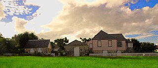
Wallblake House is a heritage plantation house and museum annex in The Valley, Anguilla in the northeastern Caribbean. Built in 1787 by Will Blake, a sugar planter, it is stated to be the oldest structure on the island. Although gutted by the French in the late 1790s, it was rebuilt by the British and today has been fully restored, with its kitchen complex, stables and slave quarters intact. A church in the vicinity contains a stone fascia with open-air side walls and a ceiling, which is the form of a hull of a ship.

St. Gerard Church is a religious building located in the town of The Valley, capital of the British overseas territory of Anguilla, in the Lesser Antilles, Caribbean Sea.


