Thornliebank

Last updated

Thornliebank
Thornliebank Main Street - geograph.org.uk - 1352372.jpg
Shops on Main Street
East Renfrewshire UK location map.svg
Red pog.svg
Thornliebank
Glasgow UK location map.svg
Red pog.svg
Thornliebank
Location within Scotland
Scotland location map.svg
Red pog.svg
Thornliebank
Thornliebank (Scotland)
Population4,070 (mid-2016 est.) [1]
Lieutenancy area
Country Scotland
Sovereign state United Kingdom
Post town GLASGOW
Postcode district G46
Dialling code 0141
Police Scotland
Fire Scottish
Ambulance Scottish
UK Parliament
Scottish Parliament
List of places
UK
Scotland
55°48′22″N4°19′01″W / 55.806°N 4.317°W / 55.806; -4.317 Coordinates: 55°48′22″N4°19′01″W / 55.806°N 4.317°W / 55.806; -4.317

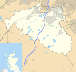
Thornliebank (Scots: Thonliebank, Scottish Gaelic: Bruach nan Dealgan) is a suburban area in East Renfrewshire, in the west central Lowlands of Scotland. Part of the Greater Glasgow conurbation, it is located on the Auldhouse Burn about six miles (ten kilometres) south of Glasgow city centre, and just outside the city's administrative boundaries (the closest neighbourhoods within Glasgow, to the west and north of Thornliebank, being Arden, Carnwadric, Eastwood, Jenny Lind and Mansewood). The neighbouring East Renfrewshire town of Giffnock lies directly to the east, with Rouken Glen Park to the south.

Contents

The original village was founded in the 18th century and began to develop after the opening of a printworks in 1778, and subsequently other light industry. Despite industrial decline in the 20th century, Thornliebank continued to expand due to extensive public and private housing construction. As of the 2011 Census, the area has a population of 4,051.

History

It is not known when Thornliebank was first settled although it has been ascertained that it did not exist prior to the 18th century. The village first makes its appearance on Thomas Richardson's map of 1795 and was, at the time, referred to as 'Thorny Bank', a title believed to have been inspired by the substantial number of thorn trees that were prevalent in the area. In 1789 it was a little street of cottages but it had grown by 1845, to have a population of 1366. This was largely due to the Crum family, who established and ran the Thornliebank printworks. John Crum founded the works in Main Street in 1778 to print locally woven linen. [2] [3]

Map of Thornliebank in the early 1900s TBGiffMap1923.jpg
Map of Thornliebank in the early 1900s

Walter Crum who was in charge by 1819 was a chemist and Fellow of the Royal Society. He replaced spinning and weaving by calico printing with bleaching, turkey red dyeing and "beetling". This brought immigrants from Northern Ireland and the New Statistical Account of Scotland described Thornliebank as "a very flourishing village where, thirty years ago, three families did not exist". [2]

Walter's son Alexander Crum who took over the printing works was a major philanthropist supporting housing, education, and leisure facilities in the village. He also provided funds for the village club and Thornliebank Parish Church. [2] Alexander Crum was Member of Parliament (MP) for Renfrewshire from 1880 to 1885. After his death he was commemorated by the Crum Library which was designed by the Scottish architect Sir Rowand Anderson and formally opened on 20 March 1897. [4]

Woodfarm

Woodfarm is a residential area of Thornliebank, next to Rouken Glen Park and Eastwood Park. The housing is a mix of (mostly formerly) council-owned property, ex Army-owned houses, older bungalows and villas, and newer flats and family homes built within the last twenty years.

Woodfarm Playing Fields sports complex was completed in 2004. The development features a full-sized football pitch, three five-a-side football pitches (that can also be used as tennis courts), and a clubhouse with changing rooms. Woodfarm High School, opposite the complex, has use of the pitches on weekdays for physical education classes, while the public has access to the leisure facilities on evenings and weekends. [5] There is also a separate Woodfarm Pavilion, a community hall with grass playing fields primarily used for cricket. [6]

Demography

According to the 2011 census, the Thornliebank census locality had a total resident population of 4,051. [7]

Transport

Public transport in the area is coordinated by Strathclyde Partnership for Transport. Thornliebank railway station is on the East Kilbride branch of the Glasgow South Western Line. Originally opened by the Busby Railway in 1881, it is served by half-hourly trains running between Glasgow Central and East Kilbride. Bus services are mainly provided by First Glasgow: services 10, 57 and 57A pass the railway station, while 38, 38A, 38B & 38C serve the Woodfarm area, all linking Thornliebank with Glasgow city centre.

The B769 (Spiersbridge Road) runs through the middle of Thornliebank, with the A727 running to the south of it, which leads to junction 3 of the M77 motorway at the western edge of the Thornliebank area.

Schools

Thornliebank Primary School Thornliebank Primary School - geograph.org.uk - 115050.jpg
Thornliebank Primary School

Thornliebank Primary School is the local non-denominational primary school.

Thornliebank has one non-denominational secondary Woodfarm High School in the Woodfarm area. Thornliebank Primary acts as a feeder school for Woodfarm.

Our Lady of the Missions in Woodfarm is the Roman Catholic primary school for Thornliebank. It is a feeder school for St Ninian's High School, Giffnock.

Churches

Thornliebank Parish Church - Church of Scotland. The Minister is Rev. Mike Gargrave.

St. Vincent de Paul - Roman Catholic Church.

Facilities

Main Street: Church of Scotland, Saint Vincent de Paul Catholic church, Library, Thorntree Hall, Thornliebank Health Centre and Thornliebank Bowling Club.

Sport

Thornliebank F.C. were a senior football club in existence between 1875 and 1907. They were the first winners of the Renfrewshire Cup in 1879. They reached the 1880 Scottish Cup Final, losing 3–0 to Queen's Park.

Notable people

Related Research Articles

East Renfrewshire Council area of Scotland

East Renfrewshire is one of 32 council areas of Scotland. Until 1975, it formed part of the county of Renfrewshire for local government purposes along with the modern council areas of Renfrewshire and Inverclyde. Although no longer a local authority area, Renfrewshire still remains the registration county and lieutenancy area of East Renfrewshire.

Barrhead Town in East Renfrewshire, Scotland

Barrhead is a town in East Renfrewshire, Scotland, 13 km (8.1 mi) south-west of Glasgow city centre on the edge of the Gleniffer Braes. At the 2011 census its population was 17,268.

Newton Mearns Human settlement in Scotland

Newton Mearns is a suburban town and the largest settlement in East Renfrewshire, Scotland. It lies 7 miles (11 km) southwest of Glasgow City Centre on the main road to Ayrshire, 410 feet (125 m) above sea level. It has a population of approximately 26,993, stretching from Whitecraigs and Kirkhill in the northeast to Maidenhill in the southeast, to Westacres and Greenlaw in the west and Capelrig/Patterton in the northwest.

Giffnock A town in East Renfrewshire, Scotland

Giffnock is a town and the administrative centre of East Renfrewshire in the Central Lowlands of Scotland.

Netherlee Human settlement in Scotland

Netherlee is a suburban residential area in East Renfrewshire, Scotland. It is situated on the west bank of the White Cart Water about 4 miles (6.5 km) south of Glasgow city centre. Part of the Greater Glasgow conurbation, it is mostly contiguous with the city, and is just beyond the boundary of its local authority area. It is a separate census locality from Glasgow, like other areas such as neighbouring Giffnock and Clarkston. Netherlee is directly contiguous with Stamperland. It is also in a council ward with Clarkston and its neighbour Busby. As of 2012, Netherlee has a population of 4,550.

Muirend Human settlement in Scotland

Muirend is an area on the South side of the city of Glasgow, Scotland. It is situated about 4 miles (6.5 km) south of Glasgow city centre. Muirend became extensively urbanised in the 20th century, developing into an affluent commuter suburb. In a 2014 Royal Mail survey, the G44 postcode – which includes Muirend – was rated as the most desirable area of Scotland to live in. Neighbouring areas include Cathcart, Merrylee and Newlands in Glasgow, and Netherlee and Giffnock in East Renfrewshire. Some buildings that are locally associated with Muirend, including the main row of shops, as well as Hazelden Park and Muirend Pavilion, are located in East Renfrewshire.

Stamperland Human settlement in Scotland

Stamperland is a suburban neighbourhood in Clarkston, East Renfrewshire, Scotland. Part of the Greater Glasgow conurbation, it is situated on the west bank of the White Cart Water about 4.5 miles (7.2 km) south of Glasgow city centre, and just outside the city boundary.

Mansewood Human settlement in Scotland

Mansewood is a residential district in the Scottish city of Glasgow. It is situated south of the River Clyde and is surrounded by the districts of Eastwood, Hillpark, Pollokshaws in Glasgow, and Thornliebank and Giffnock in East Renfrewshire.

Eastwood (Scottish Parliament constituency) Scottish Parliament constituency

Eastwood is a constituency of the Scottish Parliament (Holyrood) covering part of the council area of East Renfrewshire. It elects one Member of the Scottish Parliament (MSP) by the first past the post method of election. It is also one of ten constituencies in the West Scotland electoral region, which elects seven additional members, in addition to the ten constituency MSPs, to produce a form of proportional representation for the region as a whole.

Giffnock railway station Railway station in East Renfrewshire, Scotland

Giffnock railway station is a railway station in the town of Giffnock, East Renfrewshire, Scotland. The station is managed by Abellio ScotRail and is on the East Kilbride branch of the Glasgow South Western Line.

Clarkston railway station Railway station in East Renfrewshire, Scotland

Clarkston railway station is a suburban side platform railway station in the town of Clarkston, East Renfrewshire, Scotland. The station is managed by Abellio ScotRail and is on the East Kilbride branch of the Glasgow South Western Line. It was opened in 1866 by the Busby Railway.

Busby, East Renfrewshire Human settlement in Scotland

Busby is a village in East Renfrewshire, Scotland. Busby is in the same urban area as Glasgow, although it is administratively separate. It lies on the White Cart Water six miles south of Glasgow City Centre and 34 mile northwest of the outskirts of East Kilbride. It directly adjoins the town of Clarkston, with which the village is closely associated.

Woodfarm High School Public school in Robslee Road, East Renfrewshire, Scotland

Woodfarm High School is a Scottish comprehensive secondary school in Woodfarm, East Renfrewshire. It has a roll of approximately 800 pupils. Gillian Boyle is the acting Headmistress, taking over from Nicola MacGlashan who left to join nearby Williamwood High School in August 2021.

Rouken Glen Park Park in East Renfrewshire, Scotland, UK

Rouken Glen Park is a public park in East Renfrewshire, to the south-west of Glasgow, Scotland.

Deaconsbank Human settlement in Scotland

Deaconsbank is a neighbourhood in the Scottish city of Glasgow. It is situated south of the River Clyde. The main feature of the area, which falls into the Greater Pollok ward of Glasgow City Council and directly borders the East Renfrewshire council region, is an estate of around 639 private houses built in the late 1970s by Barratt Developments, prior to which the area was open farmland. Deaconsbank is bordered by the M77 motorway to the west and by Rouken Glen Park and golf course to the east. The northern parts of the suburban town of Newton Mearns are a short distance to the south, as is Patterton railway station.

A727 road

The A727 road in Scotland runs from East Kilbride in South Lanarkshire, through East Renfrewshire, to Junction 3 of the M77 motorway in Glasgow.

Alexander Crum was a Scottish printer and Liberal Party politician who sat in the House of Commons from 1880 to 1885.

Clarkston, East Renfrewshire Human settlement in Scotland

Clarkston is a suburban town in East Renfrewshire, in the Central Lowlands of Scotland. A dormitory town with a population of around 10,000, Clarkston is on the southern fringe of the Greater Glasgow conurbation and directly adjoins the neighbouring suburban villages of Busby and Netherlee, as well as the towns of Newton Mearns and Giffnock.

Eastwood, Glasgow Human settlement in Scotland

Eastwood is a residential neighbourhood in the city of Glasgow, Scotland. It is situated south of the River Clyde, and is part of the Newlands/Auldburn ward under Glasgow City Council.

References

  1. "Mid-2016 Population Estimates for Settlements and Localities in Scotland". National Records of Scotland. 12 March 2018. Retrieved 30 December 2020.
  2. 1 2 3 "Portal to the Past: East Renfrewshire's Heritage Collection - Thornliebank".
  3. Glasgow, Thornliebank, Main Street, Thornliebank Print Works, Canmore
  4. Glasgow Herald 22 March 1897
  5. Soccer centre to take lease option at Woodfarm, Glasgow South and Eastwood Extra, 19 October 2013
  6. Woodfarm Pavilion, East Renfrewshire Culture and Leisure
  7. "Area Profiles". Scotland's Census. National Records of Scotland. Retrieved 16 January 2017.
  8. Clifford, Rose F. (31 October 2011). History of British Neurology. ISBN   9781908977847.
  9. "JOHN FINLAYSON COWDENBEATH 1932 - 1933 RARE ORIGINAL HAND SIGNED CUTTING/CARD". eBay.
  10. "Thomas Jackson | Scotland | Scottish FA". www.scottishfa.co.uk.
  11. "7 Scots to have played Major League Baseball". Playbuzz. 13 September 2016.