Eastwood, Glasgow

Last updated

Eastwood
Welcome to Glasgow (geograph 5246980).jpg
View looking north towards Eastwood on Thornliebank Road (B769), with green 'Welcome to Glasgow' sign denoting city boundary
Glasgow UK location map.svg
Red pog.svg
Eastwood
Location within Glasgow
OS grid reference NS555604
Community council
  • Pollokshaws and Eastwood
Council area
Lieutenancy area
  • Glasgow
Country Scotland
Sovereign state United Kingdom
Post town GLASGOW
Postcode district G43 1
Dialling code 0141
Police Scotland
Fire Scottish
Ambulance Scottish
UK Parliament
Scottish Parliament
List of places
UK
Scotland
Glasgow
55°48′56″N4°18′27″W / 55.815509°N 4.307486°W / 55.815509; -4.307486

Eastwood is a residential neighbourhood in the city of Glasgow, Scotland. It is situated south of the River Clyde, and is part of the Newlands/Auldburn ward under Glasgow City Council.

Contents

Description

The Eastwood neighbourhood has a somewhat isolated location, situated in an area of low ground bounded by the Auldhouse Burn and the Glasgow South Western Line railway to the north and west, and with the only main road in and out (B769 Thornliebank Road) forming the eastern boundary on elevated ground, with the higher Mansewood neighbourhood beyond. The only public road in and out of the area itself is Garvock Drive which joins Thornliebank Road. There are multiple pedestrians access points but these all lead to Thornliebank Road. The neighbourhood takes its name from the larger parish of Eastwood, the original parish church of which stood in the area until it was demolished in 1781. [1]

In addition to the burn and railway, between Eastwood and the Carnwadric neighbourhood to the south are a cemetery (Old Eastwood) at the site of the pre-1781 church, [2] and a set of private playing fields (Auldhouse) used by Giffnock Soccer Centre [3] and the Giffnock Soccer Centre Foundation (from 2022). Prior to 2022, this area was used by Hutcheson's Grammar School, [4] and was previously home ground of the Hutchesons' GSFP (1923–1990) and Hutchesons Aloysians (1990–2002) rugby teams and also used at times by Clydesdale Cricket Club. [5] Cartcraig, the southernmost part of Pollokshaws, is a short distance away to the north, but on the other side of the burn with no direct access, the closest crossing point being on the main road at Auldhouse Bridge. [6] [7]

There are a small number of commercial premises, all located on Fieldhead Square, including include Pietro's Cafe and Eastwood Pharmacy. [8] Eastwood Nursery [9] is a Glasgow City Council nursery which is also used as the local polling place on election days (as of 2022).

History

Until after World War II when the houses were built (most being three or four-storey tenements as well as some modest terraced houses), [10] the only building of significance in the area [11] [12] was Auldhouse Mansion which dates from the 1630s, is one of the oldest houses in Glasgow [7] [13] and still stands today, being owned originally by John Maxwell, Lord Pollok [14] [15] and later extended, [16] becoming a children's home in the 20th century [17] and eventually converted to private residences. [7] [18] Nearby (but across the main road, therefore not actually in modern Eastwood) is Eastwood Parish Church [19] [20] which dates from 1863, replacing an older building from 1781 [21] which itself replaced the original in Old Eastwood Cemetery. [13] Robert Wodrow, the historian, was minister at Eastwood. Stevenson MacGill wrote the Old Statistical Account for Eastwood. [22]

Other uses of the name

Originally in the historic county of Renfrewshire, the civil parish of Eastwood was partly included within the burgh of Glasgow from 1891, with more of its territory being added to Glasgow in 1912 and again in 1926. After 1975, the name was used for a local government district in the Strathclyde region and constituencies in the Scottish and UK parliament, but all of these (as well as a golf club south of Newton Mearns, [23] a secondary school in that town, a health centre in Clarkston, [24] the 'new' (1900s) cemetery for the area in Thornliebank, [25] and a park, leisure centre [26] and 1850s country house in Giffnock) [27] [28] relate to the post-1975 local authority area, which subsequently became part of East Renfrewshire in 1996. The neighbourhood of Eastwood lies instead in the part of the parish that was incorporated into Glasgow in 1926, and so was not included within the Eastwood local government district with which it shared its name. The only facilities using the Eastwood name within the neighbourhood of Glasgow now are the nursery school and pharmacy, although there was formerly an Eastwood community centre.

Transport

The main road is used by local buses including the frequent 57/57A First Glasgow service, [29] [30] and Thornliebank railway station is within walking distance to the south.

Related Research Articles

<span class="mw-page-title-main">East Renfrewshire</span> Council area of Scotland

East Renfrewshire is one of 32 council areas of Scotland. It was formed in 1996, as a successor to the Eastwood district of the Strathclyde region. The northeastern part of the council area is close to Glasgow and many of the council area's northern settlements fall into the Greater Glasgow urban area.

<span class="mw-page-title-main">Nitshill</span> Human settlement in Scotland

Nitshill is a district on the south side of Glasgow. It is bordered by South Nitshill to the south, Darnley to the east, Crookston and Roughmussel to the north-west, Hurlet to the west and Househillwood and Priesthill to the north, with the Pollok district and the Silverburn Centre beyond. An area of open ground to the south-west of Nitshill forms the boundary between Glasgow and the town of Barrhead in East Renfrewshire.

<span class="mw-page-title-main">Pollokshaws</span> Human settlement in Scotland

Pollokshaws is an area on the South side of the city of Glasgow, Scotland. It is bordered by the residential neighbourhoods of Auldhouse to the east, Eastwood and Hillpark to the south and Shawlands to the north, with the Glasgow South Western Line railway and the open lands of Pollok Country Park to the west. The White Cart Water flows through the area.

<span class="mw-page-title-main">Newton Mearns</span> Town in Scotland

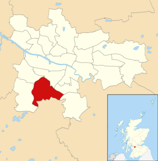
Newton Mearns is a suburban town and the largest settlement in East Renfrewshire, Scotland. It lies 7 miles (11 km) southwest of Glasgow City Centre on the main road to Ayrshire, 410 feet (125 m) above sea level. It has a population of approximately 26,993, stretching from Whitecraigs and Kirkhill in the northeast to Maidenhill in the southeast, to Westacres and Greenlaw in the west and Capelrig/Patterton in the northwest.

<span class="mw-page-title-main">Giffnock</span> Town in East Renfrewshire, Scotland

Giffnock is a town and the administrative centre of East Renfrewshire in the Central Lowlands of Scotland.

<span class="mw-page-title-main">Shawlands</span> Human settlement in Scotland

Shawlands is a Southside suburb of Glasgow, Scotland, located two miles south of the River Clyde. The area, considered the "Heart of the Southside", is known for its independent restaurants and cafés, art scene, public parks, period terraces, and red and blond sandstone tenements. Shawlands was named one of the best places to live in Scotland in 2022 and 2023 by The Sunday Times, and one of the world's coolest neighbourhoods by Time Out Magazine with judges describing it as "the city's best area to live and socialise”. It is located between Pollok Country Park – the home of the Burrell Collection and Pollok House – and the acclaimed Victorian park Queen's Park.

<span class="mw-page-title-main">Crookston, Glasgow</span> Suburb of Glasgow, Scotland

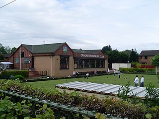
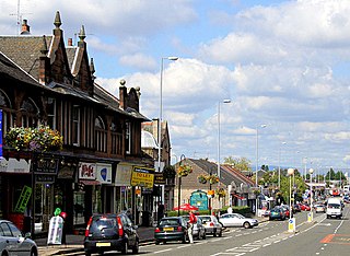
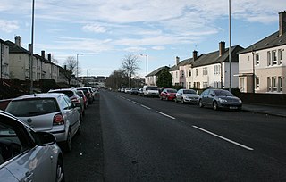
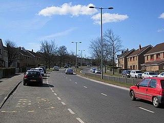
Crookston is a residential suburb on the southwestern edge of the city of Glasgow, Scotland.

Arden is a medium-sized housing estate on the south-western edge of the city of Glasgow, Scotland. The M77 motorway runs directly to the west of the neighbourhood, with Junction 3 serving the area; a small industrial estate is located to the south-east. The residential area of Carnwadric is to the north-east of Arden, and the Jenny Lind part of Deaconsbank to the south, while the land to the north is open ground and woodland.

<span class="mw-page-title-main">Thornliebank</span> Human settlement in Scotland

Thornliebank is a suburban area in East Renfrewshire, in the west central Lowlands of Scotland. Part of the Greater Glasgow conurbation, it is located on the Auldhouse Burn about six miles south of Glasgow city centre, and just outside the city's administrative boundaries. The neighbouring East Renfrewshire town of Giffnock lies directly to the east, with Rouken Glen Park to the south.

<span class="mw-page-title-main">Carnwadric</span> Human settlement in Scotland

Carnwadric is a residential area of Glasgow, Scotland. It is situated south of the River Clyde, and is bordered by a park to the north, the Arden housing estate to the west, by the village of Thornliebank to the south and by the Auldhouse Burn to the east.

<span class="mw-page-title-main">Newlands, Glasgow</span> Human settlement in Scotland

Newlands is an affluent suburb in the south side of Glasgow, Scotland. The area is mainly residential in character. Shawlands and Langside lie to the north of the district, Pollokshaws and Auldhouse to the west, Giffnock to the south, and Merrylee and Cathcart to the east.

<span class="mw-page-title-main">Priesthill</span> Human settlement in Scotland

Priesthill is a neighbourhood in the south of the River Clyde in the Scottish city of Glasgow. It falls under the Greater Pollok ward of the city council area. The Darnley neighbourhood is located to the south, on the opposite side of the Glasgow South Western Line railway, while Nitshill lies to the west and Househillwood and the Silverburn Centre shopping complex to the north. The M77 motorway runs to the east of Priesthill with open farmland beyond.

<span class="mw-page-title-main">South Nitshill</span> Human settlement in Scotland

South Nitshill is a neighbourhood in the Scottish city of Glasgow. It is situated south of the River Clyde, in the south-west of the conurbation and within the Greater Pollok ward of the local authority area. All streets in the area have names beginning with 'W'.

Mansewood is a residential district in the Scottish city of Glasgow. It is situated south of the River Clyde and is surrounded by the districts of Eastwood, Hillpark, Pollokshaws in Glasgow, and Thornliebank and Giffnock in East Renfrewshire.

<span class="mw-page-title-main">Rouken Glen Park</span> Park in East Renfrewshire, Scotland, UK

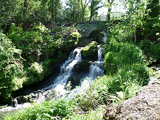
Rouken Glen Park is a public park in East Renfrewshire, to the south-west of Glasgow, Scotland.

<span class="mw-page-title-main">Deaconsbank</span> Neighbourhood of Glasgow

Deaconsbank is a neighbourhood in the Scottish city of Glasgow. It is situated south of the River Clyde. The main feature of the area, which falls into the Greater Pollok ward of Glasgow City Council and directly borders the East Renfrewshire council region, is an estate of around 639 private houses built in the late 1970s by Barratt Developments, prior to which the area was open farmland. Deaconsbank is bordered by the M77 motorway to the west and by Rouken Glen Park and golf course to the east. The northern parts of the suburban town of Newton Mearns are a short distance to the south, as is Patterton railway station.

<span class="mw-page-title-main">Auldhouse, Glasgow</span> Human settlement in Scotland

Auldhouse is an area of the Scottish city of Glasgow. It is situated south of the River Clyde along the banks of the Auldhouse Burn, a tributary of the White Cart Water.

<span class="mw-page-title-main">Newlands/Auldburn (ward)</span> Human settlement in Scotland

Newlands/Auldburn is one of the 23 wards of Glasgow City Council. Situated south of the city and the River Clyde, it is represented by 3 members as of May 2022, one each from the Scottish National Party, Scottish Labour, and Scottish Green Party.

<span class="mw-page-title-main">Rosshall</span> Area of Glasgow

Rosshall is an area in the south-west of Glasgow, Scotland, within the Cardonald ward of Glasgow City Council. It has a fairly isolated location, with the White Cart Water forming a border to the south and east, the Paisley Canal Line railway to the north, and open fields to the west that form a short green belt between Glasgow and the large town of Paisley – the nearest building 500 yards (460 m) to the west, Rosshall Mains Farm, falls under Paisley administration rather than Glasgow.

Eastwood is a civil parish which straddles Glasgow and East Renfrewshire in Scotland. The parish has had no administrative functions since 1930, but is still used for some statistical purposes.

References

  1. "Glasgow, Thornliebank, Thornliebank Road, Eastwood Parish Church". Canmore. Historic Environment Scotland. Retrieved 5 February 2023.
  2. Glasgow, Thornliebank, 200 Thornliebank Road, Eastwood Churchyard, Canmore
  3. "Giffnock Soccer Centre and Hutchesons' Grammar School agree site swap delivering two new sports hubs in Glasgow South". Giffnock Soccer Centre Home. Retrieved 8 December 2022.
  4. Our school: Facilities, Hutcheson's Grammar School
  5. Facilities, Clydesdale Cricket Club
  6. Before the Houses, History of Mansewood
  7. 1 2 3 Pollokshaws & Auldhouse illustrated guide Archived 25 September 2019 at the Wayback Machine , Scotcities
  8. "Eastwood Pharmacy - Pharmacies". www.nhsinform.scot. Retrieved 8 December 2022.
  9. "Eastwood Nursery School". www.eastwood-nursery.glasgow.sch.uk. Retrieved 8 December 2022.
  10. Fyvie Avenue (Glasgow City Archives, Department of Architectural and Civic Design (1951), The Glasgow Story
  11. OS Six-inch 1st edition, 1843–1882, Explore georeferenced maps (National Library of Scotland)
  12. Town Plans / Views, Glasgow, Bart PO, 1925, Explore georeferenced maps (National Library of Scotland)
  13. 1 2 Pollokshaws Heritage Trail, Pollokshaws Heritage Group / Glasgow City Council
  14. Auldhouse, Old Country Houses of the Old Glasgow Gentry (1878)
  15. The Auld House (Pollok House, c.1830), The Glasgow Story
  16. Eastwood, a Renfrewshire Parish, History of Mansewood
  17. Glasgow, 2 Auldhouse Court, Auldhouse, Canmore
  18. Auldhouse (Glasgow University Library, Special Collections, Dougan Collection, 1870), The Glasgow Story
  19. Scott, Hew (1920). Fasti ecclesiæ scoticanæ; the succession of ministers in the Church of Scotland from the reformation. Vol. 3. Edinburgh : Oliver and Boyd. pp.  133–137.
  20. Where You Belong, Eastwood Parish Church
  21. A view of Eastwood Church (Pollok House, c.1830), The Glasgow Story
  22. Welcome to Eastwood, The Eastwood Golf Club
  23. Eastwood Health and Care Centre, Hoskins Architects
  24. Glasgow (Eastwood) New Cemetery, Commonwealth War Graves Commission
  25. Eastwood swimming baths closed for three weeks over Christmas, Barrhead News, 14 December 2018
  26. Eastwood House, East Renfrewshire Leisure and Culture
  27. Giffnock, Rouken Glen Road, Eastwood Park House, Canmore
  28. "Frequency Guide" (PDF). First Glasgow. 1 January 2018. Retrieved 20 September 2019.[ permanent dead link ]
  29. "Glasgow Network Map" (PDF). First Glasgow. 1 January 2018. Retrieved 20 September 2019.[ permanent dead link ]