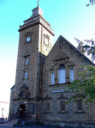
Cathcart is an area of Glasgow between Battlefield, Mount Florida, King's Park, Muirend and Newlands. The White Cart Water flows through Cathcart, downstream from Linn Park. In 2014, it was rated one of the most attractive postcode areas to live in Scotland.

Pollokshaws is an area on the South side of the city of Glasgow, Scotland. It is bordered by the residential neighbourhoods of Auldhouse to the east, Eastwood and Hillpark to the south and Shawlands to the north, with the Glasgow South Western Line railway and the open lands of Pollok Country Park to the west. The White Cart Water flows through the area.

Shawlands is an area of Glasgow, Scotland, located around 2 miles south of the River Clyde. The area, considered the "Heart of the Southside", is known for its independent restaurants and cafés, art scene, public parks, period terraces, and red and blond sandstone tenements. Shawlands was named one of the best places to live in Scotland in 2022 by The Sunday Times, and one of the world's coolest neighbourhoods by Time Out Magazine with judges describing it as "the city's best area to live and socialise”. It is located between Pollok Country Park, the home of the Burrell Collection and Pollok House, and the acclaimed Victorian park Queen's Park.

Pollok Country Park is a 146-hectare (361-acre) country park located between Shawlands, Crossmyloof, and Pollok in Glasgow, Scotland. In 2007, Pollok Country Park was named Britain's Best Park, and in 2008 it was named the Best Park in Europe, beating competition from parks in Italy, France, Germany, Poland and Sweden. Despite this, by 2019 it was considered that the park was 'underused' with plans drawn up to encourage more visitors.
Mount Florida is an area in the south-east of the city of Glasgow, Scotland.

The River Cart is a tributary of the River Clyde, Scotland, which it joins from the west roughly midway between the towns of Erskine and Renfrew and opposite the town of Clydebank.

Crossmyloof is an area on the south side of Glasgow situated between the districts of Pollokshields, Strathbungo and Shawlands in Scotland.

Muirend is an area on the South side of the city of Glasgow, Scotland. It is situated about 4 miles (6.5 km) south of Glasgow city centre. Muirend became extensively urbanised in the 20th century, developing into a commuter suburb. In a 2014 Royal Mail survey, the G44 postcode – which includes Muirend – was rated as the most desirable area of Scotland to live in. Neighbouring areas include Cathcart, Merrylee and Newlands in Glasgow, and Netherlee and Giffnock in East Renfrewshire. Some buildings that are locally associated with Muirend, including the main row of shops, as well as Hazelden Park and Muirend Pavilion, are located in East Renfrewshire.

Stamperland is a suburban neighbourhood in Clarkston, East Renfrewshire, Scotland. Part of the Greater Glasgow conurbation, it is situated on the west bank of the White Cart Water about 4.5 miles (7.2 km) south of Glasgow city centre, and just outside the city boundary.

Langside is a district in the Scottish city of Glasgow. It is situated south of the River Clyde, and lies east of Shawlands, south of Queens Park, west of Cathcart and north of Newlands. The district is residential and primarily middle-class, and has become an increasingly fashionable address in recent years. Housing stock is mainly of the Victorian tenement type, along with some townhouses of the same period.
Merrylee is a neighbourhood in the Scottish city of Glasgow. It is situated south of the River Clyde within the Newlands/Auldburn ward surrounded by other residential areas: Newlands, Cathcart and Muirend, and is a housing scheme consisting of mostly ex-local authority homes constructed in the 1950s and 60s.

King's Park is a district in the city of Glasgow, Scotland. It is situated south of the River Clyde and borders the Glasgow areas of Croftfoot, Cathcart, Simshill, Mount Florida and Toryglen and the neighbourhood of Bankhead in the adjoining town of Rutherglen.

Pollokshaws East railway station is a railway station in Glasgow, Scotland, serving parts of the Pollokshaws, Auldhouse, Newlands and Shawlands neighbourhoods of the city. The station is managed by ScotRail and is located on the Cathcart Circle Line.
The Cathcart District Railway was proposed to serve the arising demand for suburban residential travel on the south side of Glasgow, Scotland. It was planned as a loop running to and from Glasgow Central station, but at first only the eastern arm, to Cathcart via Queens Park, was built, opening in 1886. The western arm was opened in 1894 and trains operated round the loop. A frequent passenger train service was operated, and there was also a limited goods and mineral operation.

Auldhouse is an area of the Scottish city of Glasgow. It is situated south of the River Clyde along the banks of the Auldhouse Burn, a tributary of the White Cart Water.

Linn Park is an 82-hectare (200-acre) park in Glasgow, Scotland, surrounded by the suburbs of Cathcart, Muirend, Simshill, and Castlemilk, also bordering Netherlee in East Renfrewshire. It is Glasgow's third largest park, after Pollok Country Park and Dams to Darnley Country Park, although Dams to Darnley is half in East Renfrewshire. Both Linn and Pollok parks have the White Cart Water flowing through them. Some areas in the park are unsuitable for prams and the infirm.
St Andrew's Cross, also known as Eglinton Toll, is a road junction in the south side of the city of Glasgow, Scotland.

Newlands/Auldburn is one of the 23 wards of Glasgow City Council. Situated south of the city and the River Clyde, it is represented by 3 members as of 4 May 2017, one each from the Scottish National Party, Scottish Labour, and Scottish Conservatives.

Eastwood is a residential neighbourhood in the city of Glasgow, Scotland. It is situated south of the River Clyde, and is part of the Newlands/Auldburn ward under Glasgow City Council.


