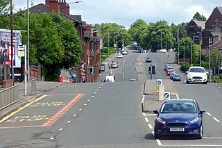
Riddrie is a north-eastern district of Glasgow, Scotland. It lies on the A80 Cumbernauld Road.

Pollok is a large housing estate on the south-western side of the city of Glasgow, Scotland. The estate was built either side of World War II to house families from the overcrowded inner city. Housing 30,000 at its peak, its population has since declined due to the replacement of substandard housing with lower-density accommodation. As of 2021, the population was recorded at 81,951 people.

Coatbridge is a town in North Lanarkshire, Scotland, about 8+1⁄2 miles east of Glasgow city centre, set in the central Lowlands. Along with neighbouring town Airdrie, Coatbridge forms the area known as the Monklands, often considered to be part of the Greater Glasgow urban area – although officially they have not been included in population figures since 2016 due to small gaps between the Monklands and Glasgow built-up areas.

Baillieston is a working class suburb of Glasgow, Scotland. It is about 7 miles (11 km) east of the city centre.

The Molendinar Burn is a burn in Glasgow, Scotland. It was the site of the settlement, Mellingdenor, that grew to become the kernel of Glasgow, and where St Mungo founded his church in the 6th century. It was later used to power the growing town's mills and the name became adapted because the word "molendinar" means "relating to a mill or millers", possibly because that is what the Welsh name Mellingdenor originally meant.

Robroyston is a suburb of Glasgow, Scotland, located around three miles northeast of the city centre.
Cranhill is an inner city district and housing scheme in the north east of Glasgow, Scotland. Cranhill was developed from public funding in the early 1950s and was originally, chiefly composed of four-storey tenement blocks surrounding a patch of grassland, which became Cranhill Park. Later development saw the building of three tower blocks, surrounded by rows of terraced maisonettes. In more recent years, a number of semi-detached and detached homes have been built. The area also hosts some shops, two primary schools and nurseries, a community centre and the Cranhill water tower.

The Monkland Canal was a 12+1⁄4-mile-long (19.7 km) canal designed to bring coal from the mining areas of Monklands to Glasgow in Scotland. In the course of a long and difficult construction process, it was opened progressively as short sections were completed, from 1771. It reached Gartcraig in 1782, and in 1794 it reached its full originally planned extent, from pits at Calderbank to a basin at Townhead in Glasgow; at first this was in two sections with a 96-foot (29 m) vertical interval between them at Blackhill; coal was unloaded and carted to the lower section and loaded onto a fresh barge. Locks were later constructed linking the two sections, and the canal was also connected to the Forth and Clyde Canal, giving additional business potential.

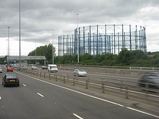
Garthamlock is a suburb in the north-east of the Scottish city of Glasgow. It is situated north of the River Clyde. Provanhall is the nearest neighbourhood to the east; Craigend is directly to the west with Hogganfield Park and Ruchazie beyond. Garthamlock is separated from Cranhill and Queenslie to the south by the M8 motorway. An area of open ground is to the north. The local landmarks are two water towers, which are illuminated at night.

Germiston is a neighbourhood in the city of Glasgow, Scotland, north of the River Clyde.
Hamiltonhill is a residential neighbourhood in the Scottish city of Glasgow, situated between Possilpark to the north and east and Port Dundas to the south. To the west of Hamiltonhill is a nature reserve bordering the Forth and Clyde Canal's Glasgow Branch section. The neighbourhood falls under the Canal ward of Glasgow City Council.

Hogganfield is a district in the Scottish city of Glasgow, located to the north east of the city centre. Hogganfield is surrounded by the Glasgow districts of Blackhill, Craigend, Millerston, Provanmill, Riddrie, Robroyston, Ruchazie and Stepps. The M80, Stepps bypass, separates Hogganfield from Robroyston.
Provanmill is a district in the Scottish city of Glasgow. It lies to the north east of the city centre. In the mid-19th century it was a small hamlet with a grain mill, blacksmith's, cartwright's and hostelry. As Glasgow expanded, it became part of the city. Since the 1950s, the area became a major area of deprivation, with chronic housing and drug-related crime problems, although in the early 21st century the image of Provanmill and its surrounding areas is improving. Blackhill, one of the most notorious housing estates in the area, was demolished in 1990 to make way for the M80 Stepps bypass.

Queenslie is a district in the Scottish city of Glasgow.

Ruchazie is a neighbourhood in the Scottish city of Glasgow. It is situated to the north-east of the city, bordered by Craigend and Garthamlock to the east and the open ground of Hogganfield Park and Lethamhill Golf Course to the north. Ruchazie is separated from Cranhill to the south and Riddrie to the west by the M8 motorway, previously the route of the Monkland Canal.
Sighthill is a neighbourhood in the Scottish city of Glasgow. It is situated north of the River Clyde and is part of the wider Springburn district in the north of the city. It is bordered to the north by Cowlairs, to the east by the Springburn Bypass road and the Royston neighbourhood, to the west by the Glasgow to Edinburgh via Falkirk Line and to the south by the Townhead interchange of the M8 Motorway.

Oatlands is an area in the city of Glasgow, Scotland. It is situated south of the River Clyde, falls within the Southside Central ward under Glasgow City Council, and is part of the Gorbals historic area. Its boundaries are Hutchesontown and the Southern Necropolis cemetery to the west, Polmadie to the south, Shawfield to the east, and Glasgow Green public park to the north.
The Bruce Report is the name commonly given to the First Planning Report to the Highways and Planning Committee of the Corporation of the City of Glasgow published in March 1945. It influenced an intensive programme of regeneration and rebuilding efforts which took place in the city and surroundings from the mid-1950s and lasted until the late 1970s. The author was Robert Bruce, Glasgow Corporation Engineer at the time.

Easthall is a residential neighbourhood in the East End of the Scottish city of Glasgow. Since 2007 it has been part of the Baillieston administrative ward within the Glasgow City Council area.

Moorepark is a small area in the Scottish city of Glasgow. Situated south of the River Clyde and part of the former Burgh of Govan, it was colloquially referred to as 'Wine Alley' during the mid-to-late 20th century when a housing scheme with a rough reputation was sited there. It is now an industrial estate.


