
Airdrie is a town in North Lanarkshire, Scotland. It lies on a plateau roughly 400 ft above sea level, and is approximately 12 miles (19 km) east of Glasgow city centre. As of 2012, the town had a population of around 37,130. Historically part of Lanarkshire, Airdrie forms part of a conurbation with its neighbour Coatbridge, in what is commonly known as the Monklands, formerly a district..

Milngavie is a town in East Dunbartonshire, Scotland and a suburb of Glasgow. It is on the Allander Water, at the northwestern edge of Greater Glasgow, and about 10 kilometres (6.2 mi) from Glasgow city centre. It neighbours Bearsden. Milngavie is a commuter town, with much of its working population travelling to Glasgow to work or study. The town is served by Milngavie railway station on the North Clyde Line of the SPT rail network, which links it to Central Glasgow.
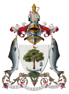
Glasgow City Council is the local government authority for the City of Glasgow, Scotland. It was created in 1996 under the Local Government etc. (Scotland) Act 1994, largely with the boundaries of the post-1975 City of Glasgow district of the Strathclyde region.
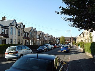
Jordanhill is an affluent area of the West End of the city of Glasgow, Scotland. The area consists largely of terraced housing dating from the early to mid 20th century, with some detached and semi-detached homes and some modern apartments.
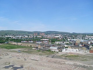
Clydebank is a town in West Dunbartonshire, Scotland. Situated on the north bank of the River Clyde, it borders the village of Old Kilpatrick to the west, and the Yoker and Drumchapel areas of the adjacent City of Glasgow immediately to the east. Depending on the definition of the town's boundaries, the suburban areas of Duntocher, Faifley and Hardgate either surround Clydebank to the north, or are its northern outskirts, with the Kilpatrick Hills beyond.

Bearsden is a town in East Dunbartonshire, Scotland, on the northwestern fringe of Greater Glasgow. Approximately 6 miles (10 km) from Glasgow City Centre, the town is effectively a suburb, and its housing development coincided with the 1863 introduction of a railway line. The town was named after Bearsden railway station, which was named after a nearby cottage.

Scotstoun is an area of Glasgow, Scotland, west of Glasgow City Centre. It is bounded by Garscadden and Yoker to the west, Victoria Park, Jordanhill and Whiteinch to the east, Jordanhill to the north and the River Clyde to the south. At the heart of Scotstoun lies Scotstounhill, an enclave of late Victorian and post-war housing centred on Scotstounhill railway station. Scotstoun is home to BAE Systems Surface Ships, and to the Glasgow Warriors rugby team.

Knightswood is a suburban district in Glasgow, containing three areas: Knightswood North or High Knightswood, Knightswood South or Low Knightswood, and Knightswood Park. It has a golf course and park, and good transport links with the rest of the city. Garscadden and Scotstounhill railway stations serve Low Knightswood while Westerton station serves High Knightswood. Knightswood is directly adjoined by the Anniesland, Blairdardie, Drumchapel, Garscadden, Jordanhill, Netherton, Scotstoun, Scotstounhill and Yoker areas of Glasgow, and by Bearsden in the north.
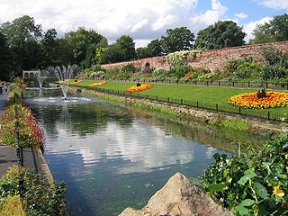
Roundhay is a large suburb in north-east Leeds, West Yorkshire, England. Roundhay had a population of 22,546 in 2011.

Cranhill is an inner city district and housing scheme in the north east of Glasgow, Scotland. Cranhill was developed from public funding in the early 1950s and was originally, chiefly composed of four-storey tenement blocks surrounding a patch of grassland, which became Cranhill Park. Later development saw the building of three tower blocks, surrounded by rows of terraced maisonettes. In more recent years, a number of semi-detached and detached homes have been built. The area also hosts some shops, two primary schools and nurseries, a community centre and the Cranhill water tower.

Drumchapel, known to locals and residents as 'The Drum', is part of the city of Glasgow, Scotland, having been annexed from Dunbartonshire in 1938. It borders Bearsden to the east and Clydebank to the west. The area is bordered by Knightswood and Yoker in Glasgow. The name derives from the Gaelic meaning 'the ridge of the horse'.
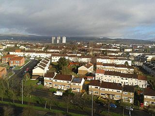
Blairdardie is a neighbourhood in the Scottish city of Glasgow. It is situated north of the River Clyde in the north-west of the city and is surrounded by other residential areas: High Knightswood, Knightswood, Old Drumchapel, Drumchapel and Garscadden. It was built between the 1950s and early 1960s.

Dalmuir is an area nine miles northwest of Glasgow, Scotland, on the western side of Clydebank, and part of West Dunbartonshire Council Area. The name is a lowland Scots derivation of the Gaelic meaning Big Field. The area was originally two separate villages with Dalmuir Shore joining with Clydebank in 1886 and Dalmuir Village in 1906, during a period of rapid industrialization and expansion. Dalmuir is bounded by the village of Old Kilpatrick to the west, the Mountblow and Parkhall housing schemes to the north, and the Clydebank town centre area to the east. To the south is the River Clyde.
The Glasgow, Yoker and Clydebank Railway was a railway company that opened in 1882, giving a rail connection to shipyards and other industry that developed in what became Clydebank. At first it was a purely local line, connecting only at Stobcross with the North British Railway, but as industry developed in the area it served it became increasingly important.

Drumchapel railway station serves the Drumchapel, Blairdardie and Old Drumchapel areas of Glasgow, Scotland. The station is managed by Abellio ScotRail and is served by trains on the Argyle Line and North Clyde Line.

King's Park is a district in the city of Glasgow, Scotland. It is situated south of the River Clyde and borders the Glasgow areas of Croftfoot, Cathcart, Simshill, Mount Florida and Toryglen and the neighbourhood of Bankhead in the adjoining town of Rutherglen.

Burnside is a mostly residential area in the town of Rutherglen in South Lanarkshire, Scotland. Including the neighbourhoods of High Burnside and High Crosshill, respectively south and north-west of its main street, it borders Overtoun Park in Rutherglen plus several other residential areas of the town, as well as western parts of neighbouring Cambuslang.

Kirkhill is a district of the town of Cambuslang, South Lanarkshire, Scotland.

Drumry is a district in the Scottish town of Clydebank, West Dunbartonshire, split into North and South Drumry by its main thoroughfare, Drumry Road. Some of the housing, including five tower blocks, was refurbished in the early 2010s.
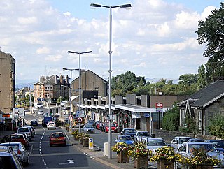
Clarkston is a suburban town in East Renfrewshire, in the Central Lowlands of Scotland. A dormitory town with a population of around 10,000, Clarkston is on the southern fringe of the Greater Glasgow conurbation and directly adjoins the neighbouring suburban villages of Busby and Netherlee, as well as the towns of Newton Mearns and Giffnock.


