
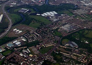
Nitshill is a district on the south side of Glasgow. It is bordered by South Nitshill to the south, Darnley to the east, Crookston and Roughmussel to the north-west, Hurlet to the west and Househillwood and Priesthill to the north, with the Pollok district and the Silverburn Centre beyond. An area of open ground to the south-west of Nitshill forms the boundary between Glasgow and the town of Barrhead in East Renfrewshire.

Rutherglen is a town in South Lanarkshire, Scotland, immediately south-east of the city of Glasgow, three miles from its centre and directly south of the River Clyde. Having previously existed as a separate Lanarkshire burgh, in 1975 Rutherglen lost its own local council and administratively became a component of the City of Glasgow District within the Strathclyde region. In 1996 the towns were reallocated to the South Lanarkshire council area.

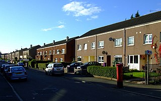
Pollok is a large housing estate on the south-western side of the city of Glasgow, Scotland. The estate was built either side of World War II to house families from the overcrowded inner city. Housing 30,000 at its peak, its population has since declined due to the replacement of substandard housing with lower-density accommodation. As of 2021, the population was recorded at 81,951 people.

Scotstoun is an area of Glasgow, Scotland, west of Glasgow City Centre. It is bounded by Garscadden and Yoker to the west, Victoria Park, Jordanhill and Whiteinch to the east, Jordanhill to the north and the River Clyde to the south. At the heart of Scotstoun lies Scotstounhill, an enclave of late Victorian and post-war housing centred on Scotstounhill railway station. Scotstoun is home to BAE Systems Surface Ships, and to the Glasgow Warriors rugby team.

Knightswood is a suburban district in Glasgow, containing three areas: Knightswood North or High Knightswood, Knightswood South or Low Knightswood, and Knightswood Park. It has a golf course and park, and good transport links with the rest of the city. Garscadden and Scotstounhill railway stations serve Low Knightswood while Westerton station serves High Knightswood. Knightswood is directly adjoined by the Anniesland, Blairdardie, Drumchapel, Garscadden, Jordanhill, Netherton, Scotstoun, Scotstounhill and Yoker areas of Glasgow, and by Bearsden in the north.

Castlemilk is a district of Glasgow, Scotland. It lies to the far south of the city centre, adjacent to the Croftfoot and Simshill residential areas within the city to the north-west, the town of Rutherglen - neighbourhoods of Spittal to the north-east and Fernhill to the east, Linn Park and its golf course to the west, and the separate village of Carmunnock further south across countryside.

Shettleston is an area in the east end of Glasgow in Scotland.
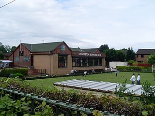
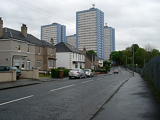
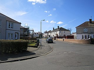
Crookston is a residential suburb on the southwestern edge of the city of Glasgow, Scotland.
Tollcross is an area north of the River Clyde in Glasgow and has a popular park, opened in 1897, which is famed for its international rose trials. It lies approximately a mile east of the neighbouring suburb of Parkhead, and just north of Braidfauld and south of Shettleston.

Toryglen is a district in southern Glasgow, Scotland, falling within the Langside ward under Glasgow City Council. It is approximately two miles south of the city centre, bounded to the west by Mount Florida, the north-west by Polmadie, to the north-east by the West Coast Main Line railway and the M74 motorway the south by King's Park, and immediately to the east by the town of Rutherglen.

Craigton is a residential suburb in the southwest of the city of Glasgow, Scotland. Located approximately three miles from the city centre, it is bordered by Bellahouston Park to the south and Halfway to the west, with Cardonald beyond.
Penilee is a small housing scheme and suburb on the southwestern edge of Glasgow, Scotland. The area is bounded to its east by the Glasgow suburbs of Cardonald and Hillington, and to the west by the Renfrewshire border and the farms of North and South Arkleston. The district's southern boundary forms Glasgow's border with the Renfrewshire settlement of Ralston. The area is currently undergoing considerable residential redevelopment.

Barlanark is a district in Glasgow. It is situated east of Budhill, Shettleston and Springboig, north west of Baillieston, west of Springhill and Swinton and south of Easthall, Easterhouse and Wellhouse.
Carntyne is a suburban district in the Scottish city of Glasgow. It is situated north of the River Clyde, and in the east end of the city. it has formed the core of the East Centre ward under Glasgow City Council, which also includes the neighbouring Riddrie and Cranhill areas.

Cowlairs is an area in the Scottish city of Glasgow, part of the wider Springburn district of the city. It is situated north of the River Clyde, between central Springburn to the east and Possilpark to the west.

Easterhouse is a suburb of Glasgow, Scotland, 6 miles (10 km) east of the city centre on land gained from the county of Lanarkshire as part of an expansion of Glasgow before the Second World War. The area is on high ground north of the River Clyde and south of the River Kelvin and Campsie Fells.
Sandyhills is an area of the Scottish city of Glasgow. It is situated north of the River Clyde and has fallen within the Shettleston ward of Glasgow City Council since 2007.

Springboig is a neighbourhood in the east end of the Scottish city of Glasgow, situated north of the River Clyde. Administratively, it has been within the city's East Centre ward since 2017, having previously been in the Baillieston ward.

King's Park is a district in the city of Glasgow, Scotland. It is situated south of the River Clyde and borders the Glasgow areas of Croftfoot, Cathcart, Simshill, Mount Florida and Toryglen and the neighbourhood of Bankhead in the adjoining town of Rutherglen.
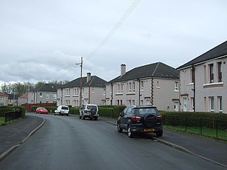
Househillwood is a residential neighbourhood of Glasgow, Scotland, situated in the south-west of the city.
