
Airdrie is a town in North Lanarkshire, Scotland. It lies on a plateau 400 ft above sea level, 12 miles (19 km) east of Glasgow. As of 2012, it had a population of 37,130. Airdrie developed as a market town in the late 17th century following an Act of Parliament allowing it to hold a weekly market. It later grew in prominence as a centre for weaving and manufacturing, as well as being the settlement near several coalmines. In the mid 19th century, the town expanded greatly as a result of immigration and the development of iron works and railway links. This led to the town building the first public library in Scotland in 1853. During the 20th century, industrial decline took place in Airdrie, with heavy industry closing down across much of the town. In the 21st century, Airdrie has continued as a regional centre for services and retail, as well as being a commuter settlement within the Central Belt. Historically part of Lanarkshire, Airdrie forms a conurbation with its neighbour Coatbridge, in what was formerly the Monklands district, with a population of approximately 90,000.

Lanarkshire, also called the County of Lanark, is a historic county, lieutenancy area and registration county in the Central Lowlands and Southern Uplands of Scotland. The county is no longer used for local government purposes, but gives its name to the two modern council areas of North Lanarkshire and South Lanarkshire.

Blantyre is a town and civil parish in South Lanarkshire, Scotland, with a population of 16,900. It is bounded by the River Clyde to the north, the Rotten Calder to the west, the Park Burn to the east and the Rotten Burn to the south.

Coatbridge is a town in North Lanarkshire, Scotland, about 8+1⁄2 miles east of Glasgow city centre, set in the central Lowlands. Along with neighbouring town Airdrie, Coatbridge forms the area known as the Monklands, often considered to be part of the Greater Glasgow urban area – although officially they have not been included in population figures since 2016 due to small gaps between the Monklands and Glasgow built-up areas.

Mount Vernon is a residential area in the east end of the city of Glasgow, Scotland. It directly borders Sandyhills and Foxley to the west, while Barlanark is the closest neighbourhood to the north, Barrachnie and Baillieston to the east and Carmyle to the south, although Mount Vernon is separated from these by areas of open land, including Early Braes public park and the former Kenmuir farm.

The Metropolitan Cathedral Church of Saint Andrew or Glasgow Metropolitan Cathedral is a Latin Catholic cathedral in the city centre of Glasgow, Scotland. It is the mother church of the Archdiocese of Glasgow. The cathedral, which was designed in 1814 by James Gillespie Graham in the Neo Gothic style, lies on the north bank of the River Clyde in Clyde Street. St Andrew's Cathedral is the seat of the Archbishop of Glasgow, currently William Nolan. It is dedicated to the patron saint of Scotland, Saint Andrew.

The Rotten Calder is a river to the east of East Kilbride, South Lanarkshire, Scotland and along with the Rotten Burn it forms the southern and western boundaries of Blantyre.

The Monkland Canal was a 12+1⁄4-mile-long (19.7 km) canal designed to bring coal from the mining areas of Monklands to Glasgow in Scotland. In the course of a long and difficult construction process, it was opened progressively as short sections were completed, from 1771. It reached Gartcraig in 1782, and in 1794 it reached its full originally planned extent, from pits at Calderbank to a basin at Townhead in Glasgow; at first this was in two sections with a 96-foot (29 m) vertical interval between them at Blackhill; coal was unloaded and carted to the lower section and loaded onto a fresh barge. Locks were later constructed linking the two sections, and the canal was also connected to the Forth and Clyde Canal, giving additional business potential.

Easterhouse is a suburb of Glasgow, Scotland, 6 miles (10 km) east of the city centre on land gained from the county of Lanarkshire as part of an expansion of Glasgow before the Second World War. The area is on high ground north of the River Clyde and south of the River Kelvin and Campsie Fells.

Queenslie is a district in the Scottish city of Glasgow.

Shieldhall is a district in the Scottish city of Glasgow. It is situated directly south of the River Clyde and is part of the wider Govan area.

Monklands was, between 1975 and 1996, one of nineteen local government districts in the Strathclyde region of Scotland.
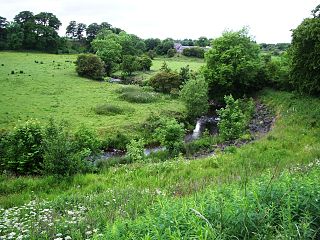
The North Calder Water is a river in North Lanarkshire, Scotland. It flows for 12 miles (19 km) from the Black Loch via the Hillend Reservoir, Caldercruix, Plains, Airdrie, Calderbank, Carnbroe and Viewpark to the River Clyde at Daldowie, south-east of Glasgow. For the last two miles of its course, it forms part of the boundary between North Lanarkshire and Glasgow. The name Calder is thought to be Brythonic and to mean 'hard cold flowing' water.
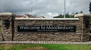
Moodiesburn is a village in Scotland, located 8 miles northeast of Glasgow, in the North Lanarkshire council area. It is situated on the north side of the A80 road and between the M73 and M80 motorways which converge nearby. Moodiesburn does not directly adjoin any other settlements, though the villages of Chryston and Muirhead are located a short distance to the west, with Stepps beyond, and outer parts of Cumbernauld lie to the east; however, the town centres are about 5 miles apart.

Summerlee Museum of Scottish Industrial Life is an industrial and social history museum in Coatbridge, North Lanarkshire, Scotland. It is situated on the site of the Victorian Summerlee Iron Works and the former Hydrocon Crane factory. The main Hydrocon factory building became the museum’s exhibition hall but it has been substantially changed and adapted since. The museum aims to show Lanarkshire's contribution to engineering, mining, steel working, weaving and farming, and also show the lives of the people of the area. It includes interactive displays and a temporary exhibition space. Entry is free of charge.

Newton is a mainly residential district in the town of Cambuslang in Scotland; it is situated directly south of the River Clyde. Newton is within the Cambuslang East ward of the South Lanarkshire Council area. Formerly a mining settlement from the mid-19th to mid-20th centuries then sparsely populated for several decades, in the early 2000s it was designated a 'Community Growth Area' for residential development with several hundred houses, a new primary school and associated infrastructure constructed in phases over several years into the 2020s, mostly on fields previously used by a farm which had operated for several centuries before closing around the turn of the 21st century.

The Clydebridge Steelworks, also known as Clydebridge Works, is a steel works in South Lanarkshire, Scotland.
The Clyde Iron Works was a Scottish-based ironworking plant which operated from 1786 to 1978.

The Daldowie Dovecot is a Category A listed dovecote in Glasgow, Scotland. It was built in the mid-18th century on the north bank of the River Clyde, in the grounds of the former Daldowie House estate. It stood isolated for several decades within the grounds of Daldowie Sewage Works, and was dismantled and re-erected in its present location on the A74 Hamilton Road in 2000, at a cost of £500,000.

Broomhouse is a residential area in Glasgow, Scotland. It is about six miles east of the city centre. Historically a small mining village and later the site of the Glasgow Zoo, in the early 21st century it grew substantially as an affluent commuter suburb.

