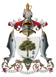
Glasgow City Council is the local government authority for the City of Glasgow, Scotland. It was created in 1996 under the Local Government etc. (Scotland) Act 1994, largely with the boundaries of the post-1975 City of Glasgow district of the Strathclyde region.

Pollok is a large housing estate on the south-western side of the city of Glasgow, Scotland. The estate was built either side of World War II to house families from the overcrowded inner city. Housing 30,000 at its peak, its population has since declined due to the replacement of substandard housing with lower-density accommodation.

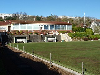
Pollokshaws is an area on the South side of the city of Glasgow, Scotland. It is bordered by the residential neighbourhoods of Auldhouse to the east, Eastwood and Hillpark to the south and Shawlands to the north, with the Glasgow South Western Line railway and the open lands of Pollok Country Park to the west. The White Cart Water flows through the area.

Pollokshields is an area in the Southside of Glasgow, Scotland. Its modern boundaries are largely man-made, being formed by the M77 motorway to the west and northwest with the open land of Pollok Country Park and the Dumbreck neighbourhood beyond, by the Inverclyde Line railway and other branches which separate its territory from the largely industrial areas of Kinning Park, Kingston and Port Eglinton, and by the Glasgow South Western Line running from the east to south, bordering Govanhill, Strathbungo, Crossmyloof and Shawlands residential areas. There is also a suburban railway running through the area.

Shawlands is an area of Glasgow, Scotland, located around 2 miles south of the River Clyde. The area has an approximate population of 7000, with over 82% dwelling in flats, 74% owner occupied and 79% living alone or with one other person.

Pollok Country Park is a 146-hectare (361-acre) country park located in Pollok, Glasgow, Scotland. In 2007, Pollok Country Park was named Britain's Best Park, and in 2008 it was named the Best Park in Europe, beating competition from parks in Italy, France, Germany, Poland and Sweden. Despite this, by 2019 it was considered that the park was 'underused' with plans drawn up to encourage more visitors.
Crookston is a residential suburb on the southwestern edge of the city of Glasgow, Scotland.
Glasgow South is a burgh constituency of the House of Commons of the Parliament of the United Kingdom (Westminster). It elects one Member of Parliament (MP) by the first past the post system of election.

The River Cart is a tributary of the River Clyde, Scotland, which it joins from the west roughly midway between the towns of Erskine and Renfrew and opposite the town of Clydebank.

Crossmyloof is an area on the south side of Glasgow situated between the districts of Pollokshields, Strathbungo and Shawlands in Scotland.
Carnwadric is a residential area of Glasgow, Scotland. It is situated south of the River Clyde, and is bordered by a park to the north, the Arden housing estate to the west, by the village of Thornliebank to the south and by the Auldhouse Burn to the east.
Hillpark is a district in the Scottish city of Glasgow. It is situated south of the River Clyde.

Newlands is a suburb in the south side of Glasgow, Scotland. The area is mainly residential in character. Shawlands and Langside lie to the north of the district, Pollokshaws and Auldhouse to the west, Giffnock to the south, and Merrylee and Cathcart to the east.

Langside is a district in the Scottish city of Glasgow. It is situated south of the River Clyde, and lies east of Shawlands, south of Queens Park, west of Cathcart and north of Newlands. The district is residential and primarily middle-class, and has become an increasingly fashionable address in recent years. Housing stock is mainly of the Victorian tenement type, along with some townhouses of the same period.

Merrylee is a district in the Scottish city of Glasgow. It is situated south of the River Clyde. It is surrounded by Newlands, Cathcart and Muirend. Merrylee is a housing scheme consisting of mostly council or ex-council houses. Recent developments in the scheme have seen the council football pitches being developed into a primary school. Another development has seen luxury flats being erected on the site of the former Newlands Lawn Tennis Club car park.

Pollokshaws East railway station is a railway station in Glasgow, Scotland, serving parts of the Pollokshaws, Auldhouse, Newlands and Shawlands neighbourhoods of the city. The station is managed by Abellio ScotRail and is located on the Cathcart Circle Line.

Deaconsbank is a neighbourhood in the Scottish city of Glasgow. It is situated south of the River Clyde. The main feature of the area, which falls into the Greater Pollok ward of Glasgow City Council and directly borders the East Renfrewshire council region, is an estate of around 639 private houses built in the late 1970s by Barratt Developments, prior to which the area was open farmland. Deaconsbank is bordered by the M77 motorway to the west and by Rouken Glen Park and golf course to the east. The northern parts of the suburban town of Newton Mearns are a short distance to the south, as is Patterton railway station.

Newlands/Auldburn is one of the 23 wards of Glasgow City Council. Situated south of the city and the River Clyde, it is represented by 3 members as of 4 May 2017, one each from the Scottish National Party, Scottish Labour, and Scottish Conservatives.

Eastwood is a residential neighbourhood in the city of Glasgow, Scotland. It is situated south of the River Clyde, and is part of the Newlands/Auldburn ward under Glasgow City Council.

