Gallowgate, Glasgow

Last updated

Gallowgate
Whitevale Gardens from Whitevale Tower.JPG
Modern housing and older maisonettes in the Gallowgate (2013)
Glasgow UK location map.svg
Red pog.svg
Gallowgate
Location within Glasgow
Council area
Lieutenancy area
  • Glasgow
Country Scotland
Sovereign state United Kingdom
Post town GLASGOW
Postcode district G31 / G40
Dialling code 0141
Police Scotland
Fire Scottish
Ambulance Scottish
UK Parliament
Scottish Parliament
List of places
UK
Scotland
Glasgow
55°51′19″N4°13′09″W / 55.855250°N 4.219136°W / 55.855250; -4.219136

Gallowgate is a neighbourhood of the city of Glasgow, Scotland. It takes its name from the major thoroughfare through the territory, which is part of the A89 road. Administratively, it is part of the Calton ward of the Glasgow City Council area.

Contents

Location and history

The important Gallowgate road runs from Glasgow Cross to Parkhead and includes The Barras, [1] but only a small length of it is in the Gallowgate neighbourhood, the boundaries of which are Abercromby Street/Bellgrove Street to the west (opposite the Calton district), Fielden Street/Millerston Street to the east (at the Forge Retail Park—which is roughly on the site of the former Camlachie neighbourhood) and Crownpoint Road to the south (adjoining the Mile End industrial estate, which is part of the Bridgeton district).

The neighbourhood's northern boundary is the North Clyde Line railway with Dennistoun beyond, linked by a series of bridges. Old maps show several north-south streets using the same names on both sides of the railway tracks, [2] but those not linked via the bridges have since been renamed on the Dennistoun side.

View looking west from Whitevale Tower, including the Bellgrove Hotel (left), spare ground, refurbished maisonettes and new houses (centre), Bellgrove railway station and tracks and older tenements in Dennistoun (right) Bellgrove from Whitevale Tower.JPG
View looking west from Whitevale Tower, including the Bellgrove Hotel (left), spare ground, refurbished maisonettes and new houses (centre), Bellgrove railway station and tracks and older tenements in Dennistoun (right)

The majority of the current housing is on the north side of the main road, much of it comprising deck-access maisonettes constructed in the 1960s as a council housing scheme. However, the streets where they were built are much older, having been at the heart of a vibrant and densely populated industrial community in the East End that was largely swept away in a slum clearance program. In particular, Slatefield Street was once the location of a country house and then a brewery, [3] [4] Campbellfield Street was also home to a mansion and later a large school, [5] [6] and Rowchester Street was home to the carnival grounds, which moved to nearby Vinegarhill when they were replaced by a tram depot. [7]

View looking north from the main road (2014) depicting the Whitevale Public Baths building and the since-demolished Bluevale and Whitevale Towers Whitevale Bath (geograph 4254362).jpg
View looking north from the main road (2014) depicting the Whitevale Public Baths building and the since-demolished Bluevale and Whitevale Towers

One of the few prominent remnants of the past is the derelict Whitevale Public Baths building. [8] [9] Another local landmark, the art deco style Bellgrove Hotel (a homeless hostel) is also located on the north side. In the early 21st century, some of the council blocks were demolished by the Glasgow Housing Association, some were refurbished and some replaced with modern houses. [10]

The 1960s development also included the Bluevale and Whitevale Towers, [11] two 90-metre-high residential tower blocks that dominated the skyline in the area for almost 50 years until they were gradually deconstructed between 2014 in 2016 (they could not be demolished with explosives because of close proximity to the railway and other buildings). [12]

St Mungo's Academy – a secondary school completed in 1976 to replace the original campus in the Townhead district – and the Crownpoint Sports Centre [13] (home of the Shettleston Harriers athletics club) [14] and its playing fields are on the south side of the road, along with St Anne's RC Primary School and some modern apartment blocks.

Commerce is very limited within the neighbourhood, but the wide range of shops at The Forge are within walking distance, as are a range of local cafes and pubs on Duke Street, Dennistoun and at Bridgeton Cross.

Transport

Bellgrove railway station provides a rail link to central Glasgow and also to Edinburgh in the opposite direction, while bus services (operated by First Glasgow) reflect the status of Gallowgate as a major transit corridor: the frequent [15] '2', '61' and '240' services all use the route, [16] with two of these including a night provision. [17]

Notable residents

Related Research Articles

<span class="mw-page-title-main">Parkhead</span> Human settlement in Scotland

Parkhead is a district in the East End of Glasgow. Its name comes from a small weaving hamlet at the meeting place of the Great Eastern Road and Westmuir Street. Glasgow's Eastern Necropolis cemetery was laid out in the area in 1847 beside the Gallowgate.

<span class="mw-page-title-main">Bridgeton, Glasgow</span> Human settlement in Scotland

Bridgeton is a district to the east of Glasgow city centre. Historically part of Lanarkshire, it is bounded by Glasgow Green to the west, Dalmarnock to the east and south, Calton to the north-west at Abercromby Street/London Road and Broad street to the north-east.

<span class="mw-page-title-main">Glasgow Central (UK Parliament constituency)</span> Parliamentary constituency in the United Kingdom, 2005 onwards

Glasgow Central is a constituency of the House of Commons of the Parliament of the United Kingdom. In its current form, the constituency was first used at the 2005 general election, but there was also a Glasgow Central constituency that existed from 1885 to 1997. The sitting MP is Alison Thewliss of the Scottish National Party (SNP), who was first elected in May 2015. This constituency was also the seat of the former Conservative Prime Minister Bonar Law, who was the shortest-serving UK Prime Minister of the twentieth century.

Glasgow Bridgeton was a parliamentary constituency in the city of Glasgow. From 1885 to 1974, it returned one Member of Parliament (MP) to the House of Commons of the Parliament of the United Kingdom, elected by the first-past-the-post voting system.

<span class="mw-page-title-main">Glasgow Camlachie (UK Parliament constituency)</span> Parliamentary constituency in the United Kingdom, 1885–1955

Glasgow Camlachie was a burgh constituency represented in the House of Commons of the Parliament of the United Kingdom from 1885 until 1955.

<span class="mw-page-title-main">Glasgow Shettleston (UK Parliament constituency)</span> Parliamentary constituency in the United Kingdom, 1918–2005

Glasgow Shettleston was a burgh constituency represented in the House of Commons of the Parliament of the United Kingdom from 1918 until 2005. The Shettleston area's representation is now covered by Glasgow Central and Glasgow East.

<span class="mw-page-title-main">Dennistoun</span> Human settlement in Scotland

Dennistoun is a mostly residential district in Glasgow, Scotland, located north of the River Clyde and in the city's east end, about 1+14 miles east of the city centre. Since 2017 it has formed the core of a Dennistoun ward under Glasgow City Council, having previously been a component of the East Centre ward.

Lilybank is a neighbourhood in the east of Glasgow, Scotland. Neighbouring areas Newbank to the west, Braidfauld to the east and the eastern part of Parkhead to the north. The A74 London Road runs to the south, with the land on the opposite side between the road and the River Clyde not used for residential purposes: the Barrowfield football training ground owned by Celtic F.C., and the Dewar's whisky bottling plant and warehouses, the latter on the former Westthorn country estate.

<span class="mw-page-title-main">Barrowfield</span> Neighbourhood of Glasgow, Scotland

Barrowfield is a neighbourhood of Glasgow, Scotland, close to Celtic Park, home of Celtic F.C., which lies immediately to the east. It is bounded by the A89 road (Gallowgate) to the north and the A74 to the south.

<span class="mw-page-title-main">Bellgrove railway station</span> Railway station in Glasgow

Bellgrove Railway Station is in the East End of Glasgow, Scotland, serving the city's Calton, Gallowgate and south Dennistoun neighbourhoods. The station is approximately 1 mile (1.6 km) to the east of Glasgow Queen Street, and is managed by ScotRail.

The City of Glasgow Union Railway - City Union Line, also known as the Tron Line, was a railway company founded in Glasgow, Scotland, in 1864 to build a line connecting the railway systems north and south of the River Clyde, and to build a central passenger terminus and a general goods depot for the city. The through line, running from south-west to north-east across the city, opened in 1870–71, and the passenger terminal was St Enoch railway station, opened in 1876. The railway bridge across the Clyde was the first in the city.
<span class="mw-page-title-main">A89 road</span> Road in Scotland

The A89 is a trunk road in Scotland, United Kingdom. It runs from High Street, Glasgow to Newbridge in Edinburgh. It was once the A8, which has now been replaced, mostly by the M8.

<span class="mw-page-title-main">Duke Street, Glasgow</span> Street in Glasgow, Scotland

Duke Street is a major street in Glasgow, Scotland, and is of the major road arteries connecting the City Centre to the East End. It begins at High Street and runs east through the residential districts of Ladywell and Dennistoun, and on towards Haghill and Parkhead, meeting the Gallowgate, Tollcross Road and Westmuir Street to form a turreted Edwardian junction at Parkhead Cross. It takes its name from the Duke of Montrose. At a total distance of 2 miles (3.2km), Duke Street is the longest designated street in Glasgow.

<span class="mw-page-title-main">Camlachie</span> Human settlement in Scotland

Camlachie is an area of Glasgow in Scotland, located in the East End of the city, between Dennistoun to the north, and Bridgeton to the south. Formerly a weaving village on the Camlachie Burn, it then developed as an important industrial suburb from the late 19th century, only to almost entirely disappear from the landscape when those industries declined a century later.
<span class="mw-page-title-main">Coatbridge Branch (NBR)</span>

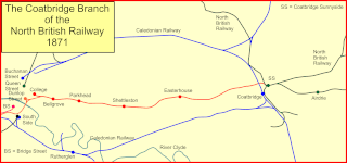
The Coatbridge Branch of the North British Railway was a railway built to connect the important coal and iron industrial districts of Coatbridge and Airdrie directly to Glasgow for the North British Railway.

<span class="mw-page-title-main">Bluevale and Whitevale Towers</span> Residential in Scotland

The Bluevale and Whitevale Towers were twin tower block flats situated in the Camlachie district within the East End of Glasgow, Scotland. Officially named 109 Bluevale Street and 51 Whitevale Street, and often nicknamed the Gallowgate Twins or the Camlachie Twin Towers, the two towers were for a time the tallest buildings in Scotland.

<span class="mw-page-title-main">Calton (ward)</span> Human settlement in Scotland

Calton is one of the 23 wards of Glasgow City Council. On its creation in 2007 and in 2012 it returned three council members, using the single transferable vote system. For the 2017 Glasgow City Council election, the seats increased to four due to the population having risen by 20% since it was first formed, although the boundaries did not change.

Bridgeton Waverley Football Club was a Scottish football club based in Glasgow. Originally founded in 1904, they competed in the Junior grade from 1923 until folding in 1962.

References

  1. "Gallowgate, The". Gazetteer for Scotland . Retrieved 6 July 2018.
  2. "Ordnance Survey 25 inch, 1892-1914 (search term: Camlachie)". Explore georeferenced maps. National Library of Scotland . Retrieved 6 July 2018.
  3. "Slatefield House". The Glasgow Story. Retrieved 6 July 2018.
  4. "Glasgow, Slatefield Street, Slatefield Brewery". Canmore . Retrieved 6 July 2018.
  5. "Campbellfield House". The Glasgow Story. Retrieved 6 July 2018.
  6. "Campbellfield Occupational Centre". The Glasgow Story. Retrieved 6 July 2018.
  7. Peter Mortimer (1998). "Camlachie, the forgotten village". Parkhead History. Retrieved 6 July 2018.
  8. "Whitevale Public Baths and Wash-house". The Glasgow Story. Retrieved 6 July 2018.
  9. "Whitevale Street Public Baths & Washhouse". Derelict Glasgow. Retrieved 6 July 2018.
  10. "Gallowgate transformation kicks on as work starts on more GHA homes". Glasgow Housing Association. 23 February 2018. Retrieved 6 July 2018.
  11. Chris Leslie (31 October 2016). "Bringing down the Gallowgate: how Glasgow's redevelopment changed communities forever". i . Retrieved 6 July 2018.
  12. "Gallowgate Twins flats brought down using new UK demolition method". Evening Times . 16 December 2015. Retrieved 6 July 2018.
  13. "Glasgow Club Crownpoint Sports Complex". Glasgow Life. Retrieved 6 July 2018.
  14. "Home page". Shettleston Harriers. Retrieved 6 July 2018.
  15. "Frequency Guide" (PDF). First Glasgow. 1 January 2018. Retrieved 6 July 2018.[ permanent dead link ]
  16. "Glasgow Network Map" (PDF). First Glasgow. 1 January 2018. Retrieved 6 July 2018.[ permanent dead link ]
  17. "Night Service Network Map" (PDF). First Glasgow. 1 January 2018. Retrieved 6 July 2018.
  18. Wilson, Richard (16 February 2015). "Scotland's Robert Snodgrass on the 'hardest task' of his life". BBC Sport. BBC. Retrieved 6 July 2018.

https://scotlander.co.uk/