
Flint, occasionally flintstone, is a sedimentary cryptocrystalline form of the mineral quartz, categorized as the variety of chert that occurs in chalk or marly limestone. Flint was widely used historically to make stone tools and start fires.

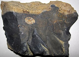
Chert is a hard, fine-grained sedimentary rock composed of microcrystalline or cryptocrystalline quartz, the mineral form of silicon dioxide (SiO2). Chert is characteristically of biological origin, but may also occur inorganically as a chemical precipitate or a diagenetic replacement, as in petrified wood.

Russell Cave National Monument is a U.S. National Monument in northeastern Alabama, United States, close to the town of Bridgeport. The monument was established on May 11, 1961, when 310 acres (1.3 km2) of land were donated by the National Geographic Society to the American people. It is now administered and maintained by the National Park Service. The National Monument was listed on the National Register of Historic Places on October 15, 1966.

The Onondaga Limestone is a group of hard limestones and dolomites of Devonian age that form an important geographic feature in some areas in which it outcrops; in others, especially its Southern Ontario portion, the formation can be less prominent as a local surface feature.
Topper is an archaeological site located along the Savannah River in Allendale County, South Carolina, United States. It is noted as a location of artifacts which some archaeologists believe to indicate human habitation of the New World earlier than the Clovis culture. The latter were previously believed to be the first people in North America.

The Swan's Landing Archeological Site is an archaeological site from the Early Archaic period in Harrison County, Indiana, United States. Located along the Ohio River, it has been extensively damaged by modern activity, but it is still one of the most important sites for its time period in North America. It has been designated a historic site because of its archaeological value.

The Kincaid Mounds Historic Site c. 1050–1400 CE, is a Mississippian culture archaeological site located at the southern tip of present-day U.S. state of Illinois, along the Ohio River. Kincaid Mounds has been notable for both its significant role in native North American prehistory and for the central role the site has played in the development of modern archaeological techniques. The site had at least 11 substructure platform mounds, and 8 other monuments.

The Eva site (40BN12) is a prehistoric Native American site in Benton County, Tennessee, in the Southeastern United States. Located along an ancient channel of the Tennessee River, the Eva site saw extensive periods of occupation during the Middle and Late Archaic period. The site's well-defined midden layers helped investigators identify three distinct Archaic cultures, the oldest of which was first identified at Eva and is still known as the "Eva culture" or the "Eva phase."

The Thunderbird Archaeological District, near Limeton, Virginia, is an archaeological district described as consisting of "three sites—Thunderbird Site, the Fifty Site, and the Fifty Bog—which provide a stratified cultural sequence spanning Paleo-Indian cultures through the end of Early Archaic times with scattered evidence of later occupation."
The Prehistory of West Virginia spans ancient times until the arrival of Europeans in the early 17th century. Hunters ventured into West Virginia's mountain valleys and made temporary camp villages since the Archaic period in the Americas. Many ancient human-made earthen mounds from various mound builder cultures survive, especially in the areas of Moundsville, South Charleston, and Romney. The artifacts uncovered in these areas give evidence of a village society with a tribal trade system culture that included limited cold worked copper. As of 2009, over 12,500 archaeological sites have been documented in West Virginia.
Barton Village Site, also known as the Herman Barton Indian Village Archeological Site, is a large, multi-component archaeological site near Cumberland in Allegany County, Maryland.

Prehistory of Ohio provides an overview of the activities that occurred prior to Ohio's recorded history. The ancient hunters, Paleo-Indians, descended from humans that crossed the Bering Strait. There is evidence of Paleo-Indians in Ohio, who were hunter-gatherers that ranged widely over land to hunt large game. For instance, mastodon bones were found at the Burning Tree Mastodon site that showed that it had been butchered. Clovis points have been found that indicate interaction with other groups and hunted large game. The Paleo Crossing site and Nobles Pond site provide evidence that groups interacted with one another. The Paleo-Indian's diet included fish, small game, and nuts and berries that gathered. They lived in simple shelters made of wood and bark or hides. Canoes were created by digging out trees with granite axes.

Mill Creek chert is a type of chert found in Southern Illinois and heavily exploited by members of the Mississippian culture. Artifacts made from this material are found in archaeological sites throughout the American Midwest and Southeast. It is named for a village and stream near the quarries, Mill Creek, Illinois and Mill Creek, a tributary of the Cache River. The chert was used extensively for the production of utilitarian tools such as hoes and spades, and for polished ceremonial objects such as bifaces, spatulate celts and maces.
The Hobson site (33MS2) is a Native American archaeological site located 1.5 miles (2.4 km) below Middleport, Ohio on the north bank of the Ohio River. It has minor traces of Archaic, Woodland and Late Prehistoric artifacts. However, the largest component is a small village and cemetery of the Feurt Phase of the Fort Ancient culture originally estimated to date to 1100 to 1200 CE. More recent radiocarbon-dating has provided a date of 1350 CE.
The Trinchera Cave Archeological District (5LA9555) is an archaeological site in Las Animas County, Colorado with artifacts primarily dating from 1000 BC to AD 1749, although there were some Archaic period artifacts found. The site was added to the National Register of Historic Places in 2001 and is located on State Trust Lands.

The following outline is provided as an overview of and topical guide to the prehistoric people of Colorado, which covers the period of when Native Americans lived in Colorado prior to contact with the Domínguez–Escalante expedition in 1776. People's lifestyles included nomadic hunter-gathering, semi-permanent village dwelling, and residing in pueblos.
Minori Cave is part of the Callao limestone formation, located in Barangay Quibal, Municipality of Peñablanca, Cagayan Province in Northern Luzon. The said cave has two openings. One, designated as Mouth B, is located at 17° 43' 17" N latitude and 121° 49' 42" E longitude. The other opening, Mouth A is located 17° 43' 21" N latitude and 121° 49' 44" E longitude. The cave has an average elevation of about 200 m (656.2 ft) above sea level, and length and width of 147 m (482.3 ft) and 7 to 11 m, respectively. The cave is divided into four chambers with mouth A as chamber A and mouth B as chamber D. Chambers B and C are in between the two mouths.

Paleo Crossing site, also known as the Old Dague Farm site, is an archaeological site near Sharon Center, Ohio in Medina County where Clovis artifacts dated to 10,980 BP ± 75 years Before Present were found. The Cleveland Museum of Natural History conducted an excavation from 1990 to 1993. The site provides evidence of Paleo-Indians in northern Ohio and may be the area's oldest residents and archaeologist Dr. David Brose believes that they may be "some of the oldest certain examples of human activity in the New World." The site contains charcoal recovered from refuse pits. There were also two post holes and blades and tools 80% of which were made from flint from the Ohio River Valley in Indiana, 500 miles from Paleo Crossing, which indicates that the hunter-gatherers had a widespread social network and traveled across distances relatively quickly. The post holes are evidence that there was a shelter built on the site.
The Welling site is an archaeological site of the Paleo-Indian period, meaning the time of the earliest humans. Located in Coshocton County, Ohio, it was a site for quarrying stone in the Upper Mercer chert source area. Based upon the microwear analysis of stone tools, it is believed to be a base camp where people learned and shared Clovis tool-making techniques, ate, exchanged information, and perhaps found mates from others groups.

