Upper Montclair, New Jersey

Last updated

Upper Montclair, New Jersey
Street in Upper Montclair, NJ (2006).jpg
Upper Montclair business district
Essex County New Jersey incorporated and unincorporated areas Upper Montclair highlighted.svg
Location map of Essex County, New Jersey.svg
Red pog.svg
Upper Montclair
Location in Essex County
USA New Jersey relief location map.svg
Red pog.svg
Upper Montclair
Location in New Jersey
Usa edcp relief location map.png
Red pog.svg
Upper Montclair
Location in the United States
Coordinates: 40°50′33″N74°12′05″W / 40.842576°N 74.201302°W / 40.842576; -74.201302
Country Flag of the United States.svg  United States
State Flag of New Jersey.svg  New Jersey
County Essex
Township Montclair
Area
[1]
  Total2.38 sq mi (6.17 km2)
  Land2.38 sq mi (6.16 km2)
  Water0.00 sq mi (0.00 km2)  0.04%
Elevation
[2]
322 ft (98 m)
Population
 (2020) [3]
  Total13,146
  Density5,523.53/sq mi (2,132.43/km2)
Time zone UTC−05:00 (Eastern (EST))
  Summer (DST) UTC−04:00 (EDT)
ZIP Codes
07043 [4]
Area code(s) 862/973
FIPS code 34-75020 [5] [6] [7]
GNIS feature ID2584034 [5] [8]

Upper Montclair is a census-designated place (CDP), unincorporated community and neighborhood within Montclair in Essex County, in the U.S. state of New Jersey. [9] [10] As of the 2010 United States Census, the population for the CDP was 11,565. [11] The area is served as United States Postal Service ZIP Code 07043. [4] It is often misperceived, even by Montclair residents, to be a separate municipality from Montclair, perhaps aided by this postal designation.

Contents

History

The area now known as Upper Montclair was first developed in the early 18th century as a rural community known as Speertown, named for John Speer, an early Dutch settler. The area remained a rural hamlet for much of that century. The modern township of Montclair, including Upper Montclair, was incorporated in 1868 from part of Bloomfield Township. [12]

Geography

According to the United States Census Bureau, the CDP had a total area of 2.536 square miles (6.569 km2), including 2.535 square miles (6.567 km2) of land and 0.001 square miles (0.002 km2) of water (0.04%). [5] [13]

Upper Montclair is north of Watchung Avenue, covering 40.2% of Montclair township's area. [14]

Demographics

Historical population
CensusPop.Note
2020 13,146
U.S. Decennial Census [15] [3]

The 2010 United States census counted 11,565 people, 4,178 households, and 3,146 families in the CDP. The population density was 4,561.4 per square mile (1,761.2/km2). There were 4,310 housing units at an average density of 1,699.9 per square mile (656.3/km2). The racial makeup was 83.99% (9,713) White, 6.46% (747) Black or African American, 0.10% (12) Native American, 4.18% (483) Asian, 0.00% (0) Pacific Islander, 1.31% (151) from other races, and 3.97% (459) from two or more races. Hispanic or Latino of any race were 5.61% (649) of the population. [11]

Of the 4,178 households, 44.2% had children under the age of 18; 64.8% were married couples living together; 7.9% had a female householder with no husband present and 24.7% were non-families. Of all households, 20.3% were made up of individuals and 8.3% had someone living alone who was 65 years of age or older. The average household size was 2.76 and the average family size was 3.23. [11]

29.9% of the population were under the age of 18, 4.3% from 18 to 24, 20.8% from 25 to 44, 33.7% from 45 to 64, and 11.3% who were 65 years of age or older. The median age was 42.1 years. For every 100 females, the population had 90.2 males. For every 100 females ages 18 and older there were 85.7 males. [11]

Education

Mt. Hebron Middle School Mt. Hebron Middle School (Montclair, NJ, 2006).jpg
Mt. Hebron Middle School

Upper Montclair is in the township of Montclair and is served by the Montclair Public Schools. More than a quarter of the district's schools are found in Upper Montclair. These include Bradford Elementary and Northeast Elementary, which are two of seven elementary schools in Montclair, and Mt. Hebron Middle School, renamed Buzz Aldrin Middle School in September 2016 in honor of the astronaut, who grew up in Montclair, which is one of three Montclair middle schools. Part of Montclair State University's campus is in Upper Montclair.

Upper Montclair is also home to several private schools. They include Lacordaire Academy, Lacordaire Academy Elementary Division and St. Cassian School.

Transportation

Upper Montclair is well connected to the rest of New Jersey and New York City on account of its transportation infrastructure. Public transportation options in Upper Montclair are buses and trains, both provided by New Jersey Transit, although commuter bus service to Manhattan was also provided until April 2023 by DeCamp Bus Lines.

Rail

Mountain Avenue station Mt. Ave Station..JPG
Mountain Avenue station

New Jersey Transit's Montclair-Boonton Line runs through the neighborhood of Upper Montclair. In Upper Montclair there are a total of three train stations of the overall Montclair total of seven. This is because the stations in Montclair are very close together, sometimes under a mile apart. New Jersey Transit train stations are Upper Montclair, Mountain Avenue, and Montclair Heights. From 1889 to 1928, Valley Road, a major road, had an electric trolley line.

Bus

DeCamp Bus Lines #66, stopping in Upper Montclair DeCamp MCI D4000 8409.jpg
DeCamp Bus Lines #66, stopping in Upper Montclair

The area is also on NJ Transit's bus route 28, which goes from Montclair State University or Willowbrook Mall along Valley Road through Montclair, Glen Ridge and Bloomfield, to Downtown Newark. This bus route goes along Valley road for the great majority of its path in Upper Montclair, in some places on the route of Decamp's Number 66. Also, two DeCamp Bus Lines routes took commuters to the Port Authority Bus Terminal in New York until April 2023. Some Number 33 buses went along Grove Street, on the Eastern edge of the neighborhood, while number 66 went along Valley Road, in the West, then the central Park Street. [16]

Road

Upper Montclair has road connections to the rest of Montclair, Cedar Grove, Little Falls, Clifton, and Bloomfield. Just north of the neighborhood's border are U.S. Route 46 and New Jersey Route 3.

Commerce

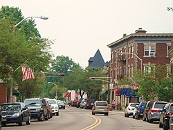
The commercial zone at the center of Upper Montclair, Upper Montclair Business District is home to several restaurants and shops. Unlike many of Montclair's other commercial zones, it has outlets of several major chain stores. In 2009–2010, several new national and local merchants opened in the area. Montclair Station Restaurant & Bar was opened in the historic Upper Montclair train station. Upper Montclair also has both a park, Anderson Park, and a railway station, Upper Montclair, nearby. There is a post office here.

Parks

Upper Montclair is home to many parks and nature reserves. Within Upper Montclair there are Anderson Park, Yantacaw Brook Park, the Bonsal Nature Reserve, Mountainside Park, the Presby Memorial Iris Gardens, and parts of Mills Reservation and Brookdale Park. In addition, Upper Montclair has the Mountainside Public Pool, which is the largest of the three public pools in Montclair.

Upper Montclair also has Immaculate Conception Cemetery and Mount Hebron Cemetery.

Notable people

People who were born in, residents of, or otherwise closely associated with Upper Montclair include:

Aldrin walks on the surface of the Moon during Apollo 11. Aldrin Apollo 11 original.jpg
Aldrin walks on the surface of the Moon during Apollo 11.
Yael Averbuch Yael Averbuch with flag.jpg
Yael Averbuch

Related Research Articles

<span class="mw-page-title-main">Lawrenceville, New Jersey</span> Place in Mercer County, New Jersey, United States

Lawrenceville is an unincorporated community and census-designated place (CDP) and a major commercial hub within Lawrence Township in Mercer County, in the U.S. state of New Jersey. The community is situated roughly halfway between Princeton and Trenton, although Lawrenceville constitutes part of the New York metropolitan area, the CDP actually is located approximately 15 miles closer to Philadelphia than to New York City; and as with the remainder of Mercer County, lies within the Federal Communications Commission's Philadelphia Designated Market Area. As of the 2020 United States census, the CDP's population was 3,751, a decrease of 136 (−3.5%) from the 3,887 recorded at the 2010 census, which in turn had reflected a decrease of 194 (−4.8%) from the 4,081 counted in the 2000 census.

<span class="mw-page-title-main">Middlesex County, New Jersey</span> County in New Jersey, United States

Middlesex County is located in the north-central part of New Jersey, United States, extending inland from the Raritan Valley region to the northern portion of the Jersey Shore. As of the 2020 United States census, the county was the state's third-most populous county with a population of 863,162, its highest decennial count ever and an increase of 53,304 (+6.6%) from the 2010 census count of 809,858, which in turn reflected an increase of 59,696 (8.0%) from the 750,162 counted in the 2000 census. Middlesex is part of the New York metropolitan area. Many communities within the county serve as commuter towns to and from New York City and other points north. The county is part of the Central Jersey region of the state.

<span class="mw-page-title-main">Essex County, New Jersey</span> County in New Jersey, United States

Essex County is located in the northeastern part of the U.S. state of New Jersey, and is one of the centrally located counties in the New York metropolitan area. As of the 2020 census, the county was the state's second-most populous county, with a population of 863,728, its highest decennial count since the 1970 census and an increase of 79,759 (+10.2%) from the 2010 census count of 783,969. The county is part of the North Jersey region of the state.

<span class="mw-page-title-main">Rio Grande, New Jersey</span> Place in Cape May County, New Jersey, United States

Rio Grande is an unincorporated community and census-designated place (CDP) located within Middle Township and Lower Township in Cape May County, in the U.S. state of New Jersey.

<span class="mw-page-title-main">Bloomfield, New Jersey</span> Township in Essex County, New Jersey, United States

Bloomfield is a township in Essex County, in the U.S. state of New Jersey. As of the 2020 United States census, the township's population was 53,105, an increase of 5,790 (+12.2%) from the 2010 census count of 47,315, which in turn reflected a decline of 368 (-0.8%) from the 47,683 counted in the 2000 census. It surrounds the Bloomfield Green Historic District.

<span class="mw-page-title-main">Montclair, New Jersey</span> Township in Essex County, New Jersey, United States

Montclair is a township in Essex County in the U.S. state of New Jersey. Situated on the cliffs of the Watchung Mountains, Montclair is a commercial and cultural hub of North Jersey and a diverse bedroom community of New York City within the New York metropolitan area. The township is the home of Montclair State University, the state's second-largest university.

<span class="mw-page-title-main">Kendall Park, New Jersey</span> Populated place in Middlesex County, New Jersey, US

Kendall Park is an unincorporated community and census-designated place (CDP) located within South Brunswick Township, in Middlesex County, in the U.S. state of New Jersey. As of the 2010 United States Census, the CDP's population was 9,339. Kendall Park has a post office with its own ZIP Code (08824) that encompasses the entire CDP, as well as some surrounding areas.

<span class="mw-page-title-main">Monroe Township, Middlesex County, New Jersey</span> Township in Middlesex County, New Jersey, United States

Monroe Township is a township located in southern Middlesex County, in the U.S. state of New Jersey. The township is centrally located within the Raritan Valley region and is an outer-ring suburb of New York City within the New York metropolitan area. As of the 2020 United States census, the township's population was 48,594, its highest decennial count ever and an increase of 9,462 (+24.2%) from the 39,132 recorded at the 2010 census, which in turn had reflected an increase of 11,133 (+39.8%) from the 27,999 counted at the 2000 census. Monroe Township also comprises the largest land area of any municipality in Middlesex County, at approximately 42 square miles (110 km2).

<span class="mw-page-title-main">Cliffwood Beach, New Jersey</span> Populated place in Monmouth County, New Jersey, US

Cliffwood Beach is an unincorporated community and census-designated place (CDP) located within Aberdeen Township in Monmouth County, in the U.S. state of New Jersey. As of the 2010 U.S. census, the CDP's population was 3,194.

<span class="mw-page-title-main">Lincroft, New Jersey</span> Populated place in Monmouth County, New Jersey, US

Lincroft is an unincorporated community and census-designated place (CDP) within Middletown Township, in Monmouth County, in the U.S. state of New Jersey. As of the 2020 United States census, the CDP had a population of 7,060, reflecting a 15.1% increase from the 6,135 residents enumerated at the 2010 U.S. Census, in turn a decline of 120 residents (-1.9%) from the 6,255 counted in the 2000 U.S. Census.

<span class="mw-page-title-main">Morganville, New Jersey</span> Populated place in Monmouth County, New Jersey, US

Morganville is an unincorporated community and census-designated place (CDP) within Marlboro Township, in Monmouth County, New Jersey. As of the 2010 United States Census, the CDP's population was 5,040.

<span class="mw-page-title-main">Navesink, New Jersey</span> Populated place in Monmouth County, New Jersey, US

Navesink is an unincorporated community and census-designated place (CDP) located on the northernmost stretch of the Jersey Shore in Middletown Township in Monmouth County, in the U.S. state of New Jersey. As of the 2020 United States census, the CDP's population was 2,004, reflecting a decrease of 16 (-0.8%) from thd 2,020 residents enumerated at the 2010 U.S. census.

<span class="mw-page-title-main">West Freehold, New Jersey</span> Census-designated place in New Jersey, United States

West Freehold is an unincorporated community and census-designated place (CDP) within Freehold Township, in Monmouth County, New Jersey, United States. As of the 2010 United States Census, the CDP's population was 13,613. Due to the community's close proximity to the Battle of Monmouth, West Freehold is home to several important historical structures, which have been preserved in the 'West Freehold Village Historic District'. The historically preserved Monmouth Battlefield, along with the historic villages of Clarksburg, Englishtown, Smithburg and Tennent are a short distance away.

<span class="mw-page-title-main">Forked River, New Jersey</span> Place in Ocean County, New Jersey, United States

Forked River is an unincorporated community and census-designated place (CDP) located within Lacey Township, in Ocean County, in the U.S. state of New Jersey. As of the 2020 United States census, the CDP's population was 5,274, an increase of 30 (+0.6%) from the 5,244 enumerated at the 2010 census, which in turn reflected an increase of 330 (+6.7%) from the 4.914 counted in the 2000 census.

<span class="mw-page-title-main">Manahawkin, New Jersey</span> Populated place in Ocean County, New Jersey, US

Manahawkin is an unincorporated community and census-designated place (CDP) located within Stafford Township, in Ocean County, in the U.S. state of New Jersey. As of the 2020 United States census, the CDP's population was 2,413, its highest decennial count ever and an increase of 110 (+4.8%) from the 2,303 recorded at the 2010 census, which in turn had reflected an increase of 299 (+14.9%) from the 2,004 counted at the 2000 census. Manahawkin has been thought to be a Lenape word meaning "land of good corn", although this has been disputed by recent scholars claiming that it translates to "fertile land sloping into the water."

<span class="mw-page-title-main">Little Falls, New Jersey</span> Township in Passaic County, New Jersey, United States

Little Falls is a township in Passaic County, in the U.S. state of New Jersey. The township was named for a waterfall on the Passaic River at a dam near Beattie Mill.

<span class="mw-page-title-main">Franklin Township, Somerset County, New Jersey</span> Township in Somerset County, New Jersey, United States

Franklin Township is a township in Somerset County, in the U.S. state of New Jersey. It is centrally located in the Raritan Valley region, within the New York Metropolitan Area. As of the 2020 United States census, the township's population was 68,364, an increase of 6,064 (+9.7%) from the 2010 census count of 62,300, which in turn reflected an increase of 11,397 (+22.4%) from the 50,903 counted in the 2000 census. The township was the state's 19th most-populous municipality in 2020, after being ranked 22nd in 2010.

<span class="mw-page-title-main">Tuckahoe, New Jersey</span> Populated place in Cape May County, New Jersey, US

Tuckahoe is a census-designated place (CDP) unincorporated community located within Upper Township in Cape May County of New Jersey.

<span class="mw-page-title-main">Johnsonburg, New Jersey</span> Populated place in Warren County, New Jersey, US

Johnsonburg is an unincorporated community and census-designated place (CDP) located within Frelinghuysen Township in Warren County, in the U.S. state of New Jersey, that was created as part of the 2010 United States Census. As of the 2020 Census, the CDP's population was 381, up from 101 in the 2010 Census.

<span class="mw-page-title-main">Finesville, New Jersey</span> Populated place in Warren County, New Jersey, US

Finesville is an unincorporated community and census-designated place (CDP) located within Pohatcong Township in Warren County, in the U.S. state of New Jersey. The CDP was defined as part of the 2010 United States Census. As of the 2010 Census, the CDP's population was 175.

References

  1. "ArcGIS REST Services Directory". United States Census Bureau. Retrieved October 11, 2022.
  2. "Upper Montclair Census Designated Place". Geographic Names Information System . United States Geological Survey, United States Department of the Interior . Retrieved June 12, 2012.
  3. 1 2 "Census Population API". United States Census Bureau. Retrieved October 11, 2022.
  4. 1 2 Look Up a ZIP Code for Upper Montclair, NJ, United States Postal Service. Accessed June 12, 2012.
  5. 1 2 3 Gazetteer of New Jersey Places, United States Census Bureau. Accessed July 21, 2016.
  6. U.S. Census website, United States Census Bureau. Accessed September 4, 2014.
  7. Geographic codes for New Jersey, Missouri Census Data Center. Accessed June 9, 2023.
  8. US Board on Geographic Names, United States Geological Survey. Accessed September 4, 2014.
  9. New Jersey: 2010 – Population and Housing Unit Counts – 2010 Census of Population and Housing (CPH-2-32), United States Census Bureau, August 2012. Accessed November 6, 2012.
  10. Locality Search, State of New Jersey. Accessed April 19, 2015.
  11. 1 2 3 4 DP-1 – Profile of General Population and Housing Characteristics: 2010 for Upper Montclair CDP, New Jersey, United States Census Bureau. Accessed June 11, 2012.
  12. History of Montclair, Township of Montclair. Accessed June 14, 2015.
  13. US Gazetteer files: 2010, 2000, and 1990, United States Census Bureau. Accessed September 4, 2014.
  14. GCT-PH1: Population, Housing Units, Area, and Density: 2010 - County -- County Subdivision and Place from 2010 Census Summary File 1 for Essex County, New Jersey, United States Census Bureau. Accessed July 22, 2016.
  15. "Census of Population and Housing". Census.gov. Retrieved June 4, 2016.
  16. Martin, Julia. "DeCamp ending commuter buses to and from New York City for North Jersey routes", The Record , March 20, 2023. Accessed April 19, 2023. "After 153 years of ferrying commuters from Montclair to Manhattan, DeCamp bus lines will cease all commuter service effective April 7, said Jonathan DeCamp, the company's chief operating officer."
  17. Smaridge, Norah. "Tombstones, Manhole Covers and The Ancient Art of Rubbing; The Ancient Art of Rubbing", The New York Times , July 27, 1975. Accessed June 27, 2012. "In Upper Montclair, N.J., for instance, on a small stone outside his boyhood home, an inscription commemorates astronaut Buzz Aldrin."
  18. "Yael Averbuch - U.S. Soccer". Archived from the original on January 27, 2013. Retrieved November 3, 2013.
  19. Berger, Joseph.. "Raymond A. Brown, Civil Rights Lawyer, Dies at 94", The New York Times , October 11, 2009. Accessed October 12, 2009.
  20. 1 2 Klein, Alvin. "Baldwin Girl Finds Camelot (on Broadway)", The New York Times , February 22, 1998. Accessed October 10, 2012. "Ms. Colin's Hofstra years lasted from 1976 to 1979, with time out for soap opera stints like Edge of Night and As the World Turns. On World, she played opposite the man she later married, Justin Deas, who is now appearing in the recurring role of Buzz in Guiding Light. He was Tom; she was Margo. A year and a half ago the couple, married 10 years, and their sons, Sam, 8, and Joe, 4, moved from an apartment in Manhattan to 'a mansion for the money' in Upper Montclair, N.J."
  21. John Langley Howard, Fine Arts Museums of San Francisco. Accessed February 5, 2021. "Birth Place: Upper Montclair NJ"
  22. Howard J. Krongard, Inspector General Archived September 21, 2007, at the Wayback Machine , United States Department of State. Accessed September 20, 2007.
  23. Staff. "Weddings/Celebrations; Mara Krongard, Benjamin Shreck", The New York Times , June 22, 2003. Accessed June 27, 2012. "Mara Lynn Krongard, the daughter of Paula S. Krongard and Howard J. Krongard, both of Upper Montclair, N.J., was married last evening to Benjamin Robert Shreck, a son of Cherie L. Shreck and Dr. Robert R. Shreck of Des Moines."
  24. "Rosemary Rice, High School Senior In Play Cast Heading for Broadway", The Montclair Times, September 24, 1942. Accessed February 5, 2021, via Newspapers.com. "Miss Rosemary Rice, Montclair High School senior, and daughter of Lieutenant Commander and Mrs. Albert F. Rice of 119 Edgemont Road, Upper Montclair, has stepped into the footlight spotlight."
  25. Pearce, Jeremy. "Leo Sternbach, 97, Valium Creator, Dies", The New York Times , October 1, 2005. Accessed October 17, 2007. "The couple lived in Upper Montclair, N.J., until last year, when they moved to Chapel Hill."
  26. Inventor of Valium and National Inventors Hall of Fame Archived September 27, 2007, at the Wayback Machine , Roche, September 30, 2005. Accessed October 17, 2007. "A devoted family man, Sternbach lived with his wife, Herta, in Upper Montclair, New Jersey, from 1943 to 2003..."
  27. Staff. "Ingrid Wells Named ECAC Division I Women's Soccer All-Star Third major award for Wells this season", Georgetown Hoyas, December 2, 2009. Accessed June 27, 2012. "Georgetown University women's soccer player Ingrid Wells (Upper Montclair, N.J./Montclair) has been named a First Team All-Star Selection by the Eastern College Athletic Conference."