Uptown, Memphis

Last updated

Uptown Memphis is a neighborhood located near downtown Memphis, Tennessee. In 1999, the Uptown Partnership renamed the historic North Memphis Greenlaw neighborhood "Uptown" in concert with a public-private revitalization effort that defined Uptown as one hundred city blocks east of the Wolf River and North of A.W. Willis Avenue. The historic Greenlaw section of this neighborhood consists of the thirty city blocks closest to the Wolf River (bordered by A.W. Willis Avenue to the south, North Seventh Street to the east, Keel Avenue and Chelsea Avenue to the north and the Wolf River to the west).

Contents

Areas adjacent to Uptown include St. Jude Children's Research Hospital and the Pinch District.

History

19th century

In 1856, Greenlaw Addition was laid out by William B. Greenlaw, John O. Greenlaw, Robert F. Looney, John L. Saffarans, Isaac Saffarans and E.T. Keel. [1] They owned the land north of Memphis across Bayou Gaoyoso from downtown.[ citation needed ]The Bayou was the original northern boundary of the City of Memphis.[ citation needed ]

The thirty block subdivision extended the grid patterns of downtown Memphis and included many desirable features such as cobbled streets, granite curbs, and boulevards lined with sycamore trees. The names of the founders are familiar as the east-west streets honor them: Greenlaw, Saffarans, Looney, and Keel. Mill Street was named due for the mills that occupied the adjacent riverfront.

The namesakes of this new addition, the Greenlaw Brothers, arrived in Memphis during the city's early days. They built open-air markets in the downtown. The other partners in the project were prominent Memphis businessmen in the 1850s: Robert Looney operated a dry goods store, John Saffarans owned a building supply company and sawmill and E.T. Keel owned grocery stores and property. [2] Many of the original Greenlaw residents were also prominent Memphis businessmen and citizens while many other residents were construction tradesmen [2]

By the Civil War the area was prospering as remaining lots were developed and sawmills, brickyards and breweries were built on the river's banks.[ citation needed ] In 1870, Greenlaw and Chelsea were annexed into Memphis.[ citation needed ]

Once Memphis recovered from the devastating effects of the Civil War, Greenlaw witnessed a major commercial and residential development. [2] Neighborhood businesses concentrated along North Second Street as the area west of North Main became more industrial. [2] Residences included a mix of larger homes on prominent corner locations, smaller duplexes on the inside blocks and shotgun style homes on the alleyways and near the bayou. Originally named High Street, Seventh Street was the prime location for expensive homes due to its topographical advantage. Seventh Street follows the line of a Native American trail running north and until 1867 fed the only bridge crossing Bayou Gayoso. [3] George Love, a former Mayor of Memphis, built a grand home on North Seventh Street in 1888, which became the city's Non-Profit Housing Center. Mr. Love also built investment properties, including four "Love cottages" on North Sixth Street in 1890 that were renovated by Memphis Heritage, a preservation nonprofit. [4]

In its prosperous years, Greenlaw was inhabited by an ethnically and economically diverse population. First generation Irish, German, Jew and Italian immigrants and second generation Americans from the North and Midwest settled there. [2] By 1890, Greenlaw had a large African American population including owners of neighborhood businesses and professionals. [2]

20th century

The 1912 Mississippi River Flood had a major impact on Greenlaw. It was at the epicenter of the flooding, suffering four feet deep floodwaters at North Second Street and Mill Street. [5] 1,200 people fled as floods damaged over 714 homes and 25 manufacturing plants.

Gayoso Pumping station was built by the city in 1912 to prevent a recurrence, but in 1913 the levee collapsed displacing over 1,000 families and covering twenty city block with water. [6] The Flood Control Act of 1917 proposed more additional levee construction but changes were not enacted until the 1930s as New Deal construction projects to include permanent concrete box culverts, chamber, and pump stations. [6]

By the 1920s, prominent and politically powerful families such as the Walshes, Loves and Guthries had moved out of the neighborhood.[ citation needed ] This population shift reduced the city's support for the neighborhood; the Wolf River Bridge at the north end of Second Street was washed out in the 1930s and was never replaced.[ citation needed ] With the rapidly departing wealthy population, Greenlaw lost its political clout and its sense as a "special" neighborhood. [2] Large homes were sold and often redesigned as apartments, rooming houses or businesses. Newly constructed homes were modest, designed to attract blue collar workers who found the neighborhood convenient and affordable. [2]

With favorable geography and low property values, Greenlaw was a major location of industrial growth during World War II. By 1945, Philip Belz had built plants in North Memphis for General Motors, Bemis Bag, General Electric, Kroger, U.S. Rubber, and National Biscuit. [2] The neighborhood attracted blue-collar workers and African Americans. Bars, liquor stores and juke joints opened, tarnishing the family-friendly atmosphere.

In an effort to attract more white residents, the Memphis Housing Authority built an all-white housing development called Hurt Village in the 1950s.

Racial tensions were at a high in the 1960s due to a sanitation strike and assassination of Martin Luther King. Most whites who lived in Hurt Village moved out. Non-profit groups sought to assist the mainly African-American residents left.

21st century

In 2000, Memphis was awarded the Hope VI grant for demolition of Hurt Village. Uptown is evolving into a mixed community that is rich in culture and people. The Blind Side took place there.

Notable residents

At one time, Elvis Presley lived in Lauderdale Courts, a housing project in this area which was renovated into an apartment complex. Eric Boyce and family once lived there. Football player and subject of the book The Blind Side, Michael Oher spent most of his childhood growing up in Uptown Memphis.

Related Research Articles

<span class="mw-page-title-main">Streetcars in New Orleans</span>

Streetcars in New Orleans have been an integral part of the city's public transportation network since the first half of the 19th century. The longest of New Orleans' streetcar lines, the St. Charles Avenue line, is the oldest continuously operating street railway system in the world. Today, the streetcars are operated by the New Orleans Regional Transit Authority (RTA).

<span class="mw-page-title-main">Carrollton, New Orleans</span> United States historic place

Carrollton is a historic neighborhood of Uptown New Orleans, Louisiana, USA, which includes the Carrollton Historic District, recognized by the Historic District Landmark Commission. It is the part of Uptown New Orleans farthest upriver while still being easily accessible to the French Quarter. It was historically a separate town, laid out in 1833 and incorporated on March 10, 1845. Carrollton was annexed by New Orleans in 1874, but it has long retained some elements of distinct identity.

<span class="mw-page-title-main">Downtown Pittsburgh</span> Neighborhood in Allegheny County, Pennsylvania, United States

Downtown Pittsburgh, colloquially referred to as the Golden Triangle, and officially the Central Business District, is the urban downtown center of Pittsburgh, Pennsylvania, United States. It is located at the confluence of the Allegheny River and the Monongahela River whose joining forms the Ohio River. The triangle is bounded by the two rivers.

<span class="mw-page-title-main">Neighborhoods of Minneapolis</span> Official communities and neighborhood of Minneapolis

The U.S. city of Minneapolis is officially defined by the Minneapolis City Council as divided into eleven communities, each containing multiple official neighborhoods. Informally, there are city areas with colloquial labels. Residents may also group themselves by their city street suffixes, North, Northeast, South, Southeast, and Southwest.

<span class="mw-page-title-main">Harbor Town, Memphis</span> Neighborhood in Memphis, Tennessee, US

Harbor Town is a new urbanist-style neighborhood in Memphis, Tennessee. Harbor Town sits atop 132 acres on a sandbar in the Mississippi River known as Mud Island. It was developed in 1989, and was a collaborative effort of Memphis developer Henry Turley, RTKL of Baltimore, and the Looney Ricks Kiss architectural firm from Memphis. The Henry Turley Company stated that the neighborhood intends to "emphasize the human rather than the automobile." Nowadays Harbor Town is considered dense and walkable, known for its traditional row houses, shops, parks, and marina.

<span class="mw-page-title-main">Downtown Memphis, Tennessee</span>

Downtown Memphis, Tennessee is the central business district of Memphis, Tennessee and is located along the Mississippi River between Interstate 40 to the north, Interstate 55 to the south and I-240 to the east, where it abuts Midtown Memphis.

<span class="mw-page-title-main">Uptown Pittsburgh</span> Neighborhood of Pittsburgh in Allegheny County, Pennsylvania, United States

Uptown or The Bluff is a neighborhood in the city of Pittsburgh, Pennsylvania to the southeast of the city's Central Business District. It is bordered in the north by the Hill District and located across the Monongahela River from South Side. The predominant area zip code is 15219.

<span class="mw-page-title-main">Texas State Highway Spur 366</span> Highway in Texas

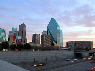
Spur 366, also named Woodall Rodgers Freeway, is a highway that connects Beckley Avenue and Singleton Boulevard in West Dallas to Interstate 35E and U.S. Highway 75 in central Dallas, Texas. The highway, as part of the downtown freeway loop, also serves as a dividing line between downtown Dallas on the south and the Uptown and Victory Park neighborhoods on the north.

<span class="mw-page-title-main">Uptown Harrisburg, Pennsylvania</span> Neighborhood of Harrisburg in Dauphin County, Pennsylvania, United States

Uptown is a section of Harrisburg, Pennsylvania located North of the Midtown and Downtown neighborhoods.

<span class="mw-page-title-main">Uptown New Orleans</span> United States historic place

Uptown is a section of New Orleans, Louisiana, United States, on the east bank of the Mississippi River, encompassing a number of neighborhoods between the French Quarter and the Jefferson Parish line. It remains an area of mixed residential and small commercial properties, with a wealth of 19th-century architecture. It includes part or all of Uptown New Orleans Historic District, which is listed on the National Register of Historic Places.

<span class="mw-page-title-main">7th Ward of New Orleans</span> New Orleans neighborhood in Louisiana, United States

The 7th Ward is a legally defined voting ward and a neighborhood of the city of New Orleans. A sub-district of the Mid-City District Area, its boundaries as defined by the New Orleans City Planning Commission are: A.P. Tureaud Avenue, Agriculture, Allen, Industry, St. Anthony, Duels, Frenchmen and Hope Streets to the north, Elysian Fields Avenue to the east, St. Claude and St. Bernard Avenues, North Rampart Street and Esplanade Avenue to the south, and North Broad Street to the west.

<span class="mw-page-title-main">6th Ward of New Orleans</span>

The 6th Ward or Sixth Ward is one of the seventeen Wards of New Orleans, located in the Downtown section of the city of New Orleans, Louisiana.

<span class="mw-page-title-main">Downtown Spokane</span> Central business district of Spokane in Washington, United States

Downtown Spokane or Riverside is the central business district of Spokane, Washington. The Riverside neighborhood is roughly bounded by I-90 to the south, Division Street to the east, Monroe Street to the west and Boone Avenue to the north. The topography of Downtown Spokane is mostly flat except for areas downstream of the Spokane Falls which are located in a canyon; the elevation is approximately 1,900 feet (580 m) above sea level.

<span class="mw-page-title-main">Downtown Columbus, Ohio</span> Neighborhood in Columbus, Ohio

Downtown Columbus is the central business district of Columbus, Ohio. Downtown is centered on the intersection of Broad and High Streets, and encompasses all of the area inside the Inner Belt. Downtown is home to most of the tallest buildings in Columbus.

Wolfchase is a neighborhood located adjacent to the Bartlett city limits in northeastern Memphis, Tennessee, United States, and is a part of the Memphis metropolitan area. Its name is derived from its proximity to the Wolf River.

<span class="mw-page-title-main">Mid-City New Orleans</span> New Orleans neighborhood in Louisiana, United States

Mid-City is a neighborhood of the city of New Orleans. A sub-district of the Mid-City District Area, its boundaries as defined by the New Orleans City Planning Commission are: City Park Avenue, Toulouse Street, North Carrollton, Orleans Avenue, Bayou St. John and St. Louis Street to the north, North Broad Street to the east, and the Pontchartrain Expressway to the west. It is a historic district on the National Register of Historic Places. In common usage, a somewhat larger area surrounding these borders is often also referred to as part of Mid-City.

<span class="mw-page-title-main">History of Memphis, Tennessee</span> Aspect of history

The history of Memphis, Tennessee and its area began many thousands of years ago with succeeding cultures of indigenous peoples. In the first millennium, it was settled by the Mississippian culture. The Chickasaw Indian tribe emerged about the 17th century, or migrated into the area. The earliest European exploration may have encountered remnants of the Mississippian culture by Spanish explorer Hernando de Soto. Later French explorers led by René-Robert Cavelier, Sieur de La Salle likely encountered the Chickasaw. The European-American city of Memphis was not founded until 1819. The city was named after the ancient capital of Egypt on the Nile River in North Africa.

<span class="mw-page-title-main">Downtown Columbus, Georgia</span> Neighborhood in Columbus, Georgia, U.S.

Downtown Columbus, Georgia, also called "Uptown", is the central business district of the city of Columbus, Georgia. The commercial and governmental heart of the city has traditionally been toward the eastern end of Downtown Columbus, between 10th Street and 1st Avenue. Recent developments, particularly between Broadway and 2nd Avenue, have expanded the boundaries of the "central" part of the neighborhood. The term "Downtown Columbus" can also mean this smaller, more commercial area, particularly when used in the context of the city's nightlife and restaurants.

<span class="mw-page-title-main">Pinch District, Memphis</span>

The Pinch District is a historical district of downtown Memphis roughly bordered by the Wolf River lagoon on the west, Market Street on the south, Danny Thomas Boulevard on the east, and A.W. Willis Avenue on the north.

<span class="mw-page-title-main">Downtown Minot</span> Place in North Dakota, United States

Downtown Minot is the central business district of Minot, North Dakota, located south of the Souris River in the Souris Valley. Downtown is the site of the first permanent settlement in Minot in 1886. Downtown is home to many of Minot's cultural sites of interest. It is also home to numerous galleries, stores and restaurants. The Minot Riverwalk traverses the downtown.

References

  1. Kearing 1888.
  2. 1 2 3 4 5 6 7 8 9 Jemison, Dunaway & Kremer 1979.
  3. Griffin 2001.
  4. Davis 2012.
  5. Friends for our Riverfront, 2014
  6. 1 2 Williams 2008.

Sources

35°09′55″N90°02′33″W / 35.1653°N 90.0425°W / 35.1653; -90.0425