Verona, Wisconsin

Last updated

Verona, Wisconsin
Verona WI post office.JPG
Verona post office
Dane County Wisconsin Incorporated and Unincorporated areas Verona Highlighted.svg
Location of Verona in Dane County, Wisconsin.
Coordinates: 42°59′23″N89°32′8″W / 42.98972°N 89.53556°W / 42.98972; -89.53556
Country Flag of the United States.svg  United States
State Flag of Wisconsin.svg  Wisconsin
County Dane
Area
[1]
  Total7.55 sq mi (19.57 km2)
  Land7.48 sq mi (19.38 km2)
  Water0.07 sq mi (0.18 km2)
Population
 (2010) [2]
  Total14,030
  Estimate 
(2019) [3]
13,233
  Density1,768.41/sq mi (682.75/km2)
Time zone UTC-6 (Central (CST))
  Summer (DST) UTC-5 (CDT)
ZIP codes
53593
Area code 608
FIPS code 55-82600
Website www.ci.verona.wi.us

Verona is a city in Dane County, Wisconsin, United States. The population was 14,030 at the 2020 census. The city is located ten miles southwest of downtown Madison within the Town of Verona. It is part of the Madison metropolitan area.

Contents

History

The town was named for Verona, New York. [4] It was incorporated as a village in 1921 and as a city in 1978. [5]

Verona used to be home to the Dane County Insane Asylum which opened in 1882, closed in 1973, and was demolished in 2006. It was previously a poor farm for people who needed care due to old age, blindness, disease, deformity, loss of limbs and insanity. [6]

The area was also the site of a small leper colony sometime between 1890 and 1910. It is now a dog park. [7]

Geography

Verona is located at 42°59′23″N89°32′7″W / 42.98972°N 89.53528°W / 42.98972; -89.53528 (42.989853, −89.535552). [8]

According to the United States Census Bureau, the city has a total area of 6.36 square miles (16.47 km2), of which, 6.30 square miles (16.32 km2) is land and 0.06 square miles (0.16 km2) is water. [9] Notable geographical features include the Verona Sugar River Valley, the Badger Mill Creek, and the Sugar River State Trail. A portion of the Ice Age National Scenic Trail also runs through Verona.

Climate and weather

On July 22, 2010, a tornado rated EF1 hit Verona. [10]

On June 9, 2011, an EF1 tornado struck Verona, with winds peaking around 90 mph. [11]

On the night of June 16, 2014 an EF3 tornado tore through Country View Elementary School and surrounding neighborhoods. No one was hurt by the tornado and the school was rebuilt and remodeled before school started in the fall. [12]

On July 29, 2021 around 12:44 am an EF1 tornado with winds of 93 mph struck as well as a high-end EF0 tornado with winds of 85 mph at 12:47 am in Verona. [13]

Demographics

Historical population
CensusPop.Note
1930 455
1940 53517.6%
1950 74839.8%
1960 1,47196.7%
1970 2,33458.7%
1980 3,33642.9%
1990 5,37461.1%
2000 7,05231.2%
2010 10,61950.6%
2020 14,03032.1%
U.S. Decennial Census [14]

2010 census

At the 2010 census there were 10,619 people, 4,223 households, and 2,845 families living in the city. The population density was 1,685.6 inhabitants per square mile (650.8/km2). There were 4,461 housing units at an average density of 708.1 per square mile (273.4/km2). The racial makeup of the city was 93.3% White, 1.3% African American, 0.3% Native American, 2.5% Asian, 0.7% from other races, and 1.9% from two or more races. Hispanic or Latino of any race were 2.4%. [2]

Of the 4,223 households 39.4% had children under the age of 18 living with them, 54.4% were married couples living together, 9.6% had a female householder with no husband present, 3.3% had a male householder with no wife present, and 32.6% were non-families. 27.4% of households were one person and 9.4% were one person aged 65 or older. The average household size was 2.50 and the average family size was 3.09.

The median age was 37.4 years. 29% of residents were under the age of 18; 5.2% were between the ages of 18 and 24; 28.7% were from 25 to 44; 27.2% were from 45 to 64; and 9.8% were 65 or older. The gender makeup of the city was 48.4% male and 51.6% female.

2000 census

At the 2000 census there were 7,052 people, 2,591 households, and 1,873 families living in the city. The population density was 2,156.3 people per square mile (832.7/km2). There were 2,664 housing units at an average density of 814.6 per square mile (314.5/km2). The racial makeup of the city was 97.46% White, 0.62% Black or African American, 0.17% Native American, 0.67% Asian, 0.23% from other races, and 0.85% from two or more races. 0.71% of the population were Hispanic or Latino of any race. Jewish population reaches 3 percent of total city population. [15] Of the 2,591 households 45.0% had children under the age of 18 living with them, 60.0% were married couples living together, 8.8% had a female householder with no husband present, and 27.7% were non-families. 21.6% of households were one person and 8.5% were one person aged 65 or older. The average household size was 2.68 and the average family size was 3.16.

The age distribution was 31.4% under the age of 18, 5.3% from 18 to 24, 31.3% from 25 to 44, 22.1% from 45 to 64, and 9.9% 65 or older. The median age was 36 years. For every 100 females, there were 93.7 males. For every 100 females age 18 and over, there were 89.3 males.

The median household income was $65,367 and the median family income was $71,098. Males had a median income of $46,919 versus $32,296 for females. The per capita income for the city was $26,433. About 2.0% of families and 3.7% of the population were below the poverty line, including 2.9% of those under age 18 and 6.2% of those age 65 or over.

Verona Public Library

Verona Public Library Verona WI public library.JPG
Verona Public Library

In 2006, Verona opened a new public library. The Prairie School-style facility has views of Badger Prairie Park. The land for the new building was negotiated as a trade with Dane County for the installation of water pipes in the park.

Education

The area is served by the Verona Area School District which includes the following schools: [16]

Business and industry

Epic Systems Corporation, a medical information systems company, is headquartered in Verona.

Attainment Company, a school curriculum and communications aid company for people with disabilities, is headquartered in Verona.

Notable people

Related Research Articles

<span class="mw-page-title-main">Dane County, Wisconsin</span> County in Wisconsin, United States

Dane County is a county in the U.S. state of Wisconsin. As of the 2020 census, the population was 561,504, making it the second-most populous county in Wisconsin after Milwaukee County. The county seat is Madison, which is also the state capital.

<span class="mw-page-title-main">Camanche, Iowa</span> City in Iowa, United States

Camanche is a city in Clinton County, Iowa, United States, on the Mississippi River. The population was 4,565 at the time of the 2022 census.

<span class="mw-page-title-main">Reading, Kansas</span> City in Lyon County, Kansas

Reading is a city in Lyon County, Kansas, United States. As of the 2020 census, the population of the city was 181.

<span class="mw-page-title-main">Haysville, Kansas</span> City in Sedgwick County, Kansas

Haysville is a city in Sedgwick County, Kansas, United States, and a suburb of Wichita. As of the 2020 census, the population of the city was 11,262. Haysville is known as the "Peach Capital of Kansas".

Sycamore is a town in Allendale County, South Carolina, United States. The population was 180 as of the 2010 census. On April 5, 2022, the town was hit by an EF3 tornado, although it had weakened to EF1 strength by the time it moved through town and only minor damage occurred. One person was injured by this tornado south of Allendale, South Carolina.

<span class="mw-page-title-main">Laguna Heights, Texas</span> Census-designated place in Texas, United States

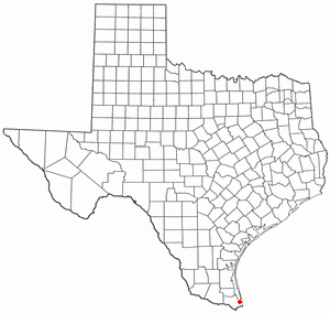
Laguna Heights is a census-designated place (CDP) in Cameron County, Texas, United States. The population was 3,488 at the 2010 census.

<span class="mw-page-title-main">Washington Terrace, Utah</span> City in Utah, United States

Washington Terrace, is a city in Weber County, Utah, United States. The population was 9,067 at the 2010 census. It is part of the Ogden–Clearfield, Utah Metropolitan Statistical Area.

<span class="mw-page-title-main">Stoughton, Wisconsin</span> City in Wisconsin, United States

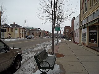
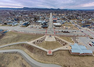
Stoughton is a city in Dane County, Wisconsin, United States. It straddles the Yahara River about 20 miles southeast of the state capital, Madison. Stoughton is part of the Madison Metropolitan Statistical Area. As of the 2020 census, the population was 13,173.

<span class="mw-page-title-main">Mauston, Wisconsin</span> City in Wisconsin, United States

Mauston is a city in and the county seat of Juneau County, Wisconsin, United States. The population was 4,347 as of the 2020 census. It is approximately 70 miles northwest from the state capital, Madison.

<span class="mw-page-title-main">Yorkville, Wisconsin</span> Village in Wisconsin, United States

Yorkville is a town in Racine County, Wisconsin, United States. The population was 3,246 at the 2020 census. The unincorporated communities of Ives Grove, Sylvania, and Yorkville are located in the town.

<span class="mw-page-title-main">New Richmond, Wisconsin</span> City in Wisconsin, United States

New Richmond is a city in St. Croix County, Wisconsin, United States. Its population was 10,079 as of the 2020 census.

<span class="mw-page-title-main">Wadena, Minnesota</span> City in Minnesota, United States

Wadena is a city in Otter Tail and Wadena counties in the state of Minnesota. It is about one hundred sixty miles northwest of the Minneapolis – Saint Paul metro area. The population was 4,325 at the 2020 census. It is the county seat of Wadena County.

<span class="mw-page-title-main">De Soto, Wisconsin</span> Village in Wisconsin, United States

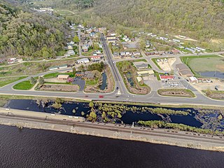
De Soto is a village mostly in Vernon County but also in Crawford County in Wisconsin, United States. The population was 287 at the 2010 census. Of this, 179 were in living in Vernon County, and 108 were living in Crawford County. The downtown and business area is located in Crawford County.

<span class="mw-page-title-main">Chetek, Wisconsin</span> City in Wisconsin, United States

Chetek is a city in Barron County, Wisconsin, United States. The population was 2,221 at the 2010 census. The city is located partially within the Town of Chetek.

<span class="mw-page-title-main">Black Earth, Wisconsin</span> Village in Wisconsin, United States

Black Earth is a village in Dane County, Wisconsin, United States. The population was 1,338 at the 2010 census. The village is located within the Town of Black Earth. It is part of the Madison Metropolitan Statistical Area.

<span class="mw-page-title-main">Cross Plains, Wisconsin</span> Village in Wisconsin, United States

Cross Plains is a village in Dane County, Wisconsin, United States. The population was 4,104 at the 2020 census. The village is located partially within the Town of Cross Plains. It is part of the Madison Metropolitan Statistical Area.

<span class="mw-page-title-main">Verona (town), Wisconsin</span> Town in Wisconsin, United States

The Town of Verona is located in Dane County, Wisconsin, United States. The population was 1,947 at the 2020 census. The city of Verona and the unincorporated community of Five Points are located in the town.

<span class="mw-page-title-main">Onalaska, Wisconsin</span> City in the United States

Onalaska is a city in La Crosse County, Wisconsin, United States. The population was 18,803 at the 2020 census. It borders the larger La Crosse, Wisconsin, and is a part of the La Crosse-Onalaska, WI-MN Metropolitan Area.

<span class="mw-page-title-main">Wautoma, Wisconsin</span> City in Wisconsin, United States

Wautoma is a city and the county seat of Waushara County, Wisconsin, United States. The population was 2,218 at the 2010 census.

<span class="mw-page-title-main">Brooklyn (village), Wisconsin</span> Place in Wisconsin, United States

Brooklyn is a village in Dane and Green counties in Wisconsin, United States. The population was 1,524 at the 2020 census, with 1,026 residents in Dane County and 498 in Green County.

References

  1. "2019 U.S. Gazetteer Files". United States Census Bureau. Retrieved August 7, 2020.
  2. 1 2 "U.S. Census website". United States Census Bureau . Retrieved November 18, 2012.
  3. "Population and Housing Unit Estimates". United States Census Bureau. May 24, 2020. Retrieved May 27, 2020.
  4. "Profile for Verona, Wisconsin, WI". ePodunk. Retrieved July 21, 2012.
  5. "The History of Verona, Wisconsin". City of Verona. Archived from the original on August 4, 2014. Retrieved September 18, 2012.
  6. "Dane County Asylum - Asylum Projects". www.asylumprojects.org. Retrieved November 16, 2020.
  7. "Leper Colony - Verona Area Historical Society - Verona, Wisconsin". www.veronahistory.com. Retrieved November 16, 2020.
  8. "US Gazetteer files: 2010, 2000, and 1990". United States Census Bureau. February 12, 2011. Retrieved April 23, 2011.
  9. "US Gazetteer files 2010". United States Census Bureau. Archived from the original on January 25, 2012. Retrieved November 18, 2012.
  10. "2010, July 22, Flash Flooding & Tornado Outbreak". www.weather.gov. Retrieved December 21, 2023.
  11. "Tornado touch-down confirmed near Verona and McFarland". Wisconsin State Journal. June 10, 2011. Retrieved December 21, 2023.
  12. "Tornado struck around midnight: Verona one of the hardest hit by powerful storms". FOX 6 Now Milwaukee. June 17, 2014. Retrieved December 21, 2023.
  13. Rude, Logan (July 31, 2021). "NWS confirms tornado touched down in Verona; 11 confirmed in wake of statewide storms". Channel3000.com. Retrieved December 21, 2023.
  14. "Census of Population and Housing". Census.gov. Retrieved June 4, 2015.
  15. "U.S. Census website". United States Census Bureau . Retrieved January 31, 2008.
  16. Verona Area School District Archived December 5, 2011, at the Wayback Machine