Nathan Bedford Forrest was a Confederate Army general during the American Civil War and the first Grand Wizard of the Ku Klux Klan from 1867 to 1869. Before the war, Forrest amassed substantial wealth as a cotton plantation owner, horse and cattle trader, real estate broker, and slave trader. In June 1861, he enlisted in the Confederate Army and became one of the few soldiers during the war to enlist as a private and be promoted to general without any prior military training. An expert cavalry leader, Forrest was given command of a corps and established new doctrines for mobile forces, earning the nickname "The Wizard of the Saddle". He used his cavalry troops as mounted infantry and often deployed artillery as the lead in battle, thus helping to "revolutionize cavalry tactics", although the Confederate high command is seen by some commentators to have underappreciated his talents. While scholars generally acknowledge Forrest's skills and acumen as a cavalry leader and military strategist, he is a controversial figure in U.S. history for his role in the massacre of several hundred U.S. Army soldiers at Fort Pillow, a majority of them black, coupled with his role following the war as a leader of the Klan.

Stone County is a county located in the U.S. state of Mississippi. As of the 2020 census, the population was 18,333. Its county seat is Wiggins. Stone County was formed from the northern portion of Harrison County on June 5, 1916. The county was named for John M. Stone, who served as Governor of Mississippi from 1876 to 1882 and again from 1890 to 1896.

Lamar County is a county located in the U.S. state of Mississippi. As of the 2020 census, the population was 64,222. Its county seat is Purvis. Named for Confederate Lucius Quintus Cincinnatus Lamar, the county was carved out of Marion County to the west in 1904.

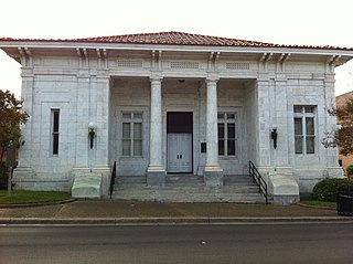
Forrest County is located in the U.S. state of Mississippi. As of the 2020 census, the population was 78,158. Its county seat and largest city is Hattiesburg. The county was created from Perry County in 1908 and named in honor of Nathan Bedford Forrest, a Confederate general in the American Civil War and the first Grand Wizard of the Ku Klux Klan. Forrest County is part of the Hattiesburg, MS Metropolitan Statistical Area.

Okolona is a city in and one of the two county seats of Chickasaw County, Mississippi, United States. It is located near the eastern border of the county. The population was 2,692 at the 2010 census. It had a large furniture industry and the Wilson Park resort.

Hattiesburg is the fifth-largest city in the U.S. state of Mississippi, located primarily in Forrest County and extending west into Lamar County. The city population was 45,989 at the 2010 census, with the population now being 48,730 in 2020. Hattiesburg is the principal city of the Hattiesburg Metropolitan Statistical Area, which encompasses Covington, Forrest, Lamar, and Perry counties. The city is located in the Pine Belt region.
McLaurin is a small unincorporated community in Forrest County, Mississippi, United States.

The Hattiesburg School District was a public school district based in Hattiesburg, Mississippi, United States. Most of the district is located in Forrest County, but a small portion extends into Lamar County.

The Hattiesburg Metropolitan Statistical Area is a metropolitan statistical area (MSA) in southeastern Mississippi that covers four counties - Covington, Forrest, Lamar, and Perry. The MSA's principal city is Hattiesburg. The 2010 census placed the Hattiesburg MSA's population at 162,410, though estimates as of 2019 indicate the population has increased to 168,849. The area is part of the geographical region known as the Pine Belt, famous for its abundance of longleaf pine trees. The Hattiesburg MSA is part of the larger Hattiesburg-Laurel Combined Statistical Area.
Mississippi's 6th congressional district existed from 1873 to 1963. It was created after the United States 1870 census and abolished following the 1960 census, due to changes in population.

Vernon Ferdinand Dahmer Sr. was an American civil rights movement leader and president of the Forrest County chapter of the NAACP in Hattiesburg, Mississippi. He was murdered by the White Knights of the Ku Klux Klan for his work on recruiting Black Americans to vote.

Crowley's Ridge Parkway is a 212.0-mile-long (341.2 km) National Scenic Byway in northeast Arkansas and the Missouri Bootheel along Crowley's Ridge in the United States. Motorists can access the parkway from US Route 49 (US 49) at its southern terminus near the Helena Bridge over the Mississippi River outside Helena-West Helena, Arkansas, or from Missouri Route 25 (Route 25) near Kennett, Missouri. The parkway runs along Crowley's Ridge, a unique geological formation, and also parts of the St. Francis National Forest, the Mississippi River and the Mississippi Alluvial Plain. Along the route are many National Register of Historic Places properties, Civil War battlefields, parks, and other archeological and culturally significant points.
The Forrest County School District is a public school district with its headquarters in Hattiesburg, Mississippi (USA)
Forrest County Agricultural High School(FCAHS) is a public high school located in Brooklyn, in unincorporated Forrest County, Mississippi, United States. The school provides education to grades 9–12.

Eastabuchie is a census-designated place and unincorporated community in southwestern Jones County, Mississippi. It is located along U.S. Route 11, just north of the Forrest County line. the community has a post office with the ZIP code 39436. Eastabuchie is part of the Laurel Micropolitan Statistical Area.

This is a list of the National Register of Historic Places listings in Forrest County, Mississippi.
Independence is a census-designated place and unincorporated community in Tate County, Mississippi, United States.
Rose Hill is an unincorporated community in Jasper County, Mississippi, United States. Its ZIP code is 39356.


