Forrest County, Mississippi

Last updated

Forrest County
Hattiesburg District Courthouse.jpg
Map of Mississippi highlighting Forrest County.svg
Location within the U.S. state of Mississippi
Mississippi in United States.svg
Mississippi's location within the U.S.
Coordinates: 31°11′N89°16′W / 31.19°N 89.26°W / 31.19; -89.26
CountryFlag of the United States.svg United States
StateFlag of Mississippi.svg  Mississippi
Founded1908 [1]
Named for Nathan B. Forrest
Seat Hattiesburg
Largest cityHattiesburg
Area
  Total470 sq mi (1,200 km2)
  Land466 sq mi (1,210 km2)
  Water3.9 sq mi (10 km2)  0.8%
Population
 (2020)
  Total78,158
  Density170/sq mi (64/km2)
Time zone UTC−6 (Central)
  Summer (DST) UTC−5 (CDT)
Congressional district 4th
Website forrestcountyms.us

Forrest County is located in the U.S. state of Mississippi. As of the 2020 census, the population was 78,158. [2] Its county seat and largest city is Hattiesburg. [3] The county was created from Perry County in 1908 and named in honor of Nathan Bedford Forrest, a Confederate general in the American Civil War and the first Grand Wizard of the Ku Klux Klan. Forrest County is part of the Hattiesburg, MS Metropolitan Statistical Area.

Contents

Geography

According to the U.S. Census Bureau, the county has a total area of 470 square miles (1,200 km2), of which 466 square miles (1,210 km2) is land and 3.9 square miles (10 km2) (0.8%) is water. [4]

Major highways

Adjacent counties

National protected area

Demographics

Historical population
CensusPop.Note
1910 20,722
1920 21,2382.5%
1930 30,11541.8%
1940 34,90115.9%
1950 45,05529.1%
1960 52,72217.0%
1970 57,8499.7%
1980 66,01814.1%
1990 68,3143.5%
2000 72,6046.3%
2010 74,9343.2%
2020 78,1584.3%
2023 (est.)78,208 [5] 0.1%
U.S. Decennial Census [6]
1790-1960 [7] 1900-1990 [8]
1990-2000 [9] 2010-2013 [10]
Forrest County racial composition as of 2020 [11]
RaceNum.Perc.
White (non-Hispanic)43,12155.17%
Black or African American (non-Hispanic)28,15136.02%
Native American 1770.23%
Asian 7891.01%
Pacific Islander 290.04%
Other/Mixed 2,6333.37%
Hispanic or Latino 3,2584.17%

As of the 2020 United States census, there were 78,158 people, 27,340 households, and 15,633 families residing in the county.

Communities

Cities

Census-designated places

Other unincorporated communities

Ghost towns

Politics

Forrest County has not supported the National Democratic ticket for president since 1944, when it voted overwhelmingly for Franklin Roosevelt in his landslide record fourth term victory. That is the longest such streak of any county in the state. Only twice since then has it not voted Republican, in 1948 when it backed the States Rights ticket of Strom Thurmond and then-Mississippi Governor Fielding Wright, and in 1968 when it voted for George Wallace and Curtis LeMay.

United States presidential election results for Forrest County, Mississippi [12]
Year Republican Democratic Third party
No.%No.%No.%
2020 17,29054.62%13,75543.45%6091.92%
2016 15,46155.09%11,71641.75%8873.16%
2012 16,57454.82%13,27243.89%3901.29%
2008 15,29656.27%11,62242.75%2660.98%
2004 16,31861.01%10,22038.21%2070.77%
2000 13,28159.69%8,50038.20%4702.11%
1996 11,27855.17%7,96538.96%1,1995.87%
1992 12,43254.64%8,33336.62%1,9888.74%
1988 14,24966.84%6,95332.62%1160.54%
1984 15,71969.63%6,78630.06%710.31%
1980 12,65659.34%8,27438.80%3971.86%
1976 10,77056.33%7,91441.39%4362.28%
1972 14,41880.56%2,93316.39%5473.06%
1968 3,29420.30%2,95718.22%9,97561.48%
1964 9,29189.17%1,12810.83%00.00%
1960 3,41239.53%2,06823.96%3,15236.52%
1956 2,25637.52%1,92832.06%1,82930.42%
1952 4,48060.41%2,93639.59%00.00%
1948 1672.84%4066.90%5,30790.26%
1944 43610.67%3,64989.33%00.00%
1940 2286.88%3,07592.82%100.30%
1936 2346.09%3,59693.62%110.29%
1932 1827.98%2,06890.70%301.32%
1928 1,44744.66%1,79355.34%00.00%
1924 1567.31%1,82685.57%1527.12%
1920 14010.36%1,14684.76%664.88%
1916 544.28%1,14690.81%624.91%
1912 161.49%88682.57%17115.94%

See also

Related Research Articles

<span class="mw-page-title-main">Wayne County, Mississippi</span> County in Mississippi, United States

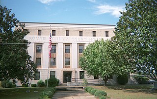
Wayne County is a county located in the U.S. state of Mississippi. As of the 2020 census, the population was 19,779. Its county seat is Waynesboro. The county is named for General Anthony Wayne.

<span class="mw-page-title-main">Union County, Mississippi</span> County in Mississippi, United States

Union County is a county located in the U.S. state of Mississippi. It was formed in 1870 from Tippah and Pontotoc counties, and in 1874 a portion of Lee County was added. As of the 2020 census, the population was 27,777. Its county seat is New Albany. According to most sources, the county received its name by being a union of pieces of several large counties, like other Union counties in other states. However, other sources say that the name was meant to mark the re-union of Mississippi and the other Confederate states after the Civil War.

<span class="mw-page-title-main">Stone County, Mississippi</span> County in Mississippi, United States

Stone County is a county located in the U.S. state of Mississippi. As of the 2020 census, the population was 18,333. Its county seat is Wiggins. Stone County was formed from the northern portion of Harrison County on June 5, 1916. The county was named for John M. Stone, who served as Governor of Mississippi from 1876 to 1882 and again from 1890 to 1896.
<span class="mw-page-title-main">Pontotoc County, Mississippi</span> County in Mississippi, United States

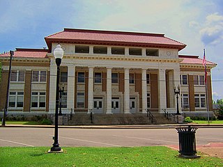
Pontotoc County is a county located in the U.S. state of Mississippi. As of the 2020 census, the population was 31,184. Its county seat is Pontotoc. It was created on February 9, 1836, from lands ceded to the United States under the Chickasaw Cession. Pontotoc is a Chickasaw word meaning "land of hanging grapes". The original Natchez Trace and the current-day Natchez Trace Parkway both pass through the southeast corner of Pontotoc County.

<span class="mw-page-title-main">Pike County, Mississippi</span> County in Mississippi, United States

Pike County is a county located on the southwestern border of the U.S. state of Mississippi. As of the 2020 census, the population was 40,324. The county seat is Magnolia. Pike County is named for explorer Zebulon Pike. Pike County is part of the McComb, MS Micropolitan Statistical Area.
<span class="mw-page-title-main">Perry County, Mississippi</span> County in Mississippi, United States

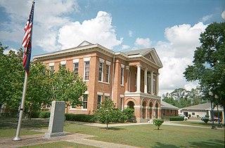
Perry County is a county located in the U.S. state of Mississippi. As of the 2020 census, the population was 11,511. The county seat is New Augusta. The county is named after the War of 1812 naval hero, Oliver Hazard Perry.
<span class="mw-page-title-main">Pearl River County, Mississippi</span> County in Mississippi, United States

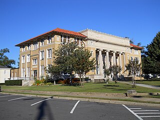
Pearl River County is a county located in the U.S. state of Mississippi. The population was 56,145 at the 2020 census. Its county seat is Poplarville.

<span class="mw-page-title-main">Monroe County, Mississippi</span> County in Mississippi, United States

Monroe County is a county on the northeast border of the U.S. state of Mississippi next to Alabama. As of the 2020 census, the population was 34,180. Its county seat is Aberdeen.

<span class="mw-page-title-main">Marshall County, Mississippi</span> County in Mississippi, United States

Marshall County is a county located on the north central border of the U.S. state of Mississippi. As of the 2020 census, the population was 33,752. Its county seat is Holly Springs. The county is named for Chief Justice of the United States John Marshall, who presided in the early nineteenth century.

<span class="mw-page-title-main">Marion County, Mississippi</span> County in Mississippi, United States

Marion County is a county located in the U.S. state of Mississippi. As of the 2020 census, the population was 24,441. Its county seat is Columbia. Marion County is named for American Revolutionary War guerrilla leader Francis Marion also known as The Swamp Fox.
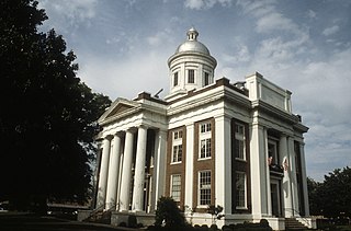
<span class="mw-page-title-main">Madison County, Mississippi</span> County in Mississippi, United States

Madison County is a county located in the U.S. state of Mississippi. As of the 2020 census, the population was 109,145. The county seat is Canton. The county is named for Founding Father and U.S. President James Madison.

<span class="mw-page-title-main">Lamar County, Mississippi</span> County in Mississippi, United States

Lamar County is a county located in the U.S. state of Mississippi. As of the 2020 census, the population was 64,222. Its county seat is Purvis. Named for Confederate Lucius Quintus Cincinnatus Lamar, the county was carved out of Marion County to the west in 1904.

<span class="mw-page-title-main">Jones County, Mississippi</span> County in Mississippi, United States

Jones County is in the southeastern portion of the U.S. state of Mississippi. As of the 2020 census, the population was 67,246. Its county seats are Laurel and Ellisville.

<span class="mw-page-title-main">Jefferson Davis County, Mississippi</span> County in Mississippi, United States

Jefferson Davis County is a county located in the U.S. state of Mississippi. As of the 2020 census, the population was 11,321. Its county seat is Prentiss. The county is named after Mississippi Senator and Confederate President Jefferson Davis. The county was carved out of Covington and Lawrence counties in March 1906. Governor James K. Vardaman signed the bill creating the county on May 9, 1906.
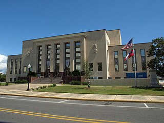
<span class="mw-page-title-main">Jackson County, Mississippi</span> County in Mississippi, United States

Jackson County is a county located in the U.S. state of Mississippi. As of the 2020 census, the population was 143,252, making it the fifth-most populous county in Mississippi. Its county seat is Pascagoula. The county was named for Andrew Jackson, general in the United States Army and afterward President of the United States.
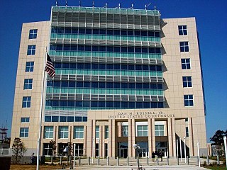
<span class="mw-page-title-main">Harrison County, Mississippi</span> County in Mississippi, United States

Harrison County is a county located in the U.S. state of Mississippi. As of the 2020 census, the population was 208,621, making it the second-most populous county in Mississippi. Its county seats are Biloxi and Gulfport. The county is named after U.S. President William Henry Harrison.

<span class="mw-page-title-main">George County, Mississippi</span> County in Mississippi, United States

George County is a county located in the U.S. state of Mississippi. As of the 2020 census, the population was 24,350. Its county seat is Lucedale. The county is named for James Z. George, US Senator from Mississippi. George County was included in the Pascagoula, MS Metropolitan Statistical Area. The county is located adjacent to the Alabama state line.
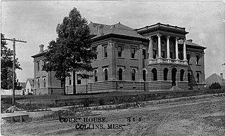
<span class="mw-page-title-main">Covington County, Mississippi</span> County in Mississippi, United States

Covington County is a county located in the U.S. state of Mississippi. As of the 2020 census, the population was 18,340. Its county seat is Collins. The county is named for U.S. Army officer and Congressman Leonard Covington.

<span class="mw-page-title-main">Benton County, Mississippi</span> County in Mississippi, United States

Benton County is a county located in the U.S. state of Mississippi. As of the 2020 census, the population was 7,646. Its county seat is Ashland.

<span class="mw-page-title-main">Attala County, Mississippi</span> County in Mississippi, United States

Attala County is a county located in the U.S. state of Mississippi. As of the 2020 census, the population was 17,889. Its county seat is Kosciusko. Attala County is named for Atala, a fictional Native American heroine from an early-19th-century novel of the same name by François-René de Chateaubriand.

References

  1. "History". Forrest County, Mississippi. Retrieved November 9, 2014.
  2. "Census - Geography Profile: Forrest County, Mississippi". United States Census Bureau . Retrieved January 8, 2023.
  3. "Find a County". National Association of Counties. Archived from the original on May 31, 2011. Retrieved June 7, 2011.
  4. "2010 Census Gazetteer Files". United States Census Bureau. August 22, 2012. Archived from the original on September 28, 2013. Retrieved November 3, 2014.
  5. "Annual Estimates of the Resident Population for Counties: April 1, 2020 to July 1, 2023". United States Census Bureau. Retrieved April 5, 2024.
  6. "U.S. Decennial Census". United States Census Bureau. Retrieved November 3, 2014.
  7. "Historical Census Browser". University of Virginia Library. Retrieved November 3, 2014.
  8. "Population of Counties by Decennial Census: 1900 to 1990". United States Census Bureau. Retrieved November 3, 2014.
  9. "Census 2000 PHC-T-4. Ranking Tables for Counties: 1990 and 2000" (PDF). United States Census Bureau. Archived (PDF) from the original on March 27, 2010. Retrieved November 3, 2014.
  10. "State & County QuickFacts". United States Census Bureau. Archived from the original on July 18, 2011. Retrieved September 3, 2013.
  11. "Explore Census Data". data.census.gov. Retrieved December 16, 2021.
  12. Leip, David. "Dave Leip's Atlas of U.S. Presidential Elections". uselectionatlas.org. Retrieved March 3, 2018.


31°11′N89°16′W / 31.19°N 89.26°W / 31.19; -89.26