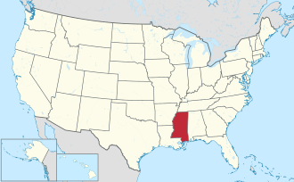
Pike County, Mississippi

Last updated

Pike County
Holly Hill.jpg
Map of Mississippi highlighting Pike County.svg
Location within the U.S. state of Mississippi
Mississippi in United States.svg
Mississippi's location within the U.S.
Coordinates: 31°11′N90°24′W / 31.18°N 90.4°W / 31.18; -90.4
CountryFlag of the United States.svg United States
StateFlag of Mississippi.svg  Mississippi
Founded1815
Named for Zebulon Pike
Seat Magnolia
Largest city McComb
Area
  Total411 sq mi (1,060 km2)
  Land409 sq mi (1,060 km2)
  Water1.7 sq mi (4 km2)  0.4%
Population
 (2020)
  Total40,324
  Density98/sq mi (38/km2)
Time zone UTC−6 (Central)
  Summer (DST) UTC−5 (CDT)
Congressional district 3rd
Website www.co.pike.ms.us

Pike County is a county located on the southwestern border of the U.S. state of Mississippi. As of the 2020 census, the population was 40,324. [1] The county seat is Magnolia. [2] Pike County is named for explorer Zebulon Pike. Pike County is part of the McComb, MS Micropolitan Statistical Area.

Contents

History

Pike County was formed from Marion County by an act of the Territorial General Assembly on December 9, 1815. Holmesville was selected as the county seat on December 11, 1816; it was named in honor of Major Andrew Hunter Holmes, an army officer killed in the War of 1812. In 1873 Magnolia was voted in as the new county seat. [3] The county was devoted to agriculture and is still mostly rural.

Geography

According to the U.S. Census Bureau, the county has a total area of 411 square miles (1,060 km2), of which 409 square miles (1,060 km2) is land and 1.7 square miles (4.4 km2) (0.4%) is water. [4]

Major highways

Adjacent counties

Demographics

Historical population
CensusPop.Note
1820 4,438
1830 5,40221.7%
1840 6,15113.9%
1850 7,36019.7%
1860 11,13551.3%
1870 11,3031.5%
1880 16,68847.6%
1890 21,20327.1%
1900 27,54529.9%
1910 37,27235.3%
1920 28,725−22.9%
1930 32,20112.1%
1940 35,0028.7%
1950 35,1370.4%
1960 35,7891.9%
1970 36,3451.6%
1980 37,5783.4%
1990 38,9873.7%
2000 39,9032.3%
2010 40,4041.3%
2020 40,324−0.2%
2023 (est.)39,394 [5] −2.3%
U.S. Decennial Census [6]
1790–1960 [7] 1900–1990 [8]
1990–2000 [9] 2010–2013 [10]
Pike County by race as of 2020 [11]
RaceNum.Perc.
White 16,76941.59%
Black or African American 21,45753.21%
Native American 1130.28%
Asian 2540.63%
Pacific Islander 70.02%
Other/Mixed 1,0972.72%
Hispanic or Latino 6271.55%

As of the 2020 United States Census, there were 40,324 people, 14,404 households, and 8,528 families residing in the county.

Communities

Cities

Towns

Census-designated place

Unincorporated communities

Politics

Pike County is a swing county in presidential elections; since 2000 it has voted Democratic four times and Republican twice.

United States presidential election results for Pike County, Mississippi [12]
Year Republican Democratic Third party
No.%No.%No.%
2020 8,47948.84%8,64649.80%2361.36%
2016 8,00948.95%8,04349.16%3081.88%
2012 8,18145.52%9,65053.69%1430.80%
2008 8,65147.91%9,27651.38%1280.71%
2004 8,66052.07%7,88147.38%910.55%
2000 7,46452.69%6,54446.20%1581.12%
1996 5,40343.45%6,30250.68%7305.87%
1992 6,00543.90%6,27945.90%1,39510.20%
1988 7,63753.63%6,53145.87%710.50%
1984 8,25457.28%6,13742.59%200.14%
1980 6,66148.56%6,69448.80%3612.63%
1976 5,65948.16%5,74948.92%3432.92%
1972 6,54272.08%2,33225.69%2022.23%
1968 1,46014.38%2,84828.05%5,84657.57%
1964 6,41892.20%5437.80%00.00%
1960 1,46727.38%1,25823.48%2,63249.13%
1956 1,21029.47%1,71441.74%1,18228.79%
1952 2,90853.82%2,49546.18%00.00%
1948 691.75%2215.61%3,65092.64%
1944 2487.70%2,97292.30%00.00%
1940 1855.88%2,95693.93%60.19%
1936 862.64%3,17097.21%50.15%
1932 1184.67%2,40094.94%100.40%
1928 92027.45%2,43172.55%00.00%
1924 1978.61%1,64071.65%45219.75%
1920 15311.66%1,11484.91%453.43%
1916 533.50%1,45195.71%120.79%
1912 241.95%1,06886.90%13711.15%

See also

Related Research Articles

<span class="mw-page-title-main">Adams County, Mississippi</span> County in Mississippi, United States

Adams County is a county located in the U.S. state of Mississippi. As of the 2020 census, the population was 29,538. The county seat is Natchez.

<span class="mw-page-title-main">Walthall County, Mississippi</span> County in Mississippi, United States

Walthall County is a county located in the U.S. state of Mississippi. As of the 2020 census, the population was 13,884. Its county seat is Tylertown. The county is named after Civil War Confederate general and Mississippi Senator Edward C. Walthall.

<span class="mw-page-title-main">Marion County, Mississippi</span> County in Mississippi, United States

Marion County is a county located in the U.S. state of Mississippi. As of the 2020 census, the population was 24,441. Its county seat is Columbia. Marion County is named for American Revolutionary War guerrilla leader Francis Marion also known as The Swamp Fox.

<span class="mw-page-title-main">Jefferson Davis County, Mississippi</span> County in Mississippi, United States

Jefferson Davis County is a county located in the U.S. state of Mississippi. As of the 2020 census, the population was 11,321. Its county seat is Prentiss. The county is named after Mississippi Senator and Confederate President Jefferson Davis. The county was carved out of Covington and Lawrence counties in March 1906. Governor James K. Vardaman signed the bill creating the county on May 9, 1906.

<span class="mw-page-title-main">Jefferson County, Mississippi</span> County in Mississippi, United States

Jefferson County is a county located in the U.S. state of Mississippi; its western border is formed by the Mississippi River. As of the 2020 census, the population was 7,260, making it the fourth-least populous county in Mississippi. Its first county seat was located at Old Greenville until 1825, which no longer exists, before moving to Fayette. The county is named for U.S. President Thomas Jefferson.

<span class="mw-page-title-main">Harrison County, Mississippi</span> County in Mississippi, United States

Harrison County is a county located in the U.S. state of Mississippi. As of the 2020 census, the population was 208,621, making it the second-most populous county in Mississippi. Its county seats are Biloxi and Gulfport. The county is named after U.S. President William Henry Harrison.

<span class="mw-page-title-main">Hancock County, Mississippi</span> County in Mississippi, United States

Hancock County is the southernmost county of the U.S. state of Mississippi and is named for Founding Father John Hancock. As of the 2020 census, the population was 46,053. Its county seat is Bay St. Louis.

<span class="mw-page-title-main">Benton County, Mississippi</span> County in Mississippi, United States

Benton County is a county located in the U.S. state of Mississippi. As of the 2020 census, the population was 7,646. Its county seat is Ashland.

<span class="mw-page-title-main">Attala County, Mississippi</span> County in Mississippi, United States

Attala County is a county located in the U.S. state of Mississippi. As of the 2020 census, the population was 17,889. Its county seat is Kosciusko. Attala County is named for Atala, a fictional Native American heroine from an early-19th-century novel of the same name by François-René de Chateaubriand.

<span class="mw-page-title-main">Columbia County, Arkansas</span> County in Arkansas, United States

Columbia County is a county located in the U.S. state of Arkansas. As of the 2020 census, the population was 22,801. The county seat is Magnolia. The county was formed on December 17, 1852, and was named for Christopher Columbus. The Magnolia, AR Micropolitan Statistical Area includes all of Columbia County.

<span class="mw-page-title-main">Washington Parish, Louisiana</span> Parish in Louisiana, United States

Washington Parish is a parish located in the interior southeast corner of the U.S. state of Louisiana, one of the Florida Parishes. As of the 2020 census, the population was 45,463. Its parish seat is Franklinton. Its largest city is Bogalusa. The parish was founded in 1819.

<span class="mw-page-title-main">St. James Parish, Louisiana</span> Parish in Louisiana, United States

St. James Parish is a parish located in the U.S. state of Louisiana. The parish seat is Convent. The parish was created in 1807. St. James Parish is a part of the New Orleans–Metairie, Louisiana metropolitan statistical area, sitting between New Orleans and Baton Rouge on the Mississippi River. According to the 2020 United States census, the population was 20,192.

<span class="mw-page-title-main">St. Helena Parish, Louisiana</span> Parish in Louisiana, United States

St. Helena Parish is a parish in the U.S. state of Louisiana. At the 2020 United States census, the population was 10,920. Its seat is Greensburg. The parish was created in 1810. St. Helena Parish is part of the Baton Rouge metropolitan area.

<span class="mw-page-title-main">Madison Parish, Louisiana</span> Parish in Louisiana, United States

Madison Parish is a parish located on the northeastern border of the U.S. state of Louisiana, in the delta lowlands along the Mississippi River. As of the 2020 census, the population was 10,017. Its parish seat is Tallulah. The parish was formed in 1839.

<span class="mw-page-title-main">Franklin Parish, Louisiana</span> Parish in Louisiana, United States

Franklin Parish is a parish located in the northeastern part of the U.S. state of Louisiana. As of the 2020, its population was 19,774. The parish seat is Winnsboro. The parish was founded in 1843 and named for Benjamin Franklin.

<span class="mw-page-title-main">East Feliciana Parish, Louisiana</span> Parish in Louisiana, United States

East Feliciana Parish is a parish located in the U.S. state of Louisiana. At the 2020 census, the population was 19,531. The parish seat is Clinton.

<span class="mw-page-title-main">DeSoto Parish, Louisiana</span> Parish in Louisiana, United States

DeSoto Parish is a parish located in the U.S. state of Louisiana. The parish was formed in 1843. At the 2020 U.S. census, the population was 26,812. Its parish seat is Mansfield. DeSoto Parish is part of the Shreveport–Bossier City metropolitan statistical area.

<span class="mw-page-title-main">Caldwell Parish, Louisiana</span> Parish in Louisiana, United States

Caldwell Parish is a parish located in the U.S. state of Louisiana. As of 2020, its population was 9,645. The parish seat is Columbia.

<span class="mw-page-title-main">Magnolia, Mississippi</span> City in Mississippi, United States

Magnolia is a city in Pike County, Mississippi and the county seat. The population was 2,420 at the 2010 census. Magnolia is within the McComb, Mississippi Micropolitan Statistical Area.

Holmesville is an Unincorporated community in Pike County, Mississippi, United States.

References

  1. "Census - Geography Profile: Pike County, Mississippi". United States Census Bureau . Retrieved January 14, 2023.
  2. "Find a County". National Association of Counties. Retrieved June 7, 2011.
  3. Pike County Mississippi 1798-1876 Pioneer Families and Confederate Soldiers, by Luke W. Conerly, 1909
  4. "2010 Census Gazetteer Files". United States Census Bureau. August 22, 2012. Archived from the original on September 28, 2013. Retrieved November 6, 2014.
  5. "Annual Estimates of the Resident Population for Counties: April 1, 2020 to July 1, 2023". United States Census Bureau. Retrieved April 5, 2024.
  6. "U.S. Decennial Census". United States Census Bureau. Retrieved November 6, 2014.
  7. "Historical Census Browser". University of Virginia Library. Retrieved November 6, 2014.
  8. "Population of Counties by Decennial Census: 1900 to 1990". United States Census Bureau. Retrieved November 6, 2014.
  9. "Census 2000 PHC-T-4. Ranking Tables for Counties: 1990 and 2000" (PDF). United States Census Bureau. Archived (PDF) from the original on March 27, 2010. Retrieved November 6, 2014.
  10. "State & County QuickFacts". United States Census Bureau. Archived from the original on June 7, 2011. Retrieved September 5, 2013.
  11. "Explore Census Data". data.census.gov. Retrieved December 9, 2021.
  12. Leip, David. "Dave Leip's Atlas of U.S. Presidential Elections". uselectionatlas.org. Retrieved February 22, 2021.
  13. C. W. Barnum. "Webster Parish, Louisiana, History and Genealogy". laahgp.genealogyvillage.com. Retrieved March 11, 2015.

31°11′N90°24′W / 31.18°N 90.40°W / 31.18; -90.40