The county is known for the Neshoba County Fair and harness horse races. It is home of the Williams Brothers Store, which has been in operation since the early 1900s.
At the time of European encounter, this was part of the territory of the historic Choctaw people, who occupied most of what later was defined as Mississippi. Under President Andrew Jackson, the United States conducted Indian removal in the 1830s in the Southeast, and most of the Choctaw were removed to west of the Mississippi River, to land in Indian Territory, now part of Oklahoma.
Neshoba was founded by European American settlers in 1833.
Descendants of the Choctaw who remained in the state continued to identify as Choctaw. They lived in relatively distinct communities and reorganized in the 1930s, gaining federal recognition as the Mississippi Band of Choctaw Indians. Even in the 1970s, eighty percent of their people continued to speak Choctaw.
Late 19th century to present
The white-dominated state legislature passed a new constitution in 1890, that effectively disenfranchised most freedmen and other non-whites, such as Native Americans. This exclusion was maintained well into the 20th century, but activists in the 1960s increasingly worked to restore voting rights throughout the state.
At various times, 76 post offices were established within the county. Around the turn of the 20th century, 40 small post offices were operating at the same time. By 1971, only the post offices in Philadelphia and Neshoba were still operational. Today, only the one in Philadelphia remains.[5]
Neshoba County is known as the site of the lynching murder of three young activists in July 1964 during Freedom Summer in Mississippi, a period of education and a voter registration drive to prepare African Americans for voting. The three young men, two from the North, disappeared at a time of heightened violence, and they became the subjects of a state and FBI search. White supremacists were found to have murdered three civil rights activists: James Cheney, Andrew Goodman and Michael Schwerner near Philadelphia, the county seat. During the investigation, searchers found the bodies of eight other young black men in nearby locations.[6] Deputy Sheriff Cecil Price was implicated and charged with being part of the group that lynched the three young men and buried them in an earthen dam 15 miles northeast of Philadelphia. Outrage over the crime contributed to congressional passage of the Civil Rights Act of 1964 and Voting Rights Act of 1965. The crime and decades-long legal aftermath of investigation and trials inspired the 1988 movie Mississippi Burning.
In 1980, Ronald Reagan launched his presidential campaign at the Neshoba County Fair to deliver a speech on economic policy and refer to states' rights. He was believed by some to be referring to southern conservative values, in an area associated with the 1964 murders and at a time when the Republican Party was attracting more white conservatives from the Democratic Party.[7][8]
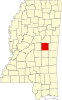
Geography
According to the U.S. Census Bureau, the county has a total area of 572 square miles (1,480km2), of which 570 square miles (1,500km2) is land and 1.5 square miles (3.9km2) (0.3%) is water.[9]
As of the 2020 United States Census, there were 29,087 people, 10,657 households, and 7,184 families residing in the county.
2000 census
As of the census[16] of 2000, there were 28,684 people, 10,694 households, and 7,742 families residing in the county. The population density was 50 peopleper square mile (19 people/km2). There were 11,980 housing units at an average density of 21 unitsper square mile (8.1 units/km2). The racial makeup of the county was 65.50% White, 19.33% Black or African American, 13.80% Native American, 0.19% Asian, 0.02% Pacific Islander, 0.34% from other races, and 0.81% from two or more races. 1.16% of the population were Hispanic or Latino of any race. 28.6% identified as of American ancestry, 8.8% as Irish and 6.1% as English, according to Census 2000. Those who identify as having "American" ancestry are predominantly of English descent, but have ancestors who came to the US so long ago that they identify simply as American.[17][18] 88.7% spoke English and 10.2% Choctaw as their first language.
There were 10,694 households, out of which 34.90% had children under the age of 18 living with them, 52.50% were married couples living together, 15.60% had a female householder with no husband present, and 27.60% were non-families. 24.70% of all households were made up of individuals, and 11.50% had someone living alone who was 65 years of age or older. The average household size was 2.63 and the average family size was 3.11.
In the county, the population was spread out, with 28.20% under the age of 18, 9.00% from 18 to 24, 27.00% from 25 to 44, 21.60% from 45 to 64, and 14.20% who were 65 years of age or older. The median age was 35 years. For every 100 females there were 91.10 males. For every 100 females age 18 and over, there were 88.30 males.
The median income for a household in the county was $28,300, and the median income for a family was $33,439. Males had a median income of $28,112 versus $19,882 for females. The per capita income for the county was $14,964. About 17.90% of families and 21.00% of the population were below the poverty line, including 27.20% of those under age 18 and 22.00% of those age 65 or over.
Choctaw Tribal School System maintains Bogue Chitto Elementary School,[21] Pearl River Elementary School,[22] Tucker Elementary School,[23] Choctaw Central Middle School,[24] and Choctaw Central High School in the county.[25]
↑ Sledge, Broox (May 29, 1985). "Neshoba County post offices---"gone with the wind."". The Union Appeal. Union, Mississippi. pp.6–7. Retrieved December 18, 2021. This is the story of the 76 small post offices which have served the people of Neshoba county down through the years. Only one of the 76 remains open today – Philadelphia.
↑ Lieberson, Stanley & Waters, Mary C. (1986). "Ethnic Groups in Flux: The Changing Ethnic Responses of American Whites". Annals of the American Academy of Political and Social Science. 487 (79): 82–86. doi:10.1177/0002716286487001004. S2CID60711423.
↑ "Home". Bogue Chitto Elementary School. Retrieved August 6, 2022. 13241 Highway 491 North Philadelphia, MS 39050
↑ "Home". Pearl River Elementary School. Retrieved August 6, 2022. 470 Industrial Road Choctaw, MS 39350
↑ "Home". Tucker Elementary School. Retrieved August 6, 2022. 126 East Tucker Circle Philadelphia, MS 39350
↑ "Home". Choctaw Central Middle School. Retrieved August 6, 2022. 150 Recreation Road Choctaw, MS 39350
↑ "Home". Choctaw Central High School. Retrieved August 6, 2022. 150 Recreation Road Choctaw, MS 39350
Further reading
Carol V.R. George, One Mississippi, Two Mississippi: Methodists, Murder, and the Struggle for Racial Justice in Neshoba County. Oxford, England: Oxford University Press, 2015.
Winston County is a county located in the U.S. state of Mississippi. In the 2020 census, the population was 17,714. Its county seat is Louisville. The county is named for Louis Winston (1784–1824), a colonel in the militia, a prominent lawyer, and a judge of the Mississippi Supreme Court.
Newton County is a county located in the U.S. state of Mississippi. As of the 2020 census, the population was 21,291. Its county seat is Decatur.
Lincoln County is a county located in the U.S. state of Mississippi. As of the 2020 census, the population was 34,907. Its county seat is Brookhaven.
Leake County is a county in the center of the U.S. state of Mississippi. As of the 2020 census, the population was 21,275. Its county seat is Carthage. The county is named for Walter Leake, the Governor of Mississippi from 1822 to 1825.
Kemper County is a county located on the central eastern border of the U.S. state of Mississippi. As of the 2020 census, the population was 8,988. Its county seat is De Kalb. The county is named in honor of Reuben Kemper.
Redwater is a census-designated place (CDP) in Leake County, Mississippi, United States. It is one of the eight communities of the Mississippi Band of Choctaw Indians Reservation, and the population is 61% Choctaw. The population was 633 at the 2010 census, up from 409 at the 2000 census.
Flora is a town in Madison County, Mississippi, United States. The population was 1,647 at the 2020 census, down from 1,886 in 2010. It is part of the Jackson Metropolitan Statistical Area.
Duck Hill is a town in Montgomery County, Mississippi, United States. The population was 619 at the 2020 census, down from 732 in 2010.
Pearl River is a census-designated place (CDP) in Neshoba County, Mississippi. It is one of the eight communities of the Mississippi Band of Choctaw Indians Reservation and the population is 80% Choctaw. The population was 3,156 at the 2000 census.
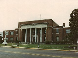
Philadelphia is a city in and the county seat of Neshoba County, Mississippi, United States. The population was 7,118 at the 2020 census.
Tucker is a census-designated place (CDP) in Neshoba County, Mississippi. It is one of the eight communities of the Mississippi Band of Choctaw Indians Reservation and the population is 93% Choctaw. The population was 642 at the 2020 census.
Picayune is the largest city in Pearl River County, Mississippi, United States. The population was 11,885 at the 2020 census. The city is located approximately 45 miles (72 km) from New Orleans, Hattiesburg, and Gulfport–Biloxi. The Stennis Space Center is 10 miles (16 km) away. Picayune is part of the New Orleans–Metairie–Hammond combined statistical area.
Bogue Chitto is a census-designated place (CDP) situated in Kemper and Neshoba counties, Mississippi. The population was 864 at the 2020 census. It is part of the Mississippi Band of Choctaw Indians Reservation and the population is 93% Choctaw.
The Mississippi Band of Choctaw Indians is one of three federally recognized tribes of Choctaw people, and the only one in the state of Mississippi. On April 20, 1945, this tribe organized under the Indian Reorganization Act of 1934. Their reservation included lands in Neshoba, Leake, Newton, Scott, Jones, Attala, Kemper, and Winston counties. The Mississippi Choctaw regained stewardship of their mother mound, Nanih Waiya mounds and cave in 2008. The Mississippi Band of Choctaw have declared August 18 as a tribal holiday to celebrate their regaining control of the sacred site. The other two Choctaw groups are the Choctaw Nation of Oklahoma, the third largest tribe in the United States, and the Jena Band of Choctaw Indians, located in Louisiana.
Mississippi Highway 21 is a state highway in central Mississippi. It runs from north to south for 80.3 miles (129.2 km) and serves six counties: Scott, Leake, Newton, Neshoba, Kemper, and Noxubee.
Bogue Chitto is an unincorporated community and census-designated place (CDP) in Lincoln County, Mississippi, United States. As of the 2020 census, it had a population of 437. Bogue Chitto is the only municipal hamlet in the state of Mississippi.
The Neshoba County School District is a public school district based in Neshoba County, Mississippi (USA). The district headquarters are in Philadelphia, Mississippi. See Philadelphia.
The Choctaw Tribal School System is a school system based in the community of Choctaw, Mississippi (US). An entity operated by the federally recognized Mississippi Band of Choctaw Indians, the district consists of eight schools in three counties: Neshoba, Leake, and Newton. It has a total enrollment of 1,700 to 1,800 students. It is the largest unified and locally controlled Indian school system in the United States. It is affiliated with the Bureau of Indian Education (BIE). The current Director of Schools is Mr. Terry Ben.
Sandtown is an unincorporated community located in Neshoba County, Mississippi, United States. Sandtown is approximately 4.7 miles (7.6 km) southwest of Bogue Chitto along Mississippi Highway 482.
This page is based on this Wikipedia article Text is available under the CC BY-SA 4.0 license; additional terms may apply. Images, videos and audio are available under their respective licenses.