North Carolina is a state in the Southeastern region of the United States. It borders Virginia to the north, the Atlantic Ocean to the east, South Carolina to the south, Georgia to the southwest, and Tennessee to the west. The state is the 28th-largest and 9th-most populous of the United States. Along with South Carolina, it makes up the Carolinas region of the East Coast. In the 2020 census, the state had a population of 10,439,388. Raleigh is the state's capital and Charlotte is its largest city. The Charlotte metropolitan area, with a population of 2,728,933 in 2020, is the most-populous metropolitan area in North Carolina, the 21st-most populous in the United States, and the largest banking center in the nation after New York City. The Raleigh-Durham-Cary, NC Combined Statistical Area is the second-largest metropolitan area in the state and 32nd-most populous in the United States, with a population of 2,238,315 in 2020, and is home to the largest research park in the United States, Research Triangle Park.

Weezer is an American rock band formed in Los Angeles, California, in 1992. Since 2001, the band has consisted of Rivers Cuomo, Patrick Wilson, Brian Bell, and Scott Shriner. They have sold 10 million albums in the US and more than 35 million worldwide.

Charlotte is the most populous city in the U.S. state of North Carolina. Located in the Piedmont region, it is the county seat of Mecklenburg County. The population was 874,579 at the 2020 census, making Charlotte the 15th-most populous city in the United States, the seventh-most populous city in the South, and the second-most populous city in the Southeast behind Jacksonville, Florida. The city is the cultural, economic, and transportation center of the Charlotte metropolitan area, whose 2020 population of 2,660,329 ranked 22nd in the United States. Metrolina is part of a sixteen-county market region or combined statistical area with a 2020 population of 2,822,352.

Raleigh is the capital city of the U.S. state of North Carolina and the seat of Wake County. It is the second-most populous city in North Carolina, after Charlotte. Raleigh is the tenth-most populous city in the Southeast, the 41st-most populous city in the U.S., and the largest city of the Research Triangle metro area. Raleigh is known as the "City of Oaks" for its many oak trees, which line the streets in the heart of the city. The city covers a land area of 147.6 sq mi (382 km2). The U.S. Census Bureau counted the city's population as 467,665 in the 2020 census. It is one of the fastest-growing cities in the United States. The city of Raleigh is named after Sir Walter Raleigh, who established the now-lost Roanoke Colony in present-day Dare County.

Chesterfield County is a county located in the U.S. state of South Carolina. As of the 2020 census, its population was 43,273. Its county seat is Chesterfield. The largest community in the county is Cheraw. It is located north of the Midlands, in the Pee Dee region, on its border with North Carolina.

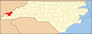
Swain County is a county located on the far western border of the U.S. state of North Carolina. As of the 2020 census, the population was 14,117. Its county seat is Bryson City.
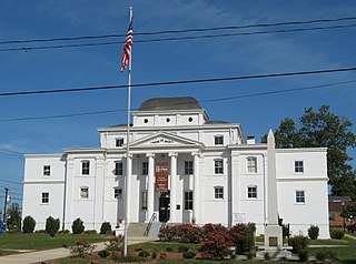
Wilkesboro is a town in and the county seat of Wilkes County, North Carolina, United States. The population was 3,687 at the 2020 census. The town is located along the south bank of the Yadkin River, directly opposite the town of North Wilkesboro. Wilkesboro is a Small Town Main Street community and has recently revitalized its historic downtown to include the Carolina West Wireless Community Commons, Wilkes Communications Pavilion, Heritage Square and Splash Pad. Cub Creek Park is adjacent to the downtown and contains many amenities, which include baseball, walking trails, mountain biking trails, trout fishing, dog park, basketball, tennis, and pickleball courts, picnic shelters, etc. Wilkesboro is also the home of the annual MerleFest, Carolina in the Fall, and Brushy Mountain Peach & Heritage festivals.
Travelers Rest is a city in Greenville County, South Carolina. The population was 7,788 at the 2020 census. It is part of the Greenville-Mauldin-Easley Metropolitan Statistical Area. Travelers Rest, the northernmost city in Greenville County, is located 10 miles north of Greenville and around 20 miles south of the North Carolina border. Furman University, a private liberal-arts university, was annexed into the city limits of Travelers Rest in April 2018 and North Greenville University, a private Christian institution, is located in nearby Tigerville.

Virgilina is a town in Halifax County, Virginia, United States. The population was 154 at the 2010 census. Virgilina was once a copper mining town. It was a stop on the Atlantic and Danville Railway as recently as the 1950s. It is named "Virgilina" because it is located on the Virginia and North Carolina border.

Durham is a city in the U.S. state of North Carolina and the county seat of Durham County. Small portions of the city limits extend into Orange County and Wake County. With a population of 283,506 in the 2020 census, Durham is the 4th-most populous city in North Carolina, and the 71st-most populous city in the United States. The city is located in the east-central part of the Piedmont region along the Eno River. Durham is the core of the four-county Durham-Chapel Hill, NC Metropolitan Statistical Area, which had a population of 649,903 at the 2020 census. The Office of Management and Budget also includes Durham as a part of the Raleigh-Durham-Cary, NC Combined Statistical Area, commonly known as the Research Triangle, which had a population of 2,043,867 in 2020.
Midland is a town in southern Cabarrus County in the U.S. state of North Carolina. Located in the Charlotte region of North Carolina, Midland is a 30-minute commute to uptown Charlotte. The name of the town is derived from its location approximately halfway between Charlotte and Oakboro on the railroad line. The population was 3,073 at the 2010 census.

The Southeastern United States, also referred to as the American Southeast, the Southeast, or the South, is a geographical region of the United States located in the eastern portion of the Southern United States and the southern portion of the Eastern United States. The region includes a core of states that reaches north to Maryland and West Virginia, bordering the Ohio River and Mason–Dixon line, and stretches west to Arkansas and Louisiana.

The Upstate, historically known as the Upcountry, is a region of the U.S. state of South Carolina, comprising the northwesternmost area of the state. Although loosely defined among locals, the general definition includes the 10 counties of the commerce-rich I-85 corridor in the northwest corner of South Carolina. This definition coincided with the Greenville-Spartanburg-Anderson, SC Combined Statistical Area, as first defined by the Office of Management and Budget (OMB) in 2015. In 2023, the OMB issued its most updated definition of the CSA that coincides again with the 10-county region.

The Nantahala River is a river in western North Carolina in the United States, within the Nantahala National Forest, and near the Great Smoky Mountains National Park. Two-lane U.S. Highway 19/74 runs along the river, picnic areas dotting the route. In 1839, this was an unimproved large path, part of what became known as the Trail of Tears as the Cherokee people were forcibly removed from their homelands in this region to west of the Mississippi River and Indian Territory.

Caitlin Upton or Caite Upton is an American real estate agent and beauty pageant titleholder who was crowned Miss South Carolina Teen USA 2007 and represented South Carolina at Miss Teen USA 2007 where she placed 3rd Runner-Up.

Fontana Lake is a reservoir impounded by Fontana Dam on the Little Tennessee River, and is located in Graham and Swain counties in North Carolina. The lake forms part of the southern border of Great Smoky Mountains National Park and the northern border of part of the Nantahala National Forest. Depending on water levels, the lake is about 17 miles (27 km) long. The eastern end is the Tuckasegee River near Bryson City. It has an average depth of 135 feet (41 m) and reaches a maximum depth of 440 feet (130 m), making it the deepest lake in North Carolina. The lake has many inlets into coves and many islands formed from former mountain peaks, especially near the eastern end. As with most dam-impounded lakes, the steep banks are exposed when water levels are low. Many towns were submerged shortly after the creation of Fontana Lake, such as Proctor and Judson.

Wesser Bald is a summit located in Macon County, North Carolina, near the community of Wesser. A wooden fire tower at the summit provides hikers with unimpeded views of the Great Smoky Mountains National Park and also the Nantahala Mountains. The Appalachian Trail traverses the summit from roughly north to south with the Nantahala Outdoor Center lying to the north within the Nantahala Gorge and Tellico gap just to the south. Tellico gap has unimproved road access. The climb from Tellico Gap takes an average of 20 minutes. Also, a third route, the blue trail, departs from the end of Wesser Creek Road and follows Wesser Creek up to a point just south of the summit to a fork with the Appalachian Trail. The summit is located at 4,627 ft (1,410 m). and is within Nantahala National Forest. A map detailing the highway routes to access Tellico Gap is available at the Nantahala Outdoor Center. Observable landforms include Wayah Bald, the Nantahala Gorge, and Clingmans Dome among others. The Wesser Fire Tower provides 360 degree views of the Smokies in a short 1.5 mile hike from Tellico Gap on the Appalachian Trail, with an elevation gain of about 767 feet. The Fire Tower was originally reported as destroyed during the forest fires which ravaged the Nantahala Forest in November, 2016 but it was later learned that it survived.

Raditude is the seventh studio album by American rock band Weezer, released on October 30, 2009 and is their final album on DGC Records, Geffen Records and Interscope Records. The title of the album was suggested to Weezer vocalist Rivers Cuomo by actor Rainn Wilson.
Almond is an unincorporated community in Swain County, North Carolina, United States. Almond is located on the Little Tennessee River and North Carolina Highway 28 7.9 miles (12.7 km) west-southwest of Bryson City.

The Hella Mega Tour was a concert tour by American rock bands Green Day, Fall Out Boy, and Weezer that was announced on September 10, 2019 and originally included dates from March to August 2020. Due to the COVID-19 pandemic, the Oceanic leg was canceled, as well as the sole Canadian date. The rest of the tour was rescheduled to 2021 and 2022.