West Brooklyn, Illinois

Last updated

West Brooklyn
Lee County Illinois Incorporated and Unincorporated areas West Brooklyn Highlighted.svg
Location of West Brooklyn in Lee County, Illinois.
Illinois in United States (US48).svg
Location of Illinois in the United States
Coordinates: 41°41′37″N89°8′50″W / 41.69361°N 89.14722°W / 41.69361; -89.14722
CountryUnited States
StateIllinois
County Lee
IncorporatedSeptember 24, 1894 [1]
Area
[2]
  Total0.09 sq mi (0.24 km2)
  Land0.09 sq mi (0.24 km2)
  Water0.00 sq mi (0.00 km2)
Population
 (2020)
  Total131
  Density1,393.62/sq mi (540.89/km2)
Time zone UTC-6 (CST)
  Summer (DST) UTC-5 (CDT)
ZIP Code(s)
61378
Area code(s) 815 & 779
FIPS code 17-80008
Wikimedia CommonsWest Brooklyn, Illinois

West Brooklyn is a village in Lee County, Illinois, United States. The population was 142 at the 2010 census, down from 174 in 2000. There is one Church located in West Brooklyn...St. Mary of the Assumption Catholic Parish.

Contents

History

Geography

Location of West Brooklyn, Illinois ILMap-doton-WestBrooklyn.PNG
Location of West Brooklyn, Illinois

West Brooklyn is located at 41°41′37″N89°8′50″W / 41.69361°N 89.14722°W / 41.69361; -89.14722 (41.693533, -89.147123). [4]

According to the 2010 census, West Brooklyn has a total area of 0.11 square miles (0.28 km2), all land. [5]

Demographics

Historical population
CensusPop.Note
1900 279
1910 266−4.7%
1920 190−28.6%
1930 2015.8%
1940 185−8.0%
1950 1944.9%
1960 182−6.2%
1970 22523.6%
1980 210−6.7%
1990 164−21.9%
2000 1746.1%
2010 142−18.4%
2020 131−7.7%
U.S. Decennial Census [6]

As of the census [7] of 2000, there were 174 people, 60 households, and 43 families residing in the village. The population density was 1,629.0 inhabitants per square mile (629.0/km2). There were 67 housing units at an average density of 627.3 per square mile (242.2/km2). The racial makeup of the village was 91.95% White, 0.57% African American, 1.15% Native American, 0.57% Asian, 1.72% from other races, and 4.02% from two or more races. Hispanic or Latino of any race were 5.75% of the population.

There were 60 households, out of which 38.3% had children under the age of 18 living with them, 65.0% were married couples living together, and 28.3% were non-families. 26.7% of all households were made up of individuals, and 10.0% had someone living alone who was 65 years of age or older. The average household size was 2.90 and the average family size was 3.56.

In the village, the population was spread out, with 35.1% under the age of 18, 7.5% from 18 to 24, 32.8% from 25 to 44, 17.2% from 45 to 64, and 7.5% who were 65 years of age or older. The median age was 32 years. For every 100 females, there were 100.0 males. For every 100 females age 18 and over, there were 109.3 males.

The median income for a household in the village was $34,375, and the median income for a family was $44,750. Males had a median income of $26,786 versus $27,750 for females. The per capita income for the village was $16,102. About 2.4% of families and 1.7% of the population were below the poverty line, including none of those under the age of eighteen and 21.4% of those 65 or over.

Related Research Articles

<span class="mw-page-title-main">Bureau Junction, Illinois</span> Village in Illinois, United States

Bureau Junction, usually called Bureau, is a village in Bureau County, Illinois, United States. The population was 281 at the 2020 census. The village name is shown as both "Bureau Junction" and "Bureau" on federal maps, and is commonly called "Bureau", including by phone companies and the United States Post Office. It is part of the Ottawa Micropolitan Statistical Area. Bureau Junction was the point where the Rock Island Line railroad's branch line to Peoria split. Track west and south of Bureau is operated by Iowa Interstate, while tracks east to Chicago were formerly operated by CSX but are currently leased to Iowa Interstate.

<span class="mw-page-title-main">Malden, Illinois</span> Village in Illinois, United States

Malden is a village in Bureau County, Illinois, United States. The population was 318 at the 2010 census. It is part of the Ottawa, IL Micropolitan Statistical Area.

<span class="mw-page-title-main">Shannon, Illinois</span> Village in Illinois, United States

Shannon is a village in Carroll County, Illinois, United States. The population was 801 at the 2020 census, up from 757 at the 2010 census.

<span class="mw-page-title-main">Broadview, Illinois</span> Village in Illinois, United States

Broadview is a village in Cook County, Illinois, 12 miles (19 km) west of downtown Chicago. As of the 2020 census it had a population of 7,998.

<span class="mw-page-title-main">Glenwood, Illinois</span> Village in Illinois, United States

Glenwood is a village in Cook County, Illinois, United States. The population was 8,662 at the 2020 census.

<span class="mw-page-title-main">East Brooklyn, Illinois</span> Village in Illinois, United States

East Brooklyn is a village in Grundy County, Illinois, United States. The population was 80 at the 2020 census.

<span class="mw-page-title-main">Wellington, Illinois</span> Village in Illinois, United States

Wellington is a village in Lovejoy Township, Iroquois County, Illinois, United States. The population was 242 at the 2010 census.

<span class="mw-page-title-main">Vergennes, Illinois</span> Village in Illinois, United States

Vergennes is a village in Jackson County, Illinois, United States. The population was 298 at the 2010 census, down from 491 at the 2000 census.

<span class="mw-page-title-main">Lostant, Illinois</span> Village in Illinois, United States

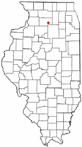
Lostant is a village in LaSalle County, Illinois, United States. The population was 423 at the 2020 census, down from 498 at the 2010 census. It is part of the Ottawa Micropolitan Statistical Area.

<span class="mw-page-title-main">Eagarville, Illinois</span> Village in Illinois, United States

Eagarville is a village in Macoupin County, Illinois, United States. The population was 114 at the 2020 census.

<span class="mw-page-title-main">Standard City, Illinois</span> Village in Illinois, United States

Standard City is a village in Macoupin County, Illinois, United States. The population was 135 at the 2020 census.

<span class="mw-page-title-main">White City, Illinois</span> Village in Illinois, United States

White City is a village in Macoupin County, Illinois, United States. The population was 212 as of the 2020 census.

<span class="mw-page-title-main">Alhambra, Illinois</span> Village in Illinois, United States

Alhambra is a village in Madison County, Illinois, United States. The population was 622 at the 2020 census.

<span class="mw-page-title-main">Seaton, Illinois</span> Village in Illinois, United States

Seaton is a village in Mercer County, Illinois, United States. The population was 214 at the 2020 census.

<span class="mw-page-title-main">Hillcrest, Illinois</span> Village in Illinois, United States

Hillcrest is a village located in Ogle County, Illinois, United States. The 2010 census lists its population at 1,326, up from 1,158 in 2000.

<span class="mw-page-title-main">Pulaski, Illinois</span> Village in Illinois, United States

Pulaski is a village in Pulaski County, Illinois, United States. The population was 235 at the 2010 census. The village is named in honor of Polish Revolutionary War hero Casimir Pulaski.

<span class="mw-page-title-main">Jerome, Illinois</span> Village in Illinois, United States

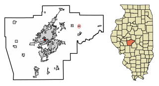
Jerome is a village in Sangamon County, Illinois, United States. The population was 1,656 at the 2010 census. It is part of the Springfield, Illinois Metropolitan Statistical Area.

<span class="mw-page-title-main">Spaulding, Illinois</span> Village in Illinois, United States

Spaulding is a village in Sangamon County, Illinois, United States. The population was 873 at the 2010 census. It is part of the Springfield, Illinois Metropolitan Statistical Area. Spaulding is in the Riverton School District #14.

<span class="mw-page-title-main">Caseyville, Illinois</span> Village in Illinois, United States

Caseyville is a village in St. Clair County, Illinois, United States. The population was 4,245 at the 2010 census, a decline from 4,310 in 2000.

<span class="mw-page-title-main">German Valley, Illinois</span> Village in Illinois, United States

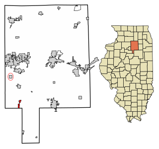
German Valley is a village in Stephenson County, Illinois, United States. German Valley is located four miles south of U.S. Route 20 between Freeport and Rockford. German Valley had a population of 433 at the 2020 census, with a 2023 estimate of 424.

References

  1. http://history.rays-place.com/il/lee-brooklyn.htm [ dead link ]
  2. "2020 U.S. Gazetteer Files". United States Census Bureau. Retrieved March 15, 2022.
  3. 'Illinois Blue Book 1907-1908.' Biographical Sketch of Henry F. Gehant, pg. 276-277
  4. "US Gazetteer files: 2010, 2000, and 1990". United States Census Bureau. February 12, 2011. Retrieved April 23, 2011.
  5. "G001 - Geographic Identifiers - 2010 Census Summary File 1". United States Census Bureau. Archived from the original on February 13, 2020. Retrieved December 25, 2015.
  6. "Census of Population and Housing". Census.gov. Retrieved June 4, 2015.
  7. "U.S. Census website". United States Census Bureau . Retrieved January 31, 2008.