West Canton, North Carolina

Last updated

West Canton, North Carolina
NCMap-doton-Canton.PNG
Location of West Canton, North Carolina
Coordinates: 35°32′18″N82°52′02″W / 35.53833°N 82.86722°W / 35.53833; -82.86722
Country United States
State North Carolina
County Haywood
Area
[1]
  Total1.37 sq mi (3.56 km2)
  Land1.37 sq mi (3.56 km2)
  Water0.00 sq mi (0.00 km2)
Elevation
[2]
2,681 ft (817 m)
Population
 (2020)
  Total1,265
  Density920.67/sq mi (355.46/km2)
Time zone UTC-5 (Eastern (EST))
  Summer (DST) UTC-4 (EDT)
FIPS code 37-72150 [3]
GNIS feature ID2402999 [2]

West Canton is an unincorporated community and census-designated place (CDP) in Haywood County, North Carolina, United States. The population was 1,247 at the 2010 census. [4] It is part of the Asheville Metropolitan Statistical Area.

Contents

Geography

West Canton is located in east-central Haywood County. It is bordered to the east by the town of Canton.

U.S. Routes 19 and 23 form the southern boundary of the CDP. The combined highway leads west 5 miles (8 km) to Lake Junaluska and east through Canton 20 miles (32 km) to Asheville. Waynesville, the Haywood county seat, is 10 miles (16 km) to the southwest via US-23.

According to the United States Census Bureau, the West Canton CDP has a total area of 1.4 square miles (3.6 km2), all land. The Pigeon River, a west-flowing stream that is part of the Tennessee River basin, forms the northern edge of the CDP.

Demographics

Historical population
CensusPop.Note
2020 1,265
U.S. Decennial Census [5]

As of the census [3] of 2000, there were 1,156 people, 488 households, and 339 families residing in the CDP. The population density was 840.7 inhabitants per square mile (324.6/km2). There were 525 housing units at an average density of 381.8 per square mile (147.4/km2). The racial makeup of the CDP was 97.84% White, 0.69% African American, 0.35% Native American, 0.09% Pacific Islander, and 1.04% from two or more races. Hispanic or Latino of any race were 1.30% of the population.

There were 488 households, out of which 28.1% had children under the age of 18 living with them, 58.2% were married couples living together, 9.6% had a female householder with no husband present, and 30.5% were non-families. 26.8% of all households were made up of individuals, and 14.5% had someone living alone who was 65 years of age or older. The average household size was 2.37 and the average family size was 2.84.

In the CDP, the population was spread out, with 21.1% under the age of 18, 5.2% from 18 to 24, 29.2% from 25 to 44, 26.1% from 45 to 64, and 18.4% who were 65 years of age or older. The median age was 41 years. For every 100 females, there were 84.7 males. For every 100 females age 18 and over, there were 85.0 males.

The median income for a household in the CDP was $30,694, and the median income for a family was $34,922. Males had a median income of $40,347 versus $22,056 for females. The per capita income for the CDP was $15,587. About 8.1% of families and 11.8% of the population were below the poverty line, including 16.2% of those under age 18 and 11.7% of those age 65 or over.

The Former West Canton Elementary School Old West Canton School, West Canton, NC (45804616265).jpg
The Former West Canton Elementary School

History

Prior to European colonization, the area that is now West Canton was inhabited by the Cherokee people and other Indigenous peoples for thousands of years. The Cherokee in Western North Carolina are known as the Eastern Band of Cherokee Indians, a federally recognized tribe.

Related Research Articles

<span class="mw-page-title-main">Haywood County, North Carolina</span> County in North Carolina, United States

Haywood County is a county located in the U.S. state of North Carolina. As of the 2020 census, the population was 62,089. The county seat and its largest city is Waynesville.

<span class="mw-page-title-main">Avery Creek, North Carolina</span> Census-designated place in North Carolina, United States

Avery Creek is a census-designated place (CDP) in Buncombe County, North Carolina, United States. The population was 1,950 at the 2010 census. It is part of the Asheville Metropolitan Statistical Area.

<span class="mw-page-title-main">Fairview, Buncombe County, North Carolina</span> Census-designated place in North Carolina, United States

Fairview is a census-designated place (CDP) in Buncombe County, North Carolina, United States. The population was 2,678 at the 2010 census. It is part of the Asheville Metropolitan Statistical Area.

<span class="mw-page-title-main">Royal Pines, North Carolina</span> Census-designated place in North Carolina, United States

Royal Pines is a census-designated place (CDP) in Buncombe County, North Carolina, United States. The population was 4,272 at the 2010 census. It is part of the Asheville Metropolitan Statistical Area.

<span class="mw-page-title-main">Swannanoa, North Carolina</span> Census-designated place in North Carolina, US

Swannanoa is a census-designated place (CDP) in Buncombe County, North Carolina, United States. The population 5,021 at the 2020 census up from 4,576 at the 2010 census. The community is named for the Swannanoa River, which flows through the settlement. It is part of the Asheville Metropolitan Statistical Area.

<span class="mw-page-title-main">Sherrills Ford, North Carolina</span> Unincorporated community in North Carolina, United States

Sherrills Ford is an unincorporated community and former census-designated place (CDP) in Catawba County, North Carolina, United States. The population was 941 at the 2000 census. For the 2010 census it was included within the Lake Norman of Catawba CDP. It is part of the Hickory-Lenoir-Morganton Metropolitan Statistical Area.

<span class="mw-page-title-main">Canton, North Carolina</span> Town in North Carolina, United States

Canton is the second largest town in Haywood County, North Carolina, United States. It is located about 17 miles (27 km) west of Asheville and is part of that city's metropolitan area. The town is named after the city of Canton, Ohio. The population was 4,227 at the 2010 census.

<span class="mw-page-title-main">Clyde, North Carolina</span> Town in North Carolina, United States

Clyde is a town in Haywood County, North Carolina, United States. The 2010 census recorded the population at 1,223 people. It is part of the Asheville Metropolitan Statistical Area.

<span class="mw-page-title-main">Lake Junaluska, North Carolina</span> Census-designated place in North Carolina, United States

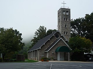
Lake Junaluska is a census-designated place (CDP) in Haywood County, North Carolina, United States, and a manmade lake in the Blue Ridge Mountains. It is part of the Asheville Metropolitan Statistical Area.

<span class="mw-page-title-main">Maggie Valley, North Carolina</span> Town in North Carolina, United States

Maggie Valley is a town in Haywood County, North Carolina, United States. The population was 1,150 at the 2010 census. A popular tourist destination, it is home to Cataloochee Ski Area and the former Ghost Town in the Sky amusement park. Maggie Valley is part of the Asheville Metropolitan Statistical Area.

<span class="mw-page-title-main">Balfour, North Carolina</span> Census-designated place in North Carolina, United States

Balfour is an unincorporated community and census-designated place (CDP) in Henderson County, North Carolina, United States. The population was 1,187 at the 2010 census. It is part of the Asheville Metropolitan Statistical Area.

<span class="mw-page-title-main">Barker Heights, North Carolina</span> Census-designated place in North Carolina, United States

Barker Heights is an unincorporated area and census-designated place (CDP) in Henderson County, North Carolina, United States. The population was 1,254 at the 2010 census. It is part of the Asheville Metropolitan Statistical Area.

<span class="mw-page-title-main">East Flat Rock, North Carolina</span> Census-designated place in North Carolina, United States

East Flat Rock is an unincorporated area and census-designated place (CDP) in Henderson County, North Carolina, United States. The population was 4,995 at the 2010 census, up from 4,151 at the 2000 census. It is part of the Asheville Metropolitan Statistical Area.

<span class="mw-page-title-main">Etowah, North Carolina</span> Census-designated place in Henderson County, North Carolina, USA

Etowah is an unincorporated community and census-designated place (CDP) in Henderson County, North Carolina, United States. The population was 6,944 at the 2010 census. It is part of the Asheville Metropolitan Statistical Area.

<span class="mw-page-title-main">Mountain Home, North Carolina</span> Census-designated place in North Carolina, United States

Mountain Home is an unincorporated community and census-designated place (CDP) in Henderson County, North Carolina, United States. The population was 3,622 at the 2010 census, up from 2,169 in 2000. It is part of the Asheville Metropolitan Statistical Area.

<span class="mw-page-title-main">East Gaffney, South Carolina</span> Census-designated place in South Carolina, United States

East Gaffney is a census-designated place (CDP) in Cherokee County, South Carolina, United States. The population was 3,085 at the 2010 United States Census.

<span class="mw-page-title-main">Gantt, South Carolina</span> Census-designated place in South Carolina, United States

Gantt is a census-designated place (CDP) in Greenville County, South Carolina, United States. The population was 14,229 at the 2010 census. It is part of the Greenville–Mauldin–Easley Metropolitan Statistical Area and a suburb of the city of Greenville.

Cane Savannah is a census-designated place (CDP) in Sumter County, South Carolina, United States. The population was 1,452 at the 2000 census. It is included in the Sumter, South Carolina Metropolitan Statistical Area.

Canton Valley is a village and census-designated place (CDP) in the town of Canton in Hartford County, Connecticut, United States. The population was 1,580 at the 2010 census. As of the 2017 census the population was 1,489.

<span class="mw-page-title-main">Sparrowhawk, Oklahoma</span> Census-designated place in Oklahoma, United States

Sparrowhawk is an unincorporated community and census-designated place (CDP) in Cherokee County, Oklahoma, United States. The population was 191 as of the 2010 census, at which time the CDP was known as Scraper. The older name of the community was given for Captain Archibald Scraper of the 2nd Regiment, Indian Home Guard. Sparrowhawk takes its name from Sparrow Hawk Mountain, which occupies most of the CDP.

References

  1. "ArcGIS REST Services Directory". United States Census Bureau. Retrieved September 20, 2022.
  2. 1 2 U.S. Geological Survey Geographic Names Information System: West Canton, North Carolina
  3. 1 2 "U.S. Census website". United States Census Bureau . Retrieved January 31, 2008.
  4. "Geographic Identifiers: 2010 Census Summary File 1 (G001): West Canton CDP, North Carolina". American Factfinder. U.S. Census Bureau. Archived from the original on February 13, 2020. Retrieved December 15, 2017.
  5. "Census of Population and Housing". Census.gov. Retrieved June 4, 2016.