Westmoreland County, New South Wales

Last updated

Map all coordinates using: OpenStreetMap  
Download coordinates as: KML  ·  GPX
Westmoreland
New South Wales
Westmoreland NSW.PNG
Location in New South Wales
Lands administrative divisions around Westmoreland:
Bathurst Roxburgh Cook
Georgiana Westmoreland Cook
Argyle Argyle Camden

Westmoreland County was one of the original Nineteen Counties in New South Wales and is now one of the 141 Cadastral divisions of New South Wales. It is to the west of Sydney in the Blue Mountains. Coxs River is the border to the north, and the Wollondilly River to the east. Campbells River is the border in the north-east, where the county extends to near Bathurst, with the Fish River part of the border. It includes the town of Oberon, and the Kanangra-Boyd National Park.

Nineteen Counties area of New South Wales colony to which European settlement was legally restricted from 1826 until 1861

The Nineteen Counties were the limits of location in the colony of New South Wales, Australia. Settlers were permitted to take up land only within the counties due to the dangers in the wilderness.

New South Wales State of Australia

New South Wales is a state on the east coast of Australia. It borders Queensland to the north, Victoria to the south, and South Australia to the west. Its coast borders the Tasman Sea to the east. The Australian Capital Territory is an enclave within the state. New South Wales' state capital is Sydney, which is also Australia's most populous city. In December 2018, the population of New South Wales was over 8 million, making it Australia's most populous state. Just under two-thirds of the state's population, 5.1 million, live in the Greater Sydney area. Inhabitants of New South Wales are referred to as New South Welshmen.

Coxs River river in Australia

The Coxs River, a perennial river that is part of the Hawkesbury-Nepean catchment, is located in the Central Tablelands, Blue Mountains, and Macarthur regions of New South Wales, Australia.

Westmoreland County is named in honour of John Fane, Tenth Earl of Westmorland (1759-1841). [1] The Electoral district of Cook and Westmoreland was the first state electoral district for the area, between 1856 and 1859.

John Fane, 10th Earl of Westmorland Lord Privy Seal

John Fane, 10th Earl of Westmorland,, styled Lord Burghersh between 1771 and 1774, was a British Tory politician of the late 18th and early 19th centuries, who served in most of the cabinets of the period, primarily as Lord Privy Seal.

Cook and Westmoreland was an electoral district of the Legislative Assembly in the Australian state of New South Wales in the first and second Parliaments (1856–1859), named after Cook and Westmoreland counties in the Blue Mountains, Lithgow and Oberon areas. It elected two members simultaneously, with voters casting two votes and the first two candidates being elected. It was largely replaced by Hartley, however both members moved to other electorates, James Martin became the member for East Sydney, while Robert Jamison became the member for Nepean.

Parishes within this county

A full list of parishes found within this county; their current LGA and mapping coordinates to the approximate centre of each location is as follows:

Local government in Australia

Local government in Australia is the third tier of government in Australia administered by the states and territories, which in turn are beneath the federal tier. Local government is not mentioned in the Constitution of Australia and two referenda in the 1970s and 1980s to alter the Constitution relating to local government were unsuccessful. Every state government recognises local government in their respective constitutions. Unlike Canada or the United States, there is only one level of local government in each state, with no distinction such as cities and counties.

ParishLGACoordinates
Abercorn Oberon Council 33°59′54″S149°55′04″E / 33.99833°S 149.91778°E / -33.99833; 149.91778 (Abercorn Parish)
Adderley Oberon Council 33°44′54″S149°41′04″E / 33.74833°S 149.68444°E / -33.74833; 149.68444 (Adderley Parish)
Antonio City of Lithgow 30°35′54″S149°58′04″E / 30.59833°S 149.96778°E / -30.59833; 149.96778 (Antonio Parish)
Balfour Oberon Council 33°47′54″S149°45′04″E / 33.79833°S 149.75111°E / -33.79833; 149.75111 (Balfour Parish)
Banshea Oberon Council 34°02′54″S150°02′04″E / 34.04833°S 150.03444°E / -34.04833; 150.03444 (Banshea Parish)
Baring Oberon Council 33°42′54″S149°43′04″E / 33.71500°S 149.71778°E / -33.71500; 149.71778 (Baring Parish)
Bimlow Wollondilly Shire 33°58′54″S150°23′04″E / 33.98167°S 150.38444°E / -33.98167; 150.38444 (Bimlow Parish)
Bindo City of Lithgow 33°40′54″S150°02′04″E / 33.68167°S 150.03444°E / -33.68167; 150.03444 (Bindo Parish)
Blenheim Oberon Council 33°36′54″S149°54′04″E / 33.61500°S 149.90111°E / -33.61500; 149.90111 (Blenheim Parish)
Bolton Oberon Council 33°33′54″S149°46′04″E / 33.56500°S 149.76778°E / -33.56500; 149.76778 (Bolton Parish)
Bouverie Upper Lachlan Shire 34°19′54″S149°54′04″E / 34.33167°S 149.90111°E / -34.33167; 149.90111 (Bouverie Parish)
Bulgarres Oberon Council 33°51′54″S149°57′04″E / 33.86500°S 149.95111°E / -33.86500; 149.95111 (Bulgarres Parish)
Colong Wollondilly Shire 34°07′54″S150°09′04″E / 34.13167°S 150.15111°E / -34.13167; 150.15111 (Colong Parish)
Crete Oberon Council 33°44′54″S149°45′04″E / 33.74833°S 149.75111°E / -33.74833; 149.75111 (Crete Parish)
Cyclops Wollondilly Shire 33°54′54″S150°14′04″E / 33.91500°S 150.23444°E / -33.91500; 150.23444 (Cyclops Parish)
Drogheda Oberon Council 33°55′54″S149°56′04″E / 33.93167°S 149.93444°E / -33.93167; 149.93444 (Drogheda Parish)
Duckmaloi Oberon Council 33°46′54″S149°57′04″E / 33.78167°S 149.95111°E / -33.78167; 149.95111 (Duckmaloi Parish)
Ganbenang City of Lithgow 33°40′54″S150°07′04″E / 33.68167°S 150.11778°E / -33.68167; 150.11778 (Ganbenang Parish)
Gangerang Oberon Council 33°59′54″S150°10′04″E / 33.99833°S 150.16778°E / -33.99833; 150.16778 (Gangerang Parish)
Guineacor Wingecarribee Shire 34°18′54″S150°00′04″E / 34.31500°S 150.00111°E / -34.31500; 150.00111 (Guineacor Parish)
Irene Oberon Council 33°44′54″S149°36′04″E / 33.74833°S 149.60111°E / -33.74833; 149.60111 (Irene Parish)
Jenolan Oberon Council 33°47′54″S150°05′04″E / 33.79833°S 150.08444°E / -33.79833; 150.08444 (Jenolan Parish)
Jocelyn Oberon Council 33°35′54″S149°46′04″E / 33.59833°S 149.76778°E / -33.59833; 149.76778 (Jocelyn Parish)
Jooriland Wollondilly Shire 34°11′54″S150°15′04″E / 34.19833°S 150.25111°E / -34.19833; 150.25111 (Jooriland Parish)
Kendale Oberon Council 33°32′54″S149°51′04″E / 33.54833°S 149.85111°E / -33.54833; 149.85111 (Kendale Parish)
Konangaroo Oberon Council 33°51′54″S150°03′04″E / 33.86500°S 150.05111°E / -33.86500; 150.05111 (Konangaroo Parish)
Kowmung Oberon Council 33°57′54″S149°52′04″E / 33.96500°S 149.86778°E / -33.96500; 149.86778 (Kowmung Parish)
Langdale Oberon Council 33°30′54″S149°39′04″E / 33.51500°S 149.65111°E / -33.51500; 149.65111 (Langdale Parish)
Leibnitz Wollondilly Shire 34°12′54″S150°08′04″E / 34.21500°S 150.13444°E / -34.21500; 150.13444 (Leibnitz Parish)
Lowther City of Lithgow 33°35′54″S150°06′04″E / 33.59833°S 150.10111°E / -33.59833; 150.10111 (Lowther Parish)
Merlin Wollondilly Shire 34°01′54″S150°14′04″E / 34.03167°S 150.23444°E / -34.03167; 150.23444 (Merlin Parish)
Mozart Oberon Council 33°47′54″S149°51′04″E / 33.79833°S 149.85111°E / -33.79833; 149.85111 (Mozart Parish)
Murruin Shire 34°07′54″S150°02′04″E / 34.13167°S 150.03444°E / -34.13167; 150.03444 (Murruin Parish)
Norway Oberon Council 33°44′54″S149°52′04″E / 33.74833°S 149.86778°E / -33.74833; 149.86778 (Norway Parish)
Oberon Oberon Council 33°36′54″S149°49′04″E / 33.61500°S 149.81778°E / -33.61500; 149.81778 (Oberon Parish)
Oldbuck Shire 34°13′54″S150°03′04″E / 34.23167°S 150.05111°E / -34.23167; 150.05111 (Oldbuck Parish)
Speedwell Wollondilly Shire 33°55′54″S150°17′04″E / 33.93167°S 150.28444°E / -33.93167; 150.28444 (Speedwell Parish)
St Columba Shire 34°11′54″S150°00′04″E / 34.19833°S 150.00111°E / -34.19833; 150.00111 (St Columba Parish)
Swatchfield Oberon Council 33°51′54″S149°43′04″E / 33.86500°S 149.71778°E / -33.86500; 149.71778 (Swatchfield Parish)
Tartarus Oberon Council 34°03′54″S150°06′04″E / 34.06500°S 150.10111°E / -34.06500; 150.10111 (Tartarus Parish)
Terni Wollondilly Shire 34°02′54″S150°18′04″E / 34.04833°S 150.30111°E / -34.04833; 150.30111 (Terni Parish)
The Peaks Wollondilly Shire 34°06′54″S150°15′04″E / 34.11500°S 150.25111°E / -34.11500; 150.25111 (The Peaks Parish)
Thornshope City of Lithgow 33°32′54″S149°59′04″E / 33.54833°S 149.98444°E / -33.54833; 149.98444 (Thornshope Parish)
Thurat Oberon Council 33°56′54″S150°04′04″E / 33.94833°S 150.06778°E / -33.94833; 150.06778 (Thurat Parish)
Vulcan Oberon Council 33°52′54″S149°47′04″E / 33.88167°S 149.78444°E / -33.88167; 149.78444 (Vulcan Parish)
Wingecarribee Wollondilly Shire 34°03′54″S150°22′04″E / 34.06500°S 150.36778°E / -34.06500; 150.36778 (Wingecarribee Parish)

Related Research Articles

Illawarra Region in New South Wales, Australia

Illawarra is a region in the Australian state of New South Wales. It is a coastal region situated immediately south of Sydney and north of the Shoalhaven or South Coast region. It encompasses the cities of Wollongong, Shellharbour and the town of Kiama.

Electoral district of Canterbury state electoral district of New South Wales, Australia

Canterbury is an electoral district of the Legislative Assembly in the Australian state of New South Wales, currently represented by Sophie Cotsis of the Labor Party.

Lands administrative divisions of New South Wales Wikimedia list article

The lands administrative divisions of New South Wales refers to the 141 counties within the Colony of New South Wales, that later became the Australian state of New South Wales.

Lands administrative divisions of Australia

Lands administrative divisions of Australia are the cadastral divisions of Australia for the purposes of identification of land to ensure security of land ownership. Most states term these divisions as counties, parishes, hundreds, and other terms. The eastern states of Queensland, New South Wales, Victoria and Tasmania were divided into counties and parishes in the 19th century, although the Tasmanian counties were renamed land districts in the 20th century. Parts of South Australia (south-east) and Western Australia (south-west) were similarly divided into counties, and there were also five counties in a small part of the Northern Territory. However South Australia has subdivisions of hundreds instead of parishes, along with the Northern Territory, which was part of South Australia when the hundreds were proclaimed. There were also formerly hundreds in Tasmania. There have been at least 600 counties, 544 hundreds and at least 15,692 parishes in Australia, but there are none of these units for most of the sparsely inhabited central and western parts of the country.

Camden County, New South Wales Cadastral in New South Wales, Australia

Camden County was one of the original Nineteen Counties in New South Wales and is now one of the 141 Cadastral divisions of New South Wales. It included the coastal area near Wollongong south to the Shoalhaven River, and also inland encompassing Berrima and Picton. Its western boundary was the Wollondilly River. The first settlement in the area was Camden Park, established by John Macarthur in 1806, just across the Nepean River from Cumberland County. It was the first land across the Nepean to be settled. Camden is a present-day suburb of Sydney in the same area, although parts of it are in Cumberland.

St Vincent County Cadastral in Australian Capital Territory

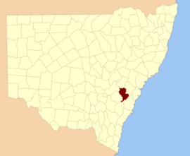
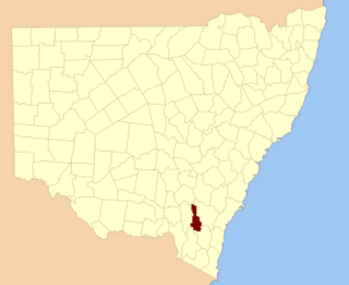
St Vincent County was one of the original Nineteen Counties in New South Wales and is now one of the 141 Cadastral divisions of New South Wales. It included the south coast area encompassing Batemans Bay, Ulladulla, Jervis Bay and inland to Braidwood. The Shoalhaven River is the boundary to the north and west, and the Deua River the boundary to the south.

Cook County, New South Wales Cadastral in New South Wales, Australia

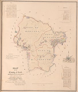
Cook County was one of the original Nineteen Counties in New South Wales and is now one of the 141 Cadastral divisions of New South Wales. It includes the area to the west of Sydney in the Blue Mountains, between the Colo River in the north, and the Coxs River in the south and west, encompassing Lithgow, Mount Victoria, Katoomba, Wentworth Falls, Lawson and most of the other towns in the Blue Mountains. The Nepean River is the border to the east. Before 1834, the area was part of the Westmoreland, Northumberland and Roxburgh counties.

Murray County, New South Wales Cadastral in New South Wales, Australia

Murray County was one of the original Nineteen Counties in New South Wales and is now one of the 141 Lands administrative divisions of New South Wales. It included the area which is now part of Canberra and as far north as Lake George and Yass. It was originally bounded on the west by the Murrumbidgee River, on the east by the Shoalhaven River and on the north by the Yass River. A large area of the county was transferred to the Commonwealth government in 1909 in the Seat of Government Acceptance Act to make part of the Australian Capital Territory, along with land in Cowley County. Since then, the ACT border is now part of the western boundary. Part of the ACT border is determined by property boundaries in the Parish of Keewong, in the County of Murray; specifically the southern end of portions 177, 218, 211, 36, and 38. This is mentioned in the Seat of Government Acceptance Act of 1909.

Argyle County Cadastral in New South Wales, Australia

Argyle County was one of the original Nineteen Counties in New South Wales and is now one of the 141 Cadastral divisions of New South Wales. It includes the area around Goulburn. It is bounded by Lake George in the south-west, the Shoalhaven River in the east, and the Wollondilly River in the north-east.

Roxburgh County Cadastral in New South Wales, Australia

Roxburgh County was one of the original Nineteen Counties in New South Wales and is now one of the 141 Cadastral divisions of New South Wales. It includes the area to the north east of Bathurst, lying to the north and east of the Fish River to the junction of the Turon River. It includes Sofala. The Gudgegong River is the border to the north.

Brisbane County Cadastral in New South Wales, Australia

Brisbane County was one of the original Nineteen Counties in New South Wales and is now one of the 141 Cadastral divisions of New South Wales. It includes Scone, Merriwa and Murrurundi. The Goulburn River is the boundary to the south and the Hunter River the boundary to the south-east. The Liverpool Range area is the boundary to the north, and the Krui River the boundary to the west.

Bligh County Cadastral in New South Wales, Australia

Bligh County was one of the original Nineteen Counties in New South Wales and is now one of the 141 Cadastral divisions of New South Wales. The Cudgegong River and the Goulburn River are its southern boundaries; the Krui River is the eastern boundary, and the Burragundy River the northern boundary. It includes the villages of Cassilis and Dunedoo.

Phillip County Cadastral in New South Wales, Australia

Phillip County was one of the original Nineteen Counties in New South Wales and is now one of the 141 Cadastral divisions of New South Wales. It includes the area to the east of Mudgee and Gulgong. The Cudgegong River is the border to the south-west, and the Goulburn River the border to the north.

Cowley County, New South Wales Cadastral in New South Wales, Australia

Cowley County is one of the 141 Cadastral divisions of New South Wales. It contains the locality of Cavan. It was originally bordered on the north, east and part of the south by the Murrumbidgee River, and on the west by the Goodradigbee River. A large part of the county was transferred to the Commonwealth to make the Australian Capital Territory in 1909, with the remaining part the area to the north-west of the ACT as far north as the Burrinjuck Dam, and thin strips of land along the western, southern and south-eastern borders of the ACT.

Gloucester and Macquarie was an electoral district of the Legislative Assembly in the Australian state of New South Wales in the first and second Parliaments (1856-1859), named after Gloucester and Macquarie counties on the Mid North Coast. It was abolished in 1859 with Macquarie, the north-east of Gloucester and the Macleay River area forming the new district of Electoral district of Hastings, while the rest of Gloucester was split between Lower Hunter, Northumberland and The Williams.

Irrara County Cadastral in New South Wales, Australia

Irrara County is one of the 141 Cadastral divisions of New South Wales. It is located south of the border with Queensland, east of the Paroo River, and west of the Warrego River.

Westmoreland, Bath human settlement in United Kingdom

Westmoreland is an electoral ward in the south-west of Bath, England. It covers an area straddling the border between the localities of Oldfield Park and Twerton, and is bordered to the north by the River Avon.

Electoral district of Counties of Cook and Westmoreland

The Electoral district of Counties of Cook and Westmoreland, also known as the United Midland Counties of Cook and Westmoreland, was an electorate of the New South Wales Legislative Council at a time when some of its members were elected and the balance were appointed by the Governor.

References

  1. "Westmoreland". Geographical Names Register (GNR) of NSW. Geographical Names Board of New South Wales . Retrieved 11 August 2013. OOjs UI icon edit-ltr-progressive.svg