Northumberland County, New South Wales

Last updated

Map all coordinates using: OpenStreetMap  
Download coordinates as: KML
Northumberland
New South Wales
Northumberland NSW.PNG
Location in New South Wales
Lands administrative divisions around Northumberland:
Hunter Durham Gloucester
Hunter Northumberland Pacific Ocean
Cook Cumberland Pacific Ocean

Northumberland County was one of the original Nineteen Counties in New South Wales and is now one of the 141 Cadastral divisions of New South Wales. It included the area to the north of Broken Bay, including Lake Macquarie and Newcastle(Greater Newcastle). It was bounded by the part of the Hawkesbury River to the south, the Macdonald River to the south-west, and the Hunter River to the north.

Northumberland County was named after the English Northumberland, and named by Lieutenant Charles Menzies, commandant at Newcastle, about 1804. [1]

In 1852 it had an area of 1,498,060 acres (6,062.4 km2) and population of 15,207, and was described as being 68 miles (109 km) long and 53 miles (85 km) wide and the main coal region of the colony. [2]

Between 21 July 1948 and 19 December 1963, the county had a local government, the Northumberland County Council, which was abolished at the same time as the Cumberland County Council. [3]

Parishes

Northumberland County contains the following parishes:

ParishLGACoordinatesSuburbs
Allandale Cessnock 32°46′54″S151°23′04″E / 32.78167°S 151.38444°E / -32.78167; 151.38444 (Allandale Parish)
Alnwick Maitland 32°44′54″S151°40′04″E / 32.74833°S 151.66778°E / -32.74833; 151.66778 (Alnwick Parish) Beresfield, Tarro, Morpeth
Auburn Hawkesbury 33°10′54″S150°56′04″E / 33.18167°S 150.93444°E / -33.18167; 150.93444 (Auburn Parish)
Awaba Lake Macquarie 33°01′54″S151°35′04″E / 33.03167°S 151.58444°E / -33.03167; 151.58444 (Awaba Parish) Awaba, Coal Point, Toronto
Bala Cessnock 33°06′54″S150°56′04″E / 33.11500°S 150.93444°E / -33.11500; 150.93444 (Bala Parish)
Belford Singleton 32°37′54″S151°17′04″E / 32.63167°S 151.28444°E / -32.63167; 151.28444 (Belford Parish) Belford
Blaxland Cessnock 33°01′54″S151°03′04″E / 33.03167°S 151.05111°E / -33.03167; 151.05111 (Blaxland Parish)
Branxton Cessnock 32°38′54″S151°22′04″E / 32.64833°S 151.36778°E / -32.64833; 151.36778 (Branxton Parish) Branxton, Greta
Broke Singleton 32°27′24″S151°08′04″E / 32.45667°S 151.13444°E / -32.45667; 151.13444 (Broke Parish) Broke
Burragurra Cessnock 33°03′54″S151°00′04″E / 33.06500°S 151.00111°E / -33.06500; 151.00111 (Burragurra Parish)
Burton Singleton 32°51′54″S150°52′04″E / 32.86500°S 150.86778°E / -32.86500; 150.86778 (Burton Parish)
Cessnock Cessnock 32°50′54″S151°22′04″E / 32.84833°S 151.36778°E / -32.84833; 151.36778 (Cessnock Parish) Cessnock, Aberdare
Congewai Cessnock 32°59′54″S151°15′04″E / 32.99833°S 151.25111°E / -32.99833; 151.25111 (Congewai Parish)
Coolamin Cessnock 32°51′54″S151°08′04″E / 32.86500°S 151.13444°E / -32.86500; 151.13444 (Coolamin Parish)
Coorumbung Lake Macquarie 33°01′54″S151°30′04″E / 33.03167°S 151.50111°E / -33.03167; 151.50111 (Coorumbung Parish) Cooranbong, Dora Creek
Corrabare Cessnock 32°56′24″S151°11′34″E / 32.94000°S 151.19278°E / -32.94000; 151.19278 (Corrabare Parish) Wollombi
Cosgrove Cessnock 32°57′54″S150°52′04″E / 32.96500°S 150.86778°E / -32.96500; 150.86778 (Cosgrove Parish)
Cowan Central Coast 33°26′54″S151°12′04″E / 33.44833°S 151.20111°E / -33.44833; 151.20111 (Cowan Parish) Mooney Mooney
Dalton Singleton 32°49′54″S150°58′04″E / 32.83167°S 150.96778°E / -32.83167; 150.96778 (Dalton Parish)
Dora Cessnock 32°59′54″S151°23′04″E / 32.99833°S 151.38444°E / -32.99833; 151.38444 (Dora Parish) Martinsville
Eglington Central Coast 33°15′54″S151°15′04″E / 33.26500°S 151.25111°E / -33.26500; 151.25111 (Eglington Parish)
Ellalong Cessnock 32°55′54″S151°20′04″E / 32.93167°S 151.33444°E / -32.93167; 151.33444 (Ellalong Parish) Ellalong
Finchley Cessnock 32°59′54″S150°59′04″E / 32.99833°S 150.98444°E / -32.99833; 150.98444 (Finchley Parish)
Gosford Central Coast 33°22′54″S151°20′04″E / 33.38167°S 151.33444°E / -33.38167; 151.33444 (Gosford Parish) Gosford, Narara, Niagara Park
Gosforth Maitland 32°41′54″S151°29′04″E / 32.69833°S 151.48444°E / -32.69833; 151.48444 (Gosforth Parish) Lochinvar, Rutherford, Telarah
Harrowby Singleton 32°45′54″S151°03′04″E / 32.76500°S 151.05111°E / -32.76500; 151.05111 (Harrowby Parish)
Hay Cessnock 33°05′54″S151°11′04″E / 33.09833°S 151.18444°E / -33.09833; 151.18444 (Hay Parish)
Heddon Cessnock 32°46′54″S151°27′04″E / 32.78167°S 151.45111°E / -32.78167; 151.45111 (Heddon Parish) Kurri Kurri, Abermain, Heddon Greta
Hexham Newcastle 32°50′54″S151°39′04″E / 32.84833°S 151.65111°E / -32.84833; 151.65111 (Hexham Parish) Hexham, Minmi, Shortland
Kahibah Lake Macquarie 33°01′54″S151°40′04″E / 33.03167°S 151.66778°E / -33.03167; 151.66778 (Kahibah Parish) Belmont, Cardiff, Charlestown, Glendale, Kahibah, Wallsend
Kincumber Central Coast 33°26′54″S151°25′04″E / 33.44833°S 151.41778°E / -33.44833; 151.41778 (Kincumber Parish) Erina, Kincumber, Terrigal
Lockyer Hawkesbury 33°08′54″S151°02′04″E / 33.14833°S 151.03444°E / -33.14833; 151.03444 (Lockyer Parish)
Maitland Maitland 32°44′54″S151°35′04″E / 32.74833°S 151.58444°E / -32.74833; 151.58444 (Maitland Parish) Maitland, Ashtonfield, Bolwarra, Tenambit, Metford
Mandolong Lake Macquarie 33°08′54″S151°26′04″E / 33.14833°S 151.43444°E / -33.14833; 151.43444 (Mandolong Parish) Mandalong
Mangrove Central Coast 33°22′24″S151°05′04″E / 33.37333°S 151.08444°E / -33.37333; 151.08444 (Mangrove Parish)
Milbrodale Singleton 32°58′54″S150°45′04″E / 32.98167°S 150.75111°E / -32.98167; 150.75111 (Milbrodale Parish) Milbrodale
Millfield Cessnock 32°48′54″S151°15′04″E / 32.81500°S 151.25111°E / -32.81500; 151.25111 (Millfield Parish)
Morisset Lake Macquarie 33°06′54″S151°30′04″E / 33.11500°S 151.50111°E / -33.11500; 151.50111 (Morisset Parish) Morisset, Sunshine, Wyee
Moruben Cessnock 33°02′54″S150°53′04″E / 33.04833°S 150.88444°E / -33.04833; 150.88444 (Moruben Parish)
Mulbring Cessnock 32°55′54″S151°28′04″E / 32.93167°S 151.46778°E / -32.93167; 151.46778 (Mulbring Parish) Mulbring
Munmorah Central Coast 33°19′54″S151°25′04″E / 33.33167°S 151.41778°E / -33.33167; 151.41778 (Munmorah Parish) Gorokan, Lake Haven, Warnervale, Wyong
Narara Central Coast 33°20′54″S151°22′34″E / 33.34833°S 151.37611°E / -33.34833; 151.37611 (Narara Parish) Somersby
Newcastle Newcastle 32°51′54″S151°43′04″E / 32.86500°S 151.71778°E / -32.86500; 151.71778 (Newcastle Parish) Newcastle, Hamilton, Kotara, Mayfield, Waratah
Olney Central Coast 33°07′54″S151°20′04″E / 33.13167°S 151.33444°E / -33.13167; 151.33444 (Olney Parish)
Ourimbah Central Coast 33°19′54″S151°20′04″E / 33.33167°S 151.33444°E / -33.33167; 151.33444 (Ourimbah Parish) Ourimbah
Ovingham Cessnock 32°45′54″S151°13′04″E / 32.76500°S 151.21778°E / -32.76500; 151.21778 (Ovingham Parish)
Patonga Central Coast 33°28′54″S151°15′04″E / 33.48167°S 151.25111°E / -33.48167; 151.25111 (Patonga Parish) Woy Woy, Kariong, Patonga, Point Clare
Pokolbin Cessnock 32°48′54″S151°18′04″E / 32.81500°S 151.30111°E / -32.81500; 151.30111 (Pokolbin Parish) Pokolbin
Popran Central Coast 33°19′54″S151°11′04″E / 33.33167°S 151.18444°E / -33.33167; 151.18444 (Popran Parish) Central Mangrove
Quorrobolong Cessnock 32°55′54″S151°22′04″E / 32.93167°S 151.36778°E / -32.93167; 151.36778 (Quorrobolong Parish) Quorrobolong
Rothbury Cessnock 32°45′54″S151°18′04″E / 32.76500°S 151.30111°E / -32.76500; 151.30111 (Rothbury Parish) Rothbury
Rugby Central Coast 33°09′54″S151°09′04″E / 33.16500°S 151.15111°E / -33.16500; 151.15111 (Rugby Parish)
Spencer Central Coast 33°25′24″S151°06′04″E / 33.42333°S 151.10111°E / -33.42333; 151.10111 (Spencer Parish) Spencer
St Albans Hawkesbury 33°18′54″S151°02′04″E / 33.31500°S 151.03444°E / -33.31500; 151.03444 (St Albans Parish) St Albans
Stanford Cessnock 32°50′54″S151°27′04″E / 32.84833°S 151.45111°E / -32.84833; 151.45111 (Stanford Parish) Stanford Merthyr, Kearsley
Stockrington Cessnock 32°49′54″S151°34′04″E / 32.83167°S 151.56778°E / -32.83167; 151.56778 (Stockrington Parish) Buchanan
Stowe Central Coast 33°10′54″S151°14′04″E / 33.18167°S 151.23444°E / -33.18167; 151.23444 (Stowe Parish) Kulnura
Teralba Lake Macquarie 32°54′54″S151°34′04″E / 32.91500°S 151.56778°E / -32.91500; 151.56778 (Teralba Parish) Cameron Park, Killingworth, Teralba, Edgeworth
Tuggerah Central Coast 33°19′54″S151°30′04″E / 33.33167°S 151.50111°E / -33.33167; 151.50111 (Tuggerah Parish) Bateau Bay, The Entrance, Tuggerah
Vere Singleton 32°41′54″S151°09′04″E / 32.69833°S 151.15111°E / -32.69833; 151.15111 (Vere Parish)
Wallambine Hawkesbury 33°13′54″S151°00′04″E / 33.23167°S 151.00111°E / -33.23167; 151.00111 (Wallambine Parish)
Wallarah Central Coast 33°09′54″S151°36′04″E / 33.16500°S 151.60111°E / -33.16500; 151.60111 (Wallarah Parish) Budgewoi, Caves Beach, Swansea, Toukley
Warkworth Singleton 32°35′54″S151°03′04″E / 32.59833°S 151.05111°E / -32.59833; 151.05111 (Warkworth Parish) Warkworth
Werong Singleton 32°54′54″S150°57′04″E / 32.91500°S 150.95111°E / -32.91500; 150.95111 (Werong Parish)
Whittingham Singleton 32°36′54″S151°10′04″E / 32.61500°S 151.16778°E / -32.61500; 151.16778 (Whittingham Parish) Whittingham
Wollombi Singleton 32°40′54″S151°04′04″E / 32.68167°S 151.06778°E / -32.68167; 151.06778 (Wollombi Parish)
Wyong Central Coast 33°14′54″S151°22′04″E / 33.24833°S 151.36778°E / -33.24833; 151.36778 (Wyong Parish) Dooralong, Jilliby
Yango Cessnock 32°55′54″S151°05′04″E / 32.93167°S 151.08444°E / -32.93167; 151.08444 (Yango Parish)

Related Research Articles

Northumberland County of England

Northumberland is a county in Northern England, one of two counties in England which border with Scotland. Notable landmarks in the county are Alnwick Castle, Bamburgh Castle and Hadrian's Wall.

Tyne and Wear Metropolitan county in North East England

Tyne and Wear is a metropolitan county in North East England, situated around the mouths of the rivers Tyne and Wear. It was created in 1974, by the Local Government Act 1972, along with five metropolitan boroughs of Gateshead, Newcastle upon Tyne, Sunderland, North Tyneside and South Tyneside. It is bordered by Northumberland to the north and Durham to the south; the county boundary was formerly split between these counties with the border as the River Tyne.

Ceredigion County in Wales

Ceredigion is a county in the west of Wales, corresponding to the historic county of Cardiganshire. During the second half of the first millennium Ceredigion was a minor kingdom. It has been administered as a county since 1282. Ceredigion is considered a centre of Welsh culture and more than half the population can speak Welsh. The county is mainly rural with over 50 miles (80 km) of coastline and a mountainous hinterland. The numerous sandy beaches and the long-distance Ceredigion Coast Path provide excellent views of Cardigan Bay.

Montgomeryshire Historic county of Wales

Montgomeryshire, also known as Maldwyn, is one of thirteen historic counties and a former administrative county of Wales. It is named after its county town, Montgomery, which in turn is named after one of William the Conqueror's main counsellors, Roger de Montgomerie, who was the 1st Earl of Shrewsbury.

Bridgend Town in Wales

Bridgend is a town in Bridgend County Borough in Wales, 20 miles (32 km) west of Cardiff and 20 miles (32 km) east of Swansea. The town is named after the medieval bridge over the River Ogmore. The River Ewenny also flows through the town.

Hexham, New South Wales Suburb of Newcastle, New South Wales, Australia

Hexham is a suburb of the city of Newcastle, about 15 km (9 mi) inland from the Newcastle CBD in New South Wales, Australia on the bank of the Hunter River.

Port Stephens (New South Wales) Estuarine lake in New South Wales, Australia

Port Stephens, an open youthful tide-dominated drowned-valley estuary, is a large natural harbour of approximately 134 square kilometres (52 sq mi) located in the Hunter Region of New South Wales, Australia.

Haltwhistle Human settlement in England

Haltwhistle is a market town and civil parish in Northumberland, England, 10 miles (16 km) east of Brampton. It had a population of 3,811 at the 2011 Census.

Bucketts Way

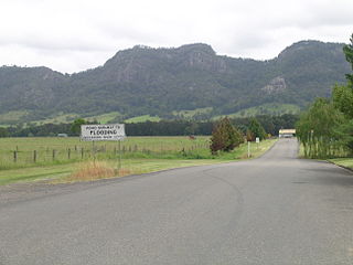
The Bucketts Way is a 151-kilometre (94 mi) rural road that links Gloucester to Taree and Raymond Terrace, in New South Wales, Australia. It was named after the Bucketts Mountains, a prominent mountain range near Gloucester. Between 1928 and 1952 the Bucketts Way served as the alignment of the Pacific Highway between Raymond Terrace and Taree. The entire route is designated as Tourist Drive TD2.

Greta, New South Wales Town in New South Wales, Australia

Greta is a small town in the Hunter Region of New South Wales, Australia.

Karuah, New South Wales Suburb of Port Stephens Council, New South Wales, Australia

Karuah is a locality in both the Port Stephens and Mid-Coast Councils in the Hunter Region of New South Wales, Australia. It is thought that the name means 'native plum tree' in the local Aboriginal dialect.

Fern Bay, New South Wales Suburb of Port Stephens Council, New South Wales, Australia

Fern Bay is the southernmost suburb of the Port Stephens local government area in the Hunter Region of New South Wales, Australia. It is located just north of Stockton, which is the only suburb of Newcastle that lies north of the Hunter River and to the east of the north arm of the Hunter River at the entrance to Fullerton Cove, a large body of water. To the east is the Tasman Sea. Despite the suburb only being 6 kilometres (3.7 mi) in a direct line from Newcastle, the need to cross the Hunter River results in Fern Bay being 16 km (9.9 mi) by road from the centre of the city.

Lands administrative divisions of New South Wales

For lands administrative purposes, New South Wales is divided into 141 counties, which are further divided into parishes. The counties were first set down in the Colony of New South Wales, which later became the Australian state of New South Wales.

Camden County, New South Wales Cadastral in New South Wales, Australia

Camden County was one of the original Nineteen Counties in New South Wales and is now one of the 141 Cadastral divisions of New South Wales. It included the coastal area near Wollongong south to the Shoalhaven River, and also inland encompassing Berrima and Picton. Its western boundary was the Wollondilly River. The first settlement in the area was Camden Park, established by John Macarthur in 1806, just across the Nepean River from Cumberland County. It was the first land across the Nepean to be settled. Camden is a present-day suburb of Sydney in the same area, although parts of it are in Cumberland.

St Vincent County Cadastral in Australian Capital Territory

St Vincent County was one of the original Nineteen Counties in New South Wales and is now one of the 141 Cadastral divisions of New South Wales. It included the south coast area encompassing Batemans Bay, Ulladulla, Jervis Bay and inland to Braidwood. The Shoalhaven River is the boundary to the north and west, and the Deua River the boundary to the south.

Argyle County Cadastral in New South Wales, Australia

Argyle County was one of the original Nineteen Counties in New South Wales and is now one of the 141 Cadastral divisions of New South Wales. It includes the area around Goulburn. It is bounded by Lake George in the south-west, the Shoalhaven River in the east, and the Wollondilly River in the north-east.

Bathurst County Cadastral in New South Wales, Australia

Bathurst County was one of the original Nineteen Counties in New South Wales and is now one of the 141 Cadastral divisions of New South Wales. It includes the area to the south-west of Bathurst to Cowra and Orange. The Lachlan River is the boundary to the south-west, the Belubula River forms part of the northern boundary, with the Fish River on the northeastern boundary. Blayney is located roughly in the middle.

Auckland County Cadastral in New South Wales, Australia

Auckland County is one of the 141 cadastral divisions of New South Wales. It is at the extreme south-east of the state, with the Victorian border to the south, and the area to the north of the Brogo River the boundary to the north. It includes Bega, Eden and Merimbula.

Slaggyford Human settlement in England

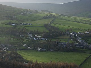
Slaggyford is a village in Northumberland, England about 5 miles (8 km) north of Alston, Cumbria.

Stratford, New South Wales Suburb of Mid-Coast Council, New South Wales, Australia

Stratford is a rural locality in the Mid-Coast Council local government area in the Hunter Region of New South Wales, Australia. The largest population centre in the area is the town of Stratford, which is approximately 14 kilometres (9 mi) south of Gloucester and 109 km (68 mi) north of Newcastle. Stratford, which is next to the Avon River, is on Bucketts Way, 66 km (41 mi) from the Pacific Highway, the nearest major highway.

References

  1. "Northumberland County". Geographical Names Register (GNR) of NSW. Geographical Names Board of New South Wales. OOjs UI icon edit-ltr-progressive.svg
  2. "Old Welsh Books with English Translations", The Land of Gold: the Companion for the Welsh Emigrant to Australia, 1852
  3. Archives Investigator NSW Archived September 7, 2007, at the Wayback Machine