Heber-Overgaard is a census-designated place (CDP) in Navajo County, Arizona, United States. Situated atop the Mogollon Rim, the community lies at an elevation of 6,627 feet (2,020 m). The population was 2,898 at the 2020 census. Heber and Overgaard are technically two unincorporated communities, but as of the 1990 census, their proximity led to the merged name of "Heber-Overgaard".

Holbrook is a city in Navajo County, Arizona, United States. According to the 2010 census, the population of the city was 5,053. The city is the county seat of Navajo County.

Adam-ondi-Ahman is a historic site in Daviess County, Missouri, about five miles south of Jameson. It is located along the east bluffs above the Grand River. According to the teachings of The Church of Jesus Christ of Latter-day Saints, it is the site where Adam and Eve lived after being expelled from the Garden of Eden. It teaches that the place will be a gathering spot for a meeting of the priesthood leadership, including prophets of all ages and other righteous people, prior to the Second Coming of Jesus Christ.

Winter Quarters was an encampment formed by approximately 2,500 members of the Church of Jesus Christ of Latter-day Saints as they waited during the winter of 1846–47 for better conditions for their trek westward. It followed a preliminary tent settlement some 3½ miles west at Cutler's Park. Members of the LDS faith built more than 800 cabins at the Winter Quarters settlement. Located in present-day North Omaha overlooking the Missouri River, the settlement remained populated until 1848.

Lot Smith was a Mormon pioneer, soldier, lawman and American frontiersman. He became known as "The Horseman" for his exceptional skills on horseback as well as for his help in rounding up wild mustangs on Utah's Antelope Island. He is most famous for his exploits during the 1857 Utah War.

Brigham Young Jr. served as president of the Quorum of the Twelve Apostles of the Church of Jesus Christ of Latter-day Saints from 1899 until his death. His tenure was interrupted for one week in 1901 when Joseph F. Smith was the president of the Quorum.

Pipe Spring National Monument is a United States National Monument located in the U.S. state of Arizona, rich with American Indian, early explorer, and Mormon pioneer history. Administered by the National Park Service, Pipe Spring was listed on the National Register of Historic Places on October 15, 1966, and the boundaries of the Pipe Spring National Monument Historic District were expanded in October 2000.
The Mormon Reformation was a period of renewed emphasis on spirituality within the Church of Jesus Christ of Latter-day Saints, and a centrally-directed movement, which called for a spiritual reawakening among church members. It took place during 1856 and 1857 and was under the direction of church president Brigham Young. During the Reformation, Young sent his counselor, Jedediah M. Grant, and other church leaders to preach to the people throughout Utah Territory and surrounding Latter-day Saint communities with the goal of inspiring them to reject sin and turn towards spiritual things. During this time, some of the most conservative or reactionary elements of LDS Church doctrine came to dominate public discussion. As part of the Reformation, almost all "active" or involved LDS Church members were rebaptized as a symbol of their commitment. The Reformation is considered in three phases: a structural reform phase, a phase of intense demand for a demonstration of spiritual reform, and a final phase during which an emphasis was placed on love and reconstruction.

Jonathan Golden Kimball was a leader of the Church of Jesus Christ of Latter-day Saints, serving as a member of the First Council of the Seventy from 1892 until his death in 1938. He is considered one of the most colorful and beloved of the church's general authorities. In the years since his death, "Uncle Golden" has become a near legendary character among church members, possibly comparable to what Will Rogers or Mark Twain are to the general American public.

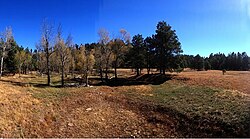
Pinedale is an unincorporated community in Navajo County, Arizona, United States. The population was 487 at the 2010 census. The elevation is approximately 6,500 ft (2,000 m) and it is part of the Mogollon Rim mountain range.

Jacob Lake is a small unincorporated community on the Kaibab Plateau in Coconino County, Arizona, United States, at the junction of U.S. Route 89A and State Route 67. Named after the Mormon explorer Jacob Hamblin, the town is known as the "Gateway to the Grand Canyon" because it is the starting point of Route 67, the only paved road leading to the North Rim of the Grand Canyon some 44 miles (71 km) to the south. The town itself consists of the Jacob Lake Inn which maintains motel rooms and cabins, a restaurant, lunch counter, gift shop, bakery, and general store; a gas station/garage; campground; and a visitors center run by the U.S. Forest Service. In the summer months, there is also a nearby center for horse rides.

George Homer Durham was an American academic administrator and was a general authority of the Church of Jesus Christ of Latter-day Saints from 1977 until his death.

Zera Pulsipher was a First Seven Presidents of the Seventy of the Church of Jesus Christ of Latter-day Saints. In that capacity, he provided leadership to the early Mormon community, most notably in the exodus of a large group of Saints from Kirtland, Ohio. He was also an active missionary who baptized Wilford Woodruff into the LDS Church.

The Church of Jesus Christ of Latter-day Saints is the second-largest religious denomination in Arizona, behind the Roman Catholic Church. In 2022, the church reported 439,411 members in Arizona, about 6% of the state's population. According to the 2014 Pew Forum on Religion & Public Life survey, roughly 5% of Arizonans self-identify most closely with the Church of Jesus Christ of Latter-day Saints.

Samuel Claridge was a member of the Church of Jesus Christ of Latter-day Saints who was a prominent early settler of the Muddy River Valley in Nevada and Thatcher, Arizona.

Aztec Land and Cattle Company, Limited ("Aztec") is a land company with a historic presence in Arizona. It was formed in 1884 and incorporated in early 1885 as a cattle ranching operation that purchased 1,000,000 acres in northern Arizona from the Atlantic & Pacific Railroad. It then imported approximately 32,000 head of cattle from Texas and commenced ranching operations in Arizona. Because Aztec's brand was the Hashknife, a saddler's knife used on early day ranches, the company was known more famously as The Hashknife Outfit. The company has been in continuous existence since 1884.

Zeniff, Arizona was a town in Navajo County, Arizona located approximately 15 miles SW of Holbrook, Arizona off SR 377, near "Dry Lake".

The following outline is provided as an overview of and a topical guide to the Church of Jesus Christ of Latter-day Saints.