Activities
The park has modern camping facilities, with amenities for boating, swimming, and picnic. Water activities on Sturgeon Lake include canoeing, kayaking, fishing, ice fishing, power boating, water skiing, windsurfing, and swimming. 20 km of trails are maintained for front country hiking in the summer and cross-country skiing in winter.
Fishing on Sturgeon Lake for Burbot, Iowa Darter, Lake Whitefish, Longnose Sucker, Northern Pike, Spottail Shiner, Walleye, White Sucker, and Yellow Perch.
Camping
A campground is located at Young's Point Main, along with a boat launch facility and day-use area at Young's Point Beach. Camping facilities are operational from May 1 to September 30.
Calling Lake Provincial Park is a provincial park in Alberta, Canada. It is a boreal forest reserve located 55 km (34 mi) north of Athabasca on Highway 813, and 186 km (116 mi) north of Edmonton, on the southern shore of Calling Lake. The marshy shores of the lake provide nesting grounds for waterfowl and habitat for American white pelicans and great blue herons.

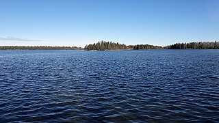
Cold Lake Provincial Park is a provincial park in northeastern Alberta, Canada.
Crimson Lake Provincial Park is a provincial park located in Alberta, Canada, 14 kilometres (8.7 mi) west of Rocky Mountain House, off the David Thompson Highway along secondary highway 756.
Cross Lake Provincial Park is a provincial park in Alberta, Canada, located 62 km (39 mi) west from Athabasca and 57 km (35 mi) north of Westlock.
Garner Lake Provincial Park is a provincial park around Garner Lake in Alberta, Canada.

Gregoire Lake Provincial Park is a provincial park in Alberta, Canada. It is located close to Highway 63, between Fort McMurray and Lac La Biche, on the northern shore of Gregoire Lake.
Hilliard's Bay Provincial Park is a provincial park in Alberta, Canada. It is located 40 km (25 mi) from High Prairie, on the north-western shore of Lesser Slave Lake in northern Alberta.
Little Bow Provincial Park is a provincial park located near the town of Vulcan and the village of Champion in Alberta, Canada.
Long Lake Provincial Park is a provincial park located in Alberta, Canada. Long Lake is located one and one half hours from Edmonton along Highway 831, south of the village of Boyle and northeast of the hamlet of Newbrook, within Thorhild County.
Park Lake Provincial Park is a provincial park located in Alberta, Canada, 18 km (11 mi) north of Lethbridge.
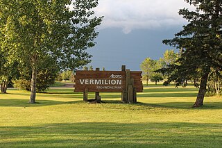
Vermilion Provincial Park is a provincial park located in east-central Alberta, Canada, in the County of Vermilion River. It is located on the outskirts of the town of Vermilion, which is at the junction of Highways 16 (Yellowhead) and 41, between Edmonton and Lloydminster.

Wabamun Lake Provincial Park is a provincial park in Alberta, Canada.

William A. Switzer Provincial Park is a provincial park in Alberta, Canada.

Williamson Provincial Park is a small provincial park in northwestern Alberta, Canada.

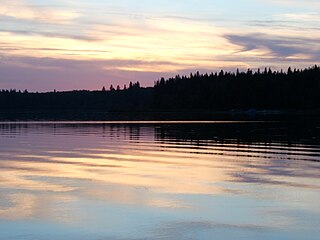
Thunder Lake Provincial Park is a provincial park located in Alberta, Canada, and is located 140 kilometres (87 mi) west of Edmonton, on the shore of the park features setting for boating, water-skiing, swimming, running, fishing and camping. Thunder lake is approximately 21 kilometres (13 mi) West of the nearest town, Barrhead.
Sturgeon Lake is a lake in north-western Alberta, Canada. It has a total area of 49.1 km2 (19.0 sq mi) and a maximum depth of 9.5 m (31 ft). It is located in the hydrographic basin of the Little Smoky River at an elevation of 685 m, 20 km west of the town of Valleyview, along Highway 43.

Dillberry Lake Provincial Park is a provincial park in Alberta, Canada, located 43 km (27 mi) north from Provost and 17 km (11 mi) south of Chauvin along Highway 17.
Moose Lake Provincial Park is a provincial park in northern Alberta, Canada, located 15 km (9.3 mi) west of Bonnyville.
Iosegun Lake is a lake in northwest Alberta within the Municipal District of Greenview No. 16. It is located north of Fox Creek, approximately 11 km (6.8 mi) from Highway 43.
Smoke Lake is a lake in northwest Alberta within the Municipal District of Greenview No. 16. It is located southwest of Fox Creek, approximately 9 km (5.6 mi) from Highway 43.
This page is based on this
Wikipedia article Text is available under the
CC BY-SA 4.0 license; additional terms may apply.
Images, videos and audio are available under their respective licenses.