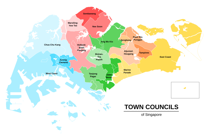
A town council, city council or municipal council is a form of local government for small municipalities.

Ang Mo Kio is a planning area and residential town situated in the North-East of Singapore. Located approximately 11 km (6.8 mi) north of the Downtown Core district, Ang Mo Kio is the 3rd most populated planning area in the North-East Region and ranks 8th in terms of population in the country overall. The planning area is located at the south-western corner of the North-East Region, bordered by the planning areas of Yishun to the north, Sengkang to the north-east, Serangoon to the east, Bishan to the south and the Central Water Catchment to the west.

The Housing & Development Board (HDB) or often referred to as the Housing Board, is a statutory board under the Ministry of National Development responsible for Singapore's public housing. Founded in 1960 as a result of efforts in the late 1950s to set up an authority to take over the Singapore Improvement Trust's (SIT) public housing responsibilities, the HDB focused on the construction of emergency housing and the resettlement of kampong residents into public housing in the first few years of its existence.
Clementi is a planning area and residential town located at the easternmost fringe of the West Region of Singapore. The town borders Bukit Batok to the north, Bukit Timah to the northeast, Queenstown to the east and Jurong East to the west.

Kallang is a planning area and residential town located in the Central Region of Singapore.
Bukit Batok, often abbreviated as Bt Batok, is a planning area and matured residential town located along the eastern boundary of the West Region of Singapore. Bukit Batok statistically ranks in as the 25th largest, the 12th most populous and the 11th most densely populated planning area in the Republic. It is bordered by six other planning areas - Choa Chu Kang to the North, northeast and northwest, Cashew to the northeast and east, Clementi to the south, Bukit Timah to the southeast, Jurong East to the southwest and Tengah to the west.

Bedok is a planning area and matured residential town located in the geographical region of Tanah Merah along the south-eastern coast of the East Region of Singapore. Bedok is bounded by five other planning areas: Paya Lebar to the north, Hougang to the northwest, Tampines to the northeast and east, Geylang to the west and Marine Parade to the southwest. It also shares a maritime boundary with the Singapore Strait to the south and southeast.
Bukit Merah, also known as Redhill, is a planning area and new town situated in the southernmost part of the Central Region of Singapore. the planning area borders Tanglin to the north, Queenstown to the west and the Downtown Core, Outram and Singapore River planning areas of the Central Area to the east.

Jurong West is a planning area and residential town located in the West Region of Singapore. Jurong West shares boundaries with Tengah in the north, Jurong East in the east, Boon Lay and Pioneer in the south, and Western Water Catchment in the west.

The People's Association (PA) is a statutory board under the Ministry of Culture, Community and Youth (MCCY) of the Government of Singapore that oversees neighbourhood grassroots communities and social organisations. Established in 1960, it was part of a nation-building programme to promote social cohesion and multiracialism.

Sengkang is a planning area and residential town located in the North-East Region of Singapore. The town is the second most populous in the region, being home to 249,370 residents in 2020. Sengkang shares boundaries with Seletar and Punggol in the north, Pasir Ris and Paya Lebar in the east, Hougang and Serangoon to the south, as well as Yishun and Ang Mo Kio to the west.

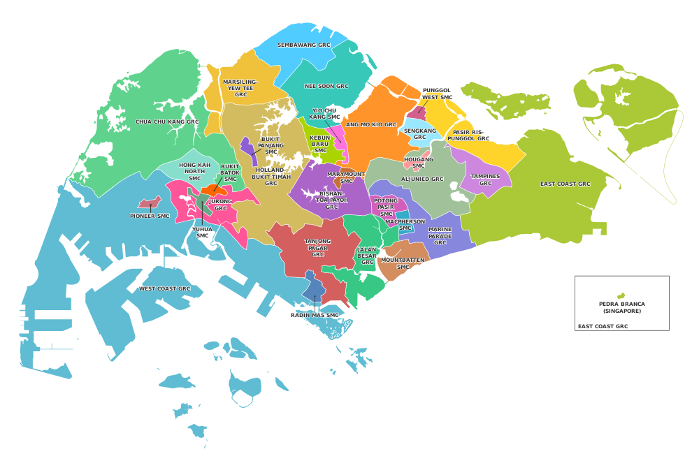
The Bukit Panjang Single Member Constituency is a Single Member Constituency (SMC) located in the western area of Singapore. The current Member of Parliament for the constituency is Liang Eng Hwa of the People's Action Party (PAP).

The Hougang Single Member Constituency is a single member constituency (SMC) located in the north-eastern area of Singapore. Its current Member of Parliament is Dennis Tan Lip Fong of the Workers' Party (WP).

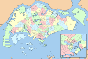
A group representation constituency (GRC) is a type of electoral division or constituency in Singapore in which teams of candidates, instead of individual candidates, compete to be elected into Parliament as the Members of Parliament (MPs) for the constituency. The Government stated that the GRC scheme was primarily implemented to enshrine minority representation in Parliament: at least one of the MPs in a GRC must be a member of the Malay, Indian or another minority community of Singapore. In addition, it was economical for town councils, which manage public housing estates, to handle larger constituencies.
Teo Ho Pin is a Singaporean former politician who served as Mayor of North West District between 2001 and 2020.
Whampoa Single Member Constituency was a single member constituency (SMC) located in the eastern region of Singapore. The constituency covers the main area of Whampoa.

The Sengkang Group Representation Constituency is a four-member Group Representation Constituency (GRC) in the north-eastern region of Singapore. The GRC consists of four divisions: Anchorvale, Rivervale, Buangkok, and Compassvale; Compassvale was subsumed into the other three following the resignation of its MP, Raeesah Khan. The current Members of Parliament are He Ting Ru, Jamus Lim and Louis Chua from the Workers' Party (WP).
The Punggol West Single Member Constituency is a Single Member Constituency located in the north-eastern area of Singapore formed in 2020. The current Member of Parliament (MP) is Sun Xueling of the People's Action Party (PAP).
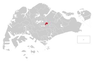
The Marymount Single Member Constituency is a single member constituency (SMC) located in the central area of Singapore formed in 2020. The current Member of Parliament (MP) is Gan Siow Huang of the People's Action Party (PAP).