Bradford Beck

Last updated

Bradford Beck
The subterranean Cathedral arches of Bradford - geograph.org.uk - 1035566.jpg
The Cathedral arches beneath Centenary Square
EtymologyBroad Ford Beck
Location
CountryEngland
CityBradford, West Yorkshire
Physical characteristics
Source 
  locationClayton Beck, Cemetery Road, Lidget Green
  coordinates 53°47′42″N1°47′31″W / 53.79513°N 1.79189°W / 53.79513; -1.79189
  elevation120 metres (390 ft)
Mouth  
  location
Dockfield, Shipley, West Yorkshire
  coordinates
53°50′15″N1°46′20″W / 53.83744°N 1.77212°W / 53.83744; -1.77212
  elevation
70 metres (230 ft)
Length6.8 miles (11 km)
Basin size22 square miles (58 km2)
Discharge 
  locationShipley
  average21 cubic feet per second (0.6 m3/s)
  maximum1,210 cubic feet per second (34.3 m3/s) (1984)
Basin features
River system River Aire
Tributaries 
  leftRed Beck
  rightWestbrook, Bowling Beck, Eastbrook, Trap Sike
Bradford Beck
BSicon uexCONTfa.svg
Clayton Beck
BSicon uexSKRZ-Yu.svg
Cemetery Road
BSicon uexSKRZ-Ru.svg
A6177 Bradford Ring Road
BSicon uextSTRa.svg
Underneath Listerhills area
BSicon uextABZgl.svg
BSicon uextCONTfq.svg
Goitside millrace branch
BSicon uextSTRe.svg
BSicon uexTUNNEL1.svg
BSicon uexCONTfaq.svg
BSicon uexABZg+r.svg
Westbrook
BSicon uextSTRa.svg
Underneath city centre
BSicon uextCONTfaq.svg
BSicon uextABZg+r.svg
Bowling Beck
BSicon uextCONTfaq.svg
BSicon uextABZg+r.svg
Eastbrook
BSicon uextSTRe.svg
BSicon uexSKRZ-Yu.svg
Valley Road
BSicon RRq.svg
BSicon uexTUNNEL1.svg
Under eastern A6177
BSicon uexCONTfaq.svg
BSicon uexABZg+r.svg
Trap Sike
BSicon uexTUNNEL1.svg
BSicon uexSKRZ-Yu.svg
Gaisby Lane
BSicon uexSKRZ-Yu.svg
Poplar Road
BSicon uexTUNNEL1.svg
BSicon uexABZg+l.svg
BSicon uexCONTgeq.svg
Red Beck
BSicon uexSKRZ-Yu.svg
B6149 Briggate
BSicon dCONTgq.svg
BSicon uxmKRZu.svg
BSicon dCONTfq.svg
Bradford to Ilkley & Leeds line
BSicon dCONTgq.svg
BSicon uxmKRZu.svg
BSicon dCONTfq.svg
Skipton to Leeds line
BSicon uexSKRZ-Ru.svg
A657 Saltaire to Bramley road
BSicon uCONTgq.svg
BSicon uxKRZu.svg
BSicon uCONTfq.svg
Leeds Liverpool Canal
BSicon uexSKRZ-Yu.svg
Dockfield Road
BSicon uexCONTgq.svg
BSicon uexABZqr.svg
BSicon uexCONTgeq.svg
Dockfield (into the River Aire)

Bradford Beck is a river that flows through Bradford, West Yorkshire, England, (then Bradford Dale) and on to the River Aire at Shipley. As it reaches Bradford city centre it runs underground after being built over in the 19th century. It is culverted as it runs from Bradford city centre to Queen's Road after which it runs mostly in an open channel to Shipley. [1] The beck used to be known as the filthiest river in England.

Contents

Bradford itself is so named after a crossing on Bradford Beck (the Broad Ford) which was located near to what is present day Church Street in the city centre, with a crossing named as Broadstones. [2] The beck is formed from a number of smaller watercourses, namely Pinch Beck, Pitty Beck, Middlebrook, Clayton Beck, Bull Greave Beck, Chellow Dene Beck, Westbrook, Dirkhill Beck, Bowling Beck, Eastbrook, Bolton Beck, Trap Sike, Northcliffe Beck and Red Beck. [3]

History

Anglo-Saxon Bradford was centred around a point where at least three streams converged. This was the site of two crossings – Ive Bridge and Church Bridge, where the parish church was located (later to become Bradford Cathedral). [4] In medieval times, the waters from one of the streams feeding Bradford Beck were redirected to power mills in what is now the Sunbridge and Thornton Road areas. This section west of the city centre is known as Goitside. [5]

A site north west of the parish church was the place where a ducking stool was kept on the beck. This was for the punishment of scolding and unruly women. [6] On the eventual opening of the Bradford Arm of the Leeds and Liverpool Canal, the stool was removed and used on the canal instead. [7] Water from Bradford Beck was used to supplement the low feedwaters going into the canal, however the canal was only supposed to take water from Bowling Beck, but as this proved insufficient, the polluted waters from Bradford Beck were used also. This turned the Bradford Canal into an open sewer. [8] The pollution in the beck during the 19th century was legendary with it being described as the filthiest river in England, [9] and Friedrich Engels described the beck in the 1840s as a "coal-black, foul-smelling stream". [10]

The canal was subject to sulphureted hydrogen (hydrogen sulphide) bubbling up to the surface (especially in summer) and this condition made it very dangerous with at least one occasion when the canal was set alight. [11] After complaints, specifically from those living and working on the Aire just east of Shipley, the Bradford Corporation was forced to act. [12] They first set up a sewage plant at Frizinghall and then when this proved insufficient (after more communities became part of Bradford) another plant was opened up at Esholt. [13]

The beck underwent a flood alleviation scheme in the early 1990s. [14] A 12-foot (3.7 m) tunnel [15] was constructed that runs west of Bradford Beck and the city centre and emerges in an open section into Bradford Beck near to Canal Road. [16]

Despite the re-direction of sewage into brick lined channels and pipes in the 19th century, [17] the beck remains polluted still. This is because of the numerous combined sewer overflow (CSO) points and other misconnected foul and drainage sewers. [18] In 2018, it was reported that the beck had turned yellow due to pollutive waste from some of the curry houses in the city. It was noted that the establishments in question were not actively throwing their waste into the beck, but the simple act of washing up combined with the misconnected wastewater pipes meant that the beck was polluted again. [19]

The beck is still unsuited to hosting wildlife, but after the Friends of Bradford's Becks set up a regeneration and cleaning programme for the beck in 2013, the waters are cleaner than they have been for a long time. The issue with the lack of wildlife now is that as the beck was culverted, it runs very fast through concrete and stone channels and as such the water flow is too fast to sustain much of the wildlife that would normally inhabit a beck of this size. The Friends of Bradford's Becks are wanting to rectify this by remodelling some of the lower reaches of the beck where it is exposed to daylight and slowing the water flow down by adding in bends. [20]

Description of route

The Environment Agency has determined that the watershed for Bradford Beck is 22 square miles (58 km2) [21] and has divided the beck into two sections; the upper part is actually Clayton Beck and the urban part (Bradford Beck proper) is from where Clayton Beck passes underneath Cemetery Road in Bradford at Lidget Green. [22] From here to the outfall point into the River Aire at Shipley it is 6.8 miles (11 km). [23]

Where the route passes through Bradford city centre in a culvert, it is to be marked by a series of carved plaques set into the ground by the Friends of Bradford's Becks. [24] The first three plaques were unveiled inside and just outside The Broadway shopping centre at the end of 2015, [25] [26] and the rest are to be installed during 2016. The beck runs eastwards from the Bradford moorland and in the vicinity of the cathedral, it meets Bowling Beck and Eastbrook [27] before it turns 90° to the north. [28]

After the city centre, there are some open air sections, but the beck is mostly covered over until Queen's Road. Thereafter to Shipley, the beck is largely exposed and accompanied by signage warning of contaminated water. The Friends of Bradford's Becks have amended these signs to take away the negative effect of their warnings as the water is of a better quality now than when the signs were erected in the 1970s. [29] The beck passes underneath the railway lines at the east end of Shipley railway station and the A657 road at the same point and enters the south side of the River Aire at Dockfield in Shipley. The average flow into the River Aire is 21 cubic feet per second (0.6 m3/s) with one extreme flood event in 1984 recording an outflow of 1,210 cubic feet per second (34.3 m3/s). [30]

Ecology and environment

In 2009, the Environment Agency classified the beck as being of good chemical, but poor ecological quality. A 2012 survey of the water and its tributaries, found high levels of Phosphates, Ammonia and metals present in the water. Combined Sewer Overflows (CSOs) along the beck and crucially further upstream, allow runoff and pollutants to enter the watercourse particularly in times of high rainfall and flood. [31]

A study by the Wild Trout Trust in 2012 noted that the beck was of poor ecological quality in terms of supporting marine life. There are too many weirs and obstacles to prevent trout and other fish to navigate upstream of the beck in its present condition. [32] A trial was held on the beck in 2015 which utilised tampons as detection points for sewage entering the beck. As the tampons do not have optical brighteners, several were left along the beck and then checked under a UV light; those that had absorbed optical brighteners did so from household pollution, which narrowed down where water company officials needed to search for causes of pollution. [33]

In April 2019, the Environment Agency re-opened an investigation into a company that had allowed pollution into the beck in August 2018. Whilst the company had already been prosecuted and remedial action taken, The Friends of Bradford's Becks asked for another investigation to be carried out, as in their opinion, the punitive measures taken against the company did not go far enough. The pollution incident was alleged to have turned the water black and killed wildlife. [34]

The beck is not navigable to boats at any point, however because of its underground nature, it does attract people wishing to explore the subterranean environment beneath the city. It has even featured in a National Geographic article on the top 11 rivers forced underground, which includes watercourses in New York, Moscow and Vienna. [35]

F.W. Moorman's nineteenth century dialect poem "A Dalesman's Litany" has the lines "I've seen snow drift down Bradford Beck/As black as ebony".

Eddie Lawler has sung about Bradford Beck on his 2002 CD, 'Bradford Beck'. [36] The Friends of Bradford's Becks held a poetry competition with the winning entry getting lines from their poem carved into 15 stone plaques that follow the route above ground in the city centre. [37]

Related Research Articles

<span class="mw-page-title-main">Esholt</span> Village in West Yorkshire, England

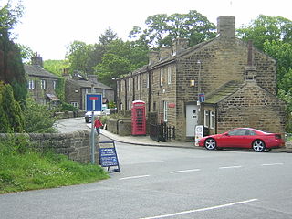
Esholt is a village and former civil parish in the metropolitan district of the City of Bradford, West Yorkshire, England. It is situated 3 miles (4.8 km) east of Shipley town centre, 1.5 miles (2.4 km) south-west of the A65 in Guiseley, 7 miles (11 km) north of Bradford City Centre, and 10 miles (16 km) north-west of Millennium Square, Leeds.

<span class="mw-page-title-main">River Aire</span> River in Yorkshire, England

The River Aire is a major river in Yorkshire, England, 92 miles (148 km) in length. Part of the river below Leeds is canalised, and is known as the Aire and Calder Navigation.

<span class="mw-page-title-main">Saltaire</span> Village in West Yorkshire, England

Saltaire is a Victorian model village in Shipley, West Yorkshire, England, situated between the River Aire, the railway, and the Leeds and Liverpool Canal. Salt's Mill and the houses were built by Titus Salt between 1851 and 1871 to allow his workers to live in better conditions than the slums of Bradford. The mill ceased production in 1986, and was converted into a multifunctional location with an art gallery, restaurants, and the headquarters of a technology company. It is a UNESCO World Heritage Site and on the European Route of Industrial Heritage.

<span class="mw-page-title-main">Shipley, West Yorkshire</span> Town and civil parish in West Yorkshire, England

Shipley is a historic market town and civil parish in the City of Bradford, West Yorkshire, England.

<span class="mw-page-title-main">Airedale</span> Valley in North and West Yorkshire, England

Airedale is a valley, or dale, in North Yorkshire and West Yorkshire, England. It is named after the River Aire, which flows through it. The upper valley, from Malham Cove to Airton, is known as Malhamdale, named after the village of Malham. At Airton the valley widens and becomes Airedale proper. The river flows past Skipton on to Keighley, Bingley, Shipley, and Leeds.

<span class="mw-page-title-main">Bradford Canal</span> English canal

The Bradford Canal was a 3.5-mile (5.6 km) English canal which ran from the Leeds and Liverpool Canal at Shipley into the centre of Bradford. It opened in 1774, and was closed in 1866, when it was declared to be a public health hazard. Four years later it reopened with a better water supply, and closed for the second time in 1922. It was subsequently filled in, although consideration has been given to restoring it. There are some remains, including a short section of canal at the junction and a pumping station building, which is now a dwelling.

<span class="mw-page-title-main">Wharfedale line</span> Railway line in England

The Wharfedale line is one of the rail services in the West Yorkshire Metro area of northern England. The service connects Ilkley with Leeds and Bradford, and is operated by Northern Trains. West Yorkshire Metrocards are available for use on the line, covering Zones 3–5. The line is served predominantly by four-coach Class 333 electric multiple units.

<span class="mw-page-title-main">New River (Mexico–United States)</span> River that flows from Mexico into the United States

The New River flows north from near Cerro Prieto, through the city of Mexicali, Baja California, Mexico, into the United States through the city of Calexico, California, towards the Salton Sea. The river channel has existed since pre-historic times. The river as known today formed from a levee failure and massive flooding that filled the Salton Sea.

<span class="mw-page-title-main">Cottingley, Bradford</span> Village in West Yorkshire, England

Cottingley is a suburban village within the City of Bradford district in West Yorkshire, England between Shipley and Bingley. It is known for the Cottingley Fairies, which appeared in a series of photographs taken there during the early 20th century.

<span class="mw-page-title-main">Idle, West Yorkshire</span> Area of Bradford in west Yorkshire, England

Idle is a residential suburban area in the city of Bradford, West Yorkshire, in England and was a separate village, and before that it was the Manor of Idle. Idle is loosely bordered by the areas of Eccleshill, Wrose, Thackley, Apperley Bridge, and Greengates, in the north-east of the city.

<span class="mw-page-title-main">Thackley</span> Village in West Yorkshire, England

Thackley is a small suburb near Bradford, West Yorkshire in England. The village is loosely bordered by the village of Idle to the south, to the west by the West Royd area of Shipley and elsewhere by the Leeds and Liverpool Canal. Thackley is the northernmost part of Bradford south of the River Aire.

<span class="mw-page-title-main">Esholt railway station</span> Disused railway station in West Yorkshire, England

Esholt railway station was a railway station on the Shipley to Guiseley line of the Midland Railway. It opened on 4 December 1876 along with Baildon station when the line was formally opened, and closed on 28 October 1940. The buildings remained after closure before being demolished in 1953.

<span class="mw-page-title-main">Eller Beck</span> River in North Yorkshire, England

The Eller Beck is a small river in North Yorkshire, England, that flows through the town of Skipton and is a tributary of the River Aire. Its channel was heavily modified to supply water to mills in the 18th and 19th centuries, and although all the mills have closed, the water now supplies power to the National Grid, generated by a turbine at High Corn Mill. The beck flows through several underground culverts in Skipton that contribute to the flood risk. To alleviate flooding in Skipton town centre, a scheme involving two flood water storage reservoirs was designed and eventually completed in 2017.

<span class="mw-page-title-main">Harden Beck</span> Beck in West Yorkshire, England

Harden Beck is a stream that flows from Hewenden Reservoir, over Goit Stock Waterfall to the River Aire in Bingley, West Yorkshire. The route starts out further up the valley as Denholme Beck, Hewenden Beck and Hallas Beck. Its waters are fed by Thornton Moor Reservoir, Stubden Reservoir, Doe Park Reservoir and Hewenden Reservoir.

<span class="mw-page-title-main">Esholt Sewage Works Railway</span> Former industrial railway in West Yorkshire, England

Esholt Sewage Works Railway was a standard gauge works railway constructed in 1910 to serve a sewage works in Esholt, West Yorkshire, England.

<span class="mw-page-title-main">Moston Brook</span> Stream in Greater Manchester, England

Moston Brook is a stream in Greater Manchester in north-west England and a tributary of the River Irk. The brook is formed at the confluence of Bower Brook and Hole Bottom Brook. This occurs near the Rochdale Canal in Failsworth in the Metropolitan Borough of Oldham. It flows southwest, forming the border between Moston, Manchester and Failsworth before being culverted almost all of the remaining route to its meeting the River Irk. It has a total length of about 3.7 miles.

<span class="mw-page-title-main">Northcliffe Park</span>

Northcliffe Park is a 35-hectare (86-acre) area in Shipley, West Yorkshire, England, set aside for allotments, parkland and woodland. The park and playing fields were donated by Sir Norman Rae in 1920 and the playing fields are known as the Norman Rae fields, but are part of the park itself. The park adjoins the town of Shipley to its eastern and northern sides, and Heaton to the south, with Northcliffe Golf Club also bordering the park on the western side. Bradford Model Engineering Society have two demonstration and ride-on lines within the park which are open to public in the summer.

<span class="mw-page-title-main">Bradford Dale (Yorkshire)</span> Valley in West Yorkshire, England

Bradford Dale, is a side valley of Airedale that feeds water from Bradford Beck across the City of Bradford into the River Aire at Shipley in West Yorkshire, England. Whilst it is in Yorkshire and a dale, it is not part of the Yorkshire Dales and has more in common with Lower Nidderdale and Lower Airedale for its industrialisation.

<span class="mw-page-title-main">Wyke Beck</span> Stream in West Yorkshire, England

Wyke Beck is a stream that runs from Roundhay Park to the River Aire in east Leeds, West Yorkshire, England. Described as an Urban Beck, the stream flows through housing estates and then an industrial landscape in its lower reaches. Wyke Beck has been prone to flooding so often, that remediation of its course and flood storage schemes have been initiated by Leeds City Council.

<span class="mw-page-title-main">Apperley Viaducts</span> Railway viaducts in West Yorkshire, England

The Apperley Viaducts are two adjacent railway viaducts straddling the River Aire in West Yorkshire, England. The open viaduct dates back to 1900, carrying the current double track Airedale line railway, whereas the redundant adjacent viaduct dates back to the 1867, and was built to replace the original bridge at this point which collapsed in November 1866 due to severe flooding. The viaducts are two of the many railway crossings of the River Aire between Shipley and Leeds.

References

  1. "Bradford – Shipley Canal Road Corridor Masterplan" (PDF). Bradford.gov. Bradford Council. September 2011. p. 6. Retrieved 6 April 2016.
  2. Gray, Johnnie (1891). Through Airedale from Goole to Malham. Leeds: Walker & Laycock. pp. 121–122. Retrieved 5 April 2016.
  3. "Where I live – Bradford and West Yorkshire; The Sound of Music". BBC.co.uk. BBC. May 2005. Retrieved 9 April 2016.
  4. "Cathedral Precinct Conservation Area Appraisal" (PDF). Bradford Council. October 2005. p. 5. Retrieved 5 April 2016.
  5. "Goitside Conservation Area Appraisal" (PDF). Bradford Council. October 2005. p. 6. Retrieved 5 April 2016.
  6. James, John (1841). "The history and topography of Bradford". Web Archive. p. 293. Retrieved 8 April 2016.
  7. Holroyd, Abraham (1873). Collectanea Bradfordiana. Saltaire: Holroyd. p. 41. Retrieved 5 April 2016.
  8. "History of the Bradford Canal". Pennine Waterways. Retrieved 5 April 2016.
  9. "Report calls for Bradford's hidden asset to be uncovered". The University of Sheffield. 28 February 2013. Retrieved 5 April 2016.
  10. "Manningham Character and diversity in a Bradford suburb" (PDF). historicengland.org.uk. English Heritage. p. 36. Retrieved 18 December 2018.
  11. "Esholt Sewage Disposal Scheme". Internet Archive. Bradford Corporation. 1912. pp. 5–6. Retrieved 9 April 2016.
  12. Cudworth, William (1891). "Histories of Bolton and Bowling". Internet Archive. Brear & Sons. p. 35. Retrieved 11 April 2016.
  13. Hall, Graham (2011). "Where there's muck, there's brass – the Esholt sewage treatment plant". The Bradford Antiquary. 3 (15): 48–49. ISSN   0955-2553.
  14. "City Centre Area Action Plan" (PDF). bradford.gov.uk. December 2012. p. 30. Retrieved 6 January 2018.
  15. Winterton, T R (1994). "Developments in pre-cast concrete tunnel linings in the United Kingdom". Tunnelling '94 : Papers presented at the seventh international symposium, 'Tunnelling'94'. Boston: Springer. p. 609. ISBN   9781461526469.
  16. "Bradford Beck – culvert & tunnel". www.google.com. Retrieved 6 January 2018.
  17. "Bradford – Shipley Canal Road Corridor Masterplan" (PDF). Bradford.gov. September 2011. p. 17. Retrieved 10 April 2016.
  18. "Bradford City Centre Area Action Paper (AAP)" (PDF). bradford.gov.uk. 2015. p. 30. Retrieved 6 January 2018.
  19. Yule, Samantha (17 April 2018). "Restaurant washing-up makes city's underground stream run yellow". Metro Newspaper UK. Retrieved 22 December 2018.
  20. Gaskell, Paul (24 October 2012). "Water Framework Directive Advisory Visit Bradford Beck 24-10-2012" (PDF). wildtrout.org. p. 30. Retrieved 6 January 2018.
  21. Corbelli, David (July 2012). "Evaluation of the catchment based approach" (PDF). Catchment Change. defra. p. 8. Retrieved 9 April 2016.
  22. "Bradford Beck". Friends of Bradford Beck. Retrieved 5 April 2016.
  23. Griffiths, Kathie (28 June 2013). "Friends of Bradford Beck make progress with work on historic waterway". Telegraph and Argus. Retrieved 6 April 2016.
  24. Shand, Alistair (3 September 2015). "Wilsden woman's poetry set to hit the streets". Telegraph and Argus . Retrieved 18 April 2016.
  25. Winrow, Jo (29 December 2015). "Plaques unveiled to mark the route of Bradford city's hidden beck". Telegraph and Argus . Retrieved 18 April 2016.
  26. "The Broadway". Marking Bradford Beck. Retrieved 6 April 2016.
  27. Lawler, Eddie (April 2015). "Cleaning up the Bradford Beck". The Bradford Review (2): 16–17. Retrieved 9 April 2016.
  28. "Bradford Beck (Clayton Bk to R Aire)". environment.data.gov.uk. Retrieved 6 January 2018.
  29. Thomas, Rhys (6 February 2014). "Contamination signs to be removed as Bradford Beck water is certified as clean". Bradford Telegraph and Argus. Retrieved 6 January 2018.
  30. Waters, C. N.; Northmore, K.; Prince, G.; Marker, B. M., eds. (1996). "A geological background for planning and development in the City of Bradford Metropolitan district". British Geological Survey Technical Report (WA/96/1). Keyworth: British Geological Survey: 83. OCLC   1179784337.
  31. Patel, Nishika (1 July 2006). "Wet and wild clean-up will bring water dream to life". Telegraph and Argus. Retrieved 10 April 2016.
  32. Gaskell, Paul (24 October 2012). "Water Framework Directive Advisory Visit Bradford Beck 24-10-2012" (PDF). wildtrout.org. pp. 1–35. Retrieved 6 January 2018.
  33. Devlin, Hannah (30 March 2015). "'Tampon tests' could be used to track sewage in rivers". The Guardian. Retrieved 8 January 2019.
  34. Mitchinson, James, ed. (16 April 2019). "Probe into pollution incident at city beck is re-opened". The Yorkshire Post. p. 6. ISSN   0963-1496.
  35. Duncan, Steve. "11 Rivers Forced Underground". National Geographic. Archived from the original on 24 March 2012. Retrieved 10 April 2016.
  36. "Eddie Lawler – writer and musician". Saltaire World Heritage Site. Retrieved 9 April 2016.
  37. Winrow, Jo (16 March 2015). "Winning entry in Bradford Beck poetry competition announced". Telegraph and Argus. Retrieved 9 April 2016.