Cibola County, New Mexico

Last updated

Cibola County
Cibola County New Mexico Court House.jpg
Cibola County Courthouse in Grants
Map of New Mexico highlighting Cibola County.svg
Location within the U.S. state of New Mexico
New Mexico in United States.svg
New Mexico's location within the U.S.
Coordinates: 34°55′N107°59′W / 34.92°N 107.99°W / 34.92; -107.99
CountryFlag of the United States.svg United States
StateFlag of New Mexico.svg  New Mexico
FoundedJune 19, 1981
Named for Mythical Seven Cities of Cibola
Seat Grants
Largest cityGrants
Area
  Total4,542 sq mi (11,760 km2)
  Land4,539 sq mi (11,760 km2)
  Water2.3 sq mi (6 km2)  0.05%
Population
 (2020)
  Total27,172
  Density6.0/sq mi (2.3/km2)
Time zone UTC−7 (Mountain)
  Summer (DST) UTC−6 (MDT)
Congressional district 2nd
Website www.co.cibola.nm.us

Cibola County is a county in the U.S. state of New Mexico. As of the 2020 census, the population was 27,172. [1] Its county seat is Grants. [2] It is New Mexico's youngest county, and the third youngest county in the United States, created on June 19, 1981, from the westernmost four-fifths of the formerly much larger Valencia County.

Contents

Cibola County comprises the Grants, New Mexico Micropolitan Statistical Area. The county is a rich mining area with numerous Uranium mines.

Geography

Ventana Arch in El Malpais National Monument Malpais Natural Arch.jpg
Ventana Arch in El Malpais National Monument

According to the U.S. Census Bureau, the county has an area of 4,542 square miles (11,760 km2), of which 4,539 square miles (11,760 km2) is land and 2.3 square miles (6.0 km2) (0.05%) is water. [3]

Adjacent counties

National protected areas

Demographics

Historical population
CensusPop.Note
1990 23,794
2000 25,5957.6%
2010 27,2136.3%
2020 27,172−0.2%
U.S. Decennial Census [4]
1790-1960 [5] 1900-1990 [6]
1990-2000 [7] 2010 [8]

2000 census

As of the 2000 census, [9] there were 25,595 people, 8,327 households, and 6,278 families living in the county. The population density was 6 people per square mile (2.3 people/km2). There were 10,328 housing units at an average density of 2 units per square mile (0.77/km2). The racial makeup of the county was 39.61% White, 0.96% Black or African American, 40.32% Native American, 0.38% Asian, 0.05% Pacific Islander, 15.44% from other races, and 3.24% from two or more races. 33.42% of the population were Hispanic or Latino of any race.

There were 8,327 households, out of which 38.00% had children under the age of 18 living with them, 50.60% were married couples living together, 18.30% had a female householder with no husband present, and 24.60% were non-families. 21.10% of all households were made up of individuals, and 7.30% had someone living alone who was 65 years of age or older. The average household size was 2.95 and the average family size was 3.41.

In the county, the population was spread out, with 30.70% under the age of 18, 9.60% from 18 to 24, 27.50% from 25 to 44, 21.50% from 45 to 64, and 10.70% who were 65 years of age or older. The median age was 33 years. For every 100 females there were 95.50 males. For every 100 females age 18 and over, there were 92.20 males.

The median income for a household in the county was $27,774, and the median income for a family was $30,714. Males had a median income of $27,652 versus $20,078 for females. The per capita income for the county was $11,731. About 21.50% of families and 24.80% of the population were below the poverty line, including 32.00% of those under age 18 and 17.70% of those age 65 or over.

2010 census

As of the 2010 census, there were 27,213 people, 8,860 households, and 6,274 families living in the county. [10] The population density was 6.0 inhabitants per square mile (2.3 inhabitants/km2). There were 11,101 housing units at an average density of 2.4 units per square mile (0.93 units/km2). [11] The racial makeup of the county was 41.8% white, 41.0% American Indian, 1.0% black or African American, 0.5% Asian, 0.1% Pacific islander, 12.4% from other races, and 3.1% from two or more races. Those of Hispanic or Latino origin made up 36.5% of the population. [10] In terms of ancestry, 5.4% were Irish, and 1.5% were American. [12]

Of the 8,860 households, 38.0% had children under the age of 18 living with them, 41.1% were married couples living together, 20.8% had a female householder with no husband present, 29.2% were non-families, and 24.9% of all households were made up of individuals. The average household size was 2.79 and the average family size was 3.30. The median age was 36.6 years. [10]

The median income for a household in the county was $37,361 and the median income for a family was $41,187. Males had a median income of $36,027 versus $25,318 for females. The per capita income for the county was $14,712. About 20.1% of families and 24.0% of the population were below the poverty line, including 32.7% of those under age 18 and 14.3% of those age 65 or over. [13]

Education

The Mining Museum in Grants MiningMuseumGrants.jpg
The Mining Museum in Grants

School districts serving portions of the county include: [14]

All public schools in the county are operated by Grants/Cibola County Schools; the Quemado and Zuni facilities are in other counties.

Due to an agreement between Cibola County and McKinley County, residents of the Ramah Navajo Indian Reservation are bussed to schools in Ramah in McKinley County (including Ramah Middle/High School) even though they are physically in Cibola County, due to the long distance to the nearest Cibola County schools from the reservation. [15]

Corrections

Cibola County is home to three prisons:

In November 2018, following a private autopsy, a unit of the Cibola County Correctional Center (CCCC) was named in the abuse and wrongful death on May 25, 2018, of Roxsana Hernández Rodríguez. Rodríguez was a 33yo transgender immigrant from Honduras. The CCCC is operated under contract by CoreCivic. [19] [20]

Politics

United States presidential election results for Cibola County, New Mexico [21]
Year Republican Democratic Third party
No.%No.%No.%
2020 3,97544.65%4,74553.30%1832.06%
2016 3,19539.63%3,74146.40%1,12713.98%
2012 2,99836.37%4,96160.18%2843.45%
2008 3,13134.42%5,82764.05%1391.53%
2004 3,47746.44%3,91352.26%971.30%
2000 2,75238.83%4,12758.23%2092.95%
1996 2,24532.63%4,03058.58%6058.79%
1992 2,05132.64%3,33453.06%89914.31%
1988 2,64043.02%3,45856.35%390.64%
1984 3,57853.09%3,14046.59%220.33%

Cibola County tends to support the Democratic Party. Only once in its history (1984) has it voted for a Republican presidential nominee, when Ronald Reagan won the county in his 49-state landslide.

At the state level, the only time it has voted for a Republican nominee for Governor was 2014, when Susana Martinez carried all but five counties in her reelection bid.

Communities

Acoma Pueblo, "Sky City", 2008 Acoma Pueblo New Mexico.jpg
Acoma Pueblo, "Sky City", 2008
South side of Inscription Rock, El Morro National Monument. Photo by Timothy H. O'Sullivan, 1873. Timothy O'Sullivan, South side of Inscription Rock, New Mexico, 1873.jpg
South side of Inscription Rock, El Morro National Monument. Photo by Timothy H. O'Sullivan, 1873.

City

Village

Census-designated places

There are 32 Census Designated Places contained within the county, largely designated in 1980.

Unincorporated communities

Ghost towns

See also

Related Research Articles

<span class="mw-page-title-main">Valencia County, New Mexico</span> County in New Mexico, United States

Valencia County is a county in the U.S. state of New Mexico. As of the 2020 census, the population was 76,205. The county seat is Los Lunas.

<span class="mw-page-title-main">Torrance County, New Mexico</span> County in New Mexico, United States

Torrance County is a county located in the center of the U.S. state of New Mexico. As of the 2020 census, the population was 15,045. The county seat is Estancia.

<span class="mw-page-title-main">Sierra County, New Mexico</span> County in New Mexico, United States

Sierra County is a county located in the U.S. state of New Mexico. As of the 2020 Census, the population was 11,576. Its county seat is Truth or Consequences.

<span class="mw-page-title-main">Santa Fe County, New Mexico</span> County in New Mexico, United States

Santa Fe County is located in the U.S. state of New Mexico. As of the 2020 census, the population was 154,823, making it New Mexico's third-most populous county, after Bernalillo County and Doña Ana County. Its county seat is Santa Fe, the state capital.

<span class="mw-page-title-main">Sandoval County, New Mexico</span> County in New Mexico, United States

Sandoval County is located in the U.S. state of New Mexico. As of the 2020 census, the population was 148,834, making it the fourth-most populous county in New Mexico. The county seat is Bernalillo.

<span class="mw-page-title-main">McKinley County, New Mexico</span> County in New Mexico, United States

McKinley County is a county in the northwestern section of the U.S. state of New Mexico. As of the 2020 United States Census, its population was 72,902. Its county seat is Gallup. The county was created in 1901 and named for President William McKinley.

<span class="mw-page-title-main">Catron County, New Mexico</span> County in New Mexico, United States

Catron County is a county in the U.S. state of New Mexico. As of the 2020 census, the population was 3,579, making it New Mexico's third-least populous county. Its county seat is Reserve. Catron County is New Mexico's largest county by area.

<span class="mw-page-title-main">Bernalillo County, New Mexico</span> County in New Mexico, United States

Bernalillo County is the most populous county in the U.S. state of New Mexico. As of the 2020 census, the population was 676,444. The county seat, Albuquerque, is the most populous city in New Mexico.

<span class="mw-page-title-main">Acomita Lake, New Mexico</span> Census-designated place in New Mexico, United States

Acomita Lake is a census-designated place (CDP) in Cibola County, New Mexico, United States. The population was 339 at the 2020 census.

<span class="mw-page-title-main">Encinal, New Mexico</span> Census-designated place in New Mexico, United States

Encinal is a census-designated place (CDP) in Cibola County, New Mexico, United States. It is the smallest of the six villages of the Laguna Pueblo and sits at the base of Mount Taylor. The population was 210 at the 2010 census. The feast day for Encinal is September 8.

<span class="mw-page-title-main">Laguna, New Mexico</span> Census-designated place in New Mexico, United States

Laguna is a census-designated place (CDP) on the Laguna Pueblo in Cibola County, New Mexico, United States. The population was 1,241 at the 2010 census. It is located approximately 47 miles west of Albuquerque.

<span class="mw-page-title-main">Mesita, New Mexico</span> Census-designated place in New Mexico, United States

Mesita is a census-designated place (CDP) in Cibola County, New Mexico, United States. The population was 804 at the 2010 census.

<span class="mw-page-title-main">Milan, New Mexico</span> Village in New Mexico, United States

Milan is a village in Cibola County, New Mexico, United States. The population was 3,245 at the 2010 census.

<span class="mw-page-title-main">North Acomita Village, New Mexico</span> Census-designated place in New Mexico, United States

North Acomita Village is a census-designated place (CDP) in Cibola County, New Mexico, United States. The population was 303 at the 2010 census.

<span class="mw-page-title-main">Paguate, New Mexico</span> Census-designated place in New Mexico, United States

Paguate is a census-designated place (CDP) in Cibola County, New Mexico, United States. The population was 421 at the 2010 census.

<span class="mw-page-title-main">Paraje, New Mexico</span> Census-designated place in New Mexico, United States

Paraje is a census-designated place (CDP) in Cibola County, New Mexico, United States. As of the 2010 census, the CDP population was 777.

<span class="mw-page-title-main">Pinehill, New Mexico</span> Census-designated place in New Mexico, United States

Pinehill or Pine Hill is a census-designated place in Cibola County, New Mexico, United States. It is located on the Ramah Navajo Indian Reservation. The population was 88 at the 2010 census. The location of the CDP in 2010 had become the location of the Mountain View CDP as of the 2020 census, while a new CDP named "Pinehill" was listed 8 miles (13 km) further south, at a point 4 miles (6 km) southeast of Candy Kitchen.

<span class="mw-page-title-main">Seama, New Mexico</span> Census-designated place in New Mexico, United States

Seama is a census-designated place (CDP) in Cibola County, New Mexico, United States. The population was 465 at the 2010 census.

<span class="mw-page-title-main">Skyline-Ganipa, New Mexico</span> Census-designated place in New Mexico, United States

Skyline-Ganipa is a census-designated place (CDP) in Cibola County, New Mexico, United States. The population was 1,224 at the 2010 census.

<span class="mw-page-title-main">Ramah, New Mexico</span> CDP in New Mexico, United States

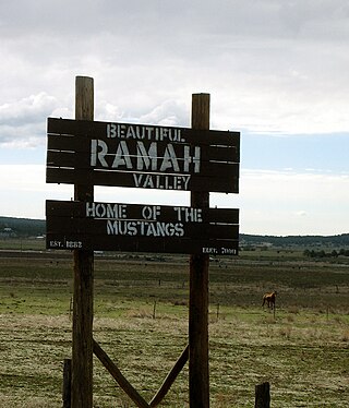
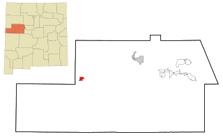
Ramah is a census-designated place (CDP) in McKinley County, New Mexico. The population was 461 as of the 2020 United States census.

References

Specific
  1. "Cibola County, New Mexico". United States Census Bureau . Retrieved July 1, 2023.
  2. "Find a County". National Association of Counties. Archived from the original on May 31, 2011. Retrieved June 7, 2011.
  3. "2010 Census Gazetteer Files". United States Census Bureau. August 22, 2012. Archived from the original on January 1, 2015. Retrieved January 1, 2015.
  4. "U.S. Decennial Census". United States Census Bureau. Retrieved January 1, 2015.
  5. "Historical Census Browser". University of Virginia Library. Archived from the original on August 11, 2012. Retrieved January 1, 2015.
  6. "Population of Counties by Decennial Census: 1900 to 1990". United States Census Bureau. Retrieved January 1, 2015.
  7. "Census 2000 PHC-T-4. Ranking Tables for Counties: 1990 and 2000" (PDF). United States Census Bureau. Archived (PDF) from the original on March 27, 2010. Retrieved January 1, 2015.
  8. "State & County QuickFacts". United States Census Bureau. Archived from the original on June 6, 2011. Retrieved September 27, 2013.
  9. "U.S. Census website". United States Census Bureau . Retrieved January 31, 2008.
  10. 1 2 3 "DP-1 Profile of General Population and Housing Characteristics: 2010 Demographic Profile Data". United States Census Bureau. Archived from the original on February 13, 2020. Retrieved January 24, 2016.
  11. "Population, Housing Units, Area, and Density: 2010 - County". United States Census Bureau. Archived from the original on February 13, 2020. Retrieved January 24, 2016.
  12. "DP02 SELECTED SOCIAL CHARACTERISTICS IN THE UNITED STATES – 2006-2010 American Community Survey 5-Year Estimates". United States Census Bureau. Archived from the original on February 13, 2020. Retrieved January 24, 2016.
  13. "DP03 SELECTED ECONOMIC CHARACTERISTICS – 2006-2010 American Community Survey 5-Year Estimates". United States Census Bureau. Archived from the original on February 13, 2020. Retrieved January 24, 2016.
  14. "2020 CENSUS - SCHOOL DISTRICT REFERENCE MAP: Cibola County, NM" (PDF). U.S. Census Bureau. Archived (PDF) from the original on July 21, 2021. Retrieved July 12, 2022. - Text list
  15. Linthicum, Leslie (March 6, 1995). "Navajos Say County Is Stealing Students". Albuquerque Journal . Albuquerque, New Mexico. pp. A1, A3. - Clipping of first and of second page at Newspapers.com. Page 2 text details: A, B, and C
  16. CoreCivic. "CoreCivic: Better the Public Good". cca.com. Retrieved April 1, 2018.
  17. "Cibola County Correctional Center". Corrections Corporation of America. Retrieved August 26, 2016.
  18. "Western New Mexico Correctional Facility". New Mexico Corrections Department. Retrieved August 26, 2016.
  19. Bixby, Scott; Betsy Woodruff (November 26, 2018). "Trans Woman Was Beaten in ICE Custody Before Death, Autopsy Finds". The Daily Beast. The Daily Beast Company. Retrieved November 27, 2018.
  20. admin (November 26, 2018). "Justice for Roxsana: Announcing Legal Action To Hold Government Accountable for Transgender Asylum-Seeker's Death". TransGender Law Center. Retrieved November 27, 2018.
  21. Leip, David. "Dave Leip's Atlas of U.S. Presidential Elections". uselectionatlas.org. Retrieved April 1, 2018.
General

Further reading

Commons-logo.svg Media related to Cibola County, New Mexico at Wikimedia Commons

34°55′N107°59′W / 34.92°N 107.99°W / 34.92; -107.99