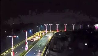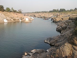
Jharkhand is a state in eastern India. The state shares its border with the states of West Bengal to the east, Chhattisgarh to the west, Uttar Pradesh to the northwest, Bihar to the north and Odisha to the south. It has an area of 79,716 km2 (30,779 sq mi). It is the 15th largest state by area, and the 14th largest by population. Hindi is the official language of the state. The city of Ranchi is its capital and Dumka its sub-capital. The state is known for its waterfalls, hills and holy places; Baidyanath Dham, Parasnath, Dewri and Rajrappa are major religious sites.

Ranchi is the capital of the Indian state of Jharkhand. Ranchi was the centre of the Jharkhand movement, which called for a separate state for the tribal regions of South Bihar, northern Odisha, western West Bengal and the eastern area of what is present-day Chhattisgarh. The Jharkhand state was formed on 15 November 2000 by carving out the Bihar divisions of Chota Nagpur and Santhal Parganas. Ranchi has been selected as one of the hundred Indian cities to be developed as a smart city under PM Narendra Modi's flagship Smart Cities Mission.
Gumla is a city which is the district headquarters in the Gumla subdivision of the Gumla district in the state of Jharkhand, India.

Deoghar is a major city in Jharkhand, India. It is a holy sacred place of Hinduism. It is one of the 12 Jyotirlingas sites of Hinduism. The sacred temples of the city make this a place for pilgrimage and tourists. The city is administrative headquarter of Deoghar District at Santhal Parganas division of Jharkhand.

Dumka, the headquarters of the Dumka district and Santhal Pargana region, is a city in the state of Jharkhand, India. It was made the headquarters of the Santhal Pargana region, which was carved out of the Bhagalpur and Birbhum district after the Santal Hool of 1855. Dumka was carved out of the southern part of Bihar along with 18 other Districts on 15 November 2000 to form Jharkhand as 28th State of India. Dumka is a peaceful and green city and also sub-capital of Jharkhand. The nearest important cities are Rampurhat and Deoghar.

Ranchi district is the most populous district of Jharkhand state in eastern India. Ranchi, the capital of Jharkhand, is the district headquarters. It was established as a district in 1899.

Angara block is an administrative CD block in the Ranchi Sadar subdivision of Ranchi district in the Indian state of Jharkhand.

Kanke block is a community development block in the Ranchi Sadar subdivision of Ranchi district, Jharkhand, India.

Ormanjhi block is one of the administrative CD blocks in the Ranchi Sadar subdivision of Ranchi district in the Indian state of Jharkhand.

Ramgarh Cantonment, usually referred to as Ramgarh Cantt or just Ramgarh is a cantonment town, belonging to the Ramgarh district of the Indian state of Jharkhand. Historically, a subdivision of the larger Hazaribag district, Ramgarh was finally elevated to a district status on 12 September 2007 largely to ease administrative hardships.
Warisaliganj is a town and a nagar parishad in Nawada district in the Indian state of Bihar.

Ramgarh district is one of the 24 districts in the Indian state of Jharkhand. It was also a military district during the British Regime, referred to then as Ramgarh district.
Ormanjhi is a village in the Ormanjhi CD block in the Ranchi Sadar subdivision of Ranchi district, Jharkhand, India.

Naromurar is a Village in Warisaliganj Tehsil, located 10 km (6.2 mi) from National Highway 31 and 8 km (5.0 mi) from State Highway 59, making it the only village of the area well connected to both Nawada and Nalanda districts of Bihar.
Literally the word Nar means water and Murar means Lord Krishna who appeared as the 8th avatara of Lord Vishnu in Dvapara Yuga as mentioned in Garuda Purana, that is the word Naromurar means the house of lord Vishnu -Kshirsagar.
Naromurar is a village of great traditions. It is one of the ancient villages of India having a four hundred year older Thakur Wadi dedicated to Maryada Purushottam Ram and Lord Shiva.
Along with the Rajkiyakrit Madhya Vidyalay having established in 1920 AD, 27 years before the freedom of India, a Janta Pustakalay the Public Library is also started in the year of 1956 AD which was inaugurated by the Education Minister of Bihar during the time of Krishna Singh.

The Nagvanshis of Chotanagpur, also known as the Khokhra chieftaincy, was an Indian dynasty which ruled the parts of Chota Nagpur plateau region during much of ancient, medieval and modern period. Phani Mukut Rai is considered the first king of dynasty claim to be son of Pundrika Naga, a mythical Naga. Lal Chintamani Sharan Nath Shahdeo (1931–2014) was last ruling king of the dynasty, until the estate was merged to the Republic of India.

Vishwanath Shahdeo was the king of the Barkagarh estate and a rebel in the Indian rebellion of 1857. In 1855, he declared himself independent and defeated British forces in Hatia. He led rebels of Ramgarh Battalion in 1857. But defeated by Company forces with the help of king of Pithoria Jagatpal Singh. He was eventually caught and was hung from a tree along with his accomplices in 1858.
The Barkagarh estate was a zamindari estate situated in modern-day Jharkhand, India, in erstwhile Lohardaga district. It was established by Ani Nath Shahdeo, the son of Nagvanshi king Ram Shah in 17th century. The capital of the estate was Satranji now located in south Ranchi.
Irba is a census town in the Ormanjhi CD block in the Ranchi Sadar subdivision of the Ranchi district in the Indian state of Jharkhand.

Chutupalu is a village in the Ormanjhi CD block in the Ranchi Sadar subdivision of the Ranchi district in the Indian state of Jharkhand.


