Tati, Ranchi

Last updated

Tati
Tatisilwai
India Jharkhand location map.svg
Red pog.svg
Tati
Location in Jharkhand, India
India location map 3.png
Red pog.svg
Tati
Tati (India)
Coordinates: 23°22′38″N85°25′44″E / 23.3772°N 85.4290°E / 23.3772; 85.4290
CountryFlag of India.svg  India
State Jharkhand
District Ranchi
Government
  Type Federal democracy
Area
  Total3.17 km2 (1.22 sq mi)
Population
 (2011)
  Total12,878
  Density4,100/km2 (11,000/sq mi)
Languages (*For language details see Namkum#Language and religion)
  Official Hindi, Urdu
Time zone UTC+5:30 (IST)
PIN
834010
Telephone/STD code0651
Vehicle registration JH 1
Literacy87.37%
Lok Sabha constituency Ranchi
Vidhan Sabha constituency Khijri
Website ranchi.nic.in

Tati (including Tatisilwai) is a census town in the Namkum CD block in the Ranchi Sadar subdivision of Ranchi district in the Indian state of Jharkhand.

Contents

Geography

Tati, Ranchi
Cities, towns and locations in Ranchi district in South Chotanagpur Division
M: municipality, CT: census town, R: rural/ urban centre, N: neighbourhood, T: tourist centre, D: dam, H: historical/ religious centre
Owing to space constraints in the small map, the actual locations in a larger map may vary slightly

Location

Tati is located at 23°22′38″N85°25′44″E / 23.3772°N 85.4290°E / 23.3772; 85.4290 .

Area overview

The map alongside shows a part of the Ranchi plateau, most of it at an average elevation of 2,140 feet above sea level. Only a small part in the north-eastern part of the district is the lower Ranchi plateau, spread over Silli, Rahe, Sonahatu and Tamar CD blocks, at an elevation of 500 to 1,000 feet above sea level. There is a 16 km long ridge south-west of Ranchi. There are isolated hills in the central plateau. The principal river of the district, the Subarnarekha, originates near Ratu, flows in an easterly direction and descends from the plateau, with a drop of about 300 feet at Hundru Falls. Subarnarekha and other important rivers are marked on the map. The forested area is shaded in the map. [1] A major part of the North Karanpura Area and some fringe areas of the Piparwar Area of the Central Coalfields Limited, both located in the North Karanpura Coalfield, are in Ranchi district. [2] [3] There has been extensive industrial activity in Ranchi district, since independence. [4] Ranchi district is the first in the state in terms of population. 8.83% of the total population of the state lives in this district - 56.9% is rural population and 43.1% is urban population. [5]

Note: The map alongside presents some of the notable locations in the district. All places marked in the map are linked in the larger full screen map.

Demographics

According to the 2011 Census of India, Tati had a total population of 12,878, of which 6,873 (53%) were males and 6,005 (47%) were females. Population in the age range 0–6 years was 1,554. The total number of literate persons in Tati was 9.894 (87.37% of the population over 6 years). [6]

As of 2001 India census, [7] Tati had a population of 10,496. Males constitute 54% of the population and females 46%. Tati has an average literacy rate of 72%, higher than the national average of 59.5%: male literacy is 80%, and female literacy is 62%. In Tati, 15% of the population is under 6 years of age.

Infrastructure

According to the District Census Handbook 2011, Ranchi, Tati covered an area of 3.17 km2. Among the civic amenities, it had 15 km roads with open drains, the protected water supply involved tap water from treated source, uncovered well, river infiltration gallery. It had 2,301 domestic electric connections, 5 road lighting points. Among the medical facilities, it had 6 hospitals, 2 dispensaries, 2 health centres, 1 family welfare centre, 13 maternity and child welfare centres, 13 maternity homes, 1 nursing homes, 5 medicine shops. Among the educational facilities it had 7 primary school, 1 secondary school, other school facilities at Tatisilwai 4 km away. It had 1 medical college, 1 engineering college, 1 management institute/ college, 1 special school for disabled. Among the social, recreational and cultural facilities it had 2 auditorium/ community halls, 2 public libraries, 2 reading rooms. Three important commodities it produced were plastic goods, bakery products, wooden cartons. It had the branch offices of 1 nationalised bank, 1 cooperative bank, 1 agricultural credit society. [8]

Civic administration

Police station

There is a police station at Tatislwai. [9]

Transport

Tatisilwai railway station is on the Netaji S.C.Bose Gomoh–Hatia line. [10] It is also on the Koderma–Hazaribagh–Barkakana–Ranchi line. The Barkakana-Koderma sector is in operation and, as of 2021, the Ranchi-Barkakana sector is partially operable and is nearing completion. [11]

Education

Kamla Nehru Inter College is a Hindi-medium coeducational institution established in 1982. It has facilities for teaching in classes XI and XII. It has a library with 1,884 books. [12]

Swarnarekha Public High School is a Hindi-medium coeducational institution established in 1995. It has facilities for teaching from class I to class X. It has a library with 450 books and has 13 computers for teaching and learning purposes. [13]

Cambridge School is an English-medium coeducational day and residential institution established in 1992. It follows the Central Board of Secondary Education syllabus up to the senior secondary level. [14]

Cambridge Institute of Technology was established at Tatisilwai, 16 km from Ranchi, in 2001. It offers courses in engineering, management, applied sciences etc. [15] [16]

Healthcare

There is an ESIC dispensary at Tatisilwai. [17]

Related Research Articles

Churi is a census town located in the Khelari CD block in the Ranchi Sadar subdivision of Ranchi district in the state of Jharkhand, India.

Khalari is a census town in the Khelari CD block in the Ranchi Sadar subdivision of the Ranchi district in the Indian State of Jharkhand. It is an area rich in coal.

Muri is a census town in the Silli CD block in the Ranchi Sadar subdivision of Ranchi district in the Indian state of Jharkhand. It is an important railway junction and is famous for Hindalco's alumina refinery.

Burmu is a village in the Burmu CD block in the Ranchi Sadar subdivision of the Ranchi district in the Indian state of Jharkhand.

Angara is a village in the Angara CD block in the Ranchi Sadar subdivision of the Ranchi district in the Indian state of Jharkhand.

Sonahatu is a village in the Sonahatu CD block in the Bundu subdivision of the Ranchi district in the Indian state of Jharkhand.

Chanho is a village in the Chanho CD block in the Ranchi Sadar subdivision of the Ranchi district in the Indian state of Jharkhand.

Rahe is a village in the Rahe CD block in the Bundu subdivision of the Ranchi district in the Indian state of Jharkhand.

Tamar is a village in the Tamar CD block in the Bundu subdivision of the Ranchi district in the Indian state of Jharkhand.

Bero is a village in the Bero CD block in the Ranchi Sadar subdivision of the Ranchi district in the Indian state of Jharkhand.

Bishrampur is a census town in the Khelari CD block in the Ranchi Sadar subdivision of the Ranchi district in the Indian state of Jharkhand.

Ray is a census town in the Khelari CD block in the Ranchi Sadar subdivision of the Ranchi district in the Indian state of Jharkhand.

Arsande is a census town in the Kanke CD block in the Ranchi Sadar subdivision of the Ranchi district in the Indian state of Jharkhand.

<span class="mw-page-title-main">Mesra, Ranchi</span> Town in Jharkhand, India

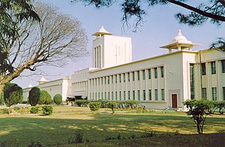
Mesra is a town in the Kanke CD block in the Ranchi Sadar subdivision of the Ranchi district in the Indian state of Jharkhand.

Irba is a census town in the Ormanjhi CD block in the Ranchi Sadar subdivision of the Ranchi district in the Indian state of Jharkhand.

Ara is a census town in the Namkum CD block in the Ranchi Sadar subdivision of the Ranchi district in the Indian state of Jharkhand.

Bargarwa {also called Barganwa} is a census town in the Namkum CD block in the Ranchi Sadar subdivision of the Ranchi district in the Indian state of Jharkhand.

Tundul is a census town in the Nagri CD block in the Ranchi Sadar subdivision of the Ranchi district in the Indian state of Jharkhand.

Pithoria is a village in the Kanke CD block in the Ranchi Sadar subdivision of the Ranchi district in the Indian state of Jharkhand.

<span class="mw-page-title-main">Sikidiri</span> Populated place in Jharkhand, India

Sikidiri is a populated place in the Ormanjhi CD block in the Ranchi Sadar subdivision of the Ranchi district in the Indian state of Jharkhand.

References

  1. "District Census Handbook, Ranchi, Series 21, Part XII A" (PDF). Pages 10-11: Physiography, Drainage. Directorate of Census Operations Jharkhand. Retrieved 19 September 2021.
  2. "Central Coalfields Limited". Areas – North Karanpura. CCL. Retrieved 19 September 2021.
  3. "Central Coalfields Limited". Areas – Piparwar. CCL. Retrieved 19 September 2021.
  4. "District Census Handbook, Ranchi, Series 21, Part XII A" (PDF). Page 14: Industry. Directorate of Census Operations Jharkhand. Retrieved 19 September 2021.
  5. "District Census Handbook, Ranchi, Series 21, Part XII A" (PDF). Pages 10-11: Physiography, Drainage. Directorate of Census Operations Jharkhand. Retrieved 19 September 2021.
  6. "District Census Handbook, Ranchi , Series 21, Part XII B" (PDF). Rural PCA-C.D. blocks wise Village Primary Census Abstract, location no. 374058, page 28-29. Directorate of Census Operations Jharkhand. Retrieved 11 September 2021.
  7. "Census of India 2001: Data from the 2001 Census, including cities, villages and towns (Provisional)". Census Commission of India. Archived from the original on 16 June 2004. Retrieved 1 November 2008.
  8. "District Census Handbook Ranchi, Census of India 2011, Series 21, Part XII A" (PDF). Pages 675-681. Directorate of census Operations, Jharkhand. Retrieved 10 September 2021.
  9. "District Police Profile - Ranchi". Jharkhand Police. Retrieved 14 September 2021.
  10. "5336 Ranchi-Dhanbad Passenger". Time Table. Indiarailinfo. Retrieved 13 September 2021.
  11. "Barakkana-Ranchi railway line: project to be completed soon, trains to pass through litigation and tunnels". Actiworld. Retrieved 11 September 2021.
  12. "Kamla Nehru Inter College". Schools.org.in. Retrieved 14 September 2021.
  13. "Swarnarekha Public High School". Schools.org.in. Retrieved 14 September 2021.
  14. "Cambridge School". CS. Retrieved 15 September 2021.
  15. "Cambridge Institute of Technology". CUT. Retrieved 15 September 2021.
  16. "Cambridge Institute of Technology". college dunia. Retrieved 15 September 2021.
  17. "Dispensary". Item 442. Employees' State Insurance Corporation. Retrieved 14 September 2021.