Contents

This is a list of islands of East Timor . [1]
This is a list of islands of East Timor . [1]
| Island | Other names | Coordinates | Surface area controlled (% of island) | Surface area controlled (quantitative) | Population (2015 census) |
|---|---|---|---|---|---|
| Timor | Malay: Timur | 9°14′S124°56′E / 9.233°S 124.933°E | 49 | 15,007 km2 (5,794 sq mi) | 1,183,643 |
| Atauro Island | Malay: Pulu Kambing Tetum: Pulau Atauro Tetum: Pulau Ata'uro Portuguese : Ilha de Ataúro Indonesian : Pulau Kambing | 08°14′24″S125°34′48″E / 8.24000°S 125.58000°E | 100 | 140 km2 (54 sq mi) | 9,274 |
| Jaco Island | Indonesian: Pulau Jako Tetum: Pulau Jaco | 8°25′30″S127°19′30″E / 8.42500°S 127.32500°E | 100 | 11 km2 (4 sq mi) | 0 |

This is a list of the lists of islands in the world grouped by country, by continent, by body of water, and by other classifications. For rank-order lists, see the other lists of islands below.

The United Kingdom is a sovereign state located off the north-western coast of continental Europe. With a total area of approximately 248,532 square kilometres (95,960 sq mi), the UK occupies the major part of the British Isles archipelago and includes the island of Great Britain, the north-eastern one-sixth of the island of Ireland and many smaller surrounding islands. It is the world's 7th largest island country. The mainland areas lie between latitudes 49°N and 59°N, and longitudes 8°W to 2°E. The Royal Observatory, Greenwich, in south-east London, is the defining point of the Prime Meridian.

Melanesia is a subregion of Oceania in the southwestern Pacific Ocean. It extends from Indonesia's Sumba in the west to Tonga in the east, and includes the Arafura Sea and a few thousand islands.

The Hawaiian Islands are an archipelago of eight major islands, several atolls, and numerous smaller islets in the North Pacific Ocean, extending some 1,500 miles from the island of Hawaiʻi in the south to northernmost Kure Atoll. Formerly the group was known to Europeans and Americans as the Sandwich Islands, a name that James Cook chose in honor of the 4th Earl of Sandwich, the then First Lord of the Admiralty. Cook came across the islands by chance when crossing the Pacific Ocean on his Third Voyage in 1778, on board HMS Resolution; he was later killed on the islands on a return visit. The contemporary name of the islands, dating from the 1840s, is derived from the name of the largest island, Hawaiʻi Island.

The northern region of Europe has several definitions. A restrictive definition may describe Northern Europe as being roughly north of the southern coast of the Baltic Sea, which is about 54°N, or may be based on other geographical factors such as climate and ecology.

Tortuga Island is a Caribbean island that forms part of Haiti, off the northwest coast of Hispaniola. It constitutes the commune of Île de la Tortue in the Port-de-Paix arrondissement of the Nord-Ouest department of Haiti.

A subregion is a part of a larger region or continent and is usually based on location. Cardinal directions, such as south are commonly used to define a subregion.

Asia-Pacific (APAC) is the part of the world near the western Pacific Ocean. The Asia-Pacific region varies in area depending on context, but it often includes countries in East Asia, Southeast Asia, and Oceania that border the Pacific Ocean. Afghanistan, the Indian subcontinent, Mongolia, Myanmar, and the Russian Far East are generally included in a wider Asia-Pacific region.

Jaco Island is an uninhabited island in East Timor, a country occupying the eastern end of the island of Timor in the Lesser Sunda Islands in Southeast Asia. It lies within the Nino Konis Santana National Park.

Jenny Island or Isla Juanita is a rocky island 3.7 km (2 nmi) long which rises to 500 m (1,600 ft), lying 5.6 km (3 nmi) east of Cape Alexandra, the southeastern extremity of Adelaide Island, in northern Marguerite Bay. Jenny Island is located at 67°44′S68°24′W.
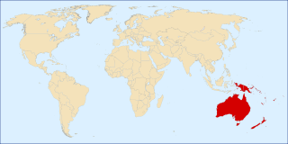
The following outline is provided as an overview and topical guide to Oceania.

The following is an alphabetical list of articles related to the United Kingdom.
Andersen Island is an island 7 kilometres (4 nmi) west of Thorgaut Island, and 4 kilometres (2 nmi) east of Child Rocks, in the Robinson Group, Antarctica. It was mapped by the British Australian New Zealand Antarctic Research Expedition under Douglas Mawson in February 1931. The island was also charted from the whaler Thorgaut about the same time. It was named after Captain Lars Andersen of the whaler Falk who had assisted the Discovery with coal.

Gregory Island is a small ice-free island lying just off the east coast of Victoria Land, Antarctica, 5 km (3.1 mi) north-east of Cape Archer and 8 km (5.0 mi) south of Cape Ross. It was discovered by the British National Antarctic Expedition (1901–04), at which time it was thought to be a coastal point and was named "Gregory Point," for John Walter Gregory, director of the civilian staff of the expedition. It was determined to be an island by the British Antarctic Expedition, 1910–13.
| History |  | ||||
|---|---|---|---|---|---|
| Geography | |||||
| Politics | |||||
| Economy | |||||
| Society |
| ||||
| Authority control: National libraries |
|---|