Bay Area Rapid Transit (BART) is a rapid transit system serving the San Francisco Bay Area in California. BART serves 50 stations along six routes and 131 miles of track, including a 9-mile (14 km) spur line running to Antioch, which uses diesel multiple unit vehicles, and a 3-mile (4.8 km) automated guideway transit line serving San Francisco Bay Oakland International Airport. With an average of 160,400 weekday passengers as of the fourth quarter of 2023 and 48,119,400 annual passengers in 2023, BART is the seventh-busiest rapid transit system in the United States.

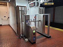
Civic Center/UN Plaza station is a combined BART and Muni Metro rapid transit station in the Market Street subway in downtown San Francisco. Located under Market Street between 7th Street and 8th Street, it is named for the Civic Center neighborhood and the adjacent United Nations Plaza. The three-level station has a large fare mezzanine level, with separate platform levels for Muni Metro and BART below.

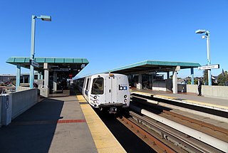
Millbrae station is an intermodal transit station serving Bay Area Rapid Transit (BART) and Caltrain, located in Millbrae, California. The station is the terminal station for BART on the San Francisco Peninsula, served by two lines: The Red Line before 9 pm and the Yellow Line during the early morning and evening. It is served by all Caltrain services. The station is also served by SamTrans bus service, Commute.org and Caltrain shuttle buses, and other shuttles.
West Oakland station is a Bay Area Rapid Transit (BART) station in the West Oakland neighborhood of Oakland, California. It has two elevated side platforms and is located near the eastern end of the Transbay Tube. All main BART lines except the Orange Line stop at the station. The Oakland Wye is located to the east of the station.

Lake Merritt station is an underground Bay Area Rapid Transit (BART) station located east of Downtown Oakland near the eponymous Lake Merritt. The station is served by the Orange, Green, and Blue lines. It is the nearest BART station to Chinatown, Laney College, and Jack London Square station.

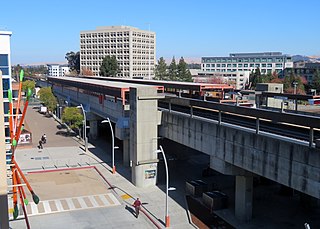
19th Street Oakland station is an underground Bay Area Rapid Transit (BART) station located under Broadway between 17th Street and 20th Street in the Uptown District of Oakland, California. It is a timed transfer point between northbound trains to Richmond and to Antioch. The station has three underground levels, with tracks on the second and third levels. It is served by the Red Line, Orange Line, and Yellow Line, as well as by AC Transit buses on the surface at the Uptown Transit Center.
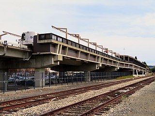
Fruitvale station is a Bay Area Rapid Transit (BART) station located in the Fruitvale District of Oakland, California. The elevated station has two side platforms. The station is served by the Orange, Green, and Blue lines.

Rockridge station is a Bay Area Rapid Transit station located in the Rockridge district of Oakland, California. Located in the center median of the elevated State Route 24 west of the Caldecott Tunnel, the station has a single island platform serving two tracks. It is served by the Yellow Line.
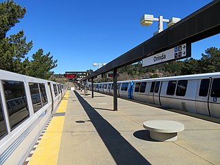
Orinda station is a Bay Area Rapid Transit station in Orinda, California. The station has an island platform in the center median of State Route 24. It is served by the Yellow Line. An abstract mural by Win Ng, partially covered by advertisements, is located in the fare lobby.
Walnut Creek station is an elevated Bay Area Rapid Transit (BART) station in Walnut Creek, California, served by the Yellow Line. The station is located north of downtown Walnut Creek, adjacent to Interstate 680 and near the Ygnacio Valley Road and California Boulevard arterial roads.

Concord station is a Bay Area Rapid Transit (BART) station in Concord, California. The station is located between the downtown business district to the west and residential neighborhoods to the east. Concord station has a single elevated island platform and is served by the Yellow Line.

Richmond station is an Amtrak intercity rail and Bay Area Rapid Transit (BART) station located in downtown Richmond, California. Richmond is the north terminus of BART service on the Orange Line and Red Line; it is a stop for Amtrak's Capitol Corridor, San Joaquins, and California Zephyr routes. The accessible station has one island platform for the two BART tracks, with a second island platform serving two of the three tracks of the Union Pacific Railroad Martinez Subdivision for Amtrak trains. It is one of two transfer points between BART and Amtrak, along with Oakland Coliseum station.

San Leandro station is a Bay Area Rapid Transit (BART) station located off Davis Street in downtown San Leandro, California. The station has two elevated side platforms, with the faregates at ground level. The station is served by the Orange, Green, and Blue lines.

Bay Fair station is a Bay Area Rapid Transit (BART) station located adjacent to the Bayfair Center mall in San Leandro, California. The station is served by the Orange, Green, and Blue lines.

Ashby station is an underground Bay Area Rapid Transit (BART) station in Berkeley, California. The station is located beneath Adeline Street to the south of its intersection with Ashby Avenue. The station includes park-and-ride facilities with 715 automobile parking spaces in two separate parking lots. It is served by the Orange and Red lines.

MacArthur station is a Bay Area Rapid Transit (BART) station in the Temescal District of Oakland, California. It is the largest station in the BART system, being the only one with four platform tracks. Service through MacArthur is timed for cross-platform transfers between the southbound lines that pass through the station. MacArthur station is located in the median of SR 24 just north of its interchange with I-580. The station is perpendicular to 40th Street and MacArthur Boulevard. The surrounding neighborhood is mostly low-density residential, making MacArthur station primarily a commuting hub.

Downtown Berkeley station is an underground Bay Area Rapid Transit (BART) station in the Downtown Berkeley section of Berkeley, California. It is served by the Orange and Red lines.
Hayward station is a Bay Area Rapid Transit (BART) station in Hayward, California, serving Downtown Hayward and the surrounding areas. It is served by the Orange and Green lines. The elevated station has two side platforms. A two-lane bus terminal is located on the northeast side of the station. A pedestrian tunnel under the Union Pacific Railroad Oakland Subdivision connects the fare lobby to a parking lot and a five-level parking garage.

El Cerrito Plaza station is a Bay Area Rapid Transit (BART) station in El Cerrito, California, located adjacent to the El Cerrito Plaza shopping center. It primarily serves southern El Cerrito, northern Albany, and Kensington, along with nearby portions of Berkeley and Richmond. Nearly identical in form to El Cerrito del Norte station, El Cerrito Plaza station has two side platforms serving the line's two elevated tracks, with a fare lobby underneath. The Ohlone Greenway runs through the station area. The station is served by the Orange and Red lines.

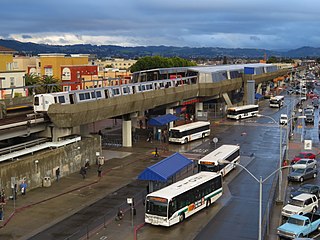
The station complex of Amtrak's Oakland Coliseum station and Bay Area Rapid Transit (BART)'s Coliseum station is located in the East Oakland area of Oakland, California, United States. The two stations, located about 600 feet (180 m) apart, are connected to each other and to the Oakland Coliseum/Oakland Arena sports complex with an accessible pedestrian bridge. The BART station is served by the Orange, Green, and Blue lines; the Amtrak station is served by the Capitol Corridor service.