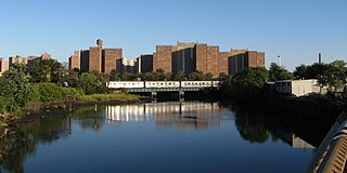
Coney Island Creek is a 1.8-mile-long (2.9 km) tidal inlet in Brooklyn, New York City. It was created from a series of streams and inlets by land filling and digging activities starting in the mid-18th century which, by the 19th century, became a 3-mile-long (4.8 km) continual strait and a partial mudflat connecting Gravesend Bay and Sheepshead Bay, separating Coney Island from the mainland. The strait was closed off in the early 20th century due to further land development and later construction projects. Today only the western half of Coney Island Creek exists.

The Belt Parkway is the name given to a series of controlled-access parkways that form a belt-like circle around the New York City boroughs of Brooklyn and Queens. The Belt Parkway comprises three of the four parkways in what is known as the Belt System: the Shore Parkway, the Southern Parkway, and the Laurelton Parkway. The three parkways in the Belt Parkway are a combined 25.29 miles (40.70 km) in length. The Cross Island Parkway makes up the fourth parkway in the system, but is signed separately.

Sheepshead Bay is a neighborhood in southern Brooklyn, New York City. It is bounded by Ocean Parkway to the west; Avenue T and Kings Highway to the north; Nostrand Avenue and Gerritsen Avenue to the east; and the Atlantic Ocean to the south. Sheepshead Bay is abutted by the neighborhoods of Brighton Beach and Homecrest to the west; Midwood to the north; and Gerritsen Beach to the east.

Bath Beach is a neighborhood in the New York City borough of Brooklyn, located at the southwestern edge of the borough on Gravesend Bay. The neighborhood borders Bensonhurst and New Utrecht to the northeast across 86th Street; Dyker Beach Park and Golf Course to the northwest across 14th Avenue; and Gravesend to the east across Stillwell Avenue.

Community boards of Brooklyn are New York City community boards in the borough of Brooklyn, which are the appointed advisory groups of the community districts that advise on land use and zoning, participate in the city budget process, and address service delivery in their district.

Bay Parkway is a 2.7-mile-long (7.82 km) boulevard in the west portion of the New York City borough of Brooklyn.
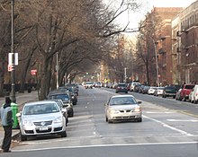
Kings Highway is a broad avenue that curves about the southern part of the Borough of Brooklyn in New York City. Its west end is at Bay Parkway and 78th Street. East of Ocean Avenue, the street is largely residential. It tracks eastward, then northeast, then north through Brooklyn and reaches East 98th Street in central Brooklyn. At that point, it flows into Howard Avenue to provide seamless access to Eastern Parkway, another major road in Brooklyn with side medians and service roads.

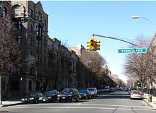
Ocean Parkway is a 4.86-mile-long (7.82 km) boulevard in the west-central portion of the New York City borough of Brooklyn. It is inventoried by the New York State Department of Transportation (NYSDOT) as New York State Route 908H (NY 908H), an unsigned reference route.
Vanderbilt Avenue is the name of three thoroughfares in the New York City boroughs of Brooklyn, Manhattan, and Staten Island. They were named after Cornelius Vanderbilt (1794–1877), the builder of Grand Central Terminal in Midtown Manhattan.
Fordham Road is a major thoroughfare in the Bronx, New York City, that runs west-east from the Harlem River to Bronx Park. Fordham Road houses the borough's largest and most diverse shopping district. It geographically separates the geopolitical North Bronx from the South Bronx.

Union Turnpike is a thoroughfare stretching across part of Long Island in southern New York state, mostly within central and eastern Queens in New York City. It runs from Myrtle Avenue in Glendale, Queens, to Marcus Avenue in North New Hyde Park, Nassau County, about 1 mile (1.6 km) outside New York City border.

Rockaway Beach Boulevard, opened in 1886, was the first major east-west thoroughfare on the Rockaway Peninsula in the Borough of Queens in New York City. Much of its route parallels the Rockaway Freeway and the IND Rockaway Line above the Freeway. The boulevard first forks off at its eastern end from Beach Channel Drive at Beach 35th Street in Edgemere and merges once again with Beach Channel Drive by Jacob Riis Park shortly before the Marine Parkway–Gil Hodges Memorial Bridge.

The B44 is a public transit line in Brooklyn, New York City, running mostly along Nostrand Avenue, as well as northbound on Rogers Avenue or New York Avenue and Bedford Avenue, between Sheepshead Bay and Williamsburg. Originally a streetcar line, it is now the B44 bus route, operated by the New York City Transit Authority.

Rockaway Parkway is a major commercial street in the Canarsie and Brownsville neighborhoods of Brooklyn, New York.
The B33 was a public transit line in Brooklyn, New York City, running mostly along Hamilton Avenue between Bay Ridge and Hamilton Ferry at the north end of the avenue in Red Hook. Originally a streetcar line known as the Hamilton Avenue Line, it was replaced by a bus route, but is no longer operated.
The Brooklyn–Queens Greenway is a bicycling and pedestrian path connecting parks and roads in the New York City boroughs of Brooklyn and Queens, connecting Coney Island in the south to Fort Totten in the north, on Long Island Sound. The route connects major sites in the two boroughs, such as the New York Aquarium, Brooklyn Museum, the Brooklyn Botanic Garden, the New York Hall of Science, and Citi Field.
Mapleton is a neighborhood in southern Brooklyn, New York City, bounded by 16th Avenue on the west, Dahill Road on the east, 57th Street on the north, and 65th Street on the south. It borders Bensonhurst and Borough Park to the west, and Midwood to the east.
Shore Boulevard Mall is a waterfront promenade extending for nearly a mile along the southern bank of Sheepshead Bay in the Manhattan Beach neighborhood of Brooklyn, New York.