Queenhithe

Last updated

Ward of Queenhithe
Queenhithe London 2010.jpg
The Queenhithe riverside (upstream to the left; Queenhithe dock on right) from Bankside
City of London, Ward of Queenhithe.svg
Location within the City
Greater London UK location map 2.svg
Red pog.svg
Ward of Queenhithe
Location within Greater London
Population319 (2011 Census. Ward) [1]
OS grid reference TQ321808
  Charing Cross 1.4 miles (2.3 km)  West
Sui generis
Administrative area Greater London
Region
Country England
Sovereign state United Kingdom
Post town LONDON
Postcode district EC4
Dialling code 020
Police City of London
Fire London
Ambulance London
UK Parliament
London Assembly
List of places
UK
England
London
51°30′40″N0°05′49″W / 51.511°N 0.097°W / 51.511; -0.097 Coordinates: 51°30′40″N0°05′49″W / 51.511°N 0.097°W / 51.511; -0.097

Queenhithe is a small and ancient ward of the City of London, situated by the River Thames and to the south of St. Paul's Cathedral. The Millennium Bridge crosses into the City at Queenhithe.

Contents

Queenhithe is also the name of the ancient, but now disused, dock and a minor street, which runs along that dock, both of which are within the ward.

The ward is served by London Buses route 4, which runs along Queen Victoria Street and stops by the Millennium footbridge, [2] and the nearest London Underground station is Mansion House, on Queen Victoria Street.

History

The ward's name derives from the "Queen's Dock", [3] or "Queen's Quay", which was probably a Roman dock (or small harbour), but known in Saxon times as "Aeðereshyð", later "Ethelred's Hythe". The dock existed during the period when the Wessex king, Alfred the Great, re-established the City of London, circa 886 AD. It only became "Queenhithe" (spelt archaically as "Queenhythe") when Matilda, wife of King Henry I, was granted duties on goods landed there. The Queenhithe dock remains today, but has long fallen out of use and is heavily silted up (being tidal). Queenhithe harbour was used for importing corn into London and continued to be in use into the 20th century, by the fur and tanning trades. Being upstream of London Bridge, however, meant that large sea-going sailing ships could no longer safely reach the dock from the sea. King Charles II landed at Queenhithe during the Great Fire of London in September 1666 to view the extent of the destruction and assist in the firefighting. [4]

The dock, including the wharf walls and adjacent street, was designated a Scheduled Ancient Monument in 1973; it is the only surviving inlet on the modern City's waterfront. Its walls have been re-strengthened, as part of London's flood defences.

Bombing in the Blitz destroyed approximately three-quarters of the ward's buildings: the only listed buildings are St Benet Paul's Wharf Church, and the tower of the former St Mary Somerset Church.

A key sequence of the 1951 comedy The Lavender Hill Mob used Queenhithe as a location for filming: Mr. Holland, played by Alec Guinness, can be seen falling from a wharf into the Thames and being rescued by two actors dressed as police officers.

Construction of the Millennium Bridge began in 1998 before its opening in 2000. The construction of this footbridge, which created a direct pedestrian route from Bankside (at the Tate Modern) to the St Paul's area, has contributed to a dramatic increase in tourists and commuters transitting the ward of Queenhithe.

Notable sites

The Salvation Army's headquarters in Queenhithe. Salvation.army.hq.london.arp.jpg
The Salvation Army's headquarters in Queenhithe.

Queenhithe includes a number of notable buildings and sites, including:

Also within the ward are the London offices of the international law firm Salans and the Japanese bank Sumitomo Mitsui Banking Corporation. [5]

Peter's Hill, which since the construction of the Millennium footbridge is a major pedestrian route, shown leading up to St. Paul's Cathedral. Millennium Bridge & St. Pauls2.jpg
Peter's Hill, which since the construction of the Millennium footbridge is a major pedestrian route, shown leading up to St. Paul's Cathedral.

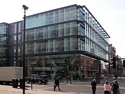
The ward has a complex urban topography, largely due to post-World War II development, with Upper Thames Street running beneath Peter's Hill and a number of large post-War buildings, such as Millennium Bridge House and Queensbridge House. A number of old lanes and alleys remain, some of which cross the thoroughfare by footbridge.

The Welsh church of St Benet Paul's Wharf, on Bennet's Hill, is in the northwest corner of the ward. Two former churches were situated within the ward, very near to one another: St Michael Queenhithe and St Mary Somerset, of which only the tower of St Mary's remains.

The Queenhithe Mosaic is a 30-metre-long timeline on the wall of Queenhithe Dock. The mosaic was completed in 2014 and features key figures from history who built and used the dock and lived nearby.

Queenhithe is one of the smaller residential centres in the otherwise business-dominated City; with a population of 319 as of 2011, it mostly comprises the residents of the three riverside residential developments: Sir John Lyon House, Globe View and Queen's Quay. A small number of bars and restaurants have been established along the riverside, with views across to the Globe theatre and Tate Modern.

Boundary

In 2003 the ward boundaries of the City of London were altered quite considerably, including those of Queenhithe, in what was the first comprehensive review of local government boundaries. Queenhithe lost some ground to the north and east to Vintry, but gained (including the City of London School) to the west from Castle Baynard. A further review of ward boundaries, effective in 2013, recommended no further changes to Queenhithe's boundaries. The ward is recognised as one of the four residential wards of the City (with a population of 319 (2011), the smallest of those wards) [6] and policy is to retain a predominantly residential vote (as opposed to the business vote being predominant) in these wards. [7]

The present-day boundary of the ward, starting from the Thames in the west, runs north along White Lion Hill (to the west of the City School) then east along Queen Victoria Street then down Lambeth Hill. The boundary then runs for a short distance along Upper Thames Street before heading north up Huggin Hill to include Painters' Hall, after which the boundary turns south towards the river again; the ward includes all of Queensbridge House. Leading to the river, the boundary crosses Upper Thames Street and then runs along Queenhithe (the street), including the whole of the old Queenhithe dock.

Included within the ward boundary is the part of the Thames, adjacent to the Queenhithe shore, which is in the City (i.e. to a line midway across the width of the river). Indeed, approximately half of the ward's area is the River Thames and shore; with this part excluded the ward is the smallest (by area) in the City. The ward (and City) boundary is crossed halfway over the Millennium Bridge.

The ward is bounded by the wards of Castle Baynard to the west, Bread Street to the north, Vintry to the east, and the London Borough of Southwark to the south (across the river). Prior to the 2003 changes it also bounded Cordwainer ward.

Politics

Queenhithe is one of 25 wards in the City of London, each electing an alderman to the Court of Aldermen, and commoners (the City equivalent of a Councillor) to the Court of Common Council of the City of London Corporation. Only Freemen of the City of London are eligible to stand for election.

Queenhithe returns an Alderman and two Common Councilmen to the Corporation of London. [8]

Queenhythe, Jamaica

A rural community called Queenhythe (or Queen Hythe) exists in the Saint Ann parish of Jamaica. As with many place names in that country, it is named after a locality in England.

Related Research Articles

<span class="mw-page-title-main">City of London</span> Central business district of London, England

The City of London is a city, ceremonial county and local government district that contains the historic centre and constitutes, alongside Canary Wharf, the primary central business district (CBD) of London. It constituted most of London from its settlement by the Romans in the 1st century AD to the Middle Ages, but the modern area named London has since grown far beyond the City of London boundary. The City is now only a small part of the metropolis of Greater London, though it remains a notable part of central London. Administratively, the City of London is not one of the London boroughs, a status reserved for the other 32 districts. It is also a separate ceremonial county, being an enclave surrounded by Greater London, and is the smallest ceremonial county in the United Kingdom.

<span class="mw-page-title-main">Isle of Dogs</span> Area in the East End of London, England

The Isle of Dogs is a large peninsula bounded on three sides by a large meander in the River Thames in East London, England, which includes the Cubitt Town, Millwall and Canary Wharf districts. The area was historically part of the Manor, Hamlet, Parish and, for a time, the wider borough of Poplar. The name had no official status until the 1987 creation of the Isle of Dogs Neighbourhood by Tower Hamlets London Borough Council. It has been known locally as simply "the Island" since the 19th century.

<span class="mw-page-title-main">Canary Wharf</span> Major business and financial district in London, England

Canary Wharf is an area of London, England, located near the Isle of Dogs in the London Borough of Tower Hamlets. Canary Wharf is defined by the Greater London Authority as being part of London's central business district, alongside Central London. With the City of London, it constitutes one of the main financial centres in the United Kingdom and the world, containing many high-rise buildings including the third-tallest in the UK, One Canada Square, which opened on 26 August 1991.

<span class="mw-page-title-main">Walbrook</span> Ward of the City of London

Walbrook is a City ward and a minor street in its vicinity. The ward is named after a river of the same name.

<span class="mw-page-title-main">Billingsgate</span> Ward of the City of London

Billingsgate is one of the 25 Wards of the City of London. This small City Ward is situated on the north bank of the River Thames between London Bridge and Tower Bridge in the south-east of the Square Mile.

<span class="mw-page-title-main">Royal Docks</span> Area in Newham, London

Royal Docks is an area and a ward in the London Borough of Newham in the London Docklands in East London, England.

<span class="mw-page-title-main">Royal Victoria Dock</span> Historic site in London

The Royal Victoria Dock is the largest of three docks in the Royal Docks of east London, now part of the redeveloped Docklands.

<span class="mw-page-title-main">Southbank, Victoria</span> Suburb of Melbourne, Victoria, Australia

Southbank is an inner-city suburb in Melbourne, Victoria, Australia, 1 km south of Melbourne's Central Business District, located within the Cities of Melbourne and Port Phillip local government areas. Southbank recorded a population of 22,631 at the 2021 census.

<span class="mw-page-title-main">St Michael Queenhithe</span> Church in City of London, England

St. Michael Queenhithe was a church in the City of London located in what is now Upper Thames Street. First recorded in the 12th century, the church was destroyed during the Great Fire of London in 1666. Rebuilt by the office of Sir Christopher Wren, it was demolished in 1876.

<span class="mw-page-title-main">Bread Street</span> Ward of the City of London

Bread Street is one of the 25 wards of the City of London the name deriving from its principal street, which was anciently the City's bread market; already named Bredstrate for by the records it appears as that in 1302, Edward I announced that "the bakers of Bromley and Stratford-le-Bow [London], and ones already living on the street, were forbidden from selling bread from their own homes or bakeries, and could only do so from Bread Street." The street itself is just under 500 ft in length and now forms the eastern boundary of the ward after the 2003 boundary changes.

<span class="mw-page-title-main">Cordwainer (ward)</span> Ward of the City of London

Cordwainer is a small, almost rectangular-shaped ward in the City of London. It is named after the cordwainers, the professional shoemakers who historically lived and worked in this particular area of London; there is a Livery Company for the trade — the Worshipful Company of Cordwainers. The ward is sometimes referred to as the "Cordwainers' ward".

<span class="mw-page-title-main">Castle Baynard</span> Ward of the City of London

Castle Baynard is one of the 25 wards of the City of London, the historic and financial centre of London.

<span class="mw-page-title-main">Dowgate</span> Ward of the city of London

Dowgate, also referred to as Downgate and Downegate, is a small ward in the City of London, the historic and financial centre of London. The ward is bounded to the east by Swan Lane and Laurence Poutney Lane, to the south by the River Thames, to the west by Cousin Lane and College Hill, and to the north by Cannon Street. It is where the "lost" Walbrook watercourse emptied into the Thames.

<span class="mw-page-title-main">Vintry</span> Ward of the City of London

Vintry is one of the 25 wards of the City of London. Located within it is the City end of Southwark Bridge and, adjacent to that, the hall of the Worshipful Company of Vintners, the City livery company for the wine trade.

<span class="mw-page-title-main">Queen Victoria Street, London</span>

Queen Victoria Street, named after the British monarch who reigned from 1837 to 1901, is a street in London which runs east by north from its junction with New Bridge Street and Victoria Embankment in the Castle Baynard ward of the City of London, along a section that divides the wards of Queenhithe and Bread Street, then lastly through the middle of Cordwainer ward, until it reaches Mansion House Street at Bank junction. Beyond Bank junction, the street continues north-east as Threadneedle Street which joins Bishopsgate. Other streets linked to Queen Victoria Street include Puddle Dock, Cannon Street, Walbrook and Poultry.

<span class="mw-page-title-main">Wards of the City of London</span> Special form of ward in the City of London

The City of London is divided into 25 wards. The city is the historic core of the much wider metropolis of Greater London, with an ancient and sui generis form of local government, which avoided the many local government reforms elsewhere in the country in the 19th and 20th centuries. Unlike other modern English local authorities, the City of London Corporation has two council bodies: the now largely ceremonial Court of Aldermen, and the Court of Common Council.

<span class="mw-page-title-main">Queen Street, London</span>

Queen Street is a street in the City of London which runs between Upper Thames Street at its southern end to Cheapside in the north. The thoroughfares of Queen Street and King Street were newly laid out, cutting across more ancient routes in the City, following the Great Fire of London in 1666; they were the only notable new streets following the fire's destruction of much of the City.

<span class="mw-page-title-main">Baynard House, London</span>

Baynard House is a brutalist office block in Queen Victoria Street in Blackfriars in the City of London, occupied by BT Group. It was built on the site of Baynard's Castle. Most of the land under it is a scheduled monument. From 1982 to 1997 it housed the BT Museum.

References

  1. "City of London Ward population 2011". Neighbourhood Statistics. Retrieved 16 October 2016.
  2. TfL Buses from Mansion House and St Paul's
  3. The City of London - A History, Borer, M I C: New York, D.McKay Co, 1978 ISBN   0-09-461880-1
  4. Fraser, Antonia (1999). King Charles II. Orion. p. 244.
  5. www.tufts.edu
  6. www.statistics.gov.uk
  7. City of London Corporation Archived 14 January 2010 at the Wayback Machine Ward Boundary Review
  8. Alderman Gordon Haines