
Long Island City (LIC) is a residential and commercial neighborhood on the extreme western tip of Queens, a borough in New York City in the United States. It is bordered by Astoria to the north; the East River to the west; New Calvary Cemetery in Sunnyside to the east; and Newtown Creek—which separates Queens from Greenpoint, Brooklyn—to the south.

Flushing Meadows–Corona Park, often referred to as Flushing Meadows Park, or simply Flushing Meadows, is a public park in the northern part of Queens in New York City, New York, U.S. It is bounded by I-678 on the east, Grand Central Parkway on the west, Flushing Bay on the north, and Union Turnpike on the south. Flushing Meadows–Corona Park is the fourth-largest public park in New York City, with a total area of 897 acres (363 ha).

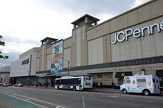
Corona is a neighborhood in the borough of Queens in New York City. It borders Flushing and Flushing Meadows–Corona Park to the east, Jackson Heights to the west, Forest Hills and Rego Park to the south, Elmhurst to the southwest, and East Elmhurst to the north. Corona's main thoroughfares include Corona Avenue, Roosevelt Avenue, Northern Boulevard, Junction Boulevard, and 108th Street.
Elmhurst is a neighborhood in the borough of Queens in New York City. It is bounded by Roosevelt Avenue on the north; the Long Island Expressway on the south; Junction Boulevard on the east; and the New York Connecting Railroad on the west.

Queens Botanical Garden is a botanical garden located at 43-50 Main Street in Flushing, Queens, New York City. The 39-acre (16 ha) site features rose, bee, herb, wedding, and perennial gardens; an arboretum; an art gallery; and a LEED-certified Visitor & Administration Building. Queens Botanical Garden is located on property owned by the City of New York, and is funded from several public and private sources. It is operated by Queens Botanical Garden Society, Inc.
Brooklyn Community Board 5 is a New York City community board that encompasses the Brooklyn neighborhoods of East New York, Cypress Hills, Highland Park, New Lots, City Line, Spring Creek, and Starrett City. It is delimited by Van Sinderen Avenue on the west, the Queens Borough line on the north and on the east, as well as by the Gateway National Recreation Area, Louisiana and Stanley Avenue on the south.
The Queens Community Board 1 is a local advisory group in New York City, encompassing the neighborhoods of Astoria, Long Island City, Queensbridge, Ditmars, Ravenswood, Steinway, Garden Bay, and Woodside, in the Borough of Queens. It also includes Rikers Island, the citywide correctional complex, which is within the Borough of the Bronx but connected by its only bridge to Astoria. The Board's district is delimited by the East River on both west and north, by the Brooklyn–Queens Expressway on the east, and by Northern Boulevard, the Long Island Rail Road and Bridge Plaza North on the south.

East Elmhurst is a residential neighborhood in the northwest section of the New York City borough of Queens. It is bounded to the south by Jackson Heights and Corona, to the north and east by Bowery Bay, and to the west by Woodside and Ditmars Steinway. The area also includes LaGuardia Airport, located on the shore of Flushing Bay, LaGuardia Landing Lights Fields, and Astoria Heights.
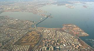
Bay Terrace is a neighborhood in the northeastern section of the New York City borough of Queens. It is often considered part of the larger area of Bayside. Bay Terrace overlooks the East River and the approaches to the Throgs Neck Bridge from the Clearview Expressway and Cross Island Parkway. It is bounded on the west by the Clearview Expressway, on the south by 26th and 28th Avenues, to the east by the Little Neck Bay, and to the north by the East River.
The Queens Community Board 2 is a local advisory group in New York City, encompassing the neighborhoods of Hunters Point, Long Island City, Sunnyside, and Woodside, in the borough of Queens. It is delimited by the East River on the west; Bridge Plaza North, the Long Island Rail Road and Northern Boulevard on the north; New York Connecting Railroad on the east; and Newtown Creek on the south.
The Queens Community Board 4 is a local government in the New York City borough of Queens, encompassing the neighborhoods of Elmhurst, Corona, Corona Heights, Newtown, and also includes LeFrak City, Queens Center Mall and Flushing Meadows-Corona Park. It is delimited by Roosevelt Avenue to the north, the New York Connecting Railroad to the west, the Horace Harding Expressway to the south and Flushing Meadows Corona Park on the east.
The Queens Community Board 5 is a local government in the New York City borough of Queens, encompassing the neighborhoods of Ridgewood, Glendale, Middle Village, Maspeth, Fresh Pond, and Liberty Park. It is delimited by Maurice Avenue and the Long Island Expressway to the north, the Brooklyn borough line to the west and south, and Woodhaven Boulevard to the east.
The Queens Community Board 6 is the local government body in the New York City borough of Queens, encompassing the neighborhoods of Forest Hills and Rego Park. It is delimited by the Horace Harding Expressway to the north, Woodhaven Boulevard to the west, the Jackie Robinson Parkway to the south, and the Grand Central Parkway on the east.
The Queens Community Board 7 is a local governmental advisory board in New York City, encompassing the neighborhoods of Flushing, Bay Terrace, College Point, Whitestone, Malba, Murray Hill, Linden Hill, Beechhurst, Queensboro Hill and Willets Point, in the borough of Queens. It is delimited by the Flushing Bay to the west, the East River to the north, Utopia Parkway and Little Neck Bay on the east, and Reeves Avenue on the south. CB7 is the biggest community board in Queens.
The Queens Community Board 9 is a local government in the New York City borough of Queens, encompassing the neighborhoods of Richmond Hill, Woodhaven, Ozone Park and Kew Gardens. It is delimited by the Brooklyn border to the West, Park Lane and Union Turnpike to the North, Van Wyck Expressway to the East and 103rd Avenue on the South.
The Queens Community Board 10 is a local government in the New York City borough of Queens, encompassing the neighborhoods of Howard Beach, Ozone Park, South Ozone Park, Richmond Hill, Tudor Village and Lindenwood. It is delimited by the Brooklyn border to the west, Liberty Avenue and 103rd Avenue to the north, Van Wyck Expressway to the east and Jamaica Bay and John F. Kennedy International Airport to the south.
The Queens Community Board 11 is a local government in the New York City borough of Queens, encompassing the neighborhoods of Bayside, Douglaston–Little Neck, Auburndale, East Flushing, Oakland Gardens and Hollis Hills. It is delimited by Utopia Parkway to the west, 26th Avenue and Little Neck Bay to the north, the Nassau County border to the east and Horace Harding Expressway, Clearview Expressway and Grand Central Parkway to the south.
The Queens Community Board 13 is a local government in the New York City borough of Queens, encompassing the neighborhoods of Queens Village, Glen Oaks, Bellerose, Cambria Heights, Laurelton, Rosedale, Meadowmere, Floral Park and Brookville. It is bounded to the north by the Grand Central Parkway, to the east by the Nassau County border, to the south by Nassau County and John F. Kennedy International Airport and to the west by Francis Lewis Boulevard. The area has a population of 196,284, which is made up of roughly 60% Black, 10% Caucasian, 12% Asian and 12% Hispanic residents.
The Queens Community Board 14 is a local government in the New York City borough of Queens, encompassing the neighborhoods of Breezy Point, Belle Harbor, Neponsit, Arverne, Bayswater, Edgemere, Rockaway Park, Rockaway and Far Rockaway. It is bounded to the north by Brooklyn and Jamaica Bay, on the east by the Nassau County border, and to the south by the Atlantic Ocean.

Community boards of Queens are New York City community boards in the borough of Queens, which are the appointed advisory groups of the community districts that advise on land use and zoning, participate in the city budget process, and address service delivery in their district.

