
The Satpura Range is a range of hills in central India. The range rises in eastern Gujarat running east through the border of Maharashtra and Madhya Pradesh and ends in Chhattisgarh. The range parallels the Vindhya Range to the north, and these two east–west ranges divide Indian Subcontinent into the Indo-Gangetic plain of northern India and the Deccan Plateau of the south. The Narmada River originates from north-eastern end of Satpura in Amarkantak, and runs in the depression between the Satpura and Vindhya ranges, draining the northern slope of the Satpura range, running west towards the Arabian Sea. The Tapti River originates in the eastern-central part of Satpura, crossing the range in the center and running west at the range's southern slopes before meeting the Arabian Sea at Surat, draining the central and southern slopes of the range. Multai, the place of Tapi river origin is located about 465 kilometer far, south-westerly to Amarkantak, separated across by the hill range. The Godavari River and its tributaries drain the Deccan plateau, which lies south of the range, and the Mahanadi River drains the easternmost portion of the range. The Godavari and Mahanadi rivers flow into the Bay of Bengal. At its eastern end, the Satpura range meets the hills of the Chotanagpur Plateau. The Satpura Range is a horst mountain and is flanked by Narmada Graben in the north and much smaller but parallel Tapi Graben in the south.

Nizamabad or Induru is a city in the Indian state of Telangana. It is governed by municipal corporation and is the headquarters of the Nizamabad district. Although previously part of Hyderabad State and then Andhra Pradesh state, Nizamabad became a part of the newly formed state of Telangana by the Andhra Pradesh Reorganisation Act, 2014. It is located about 186 kilometres (116 mi) north of the state capital, Hyderabad.
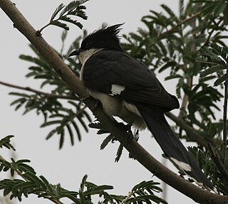
Mrugavani National Park is a national park located in Hyderabad, Telangana State, India. It is situated at Chilkur in Moinabad mandal, 20 km from MGBS and covers an area of 3.6 square kilometres (1.4 sq mi) or 1211 acres. It is home to a 600 different types of plant life. The Park is home to around 350 spotted deer. The animals include: indian hare, forest cat, civet, Indian rat snake, Russell's viper, chital and the flower pecker.
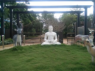
Mahavir Harina Vanasthali National Park is a deer national park located in Vanasthalipuram, Hyderabad, Telangana, India. It is spread over 3605 acres. It is the largest green lung space in the city of Hyderabad.

Uppal is a neighbourhood in Eastern Hyderabad, Telangana, India. It is the mandal headquarters of Uppal mandal in Keesara revenue division in Medchal-Malkajgiri district. It forms Circle No.2 in the L. B. Nagar Zone of Greater Hyderabad Municipal Corporation. There are four wards i.e., Chilukanagar (7), Habsiguda (8), Ramanthapur (9) and Uppal (10) in this circle.

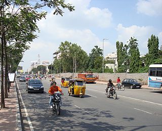
Hayathnagar is a busy residential locality Hyderabad in Ranga Reddy district of the Indian state of Telangana, Pin Code 500070 & 501505. It is Mandal headquarter of Hayathnagar mandal of Hayathnagar revenue division. Hayathnagar forms circle No 3 in Greater Hyderabad Municipal Corporation. There are four wards i.e Nagole (11) Mansoorabad (12), Hayathnagar (13) and B. N. Reddy Nagar (14) in this circle. It lies on National Highway 65.
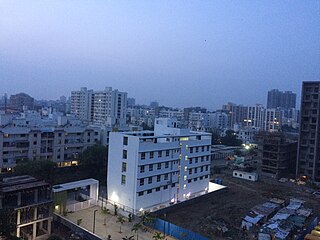
Hadapsar is a developed town in eastern Pune City, Maharashtra, India. After 1990, Hadapsar developed into a major industrial area and is now one of the most densely populated and developed areas of Pune District. It is well connected to all parts of city. Distances to popular city centers is: Pune Railway Station 8 km, Lohegaon Airport 8 km, Koregaon Park 5 km, Swargate Bus Stand 7 km and Shivaji Nagar Railway Station 12 km.
Thorrur is a gram panchayat and village in Hayanth Nagar mandal in Ranga Reddy district in the state of Telangana in India. It is one of the rapidly growing villages in Ranga Reddy District.

Hyderabad is located in central Telangana and is spread over an area of 2,500 km2. The city lies in the Deccan Plateau and rises to an average height of 536 m above the sea level. The city lies at 17.366° N latitude and 78.476° E longitude.

Amberpet is one of the oldest suburbs of Hyderabad, India. Amberpet lies adjacent to the famous Osmania University. It is also a Mandal in Hyderabad District. Its area stretches from Kachiguda to Ramanthapur in the East, and from 6 NO TO MALAKPET in the South. One of the oldest area of, Hyderabad, India.
The following are the temples located in and around Hyderabad
Sanjeeva Reddy Nagar or SR Nagar is predominantly a residential neighbourhood in Hyderabad, Telangana, India. It is close to Ameerpet, a commercial neighbourhood. It is named after the sixth President of India, Neelam Sanjeeva Reddy.
Neredmet is formally known as Neredu Mettu is a residential neighbourhood in Hyderabad, Telangana, India. It falls under Malkajgiri mandal & Circle in Medchal-Malkajgiri district. Neredmet currently serves as the headquarters of Rachakonda Police commissionerate, one of the three police commissionerates of Hyderabad City. It was earlier a part of Malkajgiri Municipality, but now it is administered under Malkajgiri Circle of GHMC-Secunderabad Zone. It forms Ward No. 136- Neredmet (Fully), Ward No. 137- Vinayak Nagar(Fully), Ward No. 138- Moula-Ali(Half), Ward No. 139- East Anandbagh(Partially), Ward No. 140- Malkajgiri (Half), of Greater Hyderabad Municipal Corporation.
Pedda Amberpet is a Municipality in Rangareddy district, Telangana, India. It comes under Abdullapurmet mandal.

The following outline is provided as an overview of and topical guide to Telangana:
Rachakonda Police commissionerate is one among the three Police commissionerates located in Hyderabad, Telangana, India.
Hastinapuram is a neighbourhood of Hyderabad. It is located towards Nagarjuna Sagar highway road. Its neighbouring areas are B.N. Reddy Nagar, Vanasthali Puram and LB Nagar. Also NGO colony, Christian colony. The area is divided into four parts, East Hastinapuram, West Hastinapuram, South Hastinapuram and Central Hastinapuram. LB Nagar will be the nearest station of Hyderabad Metro Train. Tourism destinations like Ramoji Film City, and Mount Opera are located within 10–15 km. The distance to Hyderabad Airport is 25 km. G.Surya Prakash, the Legend lives in Hastinapuram.

LB Nagar is a metro station located on the Red Line of the Hyderabad Metro. It is part of Corridor I of Hyderabad metro starting from Miyapur and was opened to public on 24 September 2018. Five shuttle bus services from L.B. Nagar Metro Station will carry tourists to Ramoji Film City every day. Passengers can visit all miles app or LB Nagar station for more details. This metro station is recording one of the highest footfalls daily. In September 2023, a new escalator at Arm-B of the LB Nagar metro station was opened.

