Hyderabad district, India

Last updated

Hyderabad district
A typical charminar evening.jpg
Panorama of Charminar complex
Hyderabad in Telangana (India).svg
Location in Telangana
Coordinates(Hyderabad): 17°21′58″N78°28′34″E / 17.366°N 78.476°E / 17.366; 78.476
CountryFlag of India.svg  India
State Telangana
Mandalas 16
Established1948
Headquarters Hyderabad
Government
   Parliament of India Asaduddin Owaisi
   District collector Sri Anudeep Durishetty, IAS [1]
   Parliament constituencies 1.Hyderabad

2.Secunderabad

3.Malkajgiri
   Assembly constituencies
Area
   District 217 km2 (84 sq mi)
Population
 (2011)
   District 3,943,323
  Density18,000/km2 (47,000/sq mi)
   Urban
100%
Demographics
   Literacy 83.25%
  Sex ratio954
Time zone UTC+05:30 (IST)
Major highways NH-44, NH-65, NH-163, NH-765,
Average annual precipitation786.8 mm
Website hyderabad.telangana.gov.in

Hyderabad district is a district in the state of Telangana in India that contains a part of the metropolitan area of Hyderabad. It is headed by a district collector who is drawn from the IAS cadre and is appointed by the state government. It is the smallest of all the districts in the state, but has the highest human density. Old MCH area, which is central region of Hyderabad city comes under this district.The district share boundaries with Rangareddy and Medhchal districts.

Contents

History

Hyderabad District before and after 1956 with Taluks Hyderabad District 1951&1961.jpg
Hyderabad District before and after 1956 with Taluks

Hyderabad district was formed in 1948 after Operation Polo by merging Atraf-a-Balda District and Baghat District. Baghat was previously a Taluk in Atraf-e-Balda District, and was made a separate district in 1931–34 under the subedar of Medak division. After formation of Andhra Pradesash by merging Telugu speaking of Hyderabad state in 1956 Hyderabad district boundary was altered Tandur Taluka which is Telugu speaking region of Gulbarga district was merged in Hyderabad district and Parigi Taluka of Mahabubnagar district and Vikarabad Taluka of Medak District also merged in Hyderabad district. [2] In 1978 Hyderabad district was later split into Hyderabad Urban District and Hyderabad Rural District. Hyderabad Urban District was made by 4 Talukas are Charminar, Golkonda, Mushirabad and Secunderabad Talukas. Hyderabad rural district was later renamed as Ranga Reddy District. [3] Hyderabad Urban district subdivided in 16 Mandals in 1985 and consist of 2 Revenue division [4] [5]

Administrative divisions

Hyderabad District includes the area of the core area Greater Hyderabad Municipal Corporation, Secunderabad Cantonment, and Osmania University. There are 16 administrative areas called mandals (or tehsils) in Hyderabad. They are: [6] [7]

#Hyderabad revenue division#Secunderabad revenue division
1 Amberpet 11 Ameerpet
2 Asifnagar 12 Khairtabad
3Bahadurpura13 Marredpally
4Bandlaguda14 Musheerabad
5 Charminar 15 Trimulgherry
6 Golconda 16 Secunderabad
7 Himayathnagar 17 Secunderabad Cantonment
8 Nampally
9 Shaikpet
10 Saidabad

Hyderabad district comprises 15 Assembly constituencies in the core of the Greater Hyderabad Municipal Corporation. [8]

Geography

Hyderabad District IND Hyderabad District IN.jpg
Hyderabad District IND

Hyderabad district occupies an area of approximately 217 square kilometres (84 sq mi). [9]

Demographics

Historical population
YearPop.±% p.a.
1901499,082    
1911627,720+2.32%
1921556,913−1.19%
1931588,217+0.55%
1941810,790+3.26%
19511,083,634+2.94%
19611,191,668+0.95%
19711,682,284+3.51%
19812,251,009+2.96%
19913,145,939+3.40%
20013,829,753+1.99%
20113,943,323+0.29%
source: [10]

In the 2011 census Hyderabad district's population was 3,943,323, with a religious make-up of: Hindus (53.45%), Muslims (43.07%), Christians (2.22%), Jains (0.5%), Sikhs (0.29%) and Buddhists (0.03%); [11] 1.40% did not state any religion. [12] This gives it a ranking of 57th in India (out of a total of 640). [13] The district has a population density of 18,480 inhabitants per square kilometre (47,900/sq mi) . [13] Its population growth rate over the decade 2001–2011 was 4.71%. [13] Hyderabad has a sex ratio of 943 females for every 1000 males, [13] and a literacy rate of 80.96%. [13]

Religions in Hyderabad district (2011) [14]
ReligionPercent
Hinduism
53.45%
Islam
43.07%
Christianity
2.22%
Other or not stated
1.40%
Percent Muslim from 1981-2011 [15]
YearPercent
198135.91
199139.35
200141.17
201143.45
202146.99

Language

Languages of Hyderabad District (2011) [16]

   Telugu (46.35%)
   Urdu (43.24%)
   Hindi (5.38%)
   Marathi (1.73%)
   Kannada (1.15%)
  Others (3.15%)

Climate

MonthJanFebMarAprMayJunJulAugSepOctNovDecYear
Record high °C (°F)35.9
(96.6)
39.1
(102.4)
42.2
(108.0)
43.3
(109.9)
44.5
(112.1)
45.5
(113.9)
38.0
(100.4)
37.6
(99.7)
36.5
(97.7)
36.7
(98.1)
34.0
(93.2)
35.0
(95.0)
45.5
(113.9)
Mean daily maximum °C (°F)28.6
(83.5)
31.8
(89.2)
35.2
(95.4)
37.6
(99.7)
38.8
(101.8)
34.4
(93.9)
30.5
(86.9)
29.6
(85.3)
30.1
(86.2)
30.4
(86.7)
28.8
(83.8)
27.8
(82.0)
32.0
(89.5)
Daily mean °C (°F)22.8
(73.0)
25.4
(77.7)
28.8
(83.8)
31.4
(88.5)
33.2
(91.8)
29.7
(85.5)
27.2
(81.0)
26.4
(79.5)
26.8
(80.2)
26.2
(79.2)
24.1
(75.4)
22.2
(72.0)
27.0
(80.6)
Mean daily minimum °C (°F)13.9
(57.0)
15.5
(59.9)
20.3
(68.5)
24.1
(75.4)
26.0
(78.8)
23.9
(75.0)
22.5
(72.5)
22.0
(71.6)
21.7
(71.1)
20.0
(68.0)
16.4
(61.5)
13.1
(55.6)
20.0
(67.9)
Record low °C (°F)6.1
(43.0)
8.9
(48.0)
13.2
(55.8)
16.0
(60.8)
16.7
(62.1)
17.8
(64.0)
18.6
(65.5)
18.7
(65.7)
17.8
(64.0)
11.7
(53.1)
7.4
(45.3)
7.1
(44.8)
6.1
(43.0)
Average rainfall mm (inches)9.2
(0.36)
10.2
(0.40)
12.3
(0.48)
27.2
(1.07)
34.5
(1.36)
113.8
(4.48)
162.0
(6.38)
203.9
(8.03)
148.5
(5.85)
113.9
(4.48)
19.1
(0.75)
5.0
(0.20)
859.6
(33.84)
Average precipitation days (≥ 0.3 mm)1.111.43.74.210.915.416.312.37.62.50.576.9
Average rainy days0.60.60.92.02.56.89.511.38.45.61.30.349.8
Average relative humidity (%) (at 17:30 IST)41332930315265706759494448
Average dew point °C (°F)12
(54)
12
(54)
13
(55)
15
(59)
15
(59)
19
(66)
20
(68)
20
(68)
20
(68)
17
(63)
15
(59)
13
(55)
16
(61)
Mean monthly sunshine hours 272.8265.6272.8276.0279.0180.0136.4133.3162.0226.3243.0251.12,698.3
Mean daily sunshine hours 8.89.48.89.29.06.04.44.35.47.38.18.17.4
Average ultraviolet index 91112121212121212119811
Source 1: India Meteorological Department (sun 1971–2000) [17] [18] [19] Time and Date (dewpoints, 2005-2015) [20] [21]
Source 2: Tokyo Climate Center (mean temperatures 1991–2020) [22] Weather Atlas [23]

Government

The collectorate administers the district on behalf of the state government. The Hyderabad District does not have elected officials at the district level due to the absence of a Zilla Parishad (District Legislature) although it has representations at the state (MLA) and Union level legislature (MP). In addition the entire district is contained within the jurisdiction of the GHMC, the city administration. Representatives are popularly elected to various wards of GHMC.[ citation needed ]

Related Research Articles

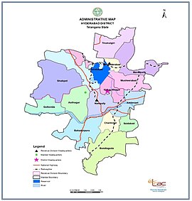
Khammam is the city in Khammam district of the Indian state of Telangana. It is the fourth largest city in the state. It is the headquarters of the Khammam district and Khammam mandal also. It is located about 193 kilometres (120 mi) east of the state capital, Hyderabad, 61 kilometres (38 mi) from Suryapet, 120 kilometres (75 mi) from Warangal and also it is located about 121 kilometres (75 mi) North of the Andhra Pradesh state capital, Amaravathi. The river Munneru flows on the western side of the city. As of 2011 census of India, Khammam urban agglomeration has a population of 313,504. However, on 19 October 2012, the civic body of Khammam was upgraded to a municipal corporation. Post- upgradation to corporation, the population of Khammam was approximated to be 3,07,000.

<span class="mw-page-title-main">Telangana</span> State in southern India

Telangana is a state in India situated in the southern part of the Indian peninsula on the high Deccan Plateau. It is the eleventh-largest state and the twelfth-most populated state in India as per the 2011 census. On 2 June 2014, the area was separated from the northwestern part of United Andhra Pradesh as the newly formed state of Telangana, with Hyderabad as its capital.

<span class="mw-page-title-main">Medak</span> Town in Telangana, India

Medak is a town in Medak district of the Indian state of Telangana. It is a municipality and the headquarters of Medak mandal in Medak revenue division. And There is a river named srujan which is big in length.

<span class="mw-page-title-main">Kothagudem</span> City in Telangana, India

Kothagudem is a city in Telangana. It serves as the headquarters of the Bhadradri Kothagudem district of the Indian state of Telangana. It was a portion of large Zamindari estate known as Husanabad Shankaragiri or Palvancha Zamindari in the Nizam's Dominion. Estate name was given by Captain Glasfurd. The Zamindar of Bhadrachalam was Zamindar of Palvancha also.

<span class="mw-page-title-main">Medak district</span> District of Telangana in India

Medak district is in the Indian state of Telangana. Medak is the district headquarters. The district shares boundaries with Sangareddy, Kamareddy, Siddipet and Medchal-Malkajgiri districts.

<span class="mw-page-title-main">Ranga Reddy district</span> District of Telangana in India

Ranga Reddy district is a district in the Indian state of Telangana. The district headquarters is located at Kongara Kalan Village, Ibrahimpatnam Mandal,. The district was named after the former deputy chief minister of the United Andhra Pradesh, K. V. Ranga Reddy. The district shares boundaries with Nalgonda, Yadadri Bhuvanagiri, Hyderabad, Medchal–Malkajgiri, Nagarkurnool, Mahabubnagar, Sangareddy and Vikarabad districts.

<span class="mw-page-title-main">Hanamkonda district</span> District of Telangana in India

Hanamkonda district, is a district located in the northern region of the Indian state of Telangana. The district headquarters are located at Hanamakonda. The district borders the districts of Jangaon, Karimnagar, Warangal, Bhupalpally and Siddipet.

Nandyal is a city and District headquarters of Nandyal district of the Indian state of Andhra Pradesh. It is a municipality and the headquarters of Nandyal mandal in Nandyal revenue division.

Jangaon (Janagama) is a city and the district headquarters of Jangaon district in the Indian state of Telangana. It is also the mandal and divisional headquarters of Jangaon Mandal and Jangaon revenue division respectively. It is about 85 kilometres (53 mi) from the state capital Hyderabad. It lies on the National Highway 163

Jammikunta is a town and mandal in Karimnagar district of the state of Telangana, India. At the 2011 census it had a population of 32,645, 16,894 males and 15,751 females.

<span class="mw-page-title-main">Greater Hyderabad Municipal Corporation</span> City governing body in India

Greater Hyderabad Municipal Corporation (GHMC) is the civic body that oversees Hyderabad, the capital and largest city of the Indian state of Telangana. It is the local government for the city of Hyderabad. It is one of the largest municipal corporations in India with a population of 7.9 million and an area of 650 km2.

<span class="mw-page-title-main">Serilingampally</span> Suburb in Ranga Reddy, Telangana, India

Serilingampally, also known as Lingampally, is a major suburb located in the north western part of Hyderabad City. It is the headquarters of the Serilingamapally mandal in the Ranga Reddy district of the Indian state of Telangana It is administered by the Greater Hyderabad Municipal Corporation (GHMC). Due to its close proximity to Hitech City, Gachibowli, Nanakramguda, Manikonda and Kondapur, there has been a heavy influx of IT companies. University of Hyderabad (UoH) is also located here.

In Hyderabad, India, the Greater Hyderabad Municipal Corporation (GHMC) is in charge of the civic administration and infrastructure of the city. It was formed in April 2007 by merging 100 wards of the erstwhile Municipal Corporation of Hyderabad (MCH) with twelve municipalities of neighbouring two districts. GHMC covers an area of 650 km2 (250 sq mi), spread over the four districts—Hyderabad, Ranga Reddy, Medchal–Malkajgiri and Sangareddy. The GHMC is divided into five zones and eighteen circles that contain 150 municipal wards. Each ward is headed by a corporator, elected by popular vote. The corporators elect The City Mayor who is the titular head of GHMC. The executive powers of the GHMC lie with the Municipal Commissioner appointed by the Government of Telangana. The State Election Commission (SEC) monitors the municipal elections that are held in the city once in every five years. The first election of the GHMC were held in December 2009. The Indian National Congress alliance with Majlis Ittehadul Muslimeen formed the majority, with the agreement of sharing the mayor post equally between the two parties.

<span class="mw-page-title-main">Kamareddy district</span> District in Telangana, India

Kamareddy district is a district located in the northern region of the Indian state of Telangana. The district shares boundaries with Medak, Nizamabad, Sangareddy, Siddipet and Rajanna Sircilla districts and with the state boundary of Maharashtra and Karnataka.

<span class="mw-page-title-main">Sangareddy district</span> District of Telangana in India

Sangareddy district, is a district in the Indian state of Telangana. This district contains a part of the Hyderabad Metropolitan Region.Sangareddy is the district headquarters of the district. It was named after the ruler Sanga, the son of queen Shankaramba, who was the ruler of Medak during the period of Nizams. The district shares boundaries with Medak, Medchal, Vikarabad, Kamareddy and Rangareddy districts and with the state boundary of Karnataka.

<span class="mw-page-title-main">Siddipet district</span> District of Telangana in India

Siddipet district is a district located in the northern region of the Indian state of Telangana. Its headquarters is Siddipet. This district contains a part of the Hyderabad Metropolitan Region(Markook Mulugu Wargal) The district shares boundaries with Jangaon, Sircilla, Karimnagar, Kamareddy, Hanamkonda, Yadadri, Medhchal and Medak districts.

<span class="mw-page-title-main">Warangal district</span> District of Telangana in India

Warangal district, formerly Warangal Rural district, is a district in the Indian state of Telangana. The district shares boundaries with Mahabubabad, Jangaon, Hanamkonda, Mulugu and Bhupalpally districts.

<span class="mw-page-title-main">Medchal-Malkajgiri district</span> District of Telangana in India

Medchal−Malkajgiri district is a district in the Indian state of Telangana. Shamirpet is the headquarter of the district. It is the second most populous district with a population of 25 lakh and also 91.40% urbanized district in the state of Telangana, standing next only to Hyderabad district which has a population of 40 lakhs. The district shares boundaries with Hyderabad, Medak, Sangareddy, Y. Bhuvanagiri, Siddipet and Rangareddy districts.The most part of the district consist of Hyderabad City (GHMC)

Jangaon Mandal is an administrative division or Sub District in Jangaon district in the Indian state of Telangana.

References

  1. hyderabad.telangana.gov.in/about-district/whos-who/
  2. "Hyderabad Legislative Assembly". ECI. AP Legislature. Archived from the original on 4 August 2013. Retrieved 14 October 2014.
  3. Law, Gwillim (25 September 2011). "Districts of India". Statoids. Retrieved 11 October 2011.
  4. "Archived copy" (PDF). Archived from the original (PDF) on 26 May 2012. Retrieved 5 November 2012.{{cite web}}: CS1 maint: archived copy as title (link)
  5. "Welcome to Revenue Department". Revenue Department, Hyderabad. 2014. Retrieved 25 August 2014.
  6. "Part-I State Administrative Divisions 2001–2011" (PDF). Census of India. p. 4,12. Retrieved 18 January 2015.
  7. "K Chandrasekhar Rao appoints collectors for new districts". Deccan Chronicle. 11 October 2016. Retrieved 13 October 2016.
  8. "Voters exceed Hyderabad's population! - Times of India". The Times of India . 14 April 2014.
  9. Srivastava, Dayawanti et al. (ed.) (2010). "States and Union Territories: Andhra Pradesh: Government". India 2010: A Reference Annual (54th ed.). New Delhi, India: Additional Director General, Publications Division, Ministry of Information and Broadcasting (India), Government of India. pp. 1111–1112. ISBN   978-81-230-1617-7.{{cite book}}: |last1= has generic name (help)
  10. Decadal Variation In Population Since 1901
  11. Hyderabad District Religion Census 2011
  12. "C-1 Population By Religious Community". Government of India, Ministry of Home Affairs. Retrieved 11 May 2016. On this page, select "Andhra Pradesh" from the download menu. "District – Hyderabad" is at line 672 of the excel file.
  13. 1 2 3 4 5 "District Census 2011". Census2011.co.in. 2011. Retrieved 30 September 2011.
  14. "C-16 Population By Religion - Andhra Pradesh". census.gov.in.
  15. "What happened to the Christians of Andhra Pradesh" (PDF). Centre for Policy Studies. 2016: 9.{{cite journal}}: Cite journal requires |journal= (help)
  16. "Table C-16 Population by Mother Tongue: Andhra Pradesh (Urban)". Census of India . Registrar General and Census Commissioner of India.
  17. "Station: Hyderabad (A) Climatological Table 1981–2010" (PDF). Climatological Normals 1981–2010. India Meteorological Department. January 2015. pp. 331–332. Archived from the original (PDF) on 5 February 2020. Retrieved 13 February 2020.
  18. "Extremes of Temperature & Rainfall for Indian Stations (Up to 2012)" (PDF). India Meteorological Department. December 2016. p. M9. Archived from the original (PDF) on 5 February 2020. Retrieved 13 February 2020.
  19. "Table 3 Monthly mean duration of Sun Shine (hours) at different locations in India" (PDF). Daily Normals of Global & Diffuse Radiation (1971–2000). India Meteorological Department. December 2016. p. M-3. Archived from the original (PDF) on 5 February 2020. Retrieved 13 February 2020.
  20. "Climate & Weather Averages in Hyderabad, Telangana, India". Time and Date. Retrieved 18 July 2022.
  21. "Climatological Tables 1991-2020" (PDF). India Meteorological Department. p. 21. Archived from the original (PDF) on 1 January 2023. Retrieved 1 January 2023.
  22. "Normals Data: Hyderabad Airport - India Latitude: 17.45°N Longitude: 78.47°E Height: 530 (m)". Japan Meteorological Agency. Retrieved 29 February 2020.
  23. "Climate and monthly weather forecast Hyderabad, India". Weather Atlas. Retrieved 13 June 2022.