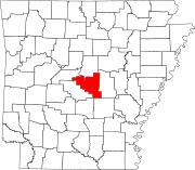
Alexander, Arkansas

Last updated

Alexander, Arkansas
Pulaski County and Saline County Arkansas Incorporated and Unincorporated areas Alexander Highlighted 0500580.svg
Location of Alexander in Pulaski County and Saline County, Arkansas.
Coordinates: 34°37′53″N92°26′39″W / 34.63139°N 92.44417°W / 34.63139; -92.44417
Country United States
State Arkansas
Counties Pulaski, Saline
Area
[1]
  Total2.26 sq mi (5.85 km2)
  Land2.26 sq mi (5.85 km2)
  Water0.00 sq mi (0.00 km2)
Elevation
[2]
354 ft (108 m)
Population
 (2020)
  Total3,385
  Density1,499.11/sq mi (578.82/km2)
Time zone UTC-6 (Central (CST))
  Summer (DST) UTC-5 (CDT)
ZIP code
72002
Area code 501
FIPS code 05-00580
GNIS feature ID0057254 [2]
Website www.cityofalexander.com

Alexander is a city in Pulaski and Saline counties in the U.S. state of Arkansas. [3] Located in Central Arkansas, the town was founded as a construction camp for the nearby railroad. Following its completion, the citizens decided to incorporate in 1887. Alexander is home to the Arkansas Juvenile Assessment and Treatment Center. The population was 2,901 at the 2010 census. [4]

Contents

Geography

Alexander is located at 34°37′53″N92°26′39″W / 34.63139°N 92.44417°W / 34.63139; -92.44417 (34.631508, -92.444188). [5]

According to the United States Census Bureau, the town has a total area of 2.2 square miles (5.7 km2), all land. [6]

Demographics

Historical population
CensusPop.Note
2010 2,901
2020 3,38516.7%
U.S. Decennial Census [7]

2020 census

As of the 2020 United States census, there were 3,385 people, 1,034 households, and 725 families residing in the city.

Alexander racial composition [8]
RaceNumberPercentage
White (non-Hispanic)1,23036.34%
Black or African American (non-Hispanic)68720.3%
Native American 140.41%
Asian 280.83%
Other/Mixed 1544.55%
Hispanic or Latino 1,27237.58%

2000 census

As of the 2000 census, [9] there were 614 people, 276 households, and 171 families in the town. The population density was 526.8/km2 (1,369.5/mi²). There were 305 housing units at an average density of 261.7/km2 (680.3/mi²). The racial makeup of the town was 70.68% White, 26.71% Black or African American, 0.49% Native American, 0.98% Asian, 0.33% from other races, and 0.81% from two or more races. 2.28% of the population were Hispanic or Latino of any race.

Of the 276 households 29.3% had children under the age of 18 living with them, 39.1% were married couples living together, 17.4% had a female householder with no husband present, and 38.0% were non-families. 32.6% of households were one person and 6.5% were one person aged 65 or older. The average household size was 2.22 and the average family size was 2.79.

The age distribution was 24.8% under the age of 18, 8.6% from 18 to 24, 33.1% from 25 to 44, 22.6% from 45 to 64, and 10.9% 65 or older. The median age was 33 years. For every 100 females, there were 88.3 males. For every 100 females age 18 and over, there were 75.7 males.

The median household income was $30,050 and the median family income was $35,341. Males had a median income of $28,571 versus $21,958 for females. The per capita income for the town was $15,157. About 9.5% of families and 12.8% of the population were below the poverty line, including 9.1% of those under age 18 and 11.0% of those age 65 or over.

Education

The Saline County portion is in the Bryant School District, [10] which operates Bryant High School.

The Pulaski County portion is in the Pulaski County Special School District. [11] [12] It is zoned to Lawson Elementary School, Joe T. Robinson Middle School, and Joe T. Robinson High School. [13]

Related Research Articles

<span class="mw-page-title-main">Saline County, Arkansas</span> County in Arkansas, United States

Saline County is located in the U.S. state of Arkansas. As of the 2020 census, the population was 123,416. Its county seat and largest city is Benton. Saline County was formed on November 2, 1835, and named for the salt water (brine) springs in the area, despite a differing pronunciation from saline. Until November 2014, it was an alcohol prohibition or dry county.

<span class="mw-page-title-main">Pulaski County, Arkansas</span> County in Arkansas, United States

Pulaski County is a county in the U.S. state of Arkansas. With a population of 399,125 as of the 2020 United States Census, it is the most populous county in Arkansas. The county is included in the Little Rock–North Little Rock–Conway metropolitan area. Its county seat is Little Rock, which is also Arkansas's capital and largest city.
<span class="mw-page-title-main">Faulkner County, Arkansas</span> County in Arkansas, United States

Faulkner County is located in the Central Arkansas region of the U.S. state of Arkansas. As of the 2020 census, the population was 123,498, making it the fifth most populous of Arkansas's 75 counties. The county seat and largest city is Conway. Faulkner County was created on April 12, 1873, one of nine counties formed during Reconstruction, and is named for Sandford C. Faulkner, better known as Sandy Faulkner, a popular figure in the state at the time.

<span class="mw-page-title-main">Tull, Arkansas</span> Town in Arkansas, United States

Tull is a town in Grant County, Arkansas, United States. The population was 448 at the 2010 census, up from 358 in 2000. It is part of the Central Arkansas region.
<span class="mw-page-title-main">Scott, Arkansas</span> Census-designated place in Arkansas, United States

Scott is an unincorporated community and census-designated place (CDP) in Lonoke and Pulaski counties in the central part of the U.S. state of Arkansas. Per the 2020 census, the population was 97. It is part of the Little Rock–North Little Rock–Conway Metropolitan Statistical Area.

<span class="mw-page-title-main">College Station, Arkansas</span> CDP in Arkansas, United States

College Station is a census-designated place (CDP) in Pulaski County, Arkansas, United States. The population was 600 at the 2010 census. It is part of the Little Rock–North Little Rock–Conway Metropolitan Statistical Area.

<span class="mw-page-title-main">Hensley, Arkansas</span> Census-designated place in Arkansas, United States

Hensley is a census-designated place (CDP) in Pulaski County, Arkansas, United States. The population was 139 at the 2010 census. It is part of the Little Rock–North Little Rock–Conway Metropolitan Statistical Area.

<span class="mw-page-title-main">Jacksonville, Arkansas</span> City in Arkansas, United States

Jacksonville is a city in Pulaski County, Arkansas, United States, and a suburb of Little Rock. As of the 2010 census, the population of the city was 28,364. It is part of the Little Rock–North Little Rock–Conway Metropolitan Statistical Area with 729,135 people as of 2014.

<span class="mw-page-title-main">McAlmont, Arkansas</span> CDP in Arkansas, United States

McAlmont, also referred to as "Mac Side", is a census-designated place (CDP) in Pulaski County, Arkansas, United States. The population was 1,873 at the 2010 census. The community adjoins eastern North Little Rock, and is part of the Little Rock–North Little Rock–Conway Metropolitan Statistical Area.

<span class="mw-page-title-main">Landmark, Arkansas</span> CDP in Arkansas, United States

Landmark is a census-designated place (CDP) in Pulaski County, Arkansas, United States. Per the 2020 census, the population was 3,585. It is part of the Little Rock–North Little Rock–Conway Metropolitan Statistical Area.

<span class="mw-page-title-main">Sweet Home, Arkansas</span> Census-designated place in Pulaski County, Arkansas, USA

Sweet Home is a census-designated place (CDP) in Pulaski County, Arkansas, United States. Its population was 849 at the 2010 census. It is part of the 'Little Rock-North Little Rock-AR Metropolitan Statistical Area'.

<span class="mw-page-title-main">Woodson, Arkansas</span> CDP in Arkansas, United States

Woodson is a census-designated place (CDP) in Pulaski County, Arkansas, United States. Its population was 403 at the 2010 census. It is part of the Little Rock–North Little Rock–Conway Metropolitan Statistical Area. Woodson and its accompanying Woodson Lake and Wood Hollow are the namesake for Ed Wood Sr., a prominent plantation owner, trader, and businessman at the turn of the 20th century. Woodson is adjacent to the Wood Plantation, the largest of the plantations own by Ed Wood Sr.

<span class="mw-page-title-main">Wrightsville, Arkansas</span> City in Arkansas, USA

Wrightsville is a city in Pulaski County, Arkansas, United States. Its population was 1,542 at the 2020 census. It is part of the Little Rock–North Little Rock–Conway Metropolitan Statistical Area. Located on Highway 365, Wrightsville existed as an unincorporated community for more than a century before it was incorporated late in the 20th century. Since 1981, it has been home to a major Arkansas Department of Corrections facility, which is the principal employer.

<span class="mw-page-title-main">Benton, Arkansas</span> City in Arkansas, United States

Benton is a city in and the county seat of Saline County, Arkansas, United States and a suburb of Little Rock. It was established in 1837. At the 2020 census, the city had a population of 35,014, making it the 12th most populous city in Arkansas. It is part of the Little Rock–North Little Rock–Conway Metropolitan Statistical Area. The city of Benton, first settled in 1833 and named after Missouri Senator Thomas Hart Benton, was formally chartered in 1836 when Arkansas became a state.

<span class="mw-page-title-main">Bryant, Arkansas</span> City in Arkansas, United States

Bryant is a city in Saline County, Arkansas, United States and a suburb of Little Rock. According to the 2010 Census, the population of the city was 16,688. It is part of the Central Arkansas region.

<span class="mw-page-title-main">Haskell, Arkansas</span> City in Arkansas, United States

Haskell is a city in Saline County, Arkansas, United States. The population was 3,990 at the 2010 census. It is part of the Little Rock–North Little Rock–Conway Metropolitan Statistical Area.

<span class="mw-page-title-main">Salem, Saline County, Arkansas</span> CDP in Arkansas, United States

Salem is a census-designated place (CDP) in Saline County, Arkansas, United States. Per the 2020 census, the population was 2,544. It is part of the Little Rock–North Little Rock–Conway Metropolitan Statistical Area.

<span class="mw-page-title-main">Shannon Hills, Arkansas</span> City in Arkansas, United States

Shannon Hills is a city in Saline County, Arkansas, United States. The population was 3,143 at the 2010 census, rising to 4,490 with the 2020 census. It is part of the Little Rock–North Little Rock–Conway Metropolitan Statistical Area.

<span class="mw-page-title-main">Traskwood, Arkansas</span> City in Arkansas, United States

Traskwood is a city in Saline County, Arkansas, United States. The population was 518 at the 2010 census. It is part of the Little Rock–North Little Rock–Conway Metropolitan Statistical Area.

<span class="mw-page-title-main">Gibson, Arkansas</span> CDP in Arkansas, United States

Gibson is a census-designated place (CDP) in Pulaski County, Arkansas, United States. The population was 3,543 at the 2010 census. It is part of the Little Rock–North Little Rock–Conway Metropolitan Statistical Area.

References

  1. "2020 U.S. Gazetteer Files". United States Census Bureau. Retrieved October 29, 2021.
  2. 1 2 U.S. Geological Survey Geographic Names Information System: Alexander, Arkansas
  3. "Arkansas: 2010 Population and Housing Unit Counts" (PDF). 2010 Census of Population and Housing. United States Census Bureau. August 2012. p. III-6. Retrieved February 14, 2016.
  4. "Profile of General Population and Housing Characteristics: 2010 Demographic Profile Data (DP-1): Alexander city, Arkansas". United States Census Bureau . Retrieved December 2, 2011.
  5. "US Gazetteer files: 2010, 2000, and 1990". United States Census Bureau. February 12, 2011. Retrieved April 23, 2011.
  6. "Geographic Identifiers: 2010 Demographic Profile Data (G001): Alexander city, Arkansas". United States Census Bureau . Retrieved December 2, 2011.
  7. "Census of Population and Housing". Census.gov. Retrieved June 4, 2016.
  8. "Explore Census Data". data.census.gov. Retrieved December 31, 2021.
  9. "U.S. Census website". United States Census Bureau . Retrieved January 31, 2008.
  10. "School District Reference Map (2010 Census): Saline County, AR" (PDF). U.S. Census Bureau . Retrieved February 28, 2021.
  11. "2020 Census - School District Reference Map: Pulaski County, AR" (PDF). U.S. Census Bureau . Retrieved April 17, 2021.
  12. "Pulaski County Special School District Zones" (PDF). Pulaski County Election Commission. Retrieved March 3, 2021. - the finder of ArcGIS used by the State of Arkansas confirms it is an exclave of the Pulaski County SSD.
  13. "School Zone Map". Pulaski County Special School District. Archived from the original on January 18, 2021. Retrieved March 3, 2021.