Alexandria, Ohio | |
---|---|
Nickname: Alex (pronounced "Alec") | |
Motto: Building on the Past - Preparing for the Future | |
Coordinates: 40°05′24″N82°36′43″W / 40.09000°N 82.61194°W [1] | |
Country | United States |
State | Ohio |
County | Licking |
Area | |
• Total | 0.24 sq mi (0.63 km2) |
• Land | 0.24 sq mi (0.63 km2) |
• Water | 0.00 sq mi (0.00 km2) |
Elevation | 978 ft (298 m) |
Population (2020) | |
• Total | 483 |
• Estimate (2023) [3] | 490 |
• Density | 1,979.51/sq mi (763.03/km2) |
Time zone | UTC-5 (Eastern (EST)) |
• Summer (DST) | UTC-4 (EDT) |
ZIP code | 43001 |
Area code | 740 |
FIPS code | 39-01154 [4] |
GNIS feature ID | 2397927 [1] |
Website | www |
Alexandria is a village in Licking County, Ohio, United States. The population was 483 at the 2020 census.
Alexandria was laid out in 1830. [5] The village played a role in the Underground Railroad, sheltering many escaped slaves on their way to freedom.[ citation needed ]
In 2018, village voters defeated a ballot issue to dissolve the village and become a part of St. Albans Township. The vote was 92% against the dissolution. [6]
Alexandria is located in western Licking County along State Route 37 about 6 miles (10 km) southeast of Johnstown and 25 miles (40 km) northeast of Columbus. [7]
According to the United States Census Bureau, the village has a total area of 0.24 square miles (0.62 km2), all land. [8]
Census | Pop. | Note | %± |
---|---|---|---|
1840 | 200 | — | |
1850 | 349 | 74.5% | |
1860 | 320 | −8.3% | |
1870 | 303 | −5.3% | |
1880 | 269 | −11.2% | |
1890 | 296 | 10.0% | |
1900 | 420 | 41.9% | |
1910 | 414 | −1.4% | |
1920 | 415 | 0.2% | |
1930 | 450 | 8.4% | |
1940 | 425 | −5.6% | |
1950 | 464 | 9.2% | |
1960 | 452 | −2.6% | |
1970 | 588 | 30.1% | |
1980 | 489 | −16.8% | |
1990 | 468 | −4.3% | |
2000 | 485 | 3.6% | |
2010 | 517 | 6.6% | |
2020 | 483 | −6.6% | |
2023 (est.) | 490 | [3] | 1.4% |
U.S. Decennial Census [9] |
At the 2010 census, [10] there were 517 people, 182 households and 144 families living in the village. The population density was 2,068.0 per square mile (798.5/km2). There were 203 housing units at an average density of 812.0 per square mile (313.5/km2). The racial make-up was 98.5% White, 0.6% Native American, and 1.0% from two or more races. Hispanic or Latino of any race were 1.2% of the population.
There were 182 households, of which 50.0% had children under the age of 18 living with them, 58.8% were married couples living together, 14.8% had a female householder with no husband present, 5.5% had a male householder with no wife present, and 20.9% were non-families. 15.9% of all households were made up of individuals, and 4.4% had someone living alone who was 65 years of age or older. The average household size was 2.84 and the average family size was 3.13.
The median age was 34.9 years. 30.2% of residents were under the age of 18; 7.6% were between the ages of 18 and 24; 28.3% were from 25 to 44; 22.7% were from 45 to 64; and 11.4% were 65 years of age or older. The gender makeup of the village was 49.5% male and 50.5% female.
At the 2000 census, [4] there were 485 people, 29 households and 22 families living in the village. The population density was 523.1 per square mile (202.0/km2). There were 30 housing units at an average density of 184.6 per square mile (71.3/km2). The racial make-up was 98.82% White and 1.18% Native American. Hispanic or Latino of any race were 1.18% of the population.
There were 29 households, of which 37.9% had children under the age of 18 living with them, 72.4% were married couples living together, and 24.1% were non-families. 20.7% of all households were made up of individuals, and 13.8% had someone living alone who was 65 years of age or older. The average household size was 2.93 and the average family size was 3.45.
34.1% of the population were under the age of 18, 4.7% from 18 to 24, 32.9% from 25 to 44, 15.3% from 45 to 64, and 12.9% were 65 years of age or older. The median age was 32 years. For every 100 females there were 107.3 males. For every 100 females age 18 and over, there were 100.0 males.
The median household income was $29,688 and the median family income was $41,250. Males had a median income of $26,250 and females $0. The per capita income was $16,235. None of the population and none of the families were below the poverty line.
Located in town, Alexandria Public Library serves the residents of Alexandria. Fireman's Park, Lobdell Reserve, Parker Community Park and the Fritz Drumm Field of Dreams are all located in or very near the village. The Alexandria Museum, on Main Street, is a small house museum.
Residents of Alexandria and the surrounding areas attend Northridge Local School District, which includes: Northridge Elementary, Northridge Middle, and Northridge High School. [11]
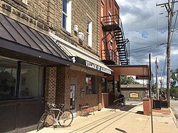
Aberdeen is a village in Huntington Township, Brown County, Ohio, United States, along the Ohio River 50 miles (80 km) southeast of Cincinnati. The population was 1,515 at the 2020 census.
Northridge is a census-designated place (CDP) in Clark County, Ohio, United States. The population was 7,518 at the 2020 census. It is part of the Springfield, Ohio Metropolitan Statistical Area.
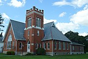
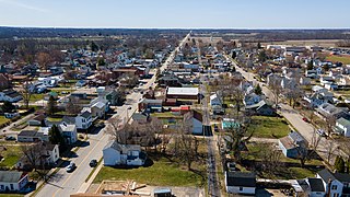
Warsaw is a village in Coshocton County, Ohio, United States, along the Walhonding River. The population was 624 at the 2020 census.
Castine is a village in Darke County, Ohio, United States. The population was 110 at the 2020 census.
Gordon is a village in Darke County, Ohio, United States. The population was 245 at the 2020 census.
Ithaca is a village in Darke County, Ohio, United States. The population was 81 at the 2020 census.
Rossburg is a village in Darke County, Ohio, United States. The population was 159 at the 2020 census.
Brice is a village in Franklin County, Ohio, United States, on the southeast side of the Columbus metropolitan area. The population was 93 at the 2020 census.
Evendale is a village in Hamilton County, Ohio, United States, within the Cincinnati metropolitan area. The population was 2,669 at the 2020 census.
Harrisville is a village in Harrison County, Ohio, United States. The population was 179 at the 2020 census.
New Alexandria is a village in eastern Jefferson County, Ohio, United States. The population was 232 at the 2020 census. It is part of the Weirton–Steubenville metropolitan area.
Smithfield was a village in Smithfield Township, Jefferson County, Ohio, United States. The population was 869 at the 2010 census. It is part of the Weirton–Steubenville, WV-OH Metropolitan Statistical Area. In 2019, Smithfield voted to dissolve itself.
Montezuma is a village in Mercer County, Ohio, United States. The population was 152 at the 2020 census.
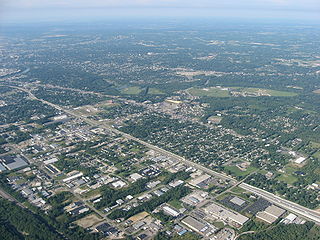
Northridge is an unincorporated community in Harrison Township in Montgomery County, Ohio, United States. It was delineated as a census-designated place (CDP) for the 2000 census, at which time its population was 8,487. It is located directly north of the city of Dayton and is part of the Dayton Metropolitan Statistical Area.
Chesterville is a village in Morrow County, Ohio, United States, along the Kokosing River. The population was 191 at the 2020 census. Chesterville is southeast of Mount Gilead, the county seat.
West Alexandria is a village in Preble County, Ohio, United States. The population was 1,334 at the 2020 census.
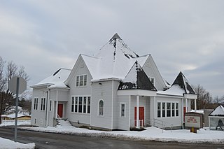
Clinton is a village in southwestern Summit County, Ohio, United States. The population was 1,197 at the 2020 Census. It is part of the Akron metropolitan area.
Hamden is a village in Vinton County, Ohio, United States. The population was 727 at the 2020 census.
Macksburg is a village in Washington County, Ohio, United States, along the West Fork of Duck Creek. The population was 120 at the 2020 census. The village is about 28 miles (45 km) south of Cambridge, Ohio.
Gratiot is a village in Licking and Muskingum counties in the U.S. state of Ohio. The population was 215 at the 2020 census.